• SAH Study Day: A New MoMA! (Lee Fellowship Report)

    by User Not Found | Jan 03, 2020

    Figure1
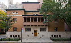
    Exterior of the Museum of Modern Art on 53rd Street. Photograph by author.

    Confession: I don’t always make it to the museum exhibitions, especially, and embarrassingly so, some architecture exhibitions I want to see despite my best efforts, intentions, or proximity. I still laugh over how I managed to plan a trip to New York after college only to have missed the outdoor presentation of the five full-size model houses constructed for the exhibition Home Delivery: Fabricating the Modern Dwelling at the Museum of Modern Art by a single day. Instead, I peeked through the chain-link fencing to catch a a glimpse of the dwellings and thus the empty lot that has since been developed into an 82-story Jean Nouvel-designed luxury residential tower, providing the additional space for the Modern to expand its permanent collection galleries on the second, fourth, and fifth floors by over 30,000 square feet in what, after a $100 million gift, is now known as the David Geffen Wing. Not all was lost, that visit was still my first visit to MoMA, so there was plenty else to see and get to know. The following year, amidst the chaos that surrounds any move, let alone one to New York, compounded with starting a master’s program, I just flat out ran out of time and energy to make it the 30 blocks and cross-town bus to catch the exhibition Frank Lloyd Wright: From Within Outward at the Guggenheim before it closed. At the time during those two weeks of overlap, a trip to Bed Bath & Beyond was about all I could handle. So, I was glad to be an SAH Study Day Fellow, along with Sarah Horowitz and Elizabeth Keslacy, to participate with colleagues in the SAH Study Day: A New MoMA! on November 1, 2019, to see the museum’s $450 million expansion and renovation by Diller Scofidio + Renfro firsthand, just over a week after its public opening on October 21.

    Figure2
    Floor 3 gallery with extensive seating and photographs by Hiroshi Sugimoto of and in dialogue with the Sculpture Garden outside. Photograph by author.

    Our day all about the new MoMA began at the old MoMA: we convened together in a 6th floor conference room in the original 1939 building, designed by Phillip L. Goodwin and Edward Durrell Stone. After a welcome from SAH President Sandy Isenstadt, Martino Stierli, The Philip Johnson Chief Curator of Architecture and Design, along with Sean Anderson, Associate Curator of Architecture and Design, led our group through the features of the museum’s physical expansion and renovation, and what that meant for the curatorial approach and collaboration necessary for the newly imagined permanent collection galleries—no longer separated by departmental disciplines—that interweaves individual, thematic, curatorial department-led galleries within a larger, singular arrangement organized, like before, chronologically: 1880s–1940s on Floor 5, 1940s–1970s on Floor 4, and 1970s–Present on Floor 2. It’s admirable, ambitious, and genuinely laudable—and also a little complicated to grasp on the first go-around. Fortunately, a video, which we viewed more than once, helped to untangle the physical interventions made to increase public space (an additional 21,000 square feet for a total of 104,000 square feet), ease vertical circulation through extending the Bauhaus staircase to the ground level and engineering a stunning new staircase dubbed the “Blade” with attendant elevator bank, and add 47,000 square feet in new and renovated galleries for a total of 166,000 square feet of exhibition space.

    Figure3
    Introductory label and floor plan for Collection 1880s–1940s on Floor 5. Photograph by author.

    A floor plan helped to make sense of the other signal maneuver of the new MoMA: the permanent collection galleries will be completely new every 18 months, allowing more works to appear on view among different themes and groupings, the impetus to telling a more complex, dynamic, and diverse story of modernism. In effect, each floor is divided into three sections (each section a suite of individual galleries) with one section reinstalled every six months, so that after 18 months each section will have been rotated once and therefore the whole floor refreshed, anew, so on and so forth, ad infinitum. It’s astounding, really. A flex of the depth and extent of MoMA's holdings, combined with a commitment to acquire new artists, areas, and geographies, but also because, frankly, it’s a lot of work. Such regular, frequent rotations and rethinking of the permanent collection galleries are not just the work of curators or curatorial departments; it’s the work of the entire museum, involving registrars, art handlers, conservators, designers, technicians, educators, and security, among others. The whole undertaking is visionary, exciting, and unprecedented at this scale, but a 30% increase in overall gallery and exhibition space for the permanent collection and temporary shows without, as I understand it, an increase in the requisite staff to make it all happen will test any institution, no matter how determined, efficient, or seasoned. Time will tell. At the very least, and since 1971, museum staff are organized in a labor union, part of MoMA Local 2110.

    Figure4
    Installation view of exhibition, Taking a Thread for a Walk. Photograph by author.

    Oriented, we set out into the museum to tour the architecture and design galleries with the curators. The day was a whirlwind through the museum; lunch, some free time to explore, and a final wrap-up with Anderson also happened. Previously, the architecture and design galleries were contained on Floor 3, separated by a sky bridge and a Bell-47D1 Helicopter (thankfully, the helicopter is still there). The spaces have now been repurposed into galleries for temporary exhibitions (all the opening shows are drawn from the permanent collection), including an excellent exhibition, Taking a Thread for a Walk, about textiles and fiber art. Integrating architecture and design into the expanded, multimedia permanent collection galleries elsewhere frees up this space and exhibition to become a deep, concentrated dive into a design topic, rather than needing to serve as a comprehensive survey of modern design in a single room as it previously did, which is for the better.

    Figure5
    Martino Stierli discusses Frank Lloyd Wright’s St. Mark’s Tower (1929) in the Vertical City Gallery. Photograph by author.

    Deftly navigated through the permanent collection galleries by the curators, who did their best to wrangle a group distracted by all the art we were just walking past, we paused to focus on the architecture and design galleries: The Vertical City, Design for Modern Life, Architecture for Modern Art, Architecture Systems, and Building Citizens, along with Sheela Gowda’s Of All the People, and works by Sheila Hicks and Sou Fujimoto up on Floor 6, part of the exhibition, Surround: 11 Installations. I’ll spare a recap, namely because the other fellowship reports provide good observations, but also because, in a practice that all museums should be doing, MoMA puts the permanent collection gallery introductory label, checklist linked to the individual object record, and installation images online. Recognizing that despite the nearly 3 million people who visit the museum every year, even more engage with it on the website, thereby making the collection, its contents and presentation available to those who cannot visit or want to revisit, and continuing MoMA’s pioneering feat in digitizing valuable material from their archive, especially their exhibition history. The day was a thrill, but it was also just a start; I knew I’d be coming back the next morning.

    Figure6
    Museum floor plan graphic and wayfinding on Floor 4. Photograph by author.

    I spent an additional four hours on Saturday, going through the entire museum. While I knew I’d “need a snack” for energy and a “ball of string” for navigation, and had just been there the day before, left to my own devices, I was still not fully prepared for quite how big MoMA is to take in on a single visit. Looking at a floor plan now, instead of seeing an elegant sequence of three sections in continual rotation, I recalled any experience at an IKEA, where to navigate the large floor plate requires knowing the built-in shortcuts from, say, kitchenware to plants, in order to bypass the meander around lighting and bed linens. But meandering is what the remixed reinstallation is all about, and with great affect. Though each curatorial department maintains “ownership” of an individual gallery, their adjacencies and their careful planning, individually and as a whole, mean that they blur and bleed together, reinforcing shared themes and ideas between and among creative disciplines in the larger cultural project of modernism. For example, I delighted seeing film stills and a poster for Fritz Lang’s Metropolis (1927), after having realized that they shared opposite sides of the same wall in different galleries, Machines, Mannequins and, Monsters for photography and The Vertical City for architecture. That the poster is then paired with a wall showing excerpts from 1920s and 1930s films focused on the changing city makes for a seamless connection across galleries and departments. A subtler connection, which might go unnoticed depending on one’s patience or knowledge, was On Kawara’s Date Painting, MAY 20, 1967, in the Idea Art gallery, which displayed its accompanying box, lined with that day’s New York Post article, “Man with a Plan to Beautify the Ghetto.” This profile of I. M. Pei, who passed away earlier this year in May, about his “Superblocks” plan with landscape architect M. Paul Friedberg in Bedford-Stuyvesant, was a smart curatorial crumb that led into the theme of the adjacent Architecture Systems gallery about all-encompassing architectural schema from component parts.

    All this art and museum meandering, with an eye trained on architecture and design, did make me wonder what this means for architectural history and the training of architectural historians. Here, with architecture as an independent and interrelated discipline to art, design and other media, and with most curatorial positions and collections separated between “modern” (i.e. historical and the past) and “contemporary” (i.e. the new and the now), the different academic pathways through primarily art history programs or architecture schools, even professional practice, while disorienting at times, probably serves our field and our scholarship for the better. Meaning that we are able to produce work from a variety of perspectives and methods, able to speak to different people interested in architecture, landscape, the built environment. That said, I look forward to following the process and eventual report of the SAH Data Project, to provide a snapshot of architectural history at this moment and going forward.

    Figure7
    Installation view in Idea Art gallery with detail of newspaper-lined box featuring I. M. Pei article, part of On Kawara’s piece, MAY 20, 1967. Photograph by author.

    In the new MoMA it’s easy to get lost, in the good serendipitous sense and also in the “How did I get here and how do I get there?” sense. The new floor layout for the permanent collection on Floors 4 and 5 is expansive, possible because of the purchase and demolition of the Tod Williams and Billie Tsien-designed American Folk Art Museum (2001) and in the aforementioned base of the Nouvel-designed tower. It’s a seamless extension, “smart, surgical, sprawling, and slightly soulless.” Which begs the question: If the 2004 Taniguchi expansion prided itself on being able to “make the architecture disappear,” then what, ultimately, could any expansion and renovation in the same language of restrained minimalism have looked like, except more of the same? Despite dark steel-framed door surrounds and subtle changes in flooring that demarcate the different buildings, the slickness and sameness of it all made me lament the loss of the American Folk Art Museum that much more, with its bronze origami-shielded façade that unfolded within into a complex, split-level sequence of galleries and staircases, a building full of character and personality. While I understand that the floor plates may not have aligned, or something like that, I will always wonder whether if, instead of a real estate transaction of plot value, that the building itself had been acquired, accessioned as an object into the museum’s permanent collection, then adapted as part of the expansion and renovation, rather than an obstacle to be bulldozed. Museums acquire and maintain modern buildings for their inherent aesthetic and cultural significance all the time. In this instance, the past is already buried and built over, but it also makes me think about the important role, even responsibility, curators and museums have as public advocates for preservation and landmarking in their own cities as civic and cultural leaders.

    With a bold, wall-size work reading “Hello. Again.” by the artist Haim Steinbach overlooking the new, sunken gift shop, detailed in blond wood and complete with freestanding glass elevator, the similarity between the new MoMA and an Apple store is clear and has been pointed out elsewhere, but I’ll go one step further since, during this visit to New York, I also made a point to visit the new Foster + Partners-renovated flagship store, Apple Fifth Avenue, which originally opened in 2006, designed by Bohlin Cywinski Jackson. The underground retail space has been rebuilt, expanded in floor size and ceiling height and now includes 18 skylights to bring in more natural light, with the original glass staircase and elevator remade in glass and stainless steel, among other improvements. While the 32-foot jewel-box glass cube of an entrance has stood on the same footprint, over the years it has been refined with fewer glass panels and reduced framing supports, the result of advancements in material and construction technology. The relentless march of progress, one of continual refinement, whether MoMA or Apple, seems to occur on a roughly 15-year cycle now. Our culture and our capitalism, like modernism, blur and bleed.

    Craig Lee is the Daniel F. and Ada L. Rice Postdoctoral Curatorial Fellow in the Department of Architecture and Design at the Art Institute of Chicago, where, among other projects, he assists with modern architecture and design rotations in the permanent collection display, Past Forward, and conducts research and cataloguing on the Bruce Goff Collection. He is a Ph.D. candidate in the Department of Art History at the University of Delaware.

  • SAH Study Day: A New MoMA! (Keslacy Fellowship Report)

    by User Not Found | Dec 17, 2019

    Keslacy-SculptureCourt
    MoMA Sculpture Garden viewed from a new 2nd floor lounge. Photograph by the author.

    The times they are a-changing … and the currents of change are sweeping up even those dominant museum institutions who have historically conferred significance on a mostly white, mostly male, and thoroughly Western cadre of artists, designers and architects through restrictive acquisitions policies and canon-enforcing exhibitions. But in a #metoo world in which the Merriam-Webster word of the year is the singular pronoun ‘they’ and the so-called ‘post-racial’ promise of the Obama years has been thoroughly, completely debunked, the exclusivity of the western canon is past-due for a reckoning. Following on the heels of major reorganizations at peer institutions like the Tate and the Pompidou Centre, the venerable Museum of Modern Art has undergone a physical expansion and renovation as well as a complete reimagining of the permanent collections—all with an eye toward increasing access and prying open the canon through the values of diversity and inclusion.   

    On November 1, 2019, members of the Society of Architectural Historians were privileged to come together for a day-long, in-depth look into the changes afoot at MoMA, which I was honored to join as a Study Day Fellow. Led by Martino Stierli, The Philip Johnson Chief Curator of Architecture and Design, and Associate Curator of Architecture and Design Sean Anderson, the group was treated to a series of presentations, tours and discussions about the physical and intellectual reorientations recently undertaken by the institution. I was curious to understand how architecture and design, so often subordinated to the fine arts of painting and sculpture, would be integrated into a more cohesive presentation. Furthermore, given that architecture as a professional practice has had race and gender problems perhaps even more egregious than the art world, I was keen to see what curatorial changes the values of diversity and inclusion would motivate. Finally, I knew that the museum planned to address issues of access, and I wondered in particular how they would solve their enviable dilemma of owning a permanent collection that far outstrips the capacity of its exhibition spaces, and the resulting widespread lack of access to a warehouse full of objects that sits idle in deep storage while the canonical crowd-pleasers hold audience in the galleries.

    Addressing these and other issues, the museum conducted a total restructuring of the curatorial vision and the corresponding gallery organization while the museum was temporary closed for renovation and expansion. One decisive change made in the new vision is to fully integrate architecture, design, photography and drawings into the same exhibition experience as painting and sculpture, which were previously segregated from one another. Objects of all types from the permanent collections are now shown on three floors that hew to a chronological set of three periods. The ideal visitor first visits the 5th floor for early modernism and the avant-garde to the end of the second world war (1880s-1940s), then the 4th floor for post-war, midcentury objects (1940s-1970s), and finally the 2nd floor for those produced from the 1970s to the present, thereby doing away with separate “contemporary” galleries.

    To increase access to the permanent collection, the museum has developed an ambitious plan to rotate objects sesquiennially, with one third of the galleries to be reinstalled with different works every six months. So, instead of the less than 5% of the permanent collection that was previously on view at any one time, a diligent museum goer could experience something closer to 20% of it over a year and a half of visits. Addressing the question of access another way, two ground-floor galleries on the western end are freely open to visitors without the purchase of a ticket.

    In the department of architecture and design, the ethos of diversity and inclusion is most visibly manifested at the scale of the individual gallery. Rather than installing the galleries according to a single narrative of avant-garde Modernism, or even a single continuous chronology, the galleries feature a multiplicity of interpretive lenses, interests and stories that are expressed through explicitly titled themes. The thematic approach allows curators to take a variety of cross-sections through the permanent collections, highlighting affinities, debates, or continuities that wouldn’t emerge through a flatter, single historical narrative. It also allows curators to mix well-known works with deeper cuts, thereby exposing the visitor to a broader constituency of artists and designers. And while each gallery is “owned” and programmed by a single curatorial department, the curators work collaboratively to install a variety of media in each room to most fully engage the chosen themes. Most significantly for an architectural audience, architecture and design are no longer segregated from the rest of the museum, but are rather fully integrated into and prominently located on each of the permanent collections floors.

    For example, on the 5th floor “The Vertical City” gallery Martino Stierli explores the emergence of the skyscraper in the late 19th century and its early 20th-century developments. The centerpiece of the installation is undoubtedly two large models of unbuilt Frank Lloyd Wright skyscraper designs—the San Francisco Call Building (1913) and St. Mark’s Tower (1927–29)—as well as what might stand as the single most canonical Modernist image, Mies’ charcoal rendering of the Friedrichstrasse Skyscraper project (1921). To round out the theme, the curators included architectural photography by Edward Steichen, Berenice Abbot and Alfred Stiegliz, El Lissitzky-designed covers of avant-garde Russian journals, pencil drawings of a less familiar housing design by the German brothers Heinz and Bodo Rasch, and the famous film poster for Fritz Lang’s Metropolis (1926). The biggest innovation, however, is the inclusion of motion picture clips from films like Dziga Vertov’s Man with a Movie Camera (1929) and Walter Ruttmann’s Berlin: Symphony of a Great City (1927). Within those film loops, one can see another canonical moment in the history of Modernist architecture, but this time come alive with motion: Le Corbusier’s disembodied hand not just gesturing at the Plan Voisin, but animatedly sweeping across it.

    Keslacy-VerticalCity
    Flip clips projected in the “Vertical City” Gallery. Photograph by the author.

    The Department of Architecture and Design, like the rest of the institution, has seriously contended with the new mission of diversity and inclusion. The “Building Citizens” gallery on the 2nd floor responds particularly thoughtfully to that mission, addressing questions of community and belonging through a collection of projects on houses and housing. Set amid a large-scale projection of clips from The Pruitt-Igoe Myth (2011), curator Sean Anderson assembled a variety of projects from the speculative to the built, including drawings from Peter Eisenman’s House VI (1972–1975) and sketches and photographs of Alvaro Siza’s SAAL S. Victor Social Housing project built in Porto, Portugal (1977). The gallery also presents a number of the museum’s splendid collections of architectural models: before-and-after models of Lacaton and Vassal’s Tour Bois-le-Prêtre (2008), Ryue Nishizawa’s Moriyama House (2005), and OMA’s Maison à Bordeaux (1998), among others.

    Keslacy-BuildingCitizens
    Architectural models on display in the “Building Citizens” gallery. Photograph by the author.

    It is in this gallery that one finds important evidence of the museum’s new commitments: a selection of photographs by the architecturally trained, Chicago-based visual artist, Amanda Williams. Taken from her Color(ed) Theory series (2014–16), the photographs depict abandoned houses in Chicago’s Englewood neighborhood slated for demolition that she painted with bright colors associated with advertising geared toward African Americans. Contributing the crucial voice of the artist-activist, her work reveals the economic, social, and political forces at work in the built environment that are beyond the power of any single building to resist. Surprisingly, Williams stands as the first female African-American to have works acquired for the permanent collection in architecture—and it was a decision not without controversy, as some in the acquisitions committee felt the works were more suitably placed in the department of photography. While the new curatorial agenda engenders a variety of benefits—more integration among art forms, and a greater diversity in both creators and themes to understand their work—the mandate of collaboration seems also to have injected some difficulty, in that now curators must address not just their own baggage of disciplinary bias, but their sister departments’ as well.

    The museum seems to be extending the ethos of inclusion beyond the categories of human identity to make room for new kinds of objects subject to acquisition. In the “Architecture Systems” gallery on the 4th floor one is confronted by the first and only instance of a large-scale mass-produced fragment of an existing building in the permanent collection: three panels of original curtain wall from the iconic United Nations Secretariat in New York City (1952). As one of the first applications of curtain wall technology to a skyscraper in the United States, the United Nations fragment serves well as the anchor for the gallery’s theme of rules-based systems in architectural design. Installed in the center of the gallery, clips from Jacques Tati’s Playtime (1967) are visible upon entering through the green glass and aluminum mullions of the wall. Viewing Tati’s playfully absurd rendering of the office landscape is made all the more poignant when viewed through the screen of the curtain wall that undoubtedly witnessed some less aesthetic but more frustratingly bureaucratic version of the modern workplace. Monsieur Hulot’s inability to navigate the social and spatial logic of the office stands in stark contrast with the rest of the gallery’s architectural propositions, which celebrate the top-down imposition of complex systems to their sometimes rational, sometimes farcical, conclusions. There it is joined by urban proposals by Constant, Peter Cook, and Kisho Kurakawa, furniture design by Ettore Sottsass, and Mies’ well-known collage of his Chicago Convention Hall project (1954).

    Keslacy-Playtime
    Jacques Tati’s Playtime visible through a fragment of original curtain wall from the United Nations Secretariat building. Photograph by the author.

    These architectural works are joined by a series of studies by the Brazilian artist Lygia Clark, whose early formalist, two-dimensional paintings were similarly motivated by a strong internal logic of compositional rules. The wall text explaining the gallery’s theme is too succinct to make explicit connections between the architectural and artistic propositions. Rather, the visitor is left to interpret the inclusion of Clark’s drawings visually or formally, or the motivated guest can mine the museum’s website where short audio clips and longer written texts are made available. For those desiring to dive more deeply, MoMA’s non-western research program, entitled Contemporary and Modern Art Perspectives (C-MAP), provides deeply researched essays on artists and movements from Africa, Asia, Central and Eastern Europe, and Latin America published on their website, post.

    The new curatorial directions undertaken by the museum are spatially underwritten by the museum’s physical expansion, most recently designed by Diller, Scofidio and Renfro working in collaboration with Gensler. (See an explanatory video of the overall project here.) The expansion involved the construction of a new building on the site of the former Folk Art Museum, expansion further west into three floors of the Jean Nouvel-designed 53W53 residential tower, and a total reconfiguration of the museum’s existing quarters. The result includes a vastly opened up ground floor with a particularly spectacular sunken, double-height retail space that is visible through the 53rd Street façade.

    Keslacy-Store
    View of the MoMA Store from 53rd Street. Photograph by the author.

    Diller, Scofidio and Renfro, known for their own spectacular work on the High Line and the Broad contemporary art museum in Los Angeles among others, has managed an elegant and understated renovation that eschews the complex geometries found in their recent projects, but beautifully utilizes the sectional play of variable ceiling heights and corresponding diagonal views between floors that the firm is fond of creating. The centerpiece of the new addition is an exquisitely detailed, six-story stair called “The Blade” that facilitates vertical circulation on the western end of the building and a dazzling, unobstructed view out into the city. Some of the most spectacular spaces in the newly configured MoMA are those devoted to special exhibitions, temporary installations, and experimental media. There one finds some of the most voluminous spaces designed to accommodate large scale works, new media and performance, and they often feature large areas of glazing admitting natural light that would harm older, more delicate objects.

    Keslacy-blade
    Views of the Diller, Scofidio and Renfro-designed “Blade” stair. Photograph by the author.

    The physical and curatorial changes at the Museum of Modern Art are new, and it seems clear that the curators are still exploring what’s possible at the intersection of the institution’s long history, the facts of its permanent collections, and its ambitions to practice the values of social justice and inclusivity. The institution’s willingness to engage in self-critique and course-correction is laudable, and I’m excited to see what new voices and new interpretive lenses the curators will bring in to public view.


    Elizabeth Keslacy is Assistant Professor of Architecture at Miami University of Ohio. She is an architectural historian whose work centers on the museology of architecture and design, the intellectual history of concepts like ‘decoration’ and ‘design’, and the reception of postmodern architecture. She is currently at work on a monograph tracing the history of the Cooper Hewitt, Smithsonian Design Museum. Her work has been published in the Journal of Architectural Education, Footprint, Thresholds, and Lotus International. Keslacy earned a M.Arch from the Southern California Institute of Architecture and a Ph.D. in architectural history and theory from the University of Michigan.
  • SAH Study Day: A New MoMA! (Horowitz Fellowship Report)

    by User Not Found | Dec 09, 2019

    What are the intersections between art and architecture in the design of exhibition spaces and new museums? What are some of the challenges associated with exhibiting architecture in a museum dedicated primarily to modern and contemporary art? How can we present histories of modern art and architecture in new and refreshing ways? These are just some of the many questions I considered as an attendee of the SAH Study Day: A New MoMA! on Friday, November 1, 2019.

    1. New MoMA lobby at 53 Street Entrance
    New MoMA lobby at 53rd Street Entrance. Photograph by the author.

    The day began with an introduction given by Martino Stierli, The Philip Johnson Chief Curator of Architecture and Design, about the recent renovation and expansion of the MoMA galleries by Diller, Scofidio + Renfro in collaboration with Gensler. Participants saw firsthand how the architects reconceived the museum’s existing Goodwin and Stone, Johnson, and Taniguchi buildings while at the same time creating additional exhibition spaces on the western end of the museum site. A film produced by the firm showed how spaces in the current museum buildings were reconfigured to allow for enlarged, open circulation areas and additional galleries. We also learned how the architects sought to create a seamless transition between the east side of the museum and the new west end via a connector. New galleries are positioned as a series of interlocking blocks in the space once occupied by the American Folk Art Museum (demolished, 2014) as well as on the bottom floors of Jean Nouvel’s 53W53 tower that stands next to MoMA’s main buildings. In addition, Stierli explained how the architecture and design exhibition galleries were arranged spatially into three zones encompassing the second, fourth, and fifth floors of the newly expanded museum.

    2. West stairwell between The Alfred H. Barr, Jr. Galleries and the new David Geffen Wing
    West stairwell between The Alfred H. Barr, Jr. Galleries and the new David Geffen Wing. Photograph by the author.

    Next, Stierli led a tour of the new architecture and design galleries. Prior to the renovations, there was not much overlap between curatorial departments in permanent collection displays. One of the major aims of the renovation and expansion project as explained by Stierli and Sean Anderson, Associate Curator in the Department of Architecture and Design, was to foster interdisciplinary collaboration amongst the various curatorial departments at MoMA, inciting new narratives and community dialogue about modern art. By placing architectural drawings and models side-by-side with photography or film, MoMA curators sought to transcend disciplinary boundaries and provide visitors with a multimedia experience. Arranged in roughly chronological order, galleries are divided up into themes that tackle major ideas about the evolution of modern architecture.

    Our tour began on the fifth floor of the new David Geffen Wing housed in the Diller Scofidio + Renfro addition. We focused on three newly installed permanent collection galleries—The Vertical City, Design for Modern Life, and Architecture for Modern Art. Each gallery highlighted major themes in the history of modern architecture. For example, The Vertical City concentrates on the emergence of the skyscraper during the late 19th and early 20th centuries in Europe and America. Unbuilt designs—Mies van der Rohe’s iconic Friedrichstrasse Skyscraper Project, Berlin-Mitte, Germany (1921), for instance— are paired alongside architectural models such as Frank Lloyd Wright’s St. Mark’s Tower project (1927–1928) also unrealized. In addition, photographs of the New York City urban landscape by Alfred Stieglitz and Berenice Abbott are exhibited in tandem with a series of film excerpts by Walter Ruttmann, Paul Strand, Charles Sheeler, Francis Thompson, and John McAndrew depicting the frenetic movement of the city’s expansion in this period.

    3. Installation view of Mies van der Rohe, Friedrichstrasse Skyscraper Project
    Installation view of Mies van der Rohe, Friedrichstrasse Skyscraper Project. Photograph by the author.

    4. Installation view of Frank Lloyd Wright, St. Mark’s Tower project
    Installation view of Frank Lloyd Wright, St. Mark’s Tower project. Photographs by the author.

    5. Installation view of films and photography in The Vertical City gallery
    Installation view of films and photography in The Vertical City gallery. Photograph by the author.

    Moving away from the public space of the modern city, our tour ventured into the more intimate space of the modern home and office in the adjacent Design for Modern Life gallery. The gallery’s centerpiece—Grete Lihotzky’s Frankfurt Kitchen from the Ginnheim-Höhenblick Housing Estate, Frankfurt am Main, Germany (1926–1927)—positions women designers as instrumental to the re-envisioning of domestic space during the early 20th century. Other examples of design from the Bauhaus and the Soviet Union present narratives about the workplace and new technologies of communication and transportation. Like the previous gallery, a range of media are exhibited—photography, drawing, printmaking, film, design objects—drawing attention to the interdisciplinary nature of architecture and design.

    6. Installation view of Design for Modern Life gallery
    Installation view of Design for Modern Life gallery. Photograph by the author.

    7. Interior of Grete Lihotzky, Frankfurt Kitchen
    Interior of Grete Lihotzky, Frankfurt Kitchen. Photograph by the author.

    8. Installation view of Design for Modern Life gallery
    Installation view of Design for Modern Life gallery. Photograph by the author.

    9. Bauhaus Workshop designs
    Bauhaus Workshop designs. Photograph by the author.

    The final gallery on the fifth floor, Architecture for Modern Art, explores relationships between museum architecture and the works of art on display. Dynamics between art and architecture in museum spaces are presented via examples of proposed designs for the Museum of Modern Art from the 1930s, photographs of exhibition installations, as well as works that address dialectics among art, architecture, and viewer experience. Visualizing an architectural history of the MoMA building and galleries—from George Howe and William Lescaze’s unrealized staggered blocks to the completed Philip L. Goodwin and Edward Durell Stone’s white box with glass curtain wall façade—the gallery aims to contextualize the evolution of MoMA as a site for innovative displays of modern art in the early 20th century. This aspect of MoMA’s history is juxtaposed with other canonical examples of twentieth-century museum architecture such as Frank Lloyd Wright’s model for the Solomon R. Guggenheim Museum, New York (1943–1959) and works by Herbert Bayer, Frederick Keisler, Hans Richter, and Mies van der Rohe that once again remind visitors of various ties among disciplines of art, design, and architecture.

    10. Installation view of George Howe and William Lescaze, The Museum of Modern Art, New York (S
    Installation view of George Howe and William Lescaze, The Museum of Modern Art, New York (Scheme 4, First Variation). Photograph by the author.

    11. Installation view of Philip L. Goodwin and Edward Durell Stone, The Museum of Modern Art, N
    Installation view of Philip L. Goodwin and Edward Durell Stone, The Museum of Modern Art, New York City, New York. Photograph by the author.

    12. Installation view of Frank Lloyd Wright, Solomon R. Guggenheim Museum, New York (Model)
    Installation view of Frank Lloyd Wright, Solomon R. Guggenheim Museum, New York (Model). Photograph by the author.

    Our group next moved down to the fourth floor gallery, Architecture Systems, which examines the output of designers and architects in the postwar era. The focal point of the gallery—a fragment of the original façade of the United Nations Secretariat Building in New York by Wallace K. Harrison, Oscar Niemayer, and Le Corbusier (1952)—offers a screen through which to view an excerpt of Jacques Tati’s 1967 comedic film about the banality of the mid-20th century American corporate office environment. The display of an actual part of the original building transcends the boundaries of what it means to exhibit architecture in the space of the museum and transforms one’s experience of a media intended to be viewed in three dimensions.

    13. Installation view of Architecture Systems gallery with United Nations façade and Jacques Ta
    Installation view of Architecture Systems gallery with United Nations façade and Jacques Tati, “Playtime”. Photograph by the author.

    Following a lunch break, our tour continued in the afternoon on the second floor with Anderson, curator of the gallery, Building Citizens, which grapples with ideas surrounding the “death of modern architecture” and the emergence of new forms of contemporaneity via the subject of the home. From Chad Freidrich’s film, The Pruitt-Igoe Myth (2011) to Amanda Williams’s photographs from the series Color(ed) Theory Suite (2014–2016), the gallery installation incorporates a diverse range of media, approaches to, and perspectives on design’s engagement with what it means to live in today’s society. The demolition of the public housing complex, Pruitt-Igoe in the mid-1970s signifies modern architecture’s obsolescence, while Williams’s photography demonstrates how condemned buildings can be transformed into visual metaphors for deeper social and political issues surrounding race and gentrification. Williams’s photographs are a recent acquisition to the architecture and design collection, and Anderson explained how the department faced some difficulties convincing the museum’s acquisition committee of accepting it into the collection since it doesn’t fit within the traditional categories of architecture with a capital A. What are the limits of these curatorial categorizations and how do they impact exhibition and collections practices? In MoMA’s case, the rejiggering of the encyclopedic narrative of modern architecture aims to dispel fixed classifications of art and design and instead engages with more open ideas of what architecture can be.

    14. Installation view of Chad Freidrich, The Pruitt-Igoe Myth
    Installation view of Chad Freidrich, The Pruitt-Igoe Myth. Photograph by the author.

    15. Installation view of Building Citizens gallery with Amanda Williams, Color(ed) Theory Suite
    Installation view of Building Citizens gallery with Amanda Williams, Color(ed) Theory Suite. Photograph by the author.

    At the end of the day, our group reconvened for discussion with Anderson about the challenges and opportunities afforded by the new MoMA and how to meaningfully exhibit architectural works in light of the museum’s new interdisciplinary mission. Despite a concerted effort to reinsert architecture and design within broader historical narratives of modern and contemporary art, MoMA’s new displays remain largely canonical. Diller, Scofidio, + Renfro’s expansion of the galleries does not alter our perceptions of the archetypal modern art museum; instead, the white cube exhibition spaces reinforce a logical and predictable chronology. Creating dialogue between objects of various media is one step towards breaking down disciplinary boundaries among art, architecture, and design, but what other curatorial interventions could be made to further expand our notions of these categories? As an invigorating architectural and exhibition space, I have no doubt that the new MoMA will continue to grow as an experimental venue for the display and interpretation of cultural production, whether that means architecture, painting, sculpture, or anything in between.

    16. 53 Street Entrance
    53rd Street Entrance. Photograph by the author.

    Sarah Horowitz is a PhD student in the history of art and architecture at Boston University. Her research focuses on relationships among art, architecture, and display in the design of museums and cultural institutions from the postwar era to the present. Prior to attending BU, she was the curatorial assistant at the Picker Art Gallery and the Longyear Museum of Anthropology at Colgate University where she organized a number of permanent collection and special exhibitions. She received her M.A. in Art History from the University of Massachusetts–Amherst and B.A. in Art History and Museum Studies from Marlboro College.

  • Dig or Die: Fighting for Refuge in Vietnam

    by User Not Found | Dec 05, 2019

    Aymar Mariño-Maza is the 2018 recipient of the H. Allen Brooks Travelling Fellowship. All photographs are by the author, except where otherwise specified.


    figure 1
    Figure 1: Hien Luong Bridge, known as The Freedom Bridge

    “Welcome to North Vietnam,” he said. Vu Van, our trusty historian and tour guide, pointed to his right over the bridge we were crossing to another, smaller bridge. “That is the Freedom Bridge.”

    The unintimidating structure spanning the short distance across the Bến Hải River hid its significance well under its weathered paint—half baby blue, half Easter yellow. But I already knew that Hiền Lương Bridge had a long and troubled story to tell. Located along the 17th parallel, this bridge served as a strategic point between the North and South Vietnam during the Vietnam War (also known as the Second Indochina War, the American War, or the Resistance War Against America). It was built by the French, destroyed by the Viet Minh in 1945, rebuilt by the Vietnamese in 1957, used as a strategic transport passage by the Viet Cong, and then repeatedly targeted by the Americans in the infamous Operation Rolling Thunder. All this until it became less of a strategic point of interest than a symbolic one.

    figure 2
    Figure 2: Freedom Bridge as seen during time of peace (left); Aerial of Freedom Bridge and land North of the Ben Hai River taken after the bridge was blown up (right)

    Another similarly strategic-to-symbolic bridge is the Thanh Hóa Bridge, located some 400 kilometers north of where we stand. Also known as the Dragon’s Jaw (for its uncanny resemblance to the open mouth of that mythical creature), it crosses the Song Ma River.

    The indestructibility of both these bridges has made them symbols of Vietnamese reunification. Every time either bridge was bombed by U.S. missiles, it was rebuilt by North Vietnamese hands. As one U.S. writer and retired Air Force colonel wrote about the Dragon’s Jaw, “after seven years, 871 sorties, tremendous expenditure in lives, 11 lost aircraft, and a bewildering array of expended munitions, the Dragon’s Jaw was finally broken.”1 But of course, it has since been rebuilt—though the writer failed to mention that at the end of his article.

    We parked the car along the edge of the road and stepped out. The flat landscape around us did little to shield us from the harsh midday sun that came down through the cloudless sky. We were caught between the hot and rainy seasons, so that we had to trade our raincoats for sunglasses every few hours.

    figure 3
    Figure 3: Aerial of the DMZ north of the Ben Hai River taken during the war

    We looked out over the Bến Hải River. As Vu spoke, I learned how the colors of the Freedom Bridge hold more significance than I could have guessed on first glance. Nowadays, the blue and yellow contrast across the north-south divide like two friends extending hands, but during the war that same contrast was a running “joke.” According to Vu, anytime the South would paint the southern half of the bridge to differentiate it from the northern side, the North would rush to paint theirs the same color, displaying a resilient defiance to Vietnamese division that would foreshadow the ultimate outcome of the war.

    Behind us, a lone flagpole rose high to meet the sun, the Vietnamese flag flapping above our heads. This flag was another target of the Southern forces, who kept blowing it up only to see it quickly rebuilt. Now it stands over the DMZ and its cratered earth, which has been adapted into rectangular shrimp fields by the locals who have returned to claim this once depopulated land.

    figure 4
    Figure 4: A note written on a chalkboard in the ruins of a Buddhist school in Quang Tri advertising a school reunion. The Buddhist school was one of the two structures that survived the War.

    They have returned to take care of their ancestors, Vu told us. Ancestral worship was introduced to Vietnam by the Chinese, who occupied the area intermittently from 111 BCE until 1427 CE. Nowadays, the practice remains a strong part of Vietnamese spiritual life. In keeping with this tradition, after the war ended many people moved back to the lands where their ancestors had been buried. A member of the families that once lived here, usually the youngest male son, would return to lands marred with bomb-craters and hiding lethal mines because of this strong sense of ancestral lineage.

    Here we see how the geography of refuge can be redrawn by the influence of cultural traditions. It’s not that these spaces marked by ancestral significance serve as some form of social refuge (though of course they do) but that they represent a sphere of spiritual refuge within the people’s conscience that counterbalances the instinct to find immediate refuge. It isn’t unlike the nationalism that leads civilians into war, with the understanding that protecting the integrity and power of the nation ensures the survival of their own future, lifestyle, and values—their social refuge.

    As a child of a society that has never felt “the sorrow of war,” to quote the Vietnamese author Bảo Ninh, I am unable to grasp the power of such counteracting forces. I look upon the decisions made by these men and women who were forced to be much braver than me, and I can only create a fiction around their humble and heroic decision to return home. Home may have not been where their heart was leading them, but where it lay buried.

    figure 5
    Figure 5: Man reenacting the way Viet Cong soldiers would come in and out of the small hidden entrances to the Cu Chi Tunnels

    Back in ’54

    Bắc 54 was the term used to identify the group of people that migrated south from North Vietnam in 1954 under the Operation Passage to Freedom, a U.S. Navy and French military initiative. Among those who moved south were Catholics, whose religion was now supported by the new president in the South. Christians were a small minority in Vietnam, but that did not stop them from holding power under Diem’s presidency. In Quang Tri, the remains of a concrete church built in 1955 stands as a testament to this power. One of only two buildings made of concrete in the area, it survived (though not unscathed) the ravages of war. The plaque that adorns the otherwise unkempt plot of land around the ruins of this church explains to the visitor that this is “a relic of the war… the memorial of the bravery of our soldiers and people,” not a relic of the Catholic religion or of a small group of people making a home for themselves. This is a small reminder that no meaning is permanent, that the significance of a place or thing is applied, be it through a congregation of people praying or through a round of bullets incrusted into a concrete wall.

    In 1954, southerners were also allowed freedom to go north. Many of the soldiers who were in the south during the fighting returned—but not all. Some soldiers remained as sleeper agents in the south, biding their time until the war would inevitably start up again. These sleeper agents are the origins of the Viet Cong, whose stealthy approach to war played a major role in the subsequent North Vietnam victory. 

    figure 6
    Figure 6: One of the booby-trapped entrances designed by the Viet Cong at the Cu Chi Tunnels

    Ideological Home

    No Man’s Land. I had never fully questioned the term before I found myself in the Demilitarized Zone, or DMZ. It is a term that carries its poetic meaning right on its branded military-issue sleeve. The mere sound of it is enough to bring up notions of death, inhumanity, and futility. But there is another layer of meaning in the words. No Man’s Land is a land that does not belong to anyone. But it did once belong to someone. Before it was chosen as the space of No Man, it belonged to some man or woman, to a family or community. It was someone’s home, someone’s inheritance, someone’s entire livelihood. So what happened to them?

    In the south, the civilians that once populated the fertile lands in the DMZ were shepherded into refugee camps under the Strategic Hamlet Program begun in 1962. Under the leadership of Ngo Dinh Diem, South Vietnam’s first president, the Strategic Hamlet Program was an attempt to thwart communist influence in South Vietnam by separating rural villagers from Viet Cong insurgents and to develop a political population base for Diem’s party. These camps were also meant to provide the inhabitants with a higher standard of living, but this was far from the case. A report from the Pentagon found only 20% of the completed hamlets met the U.S. standard of living. By 1963, after a military coup carried out against President Diem, the program was dismantled.

    Though the Strategic Hamlet Program is the best known, it was not the first program within Vietnam that used human displacement for ideological purposes. Others include the 1957 transfer of tens of thousands to uncultivated tracts of land in the center and south of the country or around the Mekong Delta, which was carried out with the intention of eradicating the nomadic lifestyles that still existed in the highlands and of fostering a sense of national solidarity.2 After insurgency mounted in 1958, the government implemented the agroville program, which entailed moving inhabitants from the Mekong Delta into small agrarian hamlets.

    figure 7
    Figure 7: Remains of Long Hung Church in Quang Tri. Its concrete structure made it a likely spot of fighting during the war and resilient enough to survive—one of the two structures that did so. It was built in 1955 and remains a remnant of the North ’54 Christians who migrated south.

    The hamlets were spaces but can be studied as pieces of architecture. We can analyze the materials, techniques, and structure used in their construction. We can dissect them aesthetically. We can probably learn a lot in doing so. But I would like to study them another way (through a concept that I probably have no right to appropriate): the dialectic.

    This is a dangerous little word. In the world of philosophy, the dialectic has had minds spinning in circles since the days of the Ancient Greeks. It is easy enough to explain, but not so easy to employ. Simply put, life is filled with seemingly irreconcilable contradictions. The dialectic method is the attempt to reconcile these differences by putting them in conversation. This conversation can take on many forms, including some that are less dialectical than they are confrontational, but mostly it can have many outcomes, from clean answers, to messy answers, to more questions, to non-answers.

    But whatever differences arise, the intention behind the use of the dialectic remains relatively constant. I believe it was the late Marxist philosopher Georg Lukacs who put it best when he wrote that the imperative of the dialectical method is “to change reality.” To change reality we must think through reality. A problem I have with programs such as the Strategic Hamlet has to do with the isolation they engender, with the conversation they eliminate. They are attempts to change reality by force and, whether or not they are successful, the method they employ is dangerous. They take away the dialectic.

    In a homestay in Ninh Binh, I sat across from an Israeli who is living proof that people can change their minds (and sorry, but I do mean this in the metaphysical sense). Raised Orthodox, he left the faith and took the mantle of nationalist, settler, and soldier, then left that faith and became a left-wing advocate of Bedouin rights and representation. He spoke to me of his passion for education and his desire to understand indoctrination, dissent, and the loops that the human mind can do around these two poles. His faith in the elastic power of the human mind brought to my mind a thought I had not anticipated. Yes, that elasticity is fascinating, but it also has its limits. In other words, though the mind can jump ship, it does not usually jump into the abyss. It jumps from ship to ship—from ideology to ideology, from belief to belief.

    Thinking about these government housing programs, mulling these ideas over, and looking out over the villages scattered across the DMZ, I begin once more to ask myself a question that many reading this will probably already be asking themselves: what does this have to do with architecture? The problem, I realize, is that I cannot give a good answer to that question. Architecture, the way I’ve been taught to understand it, ought to be disengaged from questions of indoctrination and dissent. It ought to be autonomous. Laugier’s Primitive Hut floats easily into the back of my head as I think of all the times architects have been drawn back to their roots, removing style, context, and anything else that may muddy the ideal concept of Architecture.

    And yet, I fear the image doesn’t hold the same sway over me as it once did. More and more I find it unbelievable that there are architects who still stand under the banner of an autonomous architecture. To study space is to study its politics, its philosophy, and its history. To study space is to study the bodies that inhabit it, make it, and break it. Studying space as an autonomous entity is like abstracting a political party down to a slogan. It can be done and it is useful, but once it is done it needs to be brought back into conversation with its context.

    figure 8
    Figure 8: Entrance to the Vinh Mốc Tunnels

    The Underground

    In the North, an entirely different approach was used when it came to war refugees. Children and the elderly were moved away from war zones, but all able-bodied men and women were made to remain as a civilian militia meant to help fight the South. These “volunteer” civilians went underground—both metaphorically and literally.

    The Vịnh Mốc Tunnels are just one example of the 3.5 kilometers of underground tunnels that the North Vietnamese burrowed beneath and around the DMZ. Used for housing ammunition and people, they were complex networks equipped with booby traps, escape routes, ventilation systems, as well as kindergartens, medical centers, kitchens, and cisterns.

    Still above ground and on our way from the car, we passed the hollowed-out trenches that served as a secondary network over the tunnels where children born in the tunnels attended kindergarten, soldiers transported weapons, and farmers went to and from the few fields they were still able to cultivate. I can picture them almost hopefully surviving, separated as they were from the direct fighting. But of course the image in my head is just that—an image.

    figure 9
    Figure 9: Naturally hidden ventilation shaft made in the ant hills, using bamboo rods to bring air down to the tunnels.

    From 1968 until the Paris Peace Accords of 1973, a small fishing village occupied the second of three levels that still make up the Vịnh Mốc Tunnels. Set against a steep hillside that meets the ocean, these interconnected levels were staggered both vertically and horizontally as a safety measure. The result? A surprisingly strong sea breeze flowed through the dark and narrow passageways. After having crawled and sweated through the Cu Chi Tunnels, I caught myself almost accepting the conditions of those living in the Vịnh Mốc Tunnels. Not too shabby, I heard myself say, finding that I could walk with my head held high. But these words sank to the pit of my stomach as Vu began speaking of the terror that the inhabitants must have felt as the bombs would make the world of clay around them shake.

    Vu showed us the couple square meters that a family would have called home: simple holes dug at repeated intervals into the long passageway. He stopped where women would have given birth, a slightly larger hole that opened up into that same long and winding passage. In a segment of the passage that widened no more than three meters to make the sole meeting place in the complex, Vu noted the corrugated walls with shallow enclaves where mats would have been placed—a small kindness. We kept going, always further down. We sidestepped a couple workers making repairs, whose voices we had been hearing since our eyes first began to adjust to the darkness. We poked our heads into the two-level space that served as a bathroom and into others that were used for storage. We kept going, the sea breeze intensifying, blowing salty hope to our bodies so unaccustomed to the claustrophobia we had been denying we had.

    When we finally poked our heads out of the shelter, the sea welcomed us with the mellow sprays of its wreaking waves. And I fear that my use of the word “welcome” cannot fully express the impact of the sight after spending just a little while within the tunnels. The fact that these tunnels, unlike so many others across Vietnam, met the sea was no small thing.

    figure 10
    Figure 10: View of the beach from the waterfront entrance of the Vinh Mốc Tunnels.

    One of my favorite quotes is by the playwright Antonin Artaud, who stated, “It is not opium which makes me work but its absence, and in order for me to feel its absence it must from time to time be present.” Sometimes we can forget the impact that our surroundings can have on us, physically, psychologically, and emotionally, until we experience its lack. As a college student, I spent five years in a campus whose long winter months came with clouds, clouds, and more clouds. But it was only on the lucky days when the sun came out that I would realize how easily those rays could lift my spirits.

    Experience—that’s another word that rests at the tip of the tongue of many thinkers, from philosophers to scientists. Its taste is somewhere between palpably real and unreliably false. It’s a word that I have heard architecture professors use with either whimsy or disdain—but not so often with critical application. (I have even heard one professor advise an entire class not to give a second thought to the way people experience architecture). An exception that comes to mind is the late Bonnie MacDougal, whose earnest attempts to get my fellow students and I to understand the world in which we were to help build a new world earned her a permanent space in my conscience. But the experience of space is something designers should neither take for granted nor simplify to the superficial genres of materiality or geometry. Architects should be thinking of the experience of space on the levels of culture, history, or psychology. It may sound extreme, but we should be thinking about it on the level of human survival.

    Architects should be constantly questioning and learning about the human experience of the world as it is. From the farmer pulling unexploded mines from their field, to the shoe store security guard sleeping on the job, to the child victim of Agent Orange handcrafting mother of pearl artifacts for tourists—and these are only momentary slivers of the world in Vietnam. Because Bonnie had the right idea. What right do we have to build upon this world if we don’t understand it? The past few months have made the truth in that perfectly clear to me. And my visit to Vietnam has reminded me that I’m not even close to understanding it.

    figure 11
    Figure 11: Stairs leading up from the waterfront tunnel entrance up to the other entrances of the Vinh Mốc Tunnels.


    1 Boyne, W. J. (Aug. 2011). “Breaking the Dragon’s Jaw.” Air Force Magazine. Retrieved from http://www.airforcemag.com/MagazineArchive/Documents/2011/August%202011/0811jaw.pdf.

    2 Catton, P. (1999). “Counter-Insurgency and Nation Building: The Strategic Hamlet Programme in South Vietnam, 1961-1963.” The International History Review 21 (4): 918-940. Retrieved from http://www.jstor.org/stable/40109167.

  • What does success look like? and other questions from SACRPH 2019

    by User Not Found | Nov 13, 2019

    Welcome to The SAH Data Project’s process blog, a series of short-form reflections and interviews about the Society’s study of architectural history in higher education. By Sarah M. Dreller, Postdoctoral Researcher in the Humanities. #SAHDataProject


    The SAH Data Project just passed a milestone of sorts: earlier this month, I answered audience questions during the Society for American City and Regional Planning History’s conference in Arlington. Without context, this may not seem like an important step forward. Participating in disciplinary conferences is a standard facet of academic culture, after all. Actually, though, this was the first time I’ve met a cohort of our project constituents on their own turf. Every other opportunity I’ve had to discuss this work with people outside the core project team (and there have been quite a few such opportunities, I’m pleased to say) has been as phone calls or in various virtual spaces or in person at SAH’s conference and Chicago headquarters. But listening to people face to face in the places that are comfortable to them can make the interaction more valuable in myriad ways that extend beyond our immediate data-gathering goals. This kind of proactive engagement has been part of the project vision from the outset for a very good reason, in other words. And it was time to start.

    Deb-Hurtt---Sarah-M-Dreller---Eliana-AbuHamdi-Murchie---SACRPH---Nov-1-2019
    During our SACRPH 2019 session, “Shaping the Field of Planning History,” my fellow panelists and I discussed various opportunities our projects offer to planning historians. My comments highlighted ways for planning historians to make their voices heard within the SAH Data Project. Dr. Deborah Hurtt (left), a Senior Program Officer with the Division of Education Programs at the National Endowment for the Humanities, emphasized two NEH grant programs that could enable more planning history-focused events and workshops. And Dr. Eliana AbuHamdi Murchie (right), the Global Architectural History Teaching Collaborative’s Project Manager, described how planning historians with global expertise can contribute to the GAHTC’s library of survey teaching modules. Image credit: Dr. LaDale C. Winling (session chair)


    My current schedule of disciplinary conference travel has been available online since we launched the SAH Data Project’s website last summer.  I invite you to have a look at that and reach out to me with questions you’d like me to address during any of those trips. I also invite you to check back regularly because we’re constantly updating that schedule as we determine more about what architectural historians need and want from this project.

    After more of the details have been hammered out in a few months’ time, I hope to use the process blog to reflect more broadly on our planning approach. So keep an eye on this space, too.

    In the meantime, I thought it might be helpful to share some key ideas I just discussed in Arlington in case questions like these are on your mind. And, as always, please leave a comment or write me an email in response because I’m eager to know if this helps or there is anything I’ve missed.

    What role does planning history play in a project about architectural history?

    The definition of “architectural history” for the purposes of the SAH Data Project is quite broad. In addition to the history of buildings, the project also encompasses the history of landscapes, cities and planning, engineered structures, and interiors. Those five subfields of architectural history are what we’re calling our “expertise scopes.” Gathering data about who, where, and how people are studying and teaching these different scopes is a big part of what we’re doing.

    Does the SAH Data Project want to hear from independent scholars?

    The project is focused on architectural history in higher education but otherwise participants are definitely not limited in any way by tenure-stream status. That means that any independent scholars who study, teach, and/or make curricular decisions about architectural history coursework are strongly encouraged to give their input. We want to hear from as many people like this as possible, in fact.

    Is the study gathering data about what motivates people to enter the field or is it only about what people are doing once they’re already students and/or faculty?

    We definitely want to know what has motivated people to enter the field. Actually, right now we are in the middle of determining what data we need to describe the “pipeline” process for architectural history, i.e. the various kinds of factors that contribute to people pursuing architectural history studies. We’re thinking of this in qualitative terms as part of our commitment to the project’s data humanism approach.

    What are the most important ways planning historians can contribute to the SAH Data Project?

    Three things come to mind. First, completing the survey when it is posted online or lands in your inbox is absolutely crucial for everyone – not just planning historians. That’s not the only way we are gathering data but it is certainly how we’ll be getting much of the qualitative information that will ultimately help us tell meaningful human-centric stories. You can sign up for the newsletter to receive email updates on when the survey will launch.

    Second, we will also be relying on everyone, including planning historians, to actively encourage their program chairs and anyone else who makes curricular decisions about architectural history coursework to complete their version of the survey. That’s because those people aren’t necessarily architectural historians and therefore won’t necessarily appreciate the importance of what we’re asking them to do, yet they’re the people who have access to enrollments, demographics, and other quantitative data that the project really needs.

    And, third, since planning historians haven’t made their perspectives known to us yet as much as, say, historians of buildings or landscapes, it would be helpful for planning historians to really start reaching out to us about what is important to them. Emailing me directly, commenting on a process blog post, and engaging on social media would go a long way toward expanding planning historians’ overall presence in the project.

    SAH-Data-Project-timeline----Nov-2019 

    When can planning historians start completing the survey?

    Everyone will be able to complete the survey at the same time regardless of their architectural history expertise scope. The current survey launch is scheduled for January 2020 and right now we expect it to remain open until after SAH’s annual conference in May.

    I should add that although each respondent will complete only one survey, we are actually developing three different versions of it. That’s because we are asking a slightly different mix of quantitative and qualitative questions to students, faculty, and people who make curricular decisions. I am planning to write a process blog delving into the key differences between the three surveys at some point during the open survey window so I recommend subscribing to the e-newsletter if you don’t want to miss that.

    What does success look like for the SAH Data Project?

    The SAH Data Project will be successful if the findings report represents the state of architectural history in higher education accurately, even if aspects of that description are unpleasant. Thinking more expansively, though, there is the hope that the SAH Data Project’s findings might eventually inspire or inform some kind of meaningful positive change in the field like new grant opportunities, revised course offerings, and so on.

  • Rediscovering the Bauhaus at 100

    by User Not Found | Nov 12, 2019

    Bauhaus Centennial in Weimar, Dessau, and Berlin
    October 10-14, 2019

    This October, Dr. Barry Bergdoll, professor of art history at Columbia University and former Curator of Architecture and Design at the Museum of Modern Art in New York, and Dr. Dietrich Neumann, professor of art and architecture and the Director of Urban Studies at Brown University, led SAH participants on a study tour celebrating the 100-year anniversary of the Bauhaus. The tour traced the development of Bauhaus art and design from its 1919 founding in Weimar through the iconic Dessau years to its 1933 demise in Berlin at the hands of the National Socialists. Exploration of important Bauhaus sites in conjunction with special centennial-inspired museum exhibitions in Weimar, Dessau, and Berlin made it clear that the Bauhaus was, in reality, far from a canonical monolith. Rather, the school was composed of multiple and sometimes competing ideas, ideologies, and experimentations from a diverse group of individuals. Understanding that the Bauhaus was more than “a kind of shorthand for an international modern style unmoored from any particular moment”1 makes it possible to recognize it instead as a deeply human endeavor. In the interlude between the devastation of World War I and the tragedy of World War II, the Bauhaus sought to use experimentation in art and design as a way to articulate uncertainties and harness the technological promise of modernity to enhance the expression of life in all its complexities.

    Bauhaus – Weimar

     Photo 2

    While the iconic Dessau structure is nearly synonymous with the “Bauhaus” architectural style today, the school began its life in a building closer in form to Mackintosh’s Glasgow School of Art than the International Style. Belgian architect Henry van de Velde designed the Grand Ducal School of Art and the Grand Ducal School of Arts and Crafts buildings from 1904 to 1911, which Walter Gropius took over in 1919 to form the Bauhaus. Gropius did apply his own design approach to the renovation of his Weimar office, however. The office plan exhibits an imposed geometric rationality based upon the square as the unit of measurement, utilizes primary color accents, and includes a bare tubular metal and fluorescent lighting fixture that would also be incorporated into the Bauhaus Dessau building.

    Photo 3
    Taking the opportunity to celebrate the work of Van de Velde and his relationship to many of the underlying themes of the early Bauhaus, the tour group visited the Haus Hohe Pappeln, Van de Velde’s Weimar home. The architect designed the house as a Gesamtkunstwerk and lived here with his family from 1908 to 1916.

    Photo 4
    Henry van de Velde’s Haus Hohe Pappeln in Weimar.

     
    Photo 5
    Johannes Itten used this pentagram-ornamented neogothic tower in the Park an der Ilm, designed by Goethe in 1816 for the local Free Masons Guild, as his classroom during the Weimar years of the Bauhaus. Itten emphasized the appreciation of form, color, and material in his introductory course and encouraged his students to participate in meditation practices and vegetarianism. Students of the Bauhaus also held wild parties in this building, which was nearly destroyed in the 1945 bombing of Weimar.

    Photo 6
    Participants contemplate the Monument to the March Dead, constructed by Gropius in 1922. The design, a concrete expressionist gesture invoking the power and fury of a lightning bolt, commemorates those killed resisting the Kapp Putsch, a right-wing attempt to overthrow the Weimar government. The original monument was destroyed by the Nazis in 1936. 

    Photo 7
    Tour group participants wait to enter the Haus am Horn, built for the Bauhaus’s first exhibition in 1923. It was designed by Georg Muche and constructed with steel and concrete. The house featured furniture by Marcel Breuer and Benita Koch-Otte’s kitchen would later inspire Margarete Schütte-Lihotzky’s Frankfurt kitchen.

    Photo 8
    Participants were lucky to visit Weimar during the Onion Festival, a tradition dating back to 1653. Food and drink stalls filled with onion tarts, beer, Thuringian sausages, and pretzels, along with craft stalls featuring wreaths and ornaments made from various onion bulbs, filled squares across the city center.


    Bauhaus – Dessau

    Photo 9
    The Bauhaus Dessau was built under the direction of Walter Gropius and his private architectural practice from 1925 to 1926, before the inclusion of architecture within the school’s curriculum. The building consists of three joined units – a vocational school, a workshop wing, and student dormitories. Heavily damaged by Allied bombing in 1945, the building was restored in 1976.

    Photo 10
    View of the entrance leading into the workshop space on the right and the bridge to the vocational school and Gropius’s office to the left. The bold red color signifies movement and guides circulation through the building.

    Photo 11
    The concrete frame of the Bauhaus building is visible through the glass curtain wall. The louvered windows open in unison, linked together by a pully and chain system. The mechanism is visible through the glass in the corner of each floor.

    Photo 12
    Exterior view of the theater and canteen leading into the dormitory tower.

    Photo 13
    View of the vocational school wing. Marianne Brandt’s light fixtures were used extensively in Bauhaus buildings, and they can be seen here through the windows of the vocational wing. As a woman Brandt had to fight for her place in the metal workshop, though she eventually became director of the department. Brandt also designed the iconic Bauhaus coffee and tea sets. 

    Photo 14
    Gropius and his architectural office designed the Törten housing development for the city of Dessau from 1926 to 1928. The low cost housing units were constructed from prefabricated concrete blocks and beams, which Gropius hoped would allow for a more efficient, organized building process. Ample garden space was included with each unit, providing families with access to fresh air and the ability to grow food. Although most houses in the development have been altered over the years, participants were able to tour a unit that was restored to its original condition.

    Photo 15
    Constructed from a steel skeleton covered in steel panels, this experimental house was designed by Georg Muche and Richard Paulick in 1926. It is located in the Bauhaus Törten housing development. Despite its austere exterior appearance, the large vertical windows flood each room with light while views out into the surrounding nature enliven the space.

    Photo 16
    Participants explore the Laubenganghäuer working-class apartments designed by Hannes Meyer and the architecture department of the Bauhaus in 1928. The brick buildings are located next to the Törten housing development.

    Photo 17
    View down the balcony hallway of the Laubenganghäuer in Dessau.

    Photo 18
    Store and attached apartment building designed by Gropius in 1928 as part of the Törten housing development in Dessau.

    Photo 19
    Tour participants examine the Employment Office in Dessau, completed by Gropius in 1929. Clerestory windows and a glass roof brighten the interior (the white trimmed lower windows in the brick exterior were a later modification). The interior was designed to maximize functionality and efficiency – Dessau citizens seeking employment would first divide according to gender and then by occupation, with movable partitions adjusted to control the flow of people through the space.

    Photo 20
    Participants examine the concrete cantilevered dining room after being treated to lunch at the historic Kornhaus Restaurant. The restaurant was designed in 1929 by Carl Fieger, a draftsman in Gropius’s office.

    Photo 21
    Gropius and his architectural firm designed the Masters Houses – three semidetached houses for Laszlo Moholy-Nagy, Lyonel Feininger, Georg Muche, Oskar Schlemmer, Wassily Kandinsky, and Paul Klee and a detached director’s house – in 1926. The interiors of the fully restored Kandinsky/Klee houses feature an explosion of color, with hues of yellow, lavender, blue, mint, red, peach, black, and white adorning every surface.

    Photo 22
    Participants explore the Moholy-Nagy/Feininger houses. The Masters Houses were damaged during the 1945 Allied bombing of Dessau and suffered further damage after the war. The Moholy-Nagy house was reconstructed in 2014 by the Berlin firm Bruno Fioretti Marquez as a simplified form symbolizing the destroyed structure – “a blurry memorial of what was irretrievably lost,” according to Dr. Neumann.

    Photo 23
    Participants listen to the tour guide explain the significance of the Trinkhalle Kiosk adjacent to the Masters Houses in Dessau. The kiosk was designed by Mies van der Rohe in 1932. Punched into the garden wall encasing Gropius’s director’s house, it is the only Mies design in Dessau. 

    Photo 24
    The fourth day of the tour began with a rowboat excursion through the Wörlitz Landscape Garden. The picturesque garden, created by the Duke of Anhalt-Dessau in the eighteenth century, was one of the earliest landscape gardens in continental Europe. It drew much of its inspiration from Stourhead in England, and significantly, was open to the public from its inception.


    Bauhaus – Berlin

     
    Photo 1
    At the Berlinische Galerie exhibition “Original Bauhaus,” a tour participant has fun recreating the iconic photograph of a masked Bauhaus woman posing in a Breuer chair. 

    Photo 25
    Participants ended the tour with a traditional German dinner at Ludwig Mies van der Rohe’s restored Lemke House. Designed in 1932, the back of the small L-shaped house opens up onto a beautifully curated garden. Used by the East German secret police during the Soviet era, the house underwent extensive restoration in 2000. 

    Photo 26
    Before saying goodbye on the final morning of the tour, participants enjoyed breakfast at the rooftop restaurant of the Reichstag. The group took in views of the city from Norman Foster’s 1999 dome addition.

    Photo 27
    Interior of the Reichstag dome.


    Sources

    “Bauhaus 100” SAH study tour guide provided by Dietrich Neumann

    “Bauhaus Buildings in Dessau,” Bauhaus Dessau Museum, https://www.bauhaus-dessau.de/en/architecture/bauhaus-buildings-in-dessau.html.

    Barry Bergdoll, “What was the Bauhaus?” The New York Times, April 30, 2019.

    Barry Bergdoll and Leah Dickerman, Bauhaus: Workshops for Modernity 1919-1933 (New York: The Museum of Modern Art, 2009).

    Wita Noack, Mies van der Rohe Schlicht und Ergreifend Landhaus Lemke (Berlin: Form + Zweck, 2017).

    Elizabeth Otto and Patrick Rössler, Bauhaus Women: A Global Perspective (London: Herbert Press, 2019).

    Wolfgang Thöner, Andreas Butter, Wolfgang Savelsberg, and Ingo Pfeifer, Architectural Guide: Dessau/Wörlitz (Berlin: DOM Publishers, 2016).

    Nina Wiedemeyer, ed., Original Bauhaus (Munich: Prestel, 2019).

    All photos by Jennifer Tate

    Jennifer is a PhD Candidate in Architectural History at the University of Texas in Austin. Her dissertation, Good Americans in Good American Houses: The Politics of Identity and Modern Housing Design in the New Deal Era, examines the intersection between American modern housing and politics, government, and society during the New Deal.


    1 Barry Bergdoll and Leah Dickerman, “Curators’ Preface,” Bauhaus: Workshops for Modernity 1919-1933 (New York: The Museum of Modern Art, 2009), 12. MoMA’s 2009 Bauhaus exhibition approached its examination of the school in these broad, contextual, multifaceted, and personal terms. See also Barry Bergdoll, “What was the Bauhaus?” The New York Times, April 30, 2019.

  • On Beauty and the City: A Brooks Final Report

    by User Not Found | Nov 01, 2019

    Zachary J. Violette is the 2018 recipient of the short-term H. Allen Brooks Travelling Fellowship. All photographs are by the author, except where otherwise noted.

    When I conceived of applying for the Brooks Fellowship back in the summer of 2018 I was in a period of intellectual expansiveness. I had just concluded what had been a decade-long research project—initially my dissertation, then my first book—on the American tenement. This was a small but crucial piece of my larger interest in the city writ large of the (long) nineteenth century, and its physical and visual manifestations. How did people, who suddenly found themselves in a new world of both abundance and unsettling change brought about by the new industrial order, mediate their experiences through architectural form? But last summer I was also feeling the limitations of my training and my intellectual horizons more generally. While trained as an Americanist, I never really conceived of my work in narrowly provincial, or even geographically constrained terms. Still, the wider urban world, even the wider western world, was largely an abstraction to me, understood mostly through reading and fairly limited travel. (When I wrote the Brooks application I had only been abroad twice, never alone, and never when I could focus solely on my work.)

    My sense that I did not adequately understand the context of the things about which I spoke was heightened by an important realization that I came upon late in the process of researching the tenement book. Most of my subjects for that project had come from central and eastern Europe; many of them were even trained there. For all of them the cities of that region had acted as an important reference point for how the modern city looked and was arranged. This gave them, I understood, a view of the city and its buildings that was different than many Americans. It became increasingly clear that the buildings I was looking at, profuse with unusual forms, were something of a cultural hybrid. With a sense that my interests might be more transnational than I had realized, I sketched out a series of observations based on the resources available to me. I knew, in short, that there were buildings in Berlin and Vienna, in Vilnius and Kyiv, that bore significant relationships to those that I was interested in in New York and Boston. But this increasingly broad viewpoint ran headlong into a core methodological conviction that I held dear as a vernacularist: that you have to look at a lot of buildings, and their context, to really understand any of them. A few isolated and decontextualized examples are shaky ground on which to build an argument about the everyday landscapes in which I am interested. I felt a bit queasy about the assertions I was making about places I had not seen.

    All that said, I also recognized, that the Brooks Fellowship was not intended to support a research project. And therein lay its great attraction. With the tenement book already off to the copy editor by the time I was writing my proposal, and with the current book in the works still American in its scope, my aspirations for the trip were more general. Indeed, at that point I had not really seen enough of these places to form any serious research questions about them. What I really needed to do was reconnaissance. I wanted to understand the broad contexts. I wanted to see and feel. To look at relationships between things. To observe and contemplate. This is exactly what the fellowship was designed for.

    But in the spirit of only asking for what you need, my request was moderate: travel to ten cities over the course of 60 days, broken up into two legs, interrupted by conference season. This resulted in what I understand to be the first short-term Brooks Fellowship ever awarded. In the spring: Berlin, Prague, Vienna, Budapest, Bucharest, and to not be entirely western-centric, Istanbul. In the summer: Warsaw and Lodz, Poland; Vilnius, Lithuania; and Lviv and Kyiv, Ukraine.  To take advantage of more reasonable flights (the original plan had been for each leg to start in Berlin) the summer trip began briefly in Paris and ended in Rome. Those were two places not on the original itinerary, but never having seen the latter city before, it turned into an important detour. In retrospect I regret not being more ambitious, asking for a longer fellowship term with more generous stays in each city and more places on the itinerary. But the compressed nature of the trip allowed me to hone the skill of achieving a high-level understanding of the essence of a place, and accumulating a lot of data on it, quickly and efficiently. The first days in each city were usually a mad dash, covering as much ground, often to the point of exhaustion, as possible. These were the “fieldwork” days.  I worked in concentric circles, starting in the old core of each city, and working my way out through the nineteenth-century extensions, and outward. My aim on these days was thoroughness, at least a thoroughly representative sampling of the sort of things I was interested in. If the early days were expansive, the middle days were intensive. This was the time to go into things: museums, churches, palaces, opera houses (so many of these), building lobbies and courtyards, anything that was open. The final days, which I always looked forward to, were the time for contemplation and reflection. Here I would go back to some of my favorite spots—parks and promenades, cafes, or most commonly the quiet interiors of baroque churches—and spend uninterrupted hours writing and sketching. Here is where I consolidated everything I saw and attempted to understand it. 

    I operated with two or three basic, guiding questions. First, I wanted to look at the diffusion, spread, and differing forms of the tenement and the bourgeois apartment building. I understood the fundamental difference between continental Europe and the United States was the extent to which the core of their cities was built up with multi-family housing. I also knew that the “rental palace” was a highly contested form in many of these places, fraught with meaning and association. I wanted to understand them in depth and in breath, to more fully comprehend their spatial and aesthetic logic. And most of these were set within cities that had grown substantially in this period, so understanding this context, and the relationship between historic core and nineteenth-century growth was a particular focus. The edges between older core and new extension, usually the site of former city walls, was a particularly fertile place for exploration. (Figure 1) In part this was because in this edge landscape was placed many of the apparatuses of bourgeois culture: opera houses, museums, universities and other institutes, government buildings of all sorts. And this usually related to some major shopping street, with a phantasmagoria of retail architecture. A second, related interest, in this landscape centered on architectural ornament. These places, in the nineteenth century, were the epicenter of the most florid forms of exterior decoration, on the widest range of building types, of perhaps any point in history, anywhere in the world. So long the subject of modernist opprobrium, I do not believe we yet understand the significance of this culture of ornamentation fully on its own terms. I wanted a fuller sense of what eclecticism and historicism—the two amorphous -isms of nineteenth century architecture—really meant, on the ground, for most people. And I sought to gain an understanding of the regional variations of ornamental forms within buildings that were, in general, programmatically consistent from city to city. (This is the germ of my next project—the third book.) Finally, the twentieth-century reaction to these buildings was also an unexpected source of fascination: the stripped facades of Berlin, their exclusion from the selective postwar reconstruction of Warsaw, the large-scale demolitions in Bucharest, their decay in Budapest and Lodz, the pristine restoration in Vienna. In all of these places the contrast between the hopefulness embodied in the nineteenth-century landscape, and the despair suggested by its devastation in the tragedies of the twentieth century, was powerfully resonant.

    Lviv, Ukraine
    Figure 1. The edges between the historic core and nineteenth-century extensions proved to be a particularly fertile place for exploration. Here in Lviv, Ukraine.

    Travel, of course, allows for a deeper understanding of a place. This is particularly true if you’re able to use a city the way it was intended. To this end, I planned as many aspects of this trip as possible to support my research interests. This was particularly true of accommodations. Instead of hotels, in every city I stayed in an Airbnb, most of which were located in exactly the sorts of buildings I was interested in. Not only were these located right where I needed to be, it meant I got to spend pretty much my entire trip living in the kind of “rental palaces” I was studying. Indeed, some of the most important insights from the trip came from the privileged and intimate access to courtyards, staircases, balconies, and interior spaces that these accommodations allowed. The last day in each city always involved careful recording of these spaces, including measured drawings. Through luck or intention, I was able to stay in some very interesting places. In Berlin, my front-facing flat, which retained all its plaster moldings, had a balcony with a view of one of the best-preserved tenement streets in the city. (Figure 2) In Warsaw, I stayed in one of only a handful of nineteenth-century apartment buildings to have survived the war and postwar redevelopment. In Lviv, my flat, in a building with incredible Secessionist moldings, was situated on a grand landscaped boulevard, closely reminiscent of the contemporary Vienna Ringstrasse. (Figure 3) The balcony had a fantastic view of the opera. In Lodz I stayed in a working-class tenement at the rear of one of the city’s unusual deep courtyards. And in Istanbul my flat was on the main floor of a nineteenth-century merchant’s house in Beyoğlu. It retained an incredible frescoed ceiling, elaborate plaster moldings, and wall painting throughout. (Figure 4) In many of the cities, “third places” also provided surroundings appropriately conducive to research and contemplation. In Vienna I became a regular at a wonderfully preserved turn-of-the-twentieth-century cafe near the Naschmarkt, where I spent many long evenings writing. In Prague, I was able to experience both an opera at the Czech National Theater (Figure 5) and Vivaldi recital at the Municipal House. Experiencing such buildings first hand in this way was really the best way to see them. And in Istanbul I was able to more fully comprehend the transcendent role of the dome in a Turkish bath, designed by the famous architect Sinan, on the last night of my spring trip. 

    Figure 2
    Figure 2. View from my flat in Berlin.

    Figure 3
    Figure 3. View from my flat in Lviv, showing the city’s opera house and grand boulevard.

    Figure 4
    Figure 4. My flat in Istanbul retained incredible plaster moldings, fresco ceilings, and painted wall panels. It was located on the second floor of a 19th-century merchant’s house.

    Figure 5
    Figure 5. A building like the Czech National Theater is best experienced as a member of the audience of an excellent performance of
    Rusalka.

    The extent to which the Brooks Fellowship was fabulously generative and productive for me can, in some ways, be easily quantified. Over the fellowship term, for example, I filled four full-size Moleskine notebooks with writing and sketches. On the more contemplative days entries stretched to 25 or more pages. Even more substantially, I shot 35,376 photographs over the course of the two months—an average of over 3,000 in each city. This, in particular, demonstrated my desire for extensive documentation: I sought to photograph everything, important landmarks and everyday places. (Figure 6) Of these, just over 400 of the best have recently been uploaded and published on SAHARA. In my initial contributions I have focused on places that had previously been under-represented in the database or missing entirely. Here I have tried to achieve a balance between famous sites, images of which would be useful to the widest audience, and the more representative buildings that have made up the majority of my photographs. I have selected many hundreds more images to share and I am in the process of cataloging these to publish on the platform in the coming months.

    Figure 6
    Figure 6. Sometimes, thorough documentation meant recording multiple views of every building on a street, as in this Lightroom screenshot showing thumbnails of my photos from Prague. Items highlighted in green have been selected for eventual inclusion in SAHARA.

    Clearly, this brief but intense period of activity has set me in good stead. But the most important aspects of it are the least quantifiable, because they were the most transformative. Indeed, it does not seem like hyperbole to say this time has been career-shaping, perhaps even life-changing. The large visual archive I built is intended to provide teaching images that will serve me throughout my career. (In grad school I had thoroughly admired my professors’ dated slides, clearly taken on research trips when they were much younger and had long aspired to the same thing.) Additionally, I now have a stock of high-quality images, ready for publication in future projects. The trip has not only supported the global turn—to use the buzzy phrase—in my own work, it has taught me how to go about executing it. And my notebooks are now filled with so many insights, so many lines of inquiry, that it would take more than a lifetime to fully do these questions justice. My research agenda is now set well into the foreseeable future, and the third book is beginning to write itself before the second one is even finished. But these entries are more important than that. Many are deep meditations about the fundamentally human longing, the aching search for beauty. This was something I could feel viscerally, sometimes to the point of tears, throughout my travels. No picture, no slide, no insightful text can make you feel that way, can connect you to those spirits. These are the sorts of things that only the periods of intense concentration, provided by the Brooks Fellowship, have allowed me to begin to comprehend.

    On the last day of my Brooks-funded travels, waiting for a late flight out of Rome, I spent all morning and a good part of the afternoon in the Pantheon. Writing. Drawing. Thinking. Staring out the oculus at the clouds and the sun. I had been drawn there like a magnet during my few days in the Eternal City. The place was at once familiar to me, seen so often in grainy slides. But the experience was wholly alien, and incredibly powerful. The evening before, after dinner, I had sat on the portico until late at night and watched a full moon rise between the columns. My musings, that night and the following day, were on the meaning of architectural history, and its great power in this world of darkness. The nature, the meaning, the purpose of our field became as bright and clear to me as the moon that night. It is our great privilege to dwell in the manifestations of the human soul at its best, that is, in its search for beauty in a complex and cold world. It is our job to bask in the reflections of the light of the past, and our awesome responsibility to protect this and project it into the future. I could not have imagined coming to such a fundamental insight when I began this journey. And it certainly would not have been possible without the Brooks Fellowship. For this I will be forever grateful.

  • The Volksdeutsche Return

    by User Not Found | Nov 01, 2019


    Aymar Mariño-Maza is the 2018 recipient of the H. Allen Brooks Travelling Fellowship. All photographs are by the author, except where otherwise specified.


    figure 1
    Figure 1: Brandenburg Gate has a special place in the spatial mythology of a unified Germany, as it was cut off from both the East and West by the Berlin Wall during the Cold War. It now serves as a symbol of peace and unity. Berlin, Germany

    Writing about the German refugees after the Second World War is a daunting task. It is telling that Sabina de Werth Neu begins her memoir on her experience as a German refugee by unburdening herself of a seemingly matter-of-fact statement: “I am German—there, I have said it.”1 With this, she brings the reader instantly under the burden of borrowed shame and extra-human guilt. The writer understood the danger inherent in the topic of the German refugee: in other words, the danger of naming and delving into a German victimhood within the narrative of World War II. Even today, the topic is a source of controversy. When the Foundation for Escape, Displacement, and Reconciliation (SFVV) advocated erecting a museum to commemorate the victims of these expulsions, there was backlash both within and outside Germany. In my naïve search for architectural spaces linked to the refugee experience in Germany, I scoured the internet for this landmark, only to discover that the museum remains unbuilt to this day.

    Outside of Germany, it is largely unknown that one of the largest forced migrations in human history was that of at least 12 million ethnic Germans forced to return to Germany directly after the Second World War.2 I myself did not know this forced population transfer had occurred until I began research into displacement—even after traveling numerous times to Germany and having had the luck to count one of its peoples as one of my best and oldest friends.

    After the end of the war, Eastern European countries such as Czechoslovakia, Poland, and Hungary quickly moved to have their ethnic German minorities transferred to Germany in an attempt to homogenize national identity. Many of these Germans had themselves been moved to these areas during the imperialistic reign of the Reich, when Nazi Germany was pursuing its own expansionist ethnic cleansing policy, sending those whom they deemed undesirable to ghettos and camps, and taking over their vacant homes for German occupation.3 As the Russian army advanced on Eastern Europe, many of these Volksdeutsche, as they were called, escaped back to Germany. When Germany lost the war, these refugees were not allowed to return back east. They were joined soon by those who were sent back to Germany in the expulsions. 

    Some documentation of their expulsions does exist (mostly written in German) and some writers have taken on the task of telling this history. Notable among these histories is Victor Gollancz’s In Darkest Germany, which offers a Jewish Englishman’s firsthand account of the inhumane conditions of refugees in the British zone in 1946. However, the information on the refugees’ integration into Germany deals almost exclusively with the period immediately after the war, of their transportation back to Germany and the first settlements in refugee camps, open fields, bunkers, cellars, and the spare spaces of German residences still left standing.

    figure 2
    Figure 2: Pieces of the Berlin Wall left along the path of the original wall, whose demarcation was a topic of debate at the time of reconstruction. Many wished to erase the scar from the face of a healing city while others advocated the preservation of some of its pieces to serve as historical monument and conscious reminder of the ravaging power of the conflict. Near Potsdamer Platz in Berlin, Germany

    Information of the refugees’ long-term integration is harder to procure. There are a few reasons for this, past the issue of German victimization. At the time of this refugee crisis, Germany was in ruins—both physically and institutionally. When these refugees arrived, they quickly realized they weren’t alone. Entire cities had been bombed to the ground, leaving millions of people homeless and, with the dismantling of camps, millions more formerly incarcerated were now officially displaced people. It’s not as simple as saying that people didn’t want to acknowledge the German refugee. On a certain level, the story of the German refugee was swallowed up within a much larger story, one of postwar displacement. 

    In an article on the legacy of World War II, Andreas Kirchof made the jarring claim that “the war’s most important legacy was a refugee crisis.”4 World War II left Europe in chaos, its landscape devastated, and millions of people homeless, displaced, and entirely dependent on a superstructure that had to be entirely and immediately rebuilt. Germany was particularly affected. At the same time it was geographically divided by the allied occupations, morally devastated by the guilt of having been part of the Reich, and physically ruined with many of its cities heavily bombed and pillaged, it was also demographically shaken by the influx of millions of refugees from across Eastern Europe and those displaced persons that emerged from concentration and labor camps across the country.

    figure 3
    Figure 3: Another outdoor remain of the wall exhibited in a museum park. Berlin, Germany

    It is important to note, however, that at the time a hierarchical distinction was made between two terms: refugee and displaced person.

    “When the dust had settled and all those who wished to had returned home, there remained in Germany, Austria, and Italy a residue of some 1 million people who were not inclined to go back to their own countries—Jews, Poles, Ukrainians, Latvians, Lithuanians, Estonians, and Yugoslavs— ... all, for complex political reasons, fell under the rubric ‘displaced persons.’ Meanwhile, several hundred thousand Germans died in the course of being expelled from Eastern Europe, but those that survived were not categorized as ‘displaced persons’; they were ‘refugees’ and, as such, at the bottom of the pecking order.”5

    There still exists a distinction between these two terms and the aid efforts that are carried out in response to them, just as there are distinct international responses for internationally and internally displaced persons or refugees of war and of climate change. These inevitably fallible categorizations contribute in defining a politically charged world of international aid.

    A final reason for the lack of information is curiously simple. When the dust has settled, when the people are no longer starving or homeless, when the crisis seems no longer critical, people tend to lose interest. It is a common occurrence: people might not forget but they do stop talking about it when it stops being the “big thing.” As R.M. Douglas writes, the fact that these expulsions have been shrouded within the narrative of World War II shouldn’t be considered an active attempt to hide this part of history, but instead an example of a phenomenon that occurs throughout history, where even the most important events are quite simply “hidden in plain sight.”6 Their existence isn’t denied, but their significance is.

    figure 4
    Figure 4: Brandenburg Gate was the backdrop of Ronald Reagan’s 1987 speech where he famously proclaimed, “Mr. Gorbachev – tear down this wall!” Berlin, Germany

    Homo barackensis

    According to historian R.M. Douglas, the overarching stance of the allies when it came to the expulsion and reallocation of Germans was to “make the Germans do it.” This was not just a policy but a popular maxim.

    At first, refugees were housed in refugee camps, which ranged from reused Nazi camps to open fields. According to the UNHCR, “West Germany’s last camps for ‘Displaced Persons’ were closed in the early 1960s,”7 nearly two decades after the end of the war. Though these reports do not deal with the refugee camp, it deserves a passing notice here, because it is the architectural space best documented in the architectural legacy of these displacements.

    At the time, the newspaper Frankfurter Allgemeine Zeitung warned its readers that keeping refugees in camps could bring about a pathological sociological subtype which it termed Homo barackensis.

     “Homo barackensis has taught humankind in the twentieth century a dreadful truth: progress, humanity, and self-esteem exist only in the context of an unbroken world. When law and order disintegrate, the camp arises—that most gruesome and cruel expression of human capabilities—and with it rises a breeding ground of nihilism.”8

    The danger was that the people within the camp would be disenfranchised from general society and therefore become a political danger for the unification of Germany. As Germany was rebuilding its national identity, both after World War II and after the fall of the Berlin Wall, it became important to consolidate the political identity of its population. As Brian Ladd notes in his book The Ghosts of Berlin, space can have a powerful effect on “the myths that constitute a collective identity.”9 Once the refugees were moved into towns, cities, and villages, they were better able to become part of German society.

    They moved into newly constructed, reconstructed, and salvaged houses, the way all Germans did. They married, went to school, and worked alongside all other Germans. Of course, there were distinctions, both cultural and economic. There were ruffled feathers, derogatory remarks, and physical clashes. There is no such thing as flawless integration, especially when the process is layered with the complications inevitable for a postwar country that was left with such enduring scars.

    When these refugees entered Germany, they found a country bearing fresh wounds. Sewing the country back together was a moral, ideological, and psychological challenge. But it was also an architectural one. The country was built back up with this collective challenge in mind. These refugees took part, whether willingly or not, in this collective architectural project. The German state absorbed these refugees, systematically aiding and integrating them into German life, and as a result diluted any architectural vestige of their culture. All this is to say that there is no such thing as a definitive architecture of the German World War II refugee in Germany. The lack is telling of both the way that Germany dealt with its refugee situation and of the larger story of reconstruction that surrounded the refugee experience there. So, since there definitely is an architecture of reconstruction, we will look at it in lieu of a refugee architecture—because, in a way, that is part and parcel of this refugee experience.

    figure 5
    Figure 5: Sculpture of Athena and a young warrior on the Schloss Bridge, designed by Karl Friedrich Schinkel in the 20th century, with the Berlin Palace under reconstruction in the background. The history of its name, like that of many spaces in Berlin, reveals the political significance given to public names. It was renamed Marx-Engels-Brücke, then re-renamed Schlossbrücke in 1991, after German unification. Berlin, Germany

    Berlin Baby

    Just before eight in the morning Friedrichshain is overrun with children. The cool Berlin neighborhood of hipsters pushing strollers becomes a scene from Lord of the Flies, German edition. Grossly outnumbered parents walk alongside their youngest; hesitant siblings hold hands at unmarked intersections (Germans don’t need their intersections marked to know how to cross streets); and early learners skillfully weave their bikes across parks, cobblestone streets, and tram lines. At times, I see the odd child running recklessly across a park or hear the high-pitched cries of joy cutting through the cool autumn air. But typically the children make their way to school in a style in keeping with the well-oiled machine that is Germany.

    The mass exodus of adults from their houses doesn’t occur until an hour later. Blame the lack of closing hours at bars or working hours created with parents in mind, but the fact is that children rule the city in those early hours. Though most Berliners will probably tell you that children rule the city all day. And that’s hard to deny. Everywhere you turn, there’s another stroller, another pack of teenagers, another toddler. It is as if the city has an overabundance of future—and perhaps it does.

    figure 6
    Figure 6: Many of the recent urban designs that have filled in Berlin’s urban gaps have taken the public form of commercial hubs. Sony Center in Berlin, Germany

    Sitting at a café in Potsdamer Platz, I hear the undeniable buzz of yet another teenage mob in search for the nearest shopping center. Luckily for them, in this city there’s always one not too far away. To my right, a woman with a thick German accent is sitting across from an American. The tired look of the American tells me they have been walking around the city all morning. The confident pride in the woman’s voice as she speaks about the area tells me she’s a Berliner. As the mob passes by, the woman raises her voice and says, “God, I hate kids.” I laugh, too loudly as always, and we lock eyes. We exchange the knowing wrinkle-free look of the childless human.

    I watch the mob of children cross the wide boulevard and disappear into a shopping center designed by Renzo Piano. And that’s when I realize they are not the only kind of child in this city. Looking around me at the massive skyscrapers that make up Potsdamer Platz, I am confronted by another version of the German child: the city itself.

    figure 7
    Figure 7: Rising above Berlin’s skyline in stark contrast to each other in central Mitte, the TV tower built by the GDR in 1969 (meant as an icon of Socialism but not representing a unified Germany and to many appearing as an icon of capitalism) and the St. Mary church tower restored in the 1950s. Berlin, Germany

    The country needed to build a lot, and quickly. As any architect will instinctively know, there is one question that must be asked before any other when it comes to reconstruction: do we look forward or do we look back? This was the question of the minds of many policy makers, urbanists, and architects at the time. Due to the extent of the reconstruction, there are various examples of all the possible responses that can be seen across the whole of Germany. In Berlin specifically we can see both strands, depicted by the two sides of a city that was, for forty-five years, split down the middle.

    The reconstruction of Germany in the East was met with a homogenization of space, a sterilization of style, and the rise of socialist universality—all this influenced the way the architecture of postwar Germany developed and, in turn, the experience of the refugees that came into its fold. The USSR designated Berlin the capital of the German Democratic Republic (GDR). This eastern part of what is now the whole of Berlin became the testing ground for a burst of Soviet construction. The remnants of this development can be seen today, from the communist-style housing blocks scattered along boulevards to the monumental buildings along Frankfurter Allee. But the GDR didn’t only build looking forward. The reconstruction of Schinkel monuments such as the Neoclassical Neue Wache, which was rededicated as the “Memorial to the Victims of Fascism and Militarism” in 1960, serves as a counterpoint to the image of the austere socialist construction.

    Through the Cold War, reunification, and up until today, the urban spaces of Berlin have taken on layers of conflicting ideological significance. It is impossible to get into the full arc of such a multi-faceted and fragmented transformation. But what I seek to convey is the idea that Germany can serve as a powerful example of how we might consider looking at the refugee integration process, which was, of course, far from seamless. In fact, the initial stages were devastating and erratic and the ultimate erasure of this episode from much of the world’s general history is troubling. However, it does serve as an example of how a country might consider the refugee within its broader national development. Losing the unique and rich culture of the refugee isn’t what we should aim for, but neither is losing the chance to enrich the larger culture by folding the refugee into the future that nation’s progress.

    figure 8
    Figure 8: Near Alexanderplatz in East Berlin, Germany

    Berliners live with the kind of vitality that I’ve seen only a handful of times in my life. Anyone who visits will immediately understand what I mean. The night clubs stay open later, the punk is more hardcore, the beer is drunk earlier in the day, the trains pass through stations more frequently, and the children are bred faster (or so it seems).

    Franz Hessel, the city’s designated flaneur, described Berlin as “a city that’s always on the go, always in the middle of becoming something else.”10 Hessel wrote these lines in the beautiful collection of essays titled Walking in Berlin: A Flaneur in the Capital. Published before World War II, the imagery that the writer uses in depicting interwar Berlin stands true even today. Berlin is a city in transformation. The danger lies in the manifestation of that change. Because the reconstruction of Berlin is still going on, the city is being rebuilt constantly. Walking through this city, it’s hard to ignore the idea that it has fallen into the hands of capitalistic society in a way that would make the old Soviet Block cringe. But then again, there’s always time to perfect that evolution. After all, Berlin’s just a kid, Benjamin Button-ing it into an ever eternal future.

    figure 9

    figure 10
    Figure 9-10: Interiors of shopping center near Checkpoint Charlie in Berlin, Germany


    1 De Werth Neu, S. (2011). A Long Silence: Memories of a German Refugee Child, 1941-1958.  New York: Prometheus Books.

    2 Douglas, R. M. (2012). Orderly and Humane: The Expulsion of the Germans after the Second World War. New Haven: Yale University Press.

    3 Ibid.

    4 Shephard, B. (2010). The Long Road Home: The Aftermath of the Second World War. New York: Knopf Doubleday.

    5 Ibid.

    6 Douglas, Orderly and Humane.

    7 Kirchhof, A. (January 5, 2006). “50 years on in Germany, Eastern Europe’s displaced still remember UNHCR.” The UN Refugee Agency. Retrieved from https://www.unhcr.org/en-us/news/latest/2006/1/43bd42cb4/50-years-germany-eastern-europes-displaced-still-remember-unhcr.html

    8 Quoted in Douglas, Orderly and Humane. See also V. Ackermann (1995). “Homo barackensis: Westdeutsche Flüchtlingslager in den 1950er Jahren,” in V. Ackermann, B.-A. Rusinek, and F. Wiesemann, eds., Anknüpfungen: Kulturgeschichte–Landesgeschichte–Zeitgeschichte: Gedenkschrift für Peter Hüttenberger. Essen: Klartext.

    9 Ladd, B. (1997). The Ghosts of Berlin. Chicago: University of Chicago.

    10 Hessel, F. (2017). Walking in Berlin. Translated by A. DeMarco. Cambridge, MA: MIT Press.

  • Charnley-Persky House Has a New Boiler

    by User Not Found | Oct 09, 2019

    HVAC (Heating, Ventilation, Air Conditioning) is not always the most glamorous house topic but is critical to the functioning and comfort of any building. The Charnley-Persky House, which serves as the headquarters of the Society of Architectural Historians, was in desperate need of a new boiler to replace the aging and deficient boiler installed in 1987. During last winter’s Polar Vortex, the old boiler barely kept the house at 55 degrees, a dangerously low temperature that had the potential to quickly result in frozen or burst pipes, should the furnace fail. The 2017 Conservation Management Plan, funded by the Alphawood Foundation and completed by Harboe Architects, recommended the boiler replacement as a near-term priority project.

    IMG_9566
    The old defunct boiler, installed in 1987.

    If you are familiar with the house, the boiler room is in the north end of the basement and powers the many hot-water radiators located on four levels. The house’s original boiler was powered by coal, and the boiler room is situated directly across from one of two storage vaults, located beneath the sidewalk in front of the house. Two manhole covers allowed access for coal delivery. A feature seen in Charnley-Persky House (also seen in Wright’s early bootleg houses) are radiators cleverly concealed within the walls, under window benches, and suspended beneath the floor, with brass grates to allow airflow. Along with the house’s six fireplaces, the radiant heat was a major factor in facilitating the beginnings of an open floor plan seen in the house. The coal burning fireplaces are no longer in use, but much of the original hot-water heating system from 1892 is still intact and functioning.

    Due to the Charnley-Persky House’s 6,500-square-foot size and configuration, it was determined that the house needed not one, but two boilers for the heating system to function during extreme weather events and to safeguard the house from potential damage. Funds to replace the boiler came from generous contributions from Charnley-Persky House Board Members Cynthia Weese and Laurie Petersen, and donors to the November 2018 Giving Tuesday campaign. In addition, SAH staff hosted an open house and yard sale at CPH on July 27 that raised funds to support the project.

    Mark Nussbaum, Principal of Architectural Consulting Engineers, Oak Park, Illinois, which specializes in preservation and restoration of historic properties, assisted SAH in oversight of the project, ensuring that the work followed conservation guidelines, preserving the integrity of the house. 

    Y-tech Heating & Air Conditioning, based in Park Ridge, Illinois, began installation on the boilers on August 21 and took approximately three weeks. During that time, the crew disassembled the old boiler, removed it from the house, disconnected fuel lines and venting, and set about installing the new boilers. To accommodate intake and exhaust, the crew drilled four holes through four courses of brick on the east exterior wall of the building.

    IMG_2889
    The two-man crew from Y-tech Heating & Air Conditioning work on the installation of the new boiler system.

    IMG_0306
    Holes were drilled to accommodate intake and exhaust. The four courses of brick are so dense that it took one man an entire day to drill four holes. 

    IMG_0310

    The previous boiler was massive and took up most of the space in the boiler room. The two new boilers are affixed to the wall and are surrounded by a virtual forest of copper supporting piping, pumps, a water descaler, water tank, and pressure gauges. The system integrates with the house’s 19th-century circulating hot water heating system, and the two boilers work alternately, in rotation, so they both get equal wear.

    SAH is grateful to every friend of Charnley-Persky House for their donations to support the boiler project. Updating the mechanical systems in the house serves the larger goal of stewardship of Louis Sullivan and Frank Lloyd Wright’s joint creation that SAH is privileged to call “home.”

    new boilers 01
    The new boiler system at Charnley-Persky House integrates with the 19th-century circulating hot water heating system.

    copper pipes

  • What Does It Mean to Study Architectural History?

    by User Not Found | Oct 08, 2019

    Welcome to The SAH Data Project’s process blog, a series of short-form reflections and interviews about the Society’s study of architectural history in higher education. By Sarah M. Dreller, Postdoctoral Researcher in the Humanities. #SAHDataProject

    Last week the Society of Architectural Historians welcomed ten students and recent graduates to Chicago. They came here from around the country on October 3rd to participate in an SAH Data Project stakeholder meeting, a full-day conversation about a single topic that is designed to inform a particular aspect of our data-gathering efforts. "Student Perspectives on Architectural History in Higher Education" was the first of four such meetings that will occur during the project, and we were tremendously excited to dedicate it to hearing from higher education’s key constituency. The stakeholders spent much of their meeting on October 4th exploring what it means to study architectural history today, for themselves individually and for society as a whole. But we also asked for more pedestrian details about their student experiences, like what kinds of support their departments offer and how their architectural history studies will contribute in their hoped-for careers. To a person their answers were consistently thorough and compelling regardless of our question types.

    I hope the following “behind-the-scenes” photographs will give you a sense of the collegiality and focus that ran through the entire event. And on behalf of the SAH Data Project team, I would like to thank these ten wonderful people for giving so much of themselves to helping us achieve the meeting’s goals. They have added true, long-lasting value to this work.

    01---SAH-Data-Project-Student-Stakeholder-Meeting-group-photo
    Back row, left to right:

    Sarah Rogers Morris is a PhD student in the Department of Art History at the University of Illinois at Chicago and former Executive Director of the Chicago Women in Architecture Foundation.

    Aura Maria Jaramillo is a Colombian-American architect and preservationist and a recent graduate of the master’s program in Historic Preservation at Columbia University.

    Alec Stewart is a PhD candidate in Architecture at the University of California, Berkeley and has a background in urban geography and city planning.

    Reid Farnsworth is an MLA candidate in the Department of Landscape Architecture at the University of Virginia and has a focus on cultural landscapes.

    Leonardo Vilchis-Zarate is a PhD student in Chicano Studies at UCLA and also holds a bachelors in art history with a focus on public housing, urban displacement, gentrification, and Latin American modern urbanism.

    Front row, left to right:

    Teonna Cooksey recently completed her bachelor’s degree from the University of Wisconsin-Milwaukee with a focus on architecture, Africology, and urban planning.

    Gary Huafan He is a PhD candidate at the Yale University School of Architecture and a licensed architect in the state of Massachusetts.

    Emily-Paige Taylor is a PhD student in the U.S. and Public History program at Loyola University Chicago and focuses on ways digital humanities and public history methodology can be applied to architectural history.

    Annie Vitale has a background in graphic design and is currently pursuing a master’s degree in Art History and a certificate in Museum Studies at the University of St. Thomas.

    Jessica Varner is an architect, historian, and PhD candidate in the History, Theory & Criticism of art and architecture at MIT with a focus on locating the history of modern corporate chemical building materials apace with their catastrophic effects.

    02---IMG_8770
    The Society of Architectural Historians welcomed the stakeholders to the Charnley-Persky House for a modest reception the evening they arrived in Chicago. Since no one knew each other at all, the idea was to provide a relaxed setting for the stakeholders to meet and begin developing the rapport they’d need during the complicated and personal conversations on their agenda for the following day.

    03---IMG_8836
    Pauline Saliga, SAH’s Executive Director, showed the stakeholders around CPH and the Society’s offices during the welcome reception. This photo is taken from the second floor looking down toward the main entrance and hearth area.

    04---IMG_0451

    The stakeholders and SAH Data Project team members sat together at one long table for the stakeholder meeting itself. The conversation shifted organically from speaker to speaker as it would in a graduate seminar. Jessica Varner (center) is speaking.

    05---IMG_0457
    Gary Huafan He (left) and Sarah Rogers Morris (right).

    06---IMG_0469
    Teonna Cooksey.


    07---IMG_3997
     Reid Farnsworth (left) and Leonardo Vilchis-Zarate (right).

     
    08---IMG_0532
    Aura Maria Jaramillo.

    09---IMG_0541
    Sandy Isenstadt, SAH’s president and one of the SAH Data Project’s Principal Investigators, (left) served as one of the meeting facilitators. Alec Stewart (right) and me (center). 

    10---IMG_0519
    Emily-Paige Taylor (left) and Annie Vitale (right).


  • Living on Italian Streets

    by User Not Found | Oct 07, 2019

    Aymar Mariño-Maza is the 2018 recipient of the H. Allen Brooks Travelling Fellowship. All photographs are by the author, except where otherwise specified.

    figure 1Figure 1: Piazza Banchi, Genoa

    Let’s paint a picture together. Now, I don’t usually like to paint with other people. I don’t even like for them to be in the same room while I’m in the act. Painting for me is intimate. It’s private, sacred and vulnerable. It’s best done with a little wine, some good music, and a whole lot of body movement. It’s not done with a throng of tourists stepping over your toes and some eager mother forcing her not-so-eager children to admire your unfinished work. But alas, we are in Italy, where privacy is not a word easily spoken without hearing a scoff. As I say this, I picture those eagle-eyed nonnas that always seem to be leaning out of windowsills whenever I happen to look up. On the off chance that one of them finds herself reading this, let it be known that this piece goes out to them.

    I raise my pen to the eyes of Italy. 

    figure 2
    Figure 2: Fontana Pretoria in Piazza Pretoria, Palermo

    With the toast out of the way, let’s paint. Let’s share in this intimate act made public.

    The streets are white-washed in heat. The blinds are drawn, with bedsheets draped over balconies like the forts children build in living rooms. The surfaces of the buildings on one side of the street make unexpected silhouettes at sharp angles, with deep dips at alleyways and entrances, corrugated ridges over mismatching stone balconies and chipped plaster walls, and odd bits where those unwanted cables, pipes, and air conditioning units poke out into the light. These same shadows fall like a single brushstroke down the other side of the street. They meet the sidewalk just far enough to give a row of pedestrians shelter. But this shelter is in short supply. Passersby throng the sidewalk, slip onto the street, balance along the curb, and slide between parked cars, all of them caught in the unspoken street fight over shade.

    This is just one of the many unspoken street fights. Under the blinding light of that Mediterranean sun, there are battles most tourists cannot see and many locals choose not to see. Turf wars, fights for survival, and battles of the fittest. In some ways, it’s that light—the double exposure granted by the street—that serves as shelter in these wars.

    Now, I do not presume to have any real insight into the underworlds of Italy. No, all I have access to is the street—the same street we all share. But, under the prolonged camouflage granted by my paintbrush and my less-than-intimidating appearance, I have a pretty decent sightline.

    figure 3
    Figure 3: Fish Market on Via Sopramuro near Porta Nolana, Napoli

    Take My Picture

    The inspiration for this post came not from pushing through the bustling markets of Palermo nor from reading one of the many newspaper articles on the mafia that are being written in an almost addict-like fashion to this day. Surprisingly (to me at least) it came from a short walk I took with my mother in Vallecas, one of Madrid’s most notorious neighborhoods. In the fifteen minutes it took to run an errand, my mother’s windshield wipers had become the unlikely home of a small stack of photocopies featuring the headless bodies of a couple half-naked women. Their photos were adorned with bold black letters reading “LATINAS NUEVAS EN TU BARRIO” (“new Latinas in your neighborhood”) and a phone number, which I failed to commit to memory.

    My first reaction was instantaneous. I wanted the images gone, burned, ripped into thousands of little pieces. It wasn’t that I wanted those women gone, but the image they had been reduced to, the form and manner in which they had been exposed. Headless bodies, flattened out, thrown onto the street. That image needed to be erased.

    figure 4
    Figure 4: Market along Via Sopramuro near Porta Nolana, Napoli

    The photocopies sent me down a rabbit hole, thinking about the way that we perceive the identity of the other within the public space. As Lefebvre wrote, “Relationships between men are masked by relationships between objects, human social existence is realized only by the abstract existence of their products. Objects seem to take on a life of their own.”1 This is a rewording of Marx’s theory of fetishization, where fetishes are these external projections of men, these objects that have taken on meaning through the projection, and the stage upon which they are exchanged is the public sphere, the city, the street, the marketplace.

    Objects take on a life of their own. The simplicity of Lefebvre’s words might take away from the profundity of the statement and the significance it has in the study of how people inhabit space, how they interact with each other, and how they see themselves. Objects that have been thrown into the street, so to speak, objects such as the photographs of these women, become something entirely different from the original.

    At this point, like a dutiful architecture student, I desperately want to tie in Walter Benjamin’s The Work of Art in the Age of Mechanical Reproduction. But what’s being discussed here isn’t a photograph (or might I say a photocopy?) within the context of an art exhibit, but one within the frame of social exhibition. As Artaud wrote in The Theater and Its Double, “art and culture cannot be considered together.”2 The distinction is significant. It’s not just the photograph as object, but the content of the photograph as object. The body of the woman is significant. The fact that it is the body of a very real and corporeal woman matters.

    Guy Debord, in his 1967 seminal text Society of the Spectacle, describes social interaction defined by what he terms “the spectacle.” The spectacle is the image-based world wherein individuals understand themselves, each other, and society as a whole through the commodified images that are circulated in the public. What is interesting to us here is the level of reality that Debord ascribes to these images. The Spectacle, he writes, “is not a mere decoration added to the real world. It is the very heart of this real society’s unreality.”3 In other words, the images become the same as the objects they image because the spectacle is not just applied, it is produced.

    In this light, the women that were photographed in the photocopies become the image that is photocopied. Moreover, all the women that exist behind the veil of these photocopies become that same image represented by a singular headless body.

    figure 5
    Figure 5: Souvenir stands in Ballarò market, Palermo

    These women had been reduced to Marxist objects of fetish. Fetishized? Definitely. Dehumanized? Clearly. Prostituted? Apparently. But displaced? Perhaps I’ve been losing myself too much in this project and can’t see the world outside its frame. Or perhaps the image of a near-naked Latin American woman being passed around the windshields of Madrid is a genuine expression of the complex reality that is human displacement.

    I have said this many times and I will continue to repeat it: let us not reduce displacement down to a singular, easily digested image. Displacement is not an abstract concept. It is not a symbol. It is a human condition experienced by individuals. And among the various branches that make displacement, quite a few take the form of roots, well-hidden in the underground world of human trafficking.

    All of the branches of displacement, though, are processed in the social sphere as objects in the manner described above. They are fetishized, processed as images that then take on a life of their own.

    figure 6
    Figure 6: Ballarò Market, Palermo

    The second reaction I had, a few seconds after I’d thrown the photocopies into the nearest bin and driven away, was regret. I wanted to take them out of the trash, to flatten them, to photograph them, to save the number, to call the police. I wanted to change their meaning somehow, to appropriate them for something else, to give them another layer of significance.

    Perhaps there is more meaning in the fact that I didn’t turn back than in all the rest. In not doing anything, I cemented the distance between myself and the woman, a distance that was initially presented in the form of that photocopy. The photocopy was the object that existed between us and that defined our alienated interaction. The photocopy was symbolic of a much larger and more complex distance: that of contemporary social interaction, or of an interaction of alienation.

    From Port to Shipping Port

    I’ve been traveling around for six months now, with a single question constantly turning around in my head. How do we inhabit space? The question seems simple enough, maybe even obvious. But with every place that I visit, every book I read, and every article I write, the farther I seem to travel away from a clear answer. And space as I’d previously understood it, through the eyes of an architecture student, through the eyes of an inhabitant, and through the eyes of a passing tourist, that space is now disengaged from the contexts that had previously framed it so simply, so that every day it seems to lose another layer of the consistency that once grounded it—and myself along with it.

    figure 7
    Figure 7: Market along Via Sopramuro near Porta Nolana, Napoli

    A byproduct of being a stranger in every country I visit is that I am privy to very few expressions of habitation. I do not enter the bedrooms of those I speak to, nor do I sit in a corner of the room unseen while they fight over dinner. There is a single architectural space that is available to me and, in its own way, depicts an honest expression of the way people inhabit space—that space is the street.

    The street is the fabric that binds a city together and paradoxically disengages its separate pieces from one another. It is the universal network within which all the constituents of the city can converge, or at least can be exposed to each other. The street is the single most indelible element of the city. The city dweller, even in his anonymity, is forced to also be the street dweller, to make use of, exploit, tread lightly through, and disappear into the street. The street is one of the few places when the entirety of urban civilization can be seen, if only momentarily and if only through the image they can present of themselves. Within the social contract of the urbanite, the street is the architecture of society: in other words, the space between architecture is the architecture of society.

    No matter how superficial we might think our street expression may be with regards to who we truly are, it is not insignificant. Repeating Debord’s words, it is not “mere decoration,” but a form of ourselves that we produce and which the street reproduces.

    figure 8
    Figure 8: Via degli Orefici, Genoa

    The streets of Genoa draw up to the sky with the virility of Ireland’s seaside cliffs. I only realize they’ve split into individual buildings by the time they reach the roofline, where their jagged ridges take sharp and unnatural chunks out of the skyline. On the level of the street, though, these same divisions blur into a near-homogeneous spectacle of all its heterogeneous parts: folded up chairs, rusted bicycles, cardboard boxes, piles of metal kegs, and umbrellas closed and opened over scattered café tables, all of them adorning a stone pavement that’s just begging to be tripped over. Then, if you’re reckless enough to look up, there are water stains seeping lazily over much lazier graffiti, neon signs, hastily written chalk signs, leftover bits of trompe l’oeils marking crumbling stones, headless statues, rootless vines, and broken windows. And finally, caught within it all, the people with their miles and miles of suntanned legs, sweaty hairlines, and coarse easy smiles that hold a “ciao” just waiting to be flicked off to anyone near enough to catch it. 

    Some streets are different though. More like back alleys, they slice dark fjords up and down the city, where cooling feet poke out of even darker doorframes, crouched bodies make ominous silhouettes, and the brilliant whites of men’s eyes appear like magnets from the shadows. What is it about these streets that makes them seem so dangerous? What is it that makes each unknowing tourist I pass look straight ahead with the stoic frown of the fearful? Is it the color of the skins that fill these streets? Is it the spheres of dominance that surround the scattered groups of men along its edges? Or is it the women whose exposed legs I can just make out, extended out into the intersection beyond?

    figure 9
    Figure 9: Piazza Caricamento in Porto Antico, Genoa

    In the battle for shade, it seems like these people have won. In the other battles—those of dominance, power, significance, or independence—it is impossible to tell just by watching people inhabit a street. Mind you, it’s also impossible to tell by reading philosophical texts, academic research papers, or even official reports. Because the intricacies of the human experience, especially of those living on the fringes of society, is not so easily explained through facts, figures, generalizations, or abstractions. This is possibly the single fact I’ve found to be proven true in each of the places visited so far: the human experience cannot be entirely explained.

    figure 10
    Figure 10: Spaccanapoli, Napoli

    Genoa is one of the three main ports from which the great Italian emigration took place between the late 1800s (after unification) and the early 1900s (after becoming a fascist state). Laws were quickly enacted to restrict emigration, especially after Italy became a fascist state, so those Italians who had the means to escape (but not the right) had to make use of Italy’s internationally acclaimed illicit ways.

    Along with Napoli and Palermo, Genoa experienced what I can only imagine in true Hollywood fashion, the twilight rush of unlit boats leaving its shores. The truth is far from cinematic. There are reports of some extreme and uncontrolled conditions experienced by many of the lower-class migrants, including drowning during boarding or sleeping for days under the rain waiting on the docks.4

    Less than a century later, the scene has reverted itself. Nowadays, overpacked boats make the inverse journey back into these ports. Some of these immigrants are caught in the act, sent into refugee camps, and more importantly, registered. They are assimilated into the legally defined category of “refugee” that has become so widespread in the 21st century. But we’d be fools if we thought the only ones that reached the shores were the ones brought in by the Italian coast guard or an international aid agency, or that all those who were registered did so using their real identity. As with any account that attempts to describe a general experience, there are always those pesky roots that never quite poke through the surface of the ground.

    There Are No Secrets In Sicily

    Visitors nowadays might want to imagine Sicily as an insular community with strong traditional values, but that wasn’t always the case. Sicily was at the crossroads of Mediterranean trade, wars, and politics well into the 20th century. Its people have been subjected to a near-constant stream of occupations, from the Greeks in 1600 BC to the Germans in the Second World War. As historian John Norwich writes, Sicily was been “[t]he stepping-stone between Europe and Africa, the gateway between the East and the West, the link between the Latin world and the Greek, at once a stronghold, clearinghouse, and observation point.”5 Sicily has witnessed countless cycles of human migration in and out of its ports and has consequently been injected with a cocktail of cultural elements, each of which have had an influence, be it small or large, over its layered identity.

    Each of these layers of influence can be seen in the architecture of the island. On one side of the island, Norman towers flank a Baroque facade below a roofline of Arabic domes, while on the other, Greek temples mirror the modernist structures crumbling around them. In an island that at first glance might give the impression of an idyllic and remote Mediterranean haven, the interlocked pieces of architectural legacy provide glimpses into Sicily’s complex history of human movement. Another element that gives that complexity away is the people—thoroughly Sicilian; in other words, thoroughly complicated.

    figure 11
    Figure 11: Ballarò Market, Palermo

    This history of occupation has had a significant effect on Sicily’s people. It helped define their independent spirit. Journalist Selwyn Raab describes the two primary veins that developed in Sicily due to this string of occupations as “contempt for and suspicion of governmental authorities; and tight-knit alliances with blood relatives and with fellow countrymen facing the same perils.”6 Out of the institutional distance, governmental instability, and foreign rule that marked Sicily, there grew a strong subversive vein that manifested itself in, among other forms, the appearance of guerilla groups that quickly evolved into the proto-governmental bodies known nowadays as the mafia. La Cosa Nostra, the well-known Sicilian mafia, literally means “Our Thing.” It’s a Sicilian thing, because Sicily can’t be run by anyone but a Sicilian.

    The origin of the word mafia isn’t known, but there are a few interesting hypotheses. One of them is that the word has an Arabic root and that it means “place of refuge.” This version of the word takes on deeper meaning when remembering the image of the Sicilian bandits under Garibaldi, who found refuge in the caves around the island while fighting the Bourbons in the 1800s. Another theory is that the word is an acronym for “Morte Alla Francia Italia Anela,” a marker of the rebellious reaction of Sicilians to French rule in the 13th century.

    The impact of the mafia on Sicily has a spatial component. In Palermo, for example, the proliferation of criminality led to an emptying out of the city center. As mentioned earlier in this text, Italy experienced major emigration in the last century. Criminal activity was one of the main reasons for this mass emigration, which is (I believe, misleadingly) designated as an example of voluntary migration. Places such as the Ballarò district experienced an urban lull that has only recently begun to reverse itself, as new groups of people have begun to refill the hollowed-out core. The journalist Jason Horowitz wrote in his article for the New York Times that “[f]or decades, the mafia ravaged Ballarò. Anyone who could get out did. The exodus hollowed out Ballarò’s buildings, and migrants moved in.”7

    figure 12
    Figure 12: Ballarò Market in Palermo, Sicily

    Visitors walking through Ballarò will be bombarded by the sound of Italian being tossed across the street in near-angry bursts of merchant banter, the rich smells of fried food and fresh-caught fish, the slimy dampness under fish stalls set against the humid smoke over open-air grills, and the frantic energy of too many people siphoned through too tight a space. But within this seemingly pure Sicilian scene, there are moments of other cultures that have recently taken root within this island. Bangladeshi merchants gesticulate over cloth bags at the back of open stores quietly discussing prices, North African women sit almost-too-comfortably on plastic chairs placed in the middle of the street, behind boards advertising the beautifully braided scalps of their previous customers, while dark-skinned men weave their bicycles between hordes of tourists with the ease only a local can manage.

    figure 13
    Figure 13: Ballarò Market, Palermo

    These images mix effortlessly into the hectic scene of this neighborhood, whose heart and soul is the seemingly neverending open-air market that runs like an artery with some of the best blood flow I’ve even seen. Some inhabitants of Palermo even acknowledge that these migrants have been a key factor is bringing Ballarò back to this overstimulating glory. Leoluca Orlando, currently Palermo’s mayor, is quoted saying that “we have to thank migrants for bringing harmony back to our city […] for showing us the human side of globalization.”8

    The situation is not as simple as this harmonious or humane image, however. Sicily is experiencing the complex ramifications that come when a new group enters into an urban fabric. New mafia groups from northern Africa have made their way alongside the migrants, creating tension with the existing power structure of the Sicilian mafia and, in turn, defining the lives of all its inhabitants. The long-term impact of these current changes cannot yet be known, but I imagine it will, in the long run at least, become one of the many waves in the turbulent and enigmatic sea of Sicily’s history of human migration.

    Everywhere and Nowhere

    The first few times I walked through the market of Ballarò I couldn’t turn my eyes from the bustle, the colors of the foods, or the vibrant energy of the people. Like any citizen caught in Rem Koolhaas’s Junkspace, I only saw what lived on the surface of that space. I consumed the accumulation of images with the blind hunger with which I consumed every cone of gelato that I could afford.

    figure 14
    Figure 14: Historic City Center, Palermo

    By my third or fourth walk through Ballarò I began to see the space more like a multi-layered scene: from the walking tourists shuffling through, blinded as I was, to the merchant who watched a young boy steal a piece of fruit and said nothing; to the merchant across from him, screaming out nonsense to attract the ears and eyes of passing shoppers; to the woman ignoring demanding customers by wasting time in the dingy, steamy back room of her store; to the small packs of young men with sweaty backs pressed against street walls, their eyes equally distributed between open purses and open necklines; to the empty space behind so many stalls that made me think of areal images shot over national borders marked by inequality; to the muffled sounds of sneezes, marital arguments, and television sets sifting down from open windows above; and finally to the buildings behind all of it, with crumbling walls that seemed more penetrable than the tightly locked windows they framed.

    But the longer I watched, the more I saw, and the clearer it became that these layers of space were all part of the same truth. They exposed and concealed, simultaneously and perpetually. Each layer contained an essential truth within the full experience of the street. At the end of Society of the Spectacle, Debord set a challenge for the reader. He asked that the reader go out in search of the moments of truth—or honest situations, in true Situationist International fashion—within the spectacle. And yet, though he goes into great depth when describing how the spectacle manifests itself and how impenetrable it is, he never really explains what these moments of truth might look like.

    An approach might be to say that they exist in the form of concepts—such as beauty or love—that can be abstracted from and stand autonomously beyond the reach of social manipulation. Even if such concepts do in fact exist in that form, it would mean the only honest moments are those abstracted from humanity. I don’t believe that’s the case.

    I’ve heard it said that in Sicily the mafia is everywhere and nowhere. I believe the same thing could be said about these moments of truth. There are moments of truth in every interaction, every space, and every thought, and at the same time, all of them are moments within the lie—or spectacle, or whatever else you want to call it. And that may be something we must learn to live with, that we must always be stepping into battle when we walk onto the street, a battle over its meaning, its impact, and definitely its shade.


    Lefebvre, Henri and Gutterman, N. (2003). “Mystification: Notes for a Critique of Everyday Life.” In S. Elden, E. Lebas, and E. Kofman (Eds.), Key Writings (Bloomsbury Revelations) (pp. 80-94). New York: Bloomsbury Publishing.

    2 Artaud, A. (1958). The Theater and Its Double. (M. C. Richards, Trans.). New York: Grove Press.

    3 Debord, G. (1970). Society of the Spectacle (D. Nicholson-Smith, Trans.). Detroit: Black & Red.

    4 Zorfini, V. (2018, Jan 23) “Genova, from a city of immigration to a city of migration.” PanoramItalia. Retrieved from https://www.panoramitalia.com/index.php/2018/01/23/genova-from-a-city-of-immigration-to-a-city-of-migration/

    5 Norwich, John. (2015). Sicily. New York: Random House.

    6 Raab, S. (2016). Five Families: The Rise, Decline, and Resurgence of America's Most Powerful Mafia Empires. New York: St. Martin's Press.

    7 Horowitz, J. (2019, May 22). “Palermo Is Again a Migrant City, Shaped Now by Bangladeshis and Nigerians.” The New York Times. Retrieved from https://www.nytimes.com/2019/05/22/world/europe/italy-palermo-immigrants-salvino.html.

    8 Merelli Quartz, A. (2016, June 22). “Refugees Are Reclaiming A Sicilian City Emptied By The Mafia.” Huffington Post. Retrieved from https://www.huffpost.com/entry/sicily-migrants-mafia_n_576addfae4b0c0252e7810d1

  • Brick, Stucco, or Both: A Reflection on Surfaces

    by User Not Found | Sep 05, 2019

    Zachary J. Violette is the 2018 recipient of the short-term H. Allen Brooks Travelling Fellowship. All photographs are by the author, except where otherwise noted.

    One of the great blessings of the Brooks Traveling Fellowship was the ability to spend a generous amount of time looking at a particular landscape with open-ended questions in mind. As I’ve previously noted, my short-term fellowship was organized around asking questions, primarily, about how housing, and the urban environment more broadly, responded to demographic changes in the nineteenth and early twentieth century. One of the most interesting aspects of this building culture, indeed one of the most salient and important characteristics of nineteenth-century architecture writ large, was the democratization of forms previously associated with the elite. Exploring the ways this played out within the context of local specificities occupied my mind throughout most of my travels. The goal, in part, was to identify, and to look closely at, the material forms associated with this culture. The palace—the palazzo—was the compositional paradigm for most of the buildings in these expanding cities. But a great deal of stylistic variety was employed within this relatively consistent form as the trove of historical ornamental forms was mined, assimilated, co-opted, and otherwise employed by a rapidly-expanding swath of people in the upper, middle, and increasingly working class who had learned to demand. These growing populations came to understand that such forms were powerful: intellectually, socially, even spiritually. That these forms became implicated in the construction of identity at both the personal and national level is comparatively well understood. But many questions remain about their place in the creation of meaning in the nineteenth century urban scene.  And the scope of the landscape constructed in this era, as well as its considerable variety, was difficult to appreciate without seeing it (or, what’s left of it) on the ground. The Brooks Fellowship has allowed me to gain an intimate sense of the mechanics of how these forms were used and manipulated. How, in a word, nineteenth-century eclecticism played out on the everyday landscapes of cities which not only shared many commonalities, but considerable differences as well, was my particular interest.

    Figure 1
    Figure 1. Stucco facades of middle- and upper-class apartment houses, Prague. A growing landscape made for people who had newly learned to demand. March 2019.

     One seemingly pedestrian question played an outsized role in the construction of meaning of these buildings: the relationship between stucco and brick. While most give the appearance of smooth ashlar, very few of these buildings employed stone, even as a veneer, in their construction. Instead, many simulated its appearance through use of stucco applied over a surface of rough common brick. To many critics, particularly in the twentieth century, this was the signal example of the corruption of nineteenth-century culture. It exemplified the fundamental dishonesty of architects who prioritized surface appearances over truth to materials. And it suggested a neurosis of the bourgeoisie in lavishing expense simply to ape their apparent cultural betters in a self-conscious projection of a false identity. Was not the national wealth and vitality sapped in creating meaningless facades? We’re not workers harmed, the value of their worked cheapened by mechanized production? Were not these forms simply specters of a dead past? And did not the palatial, decidedly bourgeois fronts stymie, or even subsume, the production of a distinct working class identity for those living and working in the rear houses?

    Figure 2
    Figure 2. A deteriorated stucco facade of a long-abandoned building, Wólczańska Street, Łódź, Poland. Showing remains of a rusticated base, window architraves, and surround. To many critics, particularly in the twentieth century, this type of construction was a signal example of the corruption of nineteenth-century culture. August 2019.

    Given such a context, the stucco facade, and the complex creature of the bourgeois apartment house behind it, became the subject of my greatest interest during both phases of my Brooks travels. The Spring trip in many ways conformed to my expectations of what I would find when looking at these buildings (although it certainly added a greater depth and understanding). The Summer trip, however, contained some surprises.

    In my Spring travels, where most of the cities had been in, or subject to the influence of, the Austro-Hungarian Empire, a very distinctive treatment demanded an entirely stuccoed facade. These were fairly convincing simulacrum of Renaissance and Baroque palazzos (although I came to understand the reference to palazzo as more habitual than intentional or, perhaps, more instinctual than literal) executed in affordable materials. Except where they were deteriorated, as many were, especially in Budapest, few of these gave lie to the true nature of the materials. While a revival of early Renaissance forms in the 1880s and 1890s saw a combination of stucco with pressed finish brick, these were never particularly common. Except for the latter buildings, the normative stucco palazzos were quite different from the American buildings of the same moment that prompted me to want to look at wider precedents. American apartment buildings of this period rarely used stucco facades, almost never for ornamental forms. Instead, what was more common here were facades of finished, glazed brick with applied ornament in terra cotta, stone (cast or carved), as well as new materials such as terra cotta.

    Figure 3
    Figure 3. Rows of typical palazzo-type apartment buildings with stucco facades, Vienna. March 2019

    Figure 4
    Figure 4. A palazzo type facade using finish brick with stucco detailing. This combination of brick with stucco work was a fad in the 1880s and 1890s, although full stucco facades were more common. Svobody Av, Lviv. August 2019.

    In Berlin there was a culture for most of the twentieth century of stripping these stucco facades. In Vienna and Prague many were finely restored. In Budapest they were left as intentional ruins. But in Warsaw, the first official stop of my summer trip, only a small number of nineteenth-century tenements survive. Most were victims of the near-total devastation of the Second World War, which saw over 70 percent of the city’s housing destroyed. The apartment buildings of the previous century were too recent, and by then too disdained by the architectural establishment, to be subject to the careful restoration that took place in the Baroque Old Town after the war. Indeed, many surviving nineteenth-century buildings were intentionally demolished in the Soviet period. Yet a few remain. Perhaps most poignantly, one remaining block of Próżna Street, in the former Warsaw ghetto, retains a handful of early buildings, most of which had been long abandoned. Until the last decade the stucco coatings on these had fully deteriorated away, leaving an evocative (and often photographed) ruin of exposed red common brick. Recently, however, all but one of the buildings have been reactivated, and their intricate stucco facades carefully restored to their prewar appearance. The one remaining unrestored building presents a study in the contrast between the finished appearance of these buildings and the structure beneath. At least it would, if it, too, were not covered in construction scaffolding, the wrapping of which indicates the restored facade details that are soon to come. Like many others in Warsaw, these restorations raise complicated questions about the erasure of an ugly history through the recreation of past beauty.

    Figure 5
    Figure 5. A newly restored stucco facade, right, on Próżna Street, one of the only intact blocks of tenements in the former Warsaw Ghetto. The scaffolding on the left building, still a ruin, indicates the stucco detailing to be restored. The rusticated brick ground floor remains exposed. July 2019.

    Figure 6
    Figure 6. A Google Streetview image of the same block in 2011, showing the righthand building before its stucco facade was recreated and before the other was wrapped in scaffolding.
    (Photo via Google Streetview)

    Given the persistence of these forms in the more western cities of the Spring trip, it was something of a surprise to see a quite distinctive treatment in most of the places—formerly of the Russian empire—that formed the core of my Summer travels. Here, in the Czarist era, a culture of building palatial apartment buildings also developed. Some of these used forms of facade treatments similar to those of the Austro-Hungarian empire. However, a more distinctive regional facade type eschewed stucco and stucco ornament for complex facades of finished pressed brick, with a grid and piers and spandrels, enlivened with what appeared to be terra cotta or cast stone ornament. But the brick, usually painted, was really the star of these buildings. I first witnessed this treatment in  Łódź, where I wrote about it in my last entry with the description of the Izrael Poznański factory, designed by a Saint Petersburg-trained architect. Of all the nineteenth-century forms I saw, this appeared to be the most regionally specific, and seems to be related to a revival of the very distinctive and flamboyant Brick Gothic architecture that had been common, particularly in the Baltic region, beginning in the 12th and 13th centuries. The wall surfaces on these structures, as in the fantastic Saint Anne’s church in Vilnius of the 16th century, had prominent trabeations that formed a grid on the facade, onto which sculptural decorations were placed along with elaborate brick corbeling and other detailing in the same material. 

    Figure 7
    Figure 7. A trabeated and corbeled facade of finished brick, Gediminas Avenue, Vilnius. This facade treatment was more common in cities formerly of the Russian empire. August 2019.

    Figure 8
    Figure 8. Church of Saint Anne, Vilnius. An excellent example of the Brick Gothic architecture common to the Baltic region. August 2019.

    And the appearance of these trabeated brick facades seemed related to a specific cultural outlook, oriented more toward Saint Petersburg rather than Vienna. In Lviv, now in Ukraine but then part of the Austro-Hungarian empire, stucco facades were dominant, with rows and rows of three-story palace type buildings with classical forms. In Kyiv, on the other hand, then part of the Russian Empire, brick facades were taken to extremes, where some of the most flamboyant examples of the type were witnessed. Here the treatment of the brick facades was particularly assertive, and the forms far less familiar than the usual Renaissance or Baroque classicism of the more Western cities. Indeed, the ornament on a great number of these buildings was non-Western in its motifs, with a distinctive preference for the Neo-Byzantine, one of the great regional revivals of the period of eclecticism. Even where these compositions contained a greater number of Classicizing elements these were generally much more robust, and set within an assertively divided facade. And these often appear on brick facades, also covered in a thick paint. The brick here appears to have been an original treatment, and not, as in the more Western buildings, a sign of missing stucco.

    Figure 9
    Figure 9. A typical street of stucco facades in an outer neighborhood of Lviv, indicating an outlook toward Vienna. August 2019.

    Figure 10
    Figure 10. A robustly-detailed trabeated brick facade with neo-Byzantine details, Andriyivskyy Descent, Kyiv.  August 2019.

    Figure 11
    Figure 11. A robust brick facade with Baroque details, Liuteranska St, Kyiv. Brick is visible even in the shafts of the engaged columns and in the voussoirs of the arched windows. A more western treatment would have obscured this with stucco. August 2019.

    When proposing the trip, the most immediate goal of my travels with the Brooks Fellowship had been to understand more deeply the context for a group of unusual American tenements I had long been examining and writing about. The most basic question was one of connections to this region. While I saw hints of direct precedents for the form of these buildings in Vilnius, in Kyiv the connections became particularly clear. In that city I noticed many of the same techniques that I had thought were most peculiar about the New York buildings: the placement of ornamental forms on a brick facade divided by piers and spandrels. The mixture of materials (although not necessarily new), complex and flamboyant rooflines, and a persistent use of non-Western architectural forms. And while, in New York, I had followed others in interpreting the latter as Moorish revival, the examples in Kyiv make it clear that the outlook is more Neo-Byzantine than Neo-Islamic. This is, of course, an important distinction, and one which has key implications in these forms and the meanings for those who selected and admired them. But I’m only now beginning to process what that means.

    Figure 12
    Figure 12. A facade with Neo-Byzantine ornament, Lva Tolstoho St, Kyiv. While the Mansard roof is a latter addition, the complex roofline forms are typical of ambitious apartment buildings in this region. August 2019.

    Figure 13
    Figure 13. Detail of nineteenth-century stucco detailing, Arkhitektora Horodetskoho St, Kyiv, restored after World War II with Communist Party insignia added. This well-preserved street, once one of the most famous in Kyiv, has been renamed after a prominent architect who designed many of the buildings in the area. August 2019.

    Figure 14
    Figure 14. A contrast between brick, left, and stucco facade treatment, with contrasting Classical and Byzantine details. Volodymyrska St, Kyiv. August 2019.

    Of course one must go below the surface, but there’s much to be learned, about a culture, its outlook, its ideas of itself and its ideals of modernity, by studying the subtle but significant variation in aesthetic choices. And this demonstrates, more than anything, the necessity of time for broad and deep looking and contemplating.

  • Four Questions for a Community College Architectural History Instructor

    by User Not Found | Sep 05, 2019
    Welcome to The SAH Data Project’s process blog, a series of short-form reflections and interviews about the Society’s study of architectural history in higher education. By Sarah M. Dreller, Postdoctoral Researcher in the Humanities. #SAHDataProject

    Just as the SAH Data Project was starting up in earnest this spring, journalist Yashar Ali invited Twitter to help dismantle the widely held and eminently problematic notion of the slacker community college student. “You should never be embarrassed that you went to a community college,” Ali declared in the first of two tweets that together have garnered over 75,000 engagements so far. “Community colleges are the backbone of our secondary education system.” He continued, “Did you go to a community college? Quote tweet this and say which community college you attended and what you’re doing today. I’ll retweet as many as I can. People who attend community colleges deserve to be as proud as people who attend Harvard.”

    As someone who attended community college, I’m happy to report that scrolling through the enthusiastic responses from so many accomplished people—award-wining journalists, policy experts at the highest levels of government, business leaders-turned-community college instructors, tenured scholars from across the humanities—is the heartening experience I’d expected/hoped it would be. And I was especially glad to see fellow architectural historians joining in the conversation, among them David Rifkind, who recently completed his three-year stint as a member of SAH’s Board of Directors.


    All of this is to say that the SAH Data Project’s proactive community college outreach may not surprise you today quite as much as it might have, say, a few years ago. To be sure, it still seems relatively rare for a scholarly society to go out of its way to solicit community college-related input in each phase of a project. But on the other hand there also seems to be something about the current social justice-informed zeitgeist that is yielding both Ali’s grassroots crowdsourced call for contributors and SAH’s systematic search for perspectives that are as widely representative of our field as possible, despite the differences in methodology.


    What are some of the things we’re doing to bring more community college voices to the project? We’re asking students at community colleges, both in the humanities and pre-professional architecture programs, to tell us why they’re studying the history of the built environment and what they hope to do with that new knowledge. We’re inviting community college faculty and administrators to contribute data about their architectural history interests, backgrounds, course offerings, and so on. We’re partnering with the Community College Humanities Association and the Coalition of Community College Architecture Programs to spread the word about the project and surveys. And we’re adding an architectural historian to the SAH Data Project’s Advisory Committee, Ashley Gardini, who can speak to what studying and then teaching at community colleges is like so that the rest of the project team can benefit from those perspectives.


    As you’ll see below we’re dedicating our first process blog interview to Gardini, currently an adjunct instructor at Diablo Valley College, so that you can hear directly from her, too. The SAH Data Project warmly welcomes her and all of her community college colleagues to the table.

    Ashley-Gardini-photo-for-website
    Ashley Gardini, Adjunct Instructor, Department of Architecture/Engineering, Diablo Valley College


    SMD: In the past you’ve told me that teaching architectural history at a community college is one of your career objectives. Is that still the case? What do you find compelling about the community college setting?

    AG: It is! Community college is a pivotal point in a student’s academic career. It can be a “make or break” moment for many students.  I was once a community college student who had no idea what she wanted to do or why she was taking classes. Because of a handful of engaging and supportive instructors, I found my path. Now I want to be that instructor for my students. As for teaching architectural history, I feel incredibly lucky to teach classes within the field that I love.  


    SMD: Tell us a little about the kinds of students who take architectural history courses at the community colleges where you teach. Do they have choices about which humanities courses they can take and, if so, what brings them to your classroom? What seems to grab their interest most during the course? And can you offer examples of students doing something specific with the architectural history knowledge they’ve gained after the course is over?

    AG: While there are students who take my architectural history courses solely to fulfill a humanities course requirement, the majority of the students enrolled intend to transfer to four-year colleges to pursue degrees in architecture. This creates a fantastic classroom environment, as I’m engaging students who are passionate about the topics I am discussing. This passion can be contagious and it also helps me connect with students who have never thought about architecture in the way it is presented to them in an architectural history course.

    My students are very interested in building materials and sustainability—two topics that greatly interrelate. Architecture students today recognize that in their future careers they will need to consider outside forces, like the changing climate and limitation of building materials. This is a discussion they want to have now. For example, when discussing Brutalism, an architectural style that heavily uses concrete, we analyze not only the form and stylistic advantages of Brutalist structures but also the impact of concrete on the environment in terms of its carbon dioxide (CO2) emissions.

    Recently a student of mine utilized an analysis of 1960s and 70s avant-garde architecture and building materials to help develop his pitch for an entry to the annual Design Village competition at California Polytechnic State University. This student used the inflatable architecture of Ant Farm and Archigram as the foundation to develop his own design ideas.


    SMD: You’ve been an adjunct instructor at various community colleges for years. How do you describe adjuncting to people outside academia? And what would you like your tenure-stream colleagues to know about your experiences of our field?

    AG: Adjuncting can be difficult to describe to people who are unfamiliar with academia. Instead of referring to myself as an adjunct, I normally describe myself as a part-time instructor who works at different community colleges.

    I would want tenure-stream colleagues to know that those who adjunct are truly passionate about teaching and their research fields. Actually, one aspect of being an adjunct instructor at a community college that I find particularly encouraging is that many of the tenured instructors—and often department chairs—were adjuncts earlier in their teaching careers. This means they understand the difficulties and stresses of adjuncting, and try to give adjuncts as much support as possible. I am fortunate in that regard.


    SMD: You’ve just agreed to help advise the SAH Data Project over the next eighteen months. Which aspects of the project are most exciting to you?

    AG: SAH has made a real commitment to understanding the whole of the field through this project. This can be seen in the focus on diversity and the desire to hear from voices across the spectrum of architectural history experiences in higher education, including adjunct instructors and community college faculty/students. This is really exciting to me because the data collected will not be meaningful if we are neglecting a selection of those practicing or studying in our field.


    The SAH Data Project is gathering quantitative and qualitative information about the status of architectural history as a field in higher education. The study is supported by The Andrew W. Mellon Foundation and scheduled to be completed in December 2020. A full report of the findings will be available on the SAH website in early 2021.


    • Mines, Mills, Museums: My Year as a Professional Industrial Heritage Tourist

      by User Not Found | Sep 03, 2019
      SAH Final Report
      Sarah Rovang is the 2017 recipient of the H. Allen Brooks Travelling Fellowship. All photographs are by the author, except where otherwise specified.
       

      My final visit to a UNESCO-listed industrial site as the 2017 H. Allen Brooks Fellow entailed a slippery descent into a dimly-lit fourth-century Roman limestone cavern covered in WWI-era graffiti under the remains of a twelfth-century French abbey in Reims, France. I stood at attention among a couple dozen other tourists and innumerable bottle racks, listening to a dapper company representative explain the manufacture and global distribution of champagne. Our guide explained that even though machines can now agitate champagne so that the sediment of secondary fermentation settles in the neck of the bottle, the best bottles are still turned by hand. I struggled to imagine the carpal tunnel-inducing job of rotating tens of thousands of bottles a quarter turn to the right and an eighth turn to the left every few days. After emerging from the dank of the cellar, the other tourists and I loitered in the slick, contemporary tasting room where there were ample opportunities to purchase a few bottles for the road. Traversing sixteen-plus centuries of architectural history, the whole experience blurred the lines between craft and mass production, heritage and consumerism, local production and global economics. It was a fitting coda to an incredible year of industrial heritage travel.

      01RomanCavern 

      02ChampagneCellar
      Underground the Tattinger Champagne House in Reims, France. Above, a sequence of caverns dating to the Roman period. Below, newer tunnels like the one seen here were welcome refuges from the destruction of World War I in northern France. The naturally cool chalk caverns are climate-stable places to store champagne during secondary fermentation and aging.

      Revisiting the Public History of Industrial Heritage

      Who is industrial heritage for? Nearly every site I visited across fourteen countries and five continents had a slightly different answer to this question, targeting a specific demographic. Spelunking a champagne cave with a slew of monied Anglophone tourists was at one end of the spectrum; lingering in the shadow of a shuttered Japanese coal mine where the only other visitor was a kindly former miner was the other. Throughout the trip, I variously found myself entirely alone, surrounded by locals, or crowded by other international tourists. I encountered aged history buffs, millennial ruin-seekers, field-tripping school children, former industrial workers, family vacationers, even a few kindred scholars of industrial heritage. And each of these groups seemed to be getting something different out the sites they were visiting.

      03FellowTourists1

      04FellowTourists2

      05FellowTourists3

      06FellowTourists4
      Fellow industrial heritage tourists in Tokyo, Japan; Idrija, Slovenia; Birmingham, England; and Valparaiso, Chile.

      Across the board, the most engaging museums and sites were those with a clear conception of who their main stakeholders were and that targeted their public storytelling towards those key groups. The South End Museum in the industrial city of Port Elizabeth, South Africa, is a prime example of a museum predominantly serving a local population. In addition to being an impressive public history record of a once vibrant neighborhood decimated by apartheid, it is an anchor of memory for the surviving diaspora of community members and their descendants. As I wrote shortly after my visit:

      This was decidedly not a museum that was out to explain the vast injustices of apartheid to foreign visitors, or even to capture or create some sweeping, master narrative about the legacy of the South End. Instead, it clearly identified the actual and real needs of its stakeholders in the community, and prioritized those, becoming a repository and safe place for individual experiences of dislocation and disenfranchisement. The restorative truth the South End Museum is providing for its community outweighs, I think, the need to cater to outsiders.

      07SouthEndTree
      The fig tree of the old South End (at far right) is one of the few surviving remnants of the community that used to be there. It now stands at the intersection of two busy highways on the sea coast of Port Elizabeth.

      Sites like the South End Museum were less common that those consciously catering to a wider regional, national, or international audience. At the tourist-oriented sites, I was frequently taken aback by how often the tone of interpretation was largely celebratory. Unfettered technological utopianism and “great man” history are still standbys at many former industrial places. Reliance on these tired and problematic tropes always felt like a lost opportunity. Interpretation, after all, has the power to determine whether public audiences experience industrial buildings, spaces, machinery, and processes as cogs within a inevitable march of progress, or as multifaceted cultural products that reciprocally shape nuanced configurations of power, privilege, and technical knowledge.

      The tourist-oriented sites and museums that I found the most effective in terms of public storytelling were those that:

      • Incorporated architectural interpretation and helped patrons to “read” and understand the built environment of industry. Often, the most vivid and tangible public history experiences were attached to well-preserved architectural landscapes.

      08WorkerHousing1

      09WorkerHousing2

      10AdminHousing

      11DirectorHousing
      The excellent interpretative signage at Humberstone in Chile helps visitors to understand how differences in pay and power were also manifested in the spatial arrangement and architecture of the nitrate mining town. Housing for lower-ranking workers (top two images) possessed less ornamentation and fewer interior rooms than the houses of engineers and administrators (second to bottom), or the house of the mine’s director (below).

      • Addressed the tension between the local idiosyncrasies of industrialization and the global and homogenizing forces that shaped industrial sites and their architecture.

      12DejimaExterior

      13DejimaInterior
      The interpretation at the fan-shaped artificial island of Dejima in Nagasaki, Japan, addresses the early global influences on the supposedly “isolated” Edo-era Japanese islands. Dejima, where Dutch traders were allowed to live in exchange for a tribute to the emperor, became an early nexus of international contact and cross-cultural exchanged between Japan and Europe. The restored interiors and high-quality multi-lingual storytelling illustrate the ways in which early Japanese industrialization relied on a unique blend of local artisanal practices and imported technical knowledge.

      • Recognized that industrial architecture and technologies are still fundamentally cultural products. For the sites I visited in Europe, this also meant de-centering European experiences and technical knowledge in favor of a more global reading.

      14IdrijiaMineTour

      15IdrijaHgMuseum

      16IdrijiaMunicipalMuseum
      The signature tour of the UNESCO-listed mercury mine in Idrija, Slovenia (above) is complemented by the museum at the restored Hg Smeltery (middle) and the Mestni muzej Idrija (Municipal Museum, below). Both museums compellingly show the role of the Idrija mine as part of a larger network of global trade and political economies.

      • Focused more on the lived experiences of a diverse array people rather than the specifics of technical processes, or used technology as an entry point to human experience.

      17MIATExterior

      18MIATInterior
      The Ghent Industriemuseum (MIAT Ghent) presents the history of textile manufacture in the northern Belgian city as a series of individual stories, told in Dutch, English, and French (and subtitled in all three). Based on the lives of real individuals, the stories encompass the experiences of factory workers from a variety of backgrounds, engineers, and even a woman factory owner. Presented as well-acted videos, these stories make palpable how the vicissitudes of the global textile industry affected everyday lives.

      • Grappled with the aestheticization of industrial ruins and the “dark tourism” aspects of industrial heritage.

      19ZeitzMOCAAExterior

      20ZeitzMOCAAInterior
      The architectural audioguide at Zeitz Museum of Contemporary African Art in Cape Town, South Africa reveals the complex social history of this former grain elevator-turned art museum. Designed to provide employment for poorer whites in the days before formalized apartheid, this building was part of a structure of economic disenfranchisement for non-white people in South Africa. While architect Thomas Heatherwick’s sumptuous re-envisioning of the elevator and silo spaces sometimes distances itself from the problematic history of the structure, many of the site-specific art installations engage the building’s history and confront the darker aspects of its uselife, and that of the South African industrial landscape at large.

      • Brought industrial legacies to bear on the postindustrial present. In other words, these were the sites that acknowledged how the Industrial Revolution, for all of its advancements, is also implicated in enduring consequences of colonialism, slavery, fossil fuels, habitat loss, fanatic nationalism, and modern warfare.

      21LondonDocklands

      22MuseumofSlavery
      Both London and Liverpool contain numerous historical sites that engage the history of the Industrial Revolution in the U.K. The Museum of London Docklands and the International Museum of Slavery, Liverpool both contend with the ways in which Britain’s industrializing economy perpetuated the North Atlantic slave trade, and the lingering effects of the exploitative trade relationships that the empire forged across the globe.

      Go Abroad to Go Broad: Process and Experience

      As a fledgling scholar, I fully subscribed to the notion that knowledge production at the Ph.D. level constituted tiny outward pushes in the ever-ballooning sphere of human knowledge. Accordingly, as the Brooks Fellow I expected to travel to new places, conduct research in the field and archives, synthesize my findings with secondary readings, and voila: new architectural history knowledge! And that was precisely how my first weeks in Johannesburg went: devouring the urban history books out of my AirBnB host’s substantial library over coffee, visiting museums and archives or going on walking tours during the day, and then writing up my analysis in the early winter twilight hours. It all felt stable, sustainable, and familiar. And it all immediately fell apart as soon as the road trip leg of my South African excursion began. After the ten-hour drive from Pilgrim’s Rest to Kimberley across a flat desert landscape punctuated only by the occasional factory or ostrich farm, I barely felt fit to locate dinner, much less “produce knowledge.” And given the pace of travel that persisted throughout much of the rest of my fellowship year, I often found myself in a similar position. I had to fundamentally rethink the way I conceived of “creating knowledge” on the road. It was a shift away from the archival research model and towards experiential learning, drawing on my own personal observations for primary evidence.

      This process of reorienting to a new way of being in the world, of encountering historical sites and museums across the globe, also came with a corresponding call to reevaluate how I was recording and sharing my experiences.The relative newness of the H. Allen Brooks Fellowship is a double-edged sword when it comes to carving out one’s own place among the pantheon of former fellows. There is not enough institutional memory around this fellowship for its expectations to have ossified in any substantial way. Conversely, the handful of previous scholars seemed like giants as I began my travel year. Indeed, I felt a deep sense of insecurity about the fact that I wasn’t going to fill up whole sketchbooks with immaculate drawings, nor did I have the photographic expertise to capture arresting, print-quality images. Over the course of the year, my photographs did get noticeably better and I grew a little bit less shy about sketching in public, though my favorite drawings tended to be of people looking at buildings rather than the buildings themselves.

      But within the first several months, I quickly settled on writing as the main medium for recording my travels, and sharing those meditations with a broader audience. In addition to the monthly SAH blog post, I maintained a weekly newsletter and a weekly podcast co-written with my partner, John Golden. I recorded my daily activities in bullet-form journal entires. I started a personal blog as well, but quickly found that I had overstretched myself. Instead, my daily Instagram posts became the most immediate venue where I processed and shared my experiences. Cumulatively, all these writing practices allowed me to experiment with format, voice, and style. Occasionally, an SAH blog post veered towards the overly academic, and risked coming off as a half-baked journal article. The most successful written pieces were those that started with my own personal experience and direct observations.

      For the majority of my time on the road, I was between jobs and cut off from the digital resources of university libraries and JStor. At first, the lack of easily downloadable journal articles made me anxious: where would I find sources to footnote? But as I relaxed into this new mode of experiential mindfulness, I found myself gradually more willing to trust my own intuition, letting cross-cultural connections and synthetic thinking occur organically. I revisited the work of other great observational writers: Jane Jacobs, Ada Louise Huxtable, J.B. Jackson, Reyner Banham, and Umberto Eco, to name but a few favorites. I re-read William Zinsser’s classic non-fiction manual, On Writing Well. I followed along with the New York Times52 Places Traveler, whose harried pace made me feel better about my own frantic itinerary. And most importantly, I pushed through my introversion and cultural shyness and talked with docents, guides, locals, and fellow tourists.

      23HardHat1

      24Theater
      Experiential learning in progress at Cullinan Mine, South Africa and the Nagasaki Museum of History and Culture, Japan.

      As I explored and read with an open mind, I found myself striving more towards the syncretic thought-webs of Aby Warburg’s Mnemosyne Atlas or Walter Benjamin’s Arcades Project rather than the microhistories I’d become so used to reading and writing. I was no longer aiming for that tiny, brilliant pinprick of new knowledge, but for networks of new connections within the existing sphere. The days I spent exploring non-industrial sites or art museums ceased to be days that I regarded as “off-task” and instead represented yet more opportunities for unexpected connections. My observations became Instagram posts, which in turn constituted the seeds of the monthly SAH blogs. In the months and years to come, I look forward to further developing my observations from the fellowship year into longer articles or a book.

      25NorwegianVikingShip

      26StaveChurchExterior

      27StaveChurchInterior

      28ChiloeShips

      29ChiloeChurchExterior

      30ChiloeChurch Interior
      Above, the Norwegian Viking Ship Museum in Oslo and the interior and exterior of Bokmål Heddal stavkirke in Notodden, Norway. Below, traditional wooden shipbuilding in progress on Chiloé, Chile, and the interior and exterior of the Church on Chonchi, Chiloé. Both forms of wooden architecture rely heavily on the techniques of naval architecture and carpentry. These were sites that I visited on “off days” from industrial heritage, but which added significantly to my experience and understanding of architectural history in a broader way.

      Since returning to the United States, I have begun another research fellowship. I’m back in the archives and my shelves are again full of books. But I’ve brought the “Brooks style” of thinking and writing with me. The historic homes I’m currently studying are an hour’s drive from my office, and I’ve taken every opportunity to visit them along with a variety of guides and colleagues. I don’t go with any particular mission in mind, except to learn from the experiences of the people who know these places intimately.

      Final Note of Thanks to SAH

      I am immeasurably thankful to the Society of Architectural Historians for this truly life-altering opportunity. My parents provided substantial moral and financial support over the course of the year, and made the last few weeks of travel particularly meaningful and productive. My in-laws not only provided dog-sitting during the first half of my travel year, but opened their apartment in Paris to me while I explored Europe. The Georgia O’Keeffe Museum was flexible and understanding about delaying some planned projects a full year while I was away on the Brooks Fellowship. A whole array of friends and colleagues intersected with me over the course of the year, bringing new insights and welcome company to my adventures. Countless local guides, docents, AirBnB hosts, hotel concierges, and airline employees made me feel at home across the globe. Finally, I’m tremendously grateful to my husband, John Golden, who was my driver and companion across South Africa, Japan, and Chile, and my dauntless editor for nearly every written piece that I put out into the world.

      31TomiokaSilkMill
      With John Golden at the Tomioka Silk Mill in Japan.


    • Strangers in England

      by User Not Found | Sep 03, 2019

      Aymar Mariño-Maza is the 2018 recipient of the H. Allen Brooks Travelling Fellowship. All photographs are by the author, except where otherwise specified.

      figure 1
      Figure 1: Dutch Gables in London

      As Dutch As the Dutch Gable

      The first thing you should know about the Dutch gable is that it’s not exactly Dutch. A more appropriate name for it might be the Low Country Gable, because it first appeared in the Middle Ages across what were then Dutch, Flemish, and Walloon regions. Sadly, that name isn’t nearly as catchy. The second thing you should know is that the Dutch Gable is to the English Renaissance what apple pie is to the USA. In other words, it is so quintessential that one easily forgets that it isn’t originally English. It was imported. And here we get to the question that is at the core of this text: who imported it? The answer, you will quickly realize, is not as simple as…well, apple pie.

      With that, we’ve entered the grey area, the murky, questionable, and generally problematic area in which we’ll remain until the end of this text. That’s not just because we’ve arrived in the land of the ever-cloudy skies. No, the grey we’re entering is one brought on by a series of contending factors overlaid on very little documentation. (It just so happens that refugees have a tendency to find themselves smack in the middle of grey areas.)

      figure 2
      Figure 2: Kew Palace, London

      The Kew Palace is a manor house built in 1631 for Samuel Fortrey, economist, writer, silk merchant, and—of import to us here—descendant of a Protestant refugee. Aptly called the Dutch House, the Kew Palace is an example of Artisan Mannerism, a style of architecture prevalent in England in the 17th century. Artisan Mannerism, a bastardization of Northern Mannerism, itself a derivation of Italian Mannerism, often made use of the Dutch gable as an ornamental feature. Ironically, though the gable Fortrey chose is considered of Dutch origin, neither the gable nor he himself were Dutch. Fortrey was the grandson of a refugee from Lille, which is now France, but was at that point part of Habsburg-controlled Flanders. Add to this that the Dutch gable isn’t even entirely Dutch but more broadly of the Low Countries, that the way he utilized it was as an ornament and not as a functional gable, and that it was hybridized with the Renaissance pediment, and you begin to get a glimpse of the stylistic mess we’re about to dip into.

      figure 3
      Figure 3: Strangers Gate as the side entrance to St. Mary's the Less Church, Norwich

      Kew Palace is a revealing example of the murky history (and architecture) surrounding the influx of Protestant refugees that traveled across the channel into England from France, Wallonia, and Flanders. Commonly classified as Huguenots, these groups came to England as refugees from various religiously motivated unrests in mainland Europe.

      Interestingly, the origin of the word refugee in English might surprise some readers. It is a mild butchering of the French word “réfugié.” Though the word has Latin roots, it was first introduced into the British lexicon in the 17th century, just as another wave of French Protestant refugees were “introduced” into the British refuge following the 1684 revocation of the Edict of Nantes.1 This is probably the most famous influx of these early refugees, along with the one following the St. Bartholomew Day Massacre of 1572.

      However, as early as 1550, twenty-two years before those assassinations of Huguenots in Paris, Edward VI had already signed a charter granting asylum to any Protestant refugees. This is because the French Huguenots were not the only group of Protestant refugees to enter England. By the mid-1500s, groups of Walloons and Flemish people were already making their way across the channel, driven by the Dutch Revolt, the religious and political civil war that waged between the Southern Hapsburg and Northern rebel-controlled regions between 1568 and 1648.

      figure 4
      Figure 4: Artillery Passage in Spitalfields, London


      Take A Step

      A good rule of thumb for all those entering the grey area is to take a step back and another step out. Sometimes even the worst tangles at some point split into individual threads. The mess in the middle may never come apart cleanly, but at least the broader context can be untangled.

      The Protestant refugees had an impact on the architecture of England, but that impact is tangled in a much larger mess of factors that influenced both England and its architecture at the time. In order to understand the impact that these refugees had on the architecture of England, a few of those contextual factors need to be explained independently.

      figure 5
      Figure 5: French Protestant Bible at the Huguenot Museum in Kent

      The first is the advent of the printing press and the translation of the Bible into lay languages. Historian Samuel Smiles begins his text on the settlements of refugee Huguenots by speaking about the printing press—an apt tactic. To anyone who undermines the significance of using multiple sources, let the experience of the Protestant Reformation serve as a powerful precedent. Up until then, the only people able to interpret the holy text were those who could read Latin: in other words, priests. And, in other words, they were the ones who, under the auspices of the Roman Catholic Church, established society’s laws of religious conduct—as well as the respective punishments (and taxes) that were applied when these were broken. When Christians were finally able to read the Bible for themselves, they were no longer dependent on the parish priest to interpret the text for them. At that point, the Bible, the supposed “original” text, was used much like a secondary source: the reference with which to analyze the validity of the primary source that was the Catholic Church. And when, with their specific interpretive abilities in hand, these people found inconsistencies between sermon and text, they protested. Much in the way that the Hebrew Bible helped to perpetuate a cycle of displacement in Jerusalem, the translation of the Christian Bible was the catalyst that brought on the displacement of large groups of Protestant Christians from across Europe after the 16th century Reformation.

      The advent of the printing press brought about the second factor we’ll mention: architecture books. Artisans and craftsmen across Europe (at that point, the architect was a relatively novel idea) were able to replicate the architecture styles that had been developed in Italy as well as the hybridization of these Renaissance styles with the vernacular architectures that already existed in other countries. The northern spread of Renaissance ideals and styles created these new hybridized architectures across northern Europe, styles which were then brought across the English Channel. This is a significant factor that explains the prominence of first Italian and then French and Flemish elements in Elizabethan and Jacobean architecture. As John Murray notes, “from 1550 on, British architects tended to copy the Dutch. The trend was undoubtedly accentuated by the great number of books on architecture published in the Low Countries.”2

      This early form of information sharing isn’t entirely new, obviously, as trade networks, wars, and displacements have always brought about some form of cross-pollination. But the book sped up the process dramatically. The once distinct and iconoclastic styles secluded within the disparate parts of Europe began slowly to interact with one another, not as localized mixtures but as more general dissemination. This is a faint foreshadow of the deeply interwoven web of styles that make up the world we currently live in, due of course in part to that other great information-sharing revolution: the advent of the internet.

      The third factor: the economic prosperity of Tudor England. Due to a series of interrelated factors such as shifting trade relations, the colonization of the Americas, the end of the Black Plague, and an upsweep in population,3 England’s economy under the Tudor reign grew. The expansion of the economy created a larger job market and urban growth in cities such as London, which went hand in hand with the integration of the new workforce, ultimately sweeping England into the industrial revolution.

      figure 6
      Figure 6: Frontispiece over front door of French Protestant Church in Soho, London

      The fourth factor has to do with the struggles between systems of power: the Protestantization of England. It seems that, if you pull hard enough, you find that all the troubles experienced by the masses can be traced up to those lucky few pulling strings. Power struggles between monarchs and their subjects, between monarchs and the Church, and between monarchs and other monarchs—that just about sums up the whole of European history up until World War I. One among this long list of struggles is of particular interest to us here: the gloriously blatant one between Henry VIII and the Catholic Church. This battle over marriage laws led to the creation of the Church of England. After breaking with the Catholic Church, the nation became a beacon for Protestants across the mainland. And, after its renewed Protestantism under Elizabethan rule, which began in 1558 (after the short return to Catholicism under Mary Tudor), England became a natural destination for the mainland Protestants fleeing persecution from the power of the Catholic Church. Elizabeth and subsequent monarchs’ dedication to the notion of religious freedom (superficial and tenuous though it may have been) was integral to defining England as a safe haven for those religiously persecuted by the Catholic Church across Europe at the time.

      This transition in the country had an architectural expression, which leads us to the sixth and final factor we will note: the dissolution of monasteries across England. When the Catholic Church lost power in the country, all the monasteries, priories, convents, and friars were disbanded, then either recycled or destroyed. The newfound availability of buildable lands, coupled with the aforementioned burst of economic prosperity in the country, led to a great push to build new architecture. The powerful men of England therefore built luxurious manors upon these newly redistributed lands.

      figure 7
      Figure 7: Flemish and French Mannerist details on the Jacobean manor house façade at Audley End House

      Strange Influence

      The Elizabethan and Jacobean styles were the architectural birth that came about when many of the previously described factors came together. An example that helps to illustrate this “factoral medley” is Audley End House, which itself is a historical medley. Originally constructed as a Benedictine priory in 1139 (then elevated to an abbey), the land and structure were acquired in 1539 by Sir Thomas Audley after the dissolution of the monasteries. Audley converted the abbey into a manor house and made a first set of alterations. In the first decades of the 17th century, Audley’s descendant, Thomas Howard, 1st Earl of Suffolk, made more alterations to the mansion, creating the symmetrical double-courtyard configuration in the Jacobean style, of which only a single face of the inner courtyard survives.

      figure 8
      Figure 8: Audley End House

      A few craftsmen are credited with the Jacobean design, including the descendant of a Flemish refugee, Bernard Jenssen. Jenssen was a stone mason who may or may not have also taken part in the design of Northumberland House in the Strand (built by Howard’s uncle, Henry Howard, 1st Earl of Northampton, on the site previously occupied by a convent). The obscurity of his involvement in both of these important designs may be due in part to the lack of documentation with regards to building craftsmen, stone masons, and carpenters at the time. And yet, the mere fact that his name, that of a first generation immigrant, is mentioned within the history of such significant buildings is if nothing else indicative of the manner in which some of the refugees managed to integrate into English society. If Jenssen did in fact contribute to the design, it might help to explain the pervasive—if restrained—use of Northern Mannerist details throughout the design.

      When it comes to stranger influence on English architecture, the truth is that there are very few clean-cut answers. As we’ve noted before, there are many additional factors that help explain the French and Flemish architectural influences across England at the time that the refugees came. Among these are included the availability of books on architecture, the travels of craftsmen and builders, as well as existing trade between England and mainland Europe.

      For these and other reasons, however, the fact is that the Low Countries had a significant impact on England at the time. As Murray states, “[t]he Low Countries were the bridge over which many European concepts and customs of the sixteenth and seventeenth centuries crossed into England.”4

      figure 9
      Figure 9: Blickling Estate, Norwich

      It should be noted that the first known group of craftsmen that migrated to England from the Low Countries were not Protestant refugees. As the tourism website for Norfolk proudly reminds its readers, “the North Sea has always been a carrier, not a barrier.”5 Andrew Pettegree argues that the Protestant refugees coming into London “were able to join a well-established and settled foreign community in the city.”6 This community made up of merchants and workmen had inevitably begun to lay a mark on the city, not only within its architecture, but on also on culture, language, and the arts.

      The style they were contributing to, as the reader will note in the various photographs, was still heavily set in what was already becoming the late Gothic style throughout mainland Europe. According to Mark Girouard, many have judged this style as a reactionary backslide in architectural style, while others have invoked the term Mannerism to explain the anti-classical tone of Elizabethan architecture (which is not a backwards conservative response to classicism, but a forwards emancipation from its restrictions).7 Whatever the subliminal intentions behind the style, the fact remains that it is a display of an architectural melting pot.

      figure 10
      Figure 10: almshouse, Canterbury

      The architectural impact of the Low Countries on English architecture, whatever roots it may have, is clearly extensive. Not only was it a strong influence in the 16th and 17th centuries, but elements such as Flemish brickwork and the Dutch gable were utilized well into the 19th-century Victorian Era. Much in the way the strangers were ultimately integrated into society, their architectural elements were adopted into the English architectural repertoire. Nowadays, it is supposed that one in every six English persons has Huguenot ancestry. Traveling through the southeast of England, it seems that nearly the same portion of English homes have some Huguenot influence. There are just so many Dutch gables!

      The influence, of course, isn’t a simple matter of gable end décor. Custom House at King’s Lynn, built in 1683, is a design heavily influenced by Flemish architecture in an entirely different way. King’s Lynn was, at the time, an important maritime port linking England with Flanders and the home to a significant group of merchants and refugees from the Low Country. The baroque design of the custom house is a near perfect replica of the baroque civic buildings seen across the Low Countries, revealing just how influenced English craftsmen were by the architecture of the Low Countries.

      figure 11
      Figure 11: Custom House, King’s Lynn

      Weaver Town

      In September 1666, a fire spread quickly across the medieval streets of London, engulfing large parts of the city in flames like the stacks of wood that it was. The fire exposed the urbanistic and architectural pitfalls of the city, problems such as too-narrow streets, lack of connectivity across the river, poor construction techniques, and the fire hazard of wooden construction. But these material bits were not the only things exposed by the fire. It also exposed what was apparently a shaky social relationship between Londoners and Strangers. Because, hidden under the well-known story of the accidental fire started in a bakery is the conspiratorial one of foreign terrorism, brought on by the arson of a city in the Netherlands at the hands of the British. Along with the flames, xenophobia spread through the city, leading to lynchings, convictions, and other violence towards immigrants and refugees from France and the Netherlands.

      This is not to say that the overwhelming sentiment across England toward the refugees was negative. That has been proven false by such historians as Scott Oldenburg, who defends a sense of mutual solidarity between the English and Strangers even during the Catholic reign of Queen Mary.8 Nothing here is black or white. As we’ve already mentioned, it’s usually grey.

      figure 12
      Figure 12: Detail of the facades of the weavers' homes on Fournier Street in Spitalfields, London. Note the penthouse spaces for weaving, posterior to the original construction.

      Many of the refugees who came were artisans. Due to the labor demand within the weaving industry, upon reaching England many of those who might otherwise have been employed in other trades quickly transitioned, employing the weaving techniques they had once used simply to supplement their primary trades.9

      As Christine Riding notes, the quality of craftsmanship among Huguenot refugees was well established in England, to the point that it was stated “hardly anything vends without a Gallic name.”10 On a more consequential scale is the role attributed to them by Lien Bich Luu within the development of England, and more specifically London, as the “engine of manufacture.” Luu argues that the immigrants served as “the principal conduit via which many skills and industries travelled from the more advanced parts of Europe to England, offering a faster route to industrial development.”11

      The strangers became synonymous with weavers, specifically when it came to the more elaborate silk-weaving techniques. Spitalfields, the neighborhood with the largest concentration of Huguenot refugees, was known as Weaver Town. Strangers flocked to the area due to the readily available properties being constructed there and, more significantly, to its location outside the city gates and, consequently, outside the guild regulations. Nowadays, we still retain the shells of the material culture of this weaver town. The material in this case is mostly brick, some wood, and bits of glass.

      figure 13
      Figure 13: Facades of the weavers' homes on Fournier Street in Spitalfields, London

      Some examples of Stranger homes still survive. The ones pictured in this text were originally built as shells upon land owned by a pair of English lawyers. These shells would be rented out to the strangers, who would then fill them in and occupy them. The dissimilar style of the penthouses reveals how they were built: as utilitarian modifications included by the strangers at a later date. Since weaving silk is a delicate craft that requires a good amount of light, the additions were furnished with large windows in order to create well-lit work spaces. The newcomers were also responsible for installing the piping in these dwellings, and a few of their ornately branded pipes can be spotted on the facades of these buildings. A few more examples of such structures are scattered within Spitalfields. Examples include 18 Folgate Street, the known residence of a Huguenot silk weaver, and 56-58 Artillery Lane, an old Huguenot shop front from 1756.

      figure 14
      Figure 14: Spitalfields Market, London

      The architectural influence of the Strangers on Spitalfields doesn’t end there. Spitalfield weavers were an integral part of London’s economy and as such, many Huguenots involved in the trade became wealthy and even influential. A mark of this influence can be found at the very social center of Spitalfields: the Spitalfields Market. In 1682, King Charles II granted John Balch, a Huguenot silk throwster, the right to hold a market in Spital Square. Since its inception, the market has served as the economic center point of the East End and as a magnet for many future generations of strangers. From Jewish to Irish to Bangladeshi, Spitalfields and its bustling market have been home to a melting pot of immigrants and their dreams of becoming part of the ever-alluring city of London.

      figure 15
      Figure 15: Christ's Church in Spitalfields, London. This 18th-century Anglican Church was funded in part by Huguenot descendants.

      Walking through Spitalfields nowadays, it is hard to imagine the pastoral landscape that once served as the visual backdrop for the early immigrants settling there. Originally a hospital (from which the area derives its name—“spital” as in hospital) surrounded by fields, the Spital of St. Mary’s was dismantled after the dissolution of the monasteries, just around the time that the fields around it began to be urbanized. Soon after the Great Fire of 1666, the area lost all signs of what had once given it its name. Today, visitors can look down through a glass floor at the scarce stone walls that make up the rediscovered remains of the hospital.

      Just as mercilessly, it seems, the refugees seem to have disappeared into the fabric of English cities and villages, weaving their way, though not without effort, into so many layers of English culture. Looking for the clues of the refugee settlements nowadays is a bit like trying to untangle single inconsistencies within a woven silk sheet, finding those near-invisible bumps, or spotting those single off-pattern knots. Thankfully, there have been writers, researchers, and descendants of these refugees that have invested the time to search for such subtle signs of life. If it were not for them, writing this piece would have been like trying to make an exact science out of if’s and if not’s. Because even when you spot what appears to be a sure sign of refugee influence, something like a Dutch gable for example, it’s usually too good to be true—or at least too good to be entirely true. If nothing else, let this study serve as a kind reminder to the traveler who does not take the time to research the spaces he or she visits that things aren’t always as they seem.

      figure 16
      Figure 16: Brick Lane Mosque in Spitalfields, London

      The unassuming building that marks the intersection of Brick Lane and Fournier Street tells the story of a much more powerful intersection. The building was originally built by Huguenots in 1741 as a Protestant church, then converted into a synagogue (after a short and unsuccessful bout as an Evangelical Christian conversion center for Jewish immigrants), and is currently a mosque. Nestled discretely into the urban fabric, this structure is a material metaphor for the long-term Huguenot experience in England. Recycled and rebranded, it is also a metaphor for the histories of the city at large.

      figure 17
      Figure 17: Street in Sandwich

      Sandwiched in the Brickwork

      Sandwich is a little-known town a half-hour car ride from the tourist-filled Canterbury. Contemporary visitors would have a hard time reconciling its current sleepy scene with the town’s long history of economic, political, and naval significance. But if they take a moment to look past its culinary call to fame (the Earl of Sandwich is credited with inventing the sandwich so as to gamble without stopping to eat), they will be surprised to discover that the town was once one of the most important port towns of England.

      Located strategically at the mouth of the Wantsum Channel, a major shipping route linking England and Continental Europe, Sandwich served as a maritime gateway into London, until silting in the channel made navigation of large commercial boats impossible. Declining the petition of the town to desilt the river, Queen Elizabeth offered instead an unexpected solution to the declining economy: refugees.

      So, a hundred years after the last French forces destroyed roughly half of Sandwich, a different wave of people found their way into the town. The immigrants were granted permission to occupy many of the structures left in disuse or disrepair, with the requirement that these be repaired by the new owners. Material traces of these reconstructions can be found throughout Sandwich, where the Flemish applied their native brickwork and styles atop the original constructions. These constructions were already a medley of eras and regions, including stones taken from Roman walls as well as stones originally intended for the construction of the Canterbury Cathedral (but which were somehow left behind during the unloading and loading at the port). The Flemish bricks reveal but one layer within the beautifully messy construction of the town’s history.

      figure 18
      Figure 18: St. Peter's Church, Sandwich

      As early as February 1570, the local government passed a series of laws restricting the professional capabilities of its Stranger population. One of these measures being that “no carpenter, bricklayer or mason might work other than as a hired hand without official permission, unless an Englishman has already refused the job.”12

      One example of this law being executed is the Fisher Gate, upon which the Strangers designed the third floor with its gable roof. Unable to construct it themselves, they paid for English citizens to lay the bricks. Another example is the Church of St. Peter’s. The Strangers were given access to St. Peter’s Church, once again with the caveat that they rebuild the structure but that the bricklaying be done by Englishmen. The tower, notably distinct from the rest of the façade, is the work of these Strangers.

      But there is another element of interest in that façade, what John Hennessy, chairman of the Sandwich Local History Society, called a small show of rebelliousness on the part of these Strangers. Aggregated onto the main building and built much like so many walls across Sandwich—let’s go ahead and call it what it looks like: a “junkyard style”—we find the quirkily and playfully off-color Dutch gable.   

      figure 19
      Figure 19: Renovated building with exposed brickwork in the Flemish fashion

      This “rebellious” Dutch gable, added by these refugees, is but one of the many expressions of rebelliousness that are literally and metaphorically rooted in the foundations of the town. Because, underneath the quaint image of medieval waddle-and-daub houses along the port street, lay the remains of smuggler dens, with their hidden storage spaces and underground tunnels that clandestinely connect the churches and the many pubs (so many pubs). Many of the Strangers that came to the town fit right in with this subversive culture, involved as they were in the Troubles of 1566 in Flanders. The Council of Troubles was the Duke of Alba’s response to heresy and rebellion, words which at that point were synonymous across much of Europe. Many of the new inhabitants of Sandwich were involved in the events surrounding the Troubles, returning at various point to Flanders and conducting secret meetings, prison breaks, and other forms of armed resistance.13 These refugees weren’t desperate and weak; they were rebels. Not exactly the image of Protestants with which we’ve grown familiar.

      In fact, even in France, Huguenots were not a weak minority, and especially were not weak in terms of the contemporary French power dynamics. The state of things at the time of the Bartholomew Day Massacre looked more like the brink of civil war than a one-sided persecution. Of course, this state of civil war teetered on persecution at various times throughout the struggle, both within France and in the Low Lands. However, the fact remains that many of the refugees that made it across to England were not destitute or uneducated. As such, many were able to make a living, integrate into society, and positively affect their environments even as refugees.  

      So when refugees from Sandwich decided to move on to London, the impact was significant. Backhouse goes as far as to write that the Strangers’ emigration from Sandwich was akin to “signing the death warrant for the once prosperous town and port.”14 The decline of the town in terms of maritime importance was linked to a broader series of factors, among which the loss of those Strangers played a role, but perhaps not the dramatic one depicted by Backhouse. In the short time they populated the town, however, they left their mark, and not just that of a few bricks.

      figure 20
      Figure 20: Interior of United Reformed Church, Sandwich

      Hand-To-Mouth

      When you imagine a Protestant, what comes to mind? It may be bold of me to say this, but I bet an image of self-restrained religious fanatics popped into your head like all well-formed stereotypes tend to do. Well, that’s exactly where we will turn to next. Because, like all stereotypes, this one has a grain of truth, and we can find that grain in architecture.

      When the Strangers came to Sandwich, they helped build a church. Like good Protestants, they built a structure that embodied the values they wished to embody themselves. Adapting an outbuilding and recycling pieces of the boat that had brought them over to England, they helped fashion a space as austere as a Protestant Church ought to be. The unadorned space reveals the ideological intentions of its inhabitants, known as Independents, whose denomination was in large part a reaction to the extravagance and theatricality of the Roman Catholic Church.

      figure 21
      Figure 21: Placard upon a column at the United Reformed Church, Sandwich, reading: “These two pillars were gifts of French refugees recognizing kind hospitality received in Sandwich. They are masts of the ships in which they reached these shores. Date 1685”

      But this form of bare-bones expression of faith isn’t the only aspect of Protestantism that came to the fore of the refugee identity. Another aspect that marked the refugees was their charitable role in English society. According to law, the refugees were granted asylum so long as they took care of their own poor. As a result, giving alms became an integral part of the Huguenot way of life in England—as well as an important marker of their culture in the eyes of their fellow English neighbors.

      figure 22
      Figure 22: French Church in the Crypt of Canterbury Cathedral

      Cryptic Ends

      We’ll end with a disappearing act.

      The Western Crypt at Canterbury Cathedral is the official home of the Église Protestante Française de Canterbury, granted to the Huguenot refugees in Canterbury by the royal decree of Elizabeth I in 1576. Easily filling the massive underground space, these early refugees numbered 2,500 by the end of the 16th century. The numbers fluctuated due to the influx of further refugees and natural causes such as the plague. However, the factor that had the most enduring trend is the assimilation of the refugees into the host community. Intermarriage and the Anglicization of these refugees led to the dwindling of the congregation. This dwindling is apparent in the shrinking of space allocated to the French Protestant Church within the crypt. As the numbers dwindled, so did the square footage of the church. It once filled out the entire western end of the crypt, but by the 1820s it was restricted to the south aisle. Nowadays, the church is contained in the Chantry of the Black Prince, which has been blocked off by elaborate wooden partition walls and fitted with the original wooden furnishings.

      This spatial evolution is a material expression of how the Huguenots embedded themselves into English society, joining the Anglican Church and marrying into English families, all the while still sustaining a culture fiercely proud of its roots. It is heartwarming to see and listen to the descendants of these refugees looking fondly into their shared past. In a time where the refugee is so often denigrated and where so many struggle day in and day out with the stigmatization that comes with being thought of as “the other,” whether that’s because of skin color, religious expression, cultural norms, or the language one speaks, the expression of refugee pride exhibited like a heart upon the sleeve of these Huguenot descendants are an unexpected display of human dignity.

      A few images of that pride stand out with tender clarity: an eager woman with grey hairs pointing up to a street sign and telling a smiling crowd that her ancestor lived right here; a tour guide with a stack of old photographs announcing, with a knowing glint in his eye, that his wife is a descendant of the Lefebvre family line; a spotlessly attired gentleman declaring, as he adjusts his suspenders, that he is able to give sermons in French and converse in Flemish; and the receptionist at the Huguenot Museum eagerly asking visitors if they have any Huguenot background—a question to which I unwittingly answered, “I’ve read a few books.”

      figure 23
      Figure 23: French Protestant Church of Canterbury, interior of the Chantry of the Black Prince in the Crypt of Canterbury Cathedral


      1 The Origin of ‘Refugee’. (n.d.) In Merriam-Webster’s Words At Play Dictionary. Retrieved from https://www.merriam-webster.com/words-at-play/origin-and-meaning-of-refugee

      2 Murray, J. (1957). “The Cultural Impact of the Flemish Low Countries on Sixteenth- and Seventeenth-Century England.” The American Historical Review, 62(4), 837-854. doi:10.2307/1845516

      3 Blanchard, I. (1970). “Population Change, Enclosure, and the Early Tudor Economy.” The Economic History Review, 23(3), 427-445. doi:10.2307/2594614

      4 Ibid, Murray, J.

      6 Pettegree, A. (1986). Foreign Protestant Communities in Sixteenth-century London. Oxford: Clarendon.

      7 Girouard, M. (1963). “Elizabethan Architecture and the Gothic Tradition.” Architectural History, 6, 23-39. doi:10.2307/1568281

      8 Oldenburg, S. (2009). “Toward a Multicultural Mid-Tudor England: The Queen's Royal Entry Circa 1553, ‘The Interlude of Wealth and Health,’ and the Question of Strangers in the Reign of Mary I.” ELH, 76(1), 99-129. Retrieved from http://www.jstor.org/stable/27654654

      9 Backhouse, M. (2017). “The strangers at work in Sandwich: Native envy of an industrious minority (1561–1603).” In Hermans T. & Salverda R. (Eds.), From Revolt to Riches: Culture and History of the Low Countries, 1500–1700 (pp. 61-68). London: UCL Press. Retrieved from http://www.jstor.org/stable/j.ctt1n2tvhw.12

      10 Riding, C. (2001). “Foreign artists and craftsmen and the introduction of the Rococo style in England.” In Littleton, C., Vigne, R. (Eds.), From Strangers to Citizens (pp. 133-143). London: The Huguenot Society of Great Britain and Ireland.

      11 Luu, L. (2005). Immigrants and the Industries of London, 1500-1700. London: Routledge.

      12 Kent Archives Office, Sa/Ac5, fos 166v, 179. See British Library, Manuscript Room, Additional 27, 462, fo.1

      13 Backhouse, M. (1988). “The Flemish Refugees in Sandwich (1561-1603).” In Revolt and Emigration: Refugees from the Westerkwartier in Sandwich in the 16th century, (pp. 91-110). Dikkebus. 

      14 Ibid., Backhouse, M. (1988).

    • Turkish Leftovers

      by User Not Found | Aug 09, 2019

      Aymar Mariño-Maza is the 2018 recipient of the H. Allen Brooks Travelling Fellowship. All photographs are by the author, except where otherwise specified.


      Aya Panagia Greek Orthodox Church 

      Figure 1: Interior of abandoned Aya Panagia Greek Orthodox Church, Isparta

      In my humble opinion, leaving food on your plate is a display of weakness of will. To leave food on your plate in Turkey, though, is just sacrilegious. Turkish food is just too good to leave behind. As proof of that, in Istanbul I once ate an entire Armenian pizza by myself in under five minutes. For anyone who has never heard of the dish, do not be alarmed. It is ridiculously thin and so delicious that nobody in their right mind would want to share it. Known as lamadjo in Armenian and as lahmacun in Turkish, this traditional Turkish dish—yes, I said Turkish—is one of the few traces of the Armenian minority that once lived in the country less than a century ago. And, much like the facts surrounding the disappearance of that minority from Turkey, the origins of that dish are the subject of a heated debate between Turks and Armenians.

      Keşlik Monastery
      Figure 2: Monk cells hidden within the rock formations at Keşlik Monastery, Cappadocia

      For better or worse, it’s usually easy to spot the immigrant in the crowd. After a few years, or a few generations, the immigrant might become part of the crowd, their influence added into the mixture that comprises a region’s cultural makeup. And yet, for whatever reason, if you look closely, you can still spot them. But it’s not always as easy to spot the emigrant. The reason is simple enough: he (or she) is no longer there. The only way to spot him is to somehow find the vacuum that emigrant left behind. The problem is that this vacuum is quickly filled up, appropriated, or erased. The emigrant’s activities, way of life, economic impact—in short, his legacy—that’s hard to find when the people who once acted these activities out can no longer be seen in the landscape. One of the few things that does get left behind is architecture—and, as we’ll see, even that has a way of disappearing.

      The following is a study of the architectural legacy of the Christian groups displaced from Turkey around the turn of the 20th century. Though the spaces being looked at are mostly Greek, those displaced also include Armenians and Assyrians, and some of the architectural spaces these three groups left behind can still be seen throughout Turkey. The different approaches to preservation that will be seen reveal the complex and variegated outlook of the Turkish people and government toward the minority groups whose legacy is (or was) held within these spaces.

      Kubbeli Kilisi
      Figure 3: Interior of Kubbeli Kilisi (The Domed Church) in Soğanlı Valley, Cappadocia


      Scorched Earth

      As the author Thea Halo aptly wrote of her Assyrian heritage, “How could I be something that doesn’t exist?”1 Assyrians do not exist anymore, she was repeatedly told by people who were unaware of the Assyrian minority displaced from Turkey in the series of expulsions that were carried out in what is now Turkey around the turn of the 20th century.

      One of the reasons most people aren’t aware of the existence of these people is because of the work that the Turkish government did to cover up these expulsions, which were, according to academics such as Taner Akçam, Benny Morris, and Dror Ze’evi, part of a larger scheme to remove the Christian population from both the ethnic and cultural makeup of Turkey. As leading academic on the Armenian Genocide Taner Akçam (dubbed by the New York Times as the “Sherlock Holmes of the Armenian Genocide”) relates, “I was not aware even that Armenians were living in Turkey… It shows clearly the impact of the Turkish education system; the existence of Armenians—Christians in general—was erased from the memory map.”2 This kind of cultural erasure is a common throughout history. After all, as Winston Churchill once said, “history is written by the victors.”

      Snake Church
      Figure 4: Medieval frescoes in Snake Church in Soğanlı Valley, Cappadocia

      Traveling around Turkey almost a century after the final series of expulsions, it is easy to forget that Christians once used to make up a large minority of the country’s population. For example, one source states that Armenians and Greeks together constituted eleven percent of the population in 1976 (take this with a grain of salt, however, as demographic numbers in Turkey during this time period are highly contested and can’t be proven due to the lack of complete documentation).3 At first glance, there seems to be no sign that such groups ever existed, and the lively and welcoming nature of Turkish people clashes with the images of violence that were reported in foreign documentation at the time of the expulsions and population transfers. Whether or not the deportation of these groups was systematic or violent, the truth is that where once there was religious diversity, now there is a nearly homogeneous religious makeup.  

      The Ottoman Empire, which spanned three continents and was inhabited by a diversity of religious, ethnic, and cultural people, is still considered by many as a historical example of diversity. Many scholars note the relatively harmonious relationship, both economic and social, between the Muslim majority and other religious minorities. This stands in stark contrast to other accounts, which describe the subjugation of minorities at the hands of the Ottomans. However, the latter might be put in perspective through what Edward Said calls the “Ottoman peril,” the lasting image of the East as a danger to the West, fomented by the Islamist Ottoman takeover of Christian Europe.4 There is probably some truth to both accounts, since the coexistence of such diverse groups has a tendency to incite friction among them. These frictions (both from within and without) culminated in the slow breakup of the empire, beginning with the Battle of Vienna in 1683 and ending soon after the Second World War, with the 1922 dismantling of the last sultan’s title. With the disintegration of the empire’s geographic makeup, however, came the dissolution of that diversity.

      view of Bosporus from Galata Bridge
      Figure 5: View of the Bosporus from Galata Bridge, Istanbul

      Architectural traces of that historical diversity are still visible throughout Turkey, notably in Istanbul, where, in the words of the writer Orhan Pamuk, they exist as “remains of a glorious past civilization,” so that “[the] people of Istanbul simply carry on with their lives amid the ruins.”5 Pamuk goes on to describe the hüzün that arises from living amid the ruins, a term that speaks to the communal melancholy felt by the inhabitants of this changed landscape.

      “History becomes a word with no meaning; they [Istanbul residents] take stones from the city walls and add them to modern materials to make new buildings, or they go about restoring old buildings with concrete. But it catches up with them: By neglecting the past and severing their connection with it, the hüzün they feel in their mean and hollow efforts is all the greater. Hüzün rises out of the pain they feel for everything that has been lost, but it is also what compels them to invent new defeats and new ways to express their impoverishment.”6

      Pamuk was writing about Istanbul specifically, but the reality he describes could easily be seen across the entire country. Though this hüzün stems from a broader societal change, it is fomented by the physical spaces that mirror the all-too-visible transformation back to the people. This is one of the most powerful qualities of the built landscape: its ability to make history physical. Ruins reveal bits of the multifaceted lives of people that have come before us.

      Panorama of Smyrna (Izmir) bay
      Figure 6: Panorama of Smyrna (Izmir) bay from the Kadifekale

      And yet, architecture doesn’t always endure very long—sometimes not even long enough to be studied in this way. In Turkey, many of the Christian structures, from churches to entire villages, were torn down or suffered fires during or after clashes between the Christians and the Turkish and/or Kurdish forces. The coastal city of Smyrna, now called Izmir, is a good example of this. Originally inhabited by a large concentration of Christian people, most of the city was burnt during the expulsions that were carried out in 1922. The only neighborhoods to survive the fires were Turkish. This form of spatial erasure is a powerful way of removing the existence of a people from the historical landscape of a region. This is a facet of the displaced experience that is seldom prioritized: people are not simply removed from their space; their spatial legacy is many times also removed from history.

      Fisherman's dock in Gölyazı
      Figure 7: Fisherman's dock in Gölyazı, a village repopulated by Muslim refugees after the 1922 expulsion of its Christian residents


      Spoils of War

      An alternative to destruction is appropriation. Many of the churches across Turkey were converted to mosques soon after the expulsions. Minarets were constructed to mark the entrances to basilicas and Christian iconography was removed, producing a hybrid religious image that mirrors the religious layering of such iconic Turkish spaces as Istanbul’s Hagia Sofia. In the words of Zeynep Kezer,

      “Such acts of repurposing were not done simply out of necessity—since in towns with large numbers of ‘abandoned properties’ less significant structures would have been available. Rather, they were deliberate demotions in status that replaced a sacred use with a mundane and, at times, sacrilegious one. In so doing, they were meant to marginalize these landmarks both physically and symbolically, as if to purge the non-Muslim communities that had built and kept them alive out of local geographies and histories.”7

      But Kezer’s point does not apply universally. Some villages were entirely repopulated with homeless Muslim refugees coming from Greece and the Balkans, who then occupied the abandoned Greek and Armenian houses. The problem lies in the fact that most of the displaced still owned these houses—even though there was no chance of them ever returning to claim them. Property rights are among the many rights that the refugee is forced to relinquish—rights that protect the very humanity of a person within contemporary society.

      Abandoned buildings in Tokat
      Figure 8: Abandoned buildings in Tokat

      Some historians assert that the government’s intention was for the displaced never to return, though many attempted to do so and a few times the government even sponsored temporary returns for some—only to renew expulsions some years later.8 As Daisy Sindelar writes, “The 1915 massacre of Armenians by Ottoman Turks was more than a systematic ethnic purge. It also was a desperate effort to save a once-great empire.”9 The expulsions of Armenians and the other Christian groups, which more often than not took the form of death marches, battles, and massacres, was partially in response to the rebellions that were taking place in the outer edges of the empire, which could be seen as signs of a nation crumbling. Christians were considered a national threat because of their economic power and their large numbers, and also because, on some level, they represented proto-nationalist elements that were emerging within the weakening nation.

      The expulsions occurred across a period of more than thirty years, under the auspices of three different governments, were executed by a variety of tribal groups and local government officials, and were directed at various individual groups separately.10 And yet, seen as an overall demographic trend, they culminate in the homogenization of a country and—if you’ll allow my appropriation of the term—the removal of an alternative form of “Ottoman fear,” the internal fear of a multi-faceted populace that is too complex to keep in check.

      Saint Panteleimon Orthodox Church
      Figure 9: Views of Saint Panteleimon Orthodox Church: exterior (left), interior (middle), and column (right)

      Other times, the abandoned structures were left to disuse. Many of them dot the Turkish landscape from Europe to Asia. Many of these abandoned buildings are eyesores to inhabitants and visitors—or as emblematic ruins of what Pamuk wrote about: a reminder of what once was. In places such as Tokat, a small town set within a picturesque valley in the Pontus, these structures are hard to ignore. After a series of deportations and clashes in the early 20th century, Tokat’s population dropped by nearly half. The buildings left behind serve as constant reminders of the town’s once sizeable Christian population (mainly Armenian) and the economic power it held in the region until World War I.

      Sometimes, however, the spaces are refurbished. An unlikely example of this is Saint Panteleimon Orthodox Church, set in the small village of Gölyazı, just south of Bursa. The small fishing village was originally populated by Greek fishermen. After they were expulsed from the country, the village was repopulated by a small group of Muslim refugees that came to Turkey as part of the population exchanges carried out at the time. The town recently restored the Orthodox church, originally built in 1903, and now it is kept open to the public for use mainly as a cultural center.

      Kayaköy
      Figure 10: Kayaköy abandoned village


      No Man’s Land

      Many readers will be well acquainted with the many ancient ruins that can be found across the Aegean coast of southern Turkey. Visitors from across the world come to Turkey to visit such places as the mythical city of Troy or the Roman ruins at Ephesus, just to name a couple. But there are another collection of ruins that are beginning to gain popularity as a tourist destination—even if it is just among the more adventurous visitors.

      Kayaköy (Levissi in Greek) is one of the few remaining Greek villages in Turkey and the only place in Turkey actively advertised to tourists as a site of the forced displacement of its inhabitants. Incoming Muslim refugees decided against repopulating the originally Greek hillside village, instead choosing to make a second village at the base of the hill. Purged of its original inhabitants in 1922–1923, the old Greek village now serves as little more than a backdrop of crumbling stone houses and, more recently, as a tourist attraction.

      Tourists amble across the vegetation that has grown across streets and into buildings, blurring the edges of these structures until it is nearly impossible to distinguish between interior and exterior. Barely a single roof remains, and the buildings open up to the sky; the scarce architectural details and bits of painted walls that remain are left to the mercy of nature.

      Turning these spaces into tourist attractions is at least one way of preserving their historical value. Other examples of this include the Ani ruins near the Armenian border or the cave monasteries in Cappadocia. The ruins in Kayaköy are distinct from these other ruins, however, in that they represent an architectural marker specifically of the displaced Greeks. 

      Abandoned buildings, Kayaköy
      Figure 11: Abandoned buildings, Kayaköy


      A Tale of Two Churches

      Cappadocia is one of the most iconic regions in all of Turkey. The rock-cut architecture built into the strange and beautiful chimney-like volcanic formations are in and of themselves architectural marvels. Rich in a long history of refuge, the area is scattered with underground cities and churches hidden within a landscape that makes one think that magic may truly exist. The architect in me wants to write about these spaces, to marvel at the ingenious ways the inhabitants of that region managed to blend architecture and nature to survive attack or the way others managed the near-impossible feat of building within a beautiful natural formation without destroying it. But, alas, the writer in me knows there is a narrative thread that must be followed. So, with this in mind, we drive a few kilometers away from the main tourist sites of Cappadocia and land in the lesser known city of Güzelyurt.

      Güzelyurt was populated by Cappadocian Greeks until the 1924 population exchanges, at which point they were replaced by Turks from northern Greece (Thessaloniki and Kavala). All across Cappadocia, the Christian influence is still preserved, if only as a series of open-air museums. At the base of this town, specifically, we can see a couple ways that heritage is preserved. Two churches in the Monastery Valley here serve as easily identifiable counter examples of how Turkey dealt with Christian “leftovers” after the population exchange.

      View of Büyük Kilise Camii
      Figure 12: View of Büyük Kilise Camii and the surrounding ruins of the Monastery Valley taken from the cliffs above Sivişli Kilisesi, Cappadocia

      Church of St. Gregory of Nazianzus, built in 385 CE, was turned into a mosque after the population exchange in 1924 and is now called Büyük Kilise Camii. Well maintained and actively used by the inhabitants of the village above, it is one of those basilicas with minarets that can be seen across Turkey. Opposite the Church of St. Gregory and elevated above the street level by steep stairs that rise into the mountain behind it is Sivişli Kilisesi (the Church of Pagania), which has been maintained as a church. It retains all its Christian iconography, with a cross over the door and its original stained glass windows and frescoes.

      These two spaces depict such different approaches to preservation that it is shocking to see them so close together, let alone within the same complex. But it paints a telling picture: a picture that should serve to caution anyone attempting to use broad strokes to explain the way Turkey has dealt with the architectural “leftovers” of its displaced minorities.

      Church of Pagania
      Figure 13: Sivişli Kilisesi (the Church of Pagania)

      Interestingly, spaces such as the churches that fill the Monastery Valley aren’t usually attributed to the Christians who were displaced at the turn of the 20th century, but rather to the legacy of the region or to Christianity in general. And yet, these are architectural markers of the cultural heritage of those Christians displaced from present-day Turkey, whether or not they are around to preserve it themselves.

      We’ve discussed how displaced people are forced to shed their agency in previous texts, but let us do it once more. This is just another power displaced people must relinquish: power over their past architectural legacy. Displaced people cannot be narrowly defined as people who inhabit refugee shelters, living a temporary truth without past or future. Displacement is not atemporal. Displacement is not only produced; it also produces. Here, we’ve seen one of the most important things that displacement can produce: history. After all, even a rolling stone must leave its mark on the earth it crosses. These spaces we’ve just studied are but pointed examples of this pervasive story, repeated across the whole of Turkey—and, more importantly, across the world. All the displaced leave leftovers; it’s just a matter of knowing how to look at a void.

      Frescoes at Keşlik Monastery
      Figure 14: Frescoes at Keşlik Monastery, Cappadocia


      1 Halo, T. Not Even My Name. Picador. Kindle Edition.

      2 Robins, J. (2018, August 30). “Taner Akçam: Defiant in the face of Armenian genocide denial.” Noted. Retrieved from https://www.noted.co.nz/currently/profiles/taner-akcam-defiant-in-face-armenian-genocide-denial/

      3 Morris, B., Ze’evi, D. (2019). The Thirty-Year Genocide: Turkey’s Destruction of its Christian Minorities, 1894-1924. Cambridge, MA: Harvard University.

      4 Said, E. (1979). Orientalism. New York, NY: Random House.

      5 Pamuk, O. Istanbul (Vintage International). Knopf Doubleday Publishing Group. Kindle Edition.

      6 Ibid.

      7 Kezer, Z. (2015). Building Modern Turkey (Culture Politics & the Built Environment). Pittsburg, PA: University of Pittsburgh Press.

      8 Morris, B., Ze’evi, D. Ibid.

      9 Sindelar, D. (2015, April 23). “1915: The Crumbling Of An Empire, And The Massacre That Ensued.” Radio Free Europe/Radio Liberty. Retrieved from https://www.rferl.org/a/crumbling-ottoman-empire-and-armenian-massacres/26974721.html.

      10 Morris, B., Ze’evi, D. Ibid.

    • Rjukan, Reflected: Twelve Short Essays on a Year of Global Industrial Heritage

      by User Not Found | Aug 09, 2019
      Rovang SAH Blog 12 Final
      Sarah Rovang is the 2017 recipient of the H. Allen Brooks Travelling Fellowship. All photographs are by the author, except where otherwise specified.
       

      Encountering Rjukan, Norway

      01RjukanMain
      Clockwise from upper left: Photo by the author of central Rjukan; Vestfjord Valley looking towards Såheim, 1907 (NIWM); Vemork power and reserve station 1920 (Norsk Hydro); Vemork station interior (Norsk Hydro); Perspective of Vemork Power station (NTNU archives). All reproduced archival material is from the Norwegian Industrial Workers Museum (abbreviated NIWM) unless otherwise noted. Where NIWM’s source material was credited, I have noted it in the captions as above.


      It has been a while since I road tripped with my parents, probably since high school. And there was part of me that felt eighteen again, in the front seat of a rented hybrid, juggling navigation and climate control. But instead of the familiar I-25 corridor between New Mexico and Colorado, we were plunging into the hinterlands of southern Norway, watching the towns get smaller and smaller while the fjords grew deeper and deeper.

      During the last weeks of my H. Allen Brooks Fellowship year, my parents joined me for my final industrial excursions in England, Norway, and France. Since retiring, my father has immersed himself in genealogical research, proving that a proclivity for stubborn, protracted archival research is indeed a heritable trait. He recently pinpointed the origins of his mother’s family near Rollag, Norway—a town conveniently close to Rjukan, a UNESCO site that has been on my Brooks itinerary since the very first draft.

      After a stop for architectural history and apple cake at Norway’s largest stave church, it was on to the Telemark region. We rolled into Rjukan around the same time as the clouds. Rjukan is situated in the steep, narrow Vestfjord Valley a few hours northeast of Oslo, and when blanketed by clouds the whole town feels a bit claustrophobic. During the winter, portions of the valley go for months at a stretch without sunlight. Before my visit, I thought the town’s recent decision to construct three massive mirrors reflecting sunlight down into the central square was a clever novelty; a bit of Atlas Obscura-bait for lovers of odd places like me. I left thoroughly convinced of its utility.

      Rjukan is perhaps best known as the site of some top-notch World War II intrigue: the factory town where cunning Norwegian saboteurs working in concert with British intelligence thwarted Germany’s production of heavy water as part of that country’s unsuccessful atomic research program.1 More recently, Rjukan served as a film set for a highly-regarded 2015 television miniseries based on these historic events. The filming provided an impetus for the town to rebuild or restore a number of the historically-significant industrial buildings in the valley. When the clouds cleared and I set out on foot to explore Rjukan’s eastern reaches in the interminable Norwegian summer twilight, portions of the town took on the glittering unreality of a stage set. I had binge-watched The Heavy Water War in a hotel room a few weeks before, and now everything felt vaguely familiar, though decidedly less covered in snow. There was the “Director’s House” right up on the hill, and over there, the courtyard where the Norwegian infiltration team snuck in to destroy the heavy water reserves.

      The reason that there was heavy water in Rjukan in the first place, and hence all the Nazis and the sabotage and the subsequent film crews, derives from the town’s singular industrial history. Compared to other European nations, Norway industrialized late and rapidly—practically skipping the first industrial revolution (that of coal and steam) and jumping in only at the second (that of electricity, specifically hydropower, and chemical engineering). The river valley landscape encompassing Rjukan and the nearby community of Notodden was the site of Norsk Hydro’s unprecedented investment in hydropower, massive chemical plants, rail transportation, and worker housing.2 Vemork, a revolutionary plant at Rjukan, manufactured nitrate fertilizer by pulling nitrogen out of the air, and also produced heavy water as a byproduct. The compounded layers of technological innovation, architectural expression, and WWII history all contributed to the inscription of the Rjukan-Notodden landscape on the UNESCO World Heritage list in 2015.

      That night when I wandered the banks of the Måna River with my camera, relishing the long, languorous golden hour, it occurred to me that I was not just witnessing Rjukan; this particular accretion of industry, town planning, and public history. Instead, I was perceiving a rich composite of related sites; memories accrued over a year’s worth of travel. For my last official SAH blog post, I wanted to do something a bit different from the longer narrative blogs I’ve been writing throughout the year. What follows is a StoryMap, created with a free digital storytelling tool published by KnightLab. This StoryMap reinterprets the architectural and cultural landscape of Rjukan through a series of comparisons with an admittedly small portion of the diverse sites I’ve visited over the past year. Some of these intentionally experimental and speculative juxtapositions ultimately revealed aspects of architecture, culture, and landscape that I hadn’t considered about either site in isolation. What ties each of these comparisons together is the recurrent tension they reveal in nineteenth- and twentieth-century industrial sites between global trends and local forces, the international and the idiosyncratic.

      Below, you can click to enter the embedded StoryMap, or see the same text and images in a more standard blog format further down.

      Humberstone: Nitrate Mine at the Antipodes

      Global Industrial Economies I

      02Humbertstone
      Clockwise from upper left (all photos by the author): A model of the original 1912 Vemork hydropower plant behind the modernist nitrate plant and related structures at NIWM; the Humberstone engine house interior; the industrial sector with chimney at Humberstone, and Humberstone engine house exterior.


      On the other side of the globe from Norway, high upon the plains of the Atacama Desert lie the remains of around two hundred Chileansalitreras, or nitrate mines, strewn across the strip of nitrate-rich earth snaking north from Antofagasta to Pisaqua. A 1912 article in Scientific American notes that the nitrate produced at Rjukan was called “Norwegian saltpeter…in distinction from Chili saltpeter. Chili, as is well known, has hitherto been the only country from which this absolutely necessary product could be obtained for agricultural fertilizing processes.”3 Before factories like Rjukan were able to chemically synthesize nitrate for use in fertilizers and explosives, the powdery white saltpeter had to be laboriously extracted from the earth. And whereas saltpeter mining in the Atacama was mostly unskilled work, the chemical manufacture of nitrate in Rjukan required training and precision. Indeed, the process employed at Rjukan, through which nitric acid, chemically manufactured using nitrogen pulled from the atmosphere, was used to decompose limestone, eventually put the majority of Chilean salitreras out of business.

      Early nitrate mines provided workers with scant social services or recreation. Those few salitreras that survived the advent of synthetic nitrate were forced to change and adapt. I saw evidence of this in December, when I visited the UNESCO site of Humberstone near Iquique. During the 1930s, by which time the Chilean government had seized partial ownership of the nitrate industry, Humberstone entered an era of worker reforms. In its focus on worker life and welfare, the new version of Humberstone looked a little more like Rjukan and idealized factory towns elsewhere in the world. The plaza at Humberstone’s core is ringed with an Art Deco hotel and swimming pool, a shaded marketplace and public fountain, a pulperia (or general store), and a Pueblo Deco theater. Humberstone at first appears as a ghost town, devoid of life and living history. But each year for “Saltpeter Week,” the families of pampinos past return to the town to celebrate their ancestors and the unique culture of Chile’s Atacama nitrate mines.4

      Though Rjukan’s early twentieth-century boom entailed the bust of many, many salitreras, the Norwegian factory town was not immune from the vicissitudes of the global industrial economy.

      Omuta: One-Industry UNESCO City Transformed

      Global Industrial Economies II

      03Omuta
      Clockwise from upper left: Part of the Såheim complex that was rebuilt for the shooting of “The Heavy Water Wars” miniseries; a production photograph from this miniseries seen on an interpretive sign at the Såheim site; a photo opportunity at one of the Meiji-era Miike coal pits in Omuta, Japan; and the long, hot rail corridor trail between the Miyanohara Pit and the Manda Pit in Omuta.


      The pivot away from a purely industrial economy has radically transformed European towns like Rjukan. In 1963, Norsk Hydro changed the technologies it was using to make ammonia and moved its production facilities to the Norwegian coast. As a result, the town of 9,400 lost 1,500 jobs. The situation worsened when Norsk Hydro completely stopped production of ammonia and ammonia nitrate in Rjukan in 1989 and 1991, respectively. Across Norway, Rjukan became a kind of cautionary tale of a one-industry town in a post-industrial Europe.5 While the situation has improved somewhat since the closing of the factories, the docent I spoke with at the Norwegian Industrial Workers Museum reported that a single-family house can be had in the valley for a fraction of the price of an equivalent property in Oslo.

      Of course, the plight of the one-industry town is not unique to Norway. A number of the sites that comprise Japan’s UNESCO-inscribed Sites of the Meiji Industrial Revolution fall into a similar category, as the sites of once-booming industries gone bust. Omuta, a coastal city on Japan’s southernmost main island of Kyushu, was formerly a prosperous coal town critical to the early industrialization of southern Japan. Unlike Rjukan, whose linear, valley-bound topography creates a certain feeling of density, Omuta by contrast faces the challenge of low-density heritage, with sites spread out across the city at a distance that is bikeable but questionably walkable. Indeed, I spent a long, hot day tracing old rail corridors and hiking down city streets peppered with shuttered storefronts. Nonetheless, as in Rjukan, Omuta’s recent UNESCO inscription seems to have breathed some new life into the city. Signs for the UNESCO sites are everywhere, and Omuta’s kawaii miner mascot flits across the signage for the major coal sites across the city. But despite the clear enthusiasm on the part of civic leaders and tourism promoters for the new Miike UNESCO sites, I saw no other tourists at any of the three UNESCO sites we visited in Omuta.

      Today, Rjukan’s surplus housing, leftover from its more prosperous industrial past, has been repurposed as housing for resettled refugees. Even compared to cosmopolitan Oslo, Rjukan felt notably diverse. Recent headline-making investments such as the solar mirror and the restoration for the shooting of The Heavy Water War have enlarged Rjukan’s cultural footprint if not spurred a full-on renaissance.

      Arc-et-Senans: Industrial Architecture Parlante

      Industrial Architectural Expression I

      04RoyalSaltworks
      Clockwise from upper left, all photos by the author: The Såheim hydropower plant (1915); the director’s house between the two factory buildings at the Royal Saltworks of Arc-et-Senans where salt was extracted from saline marsh water through evaporation; one of the ornamental salt flow details from Arc-et-Senans; the guardhouse at Arc-et-Senans with its artificial grotto; the entrance with exaggerated columns at Såheim; an ornamental bay window at Såheim.


      When Rjukan’s Såheim Power Plant opened in 1915, it was the largest hydropower plant in the world. Designed by Olaf Nordhagen and Thorvald Astrup, it was nicknamed “the Opera,” a reference to the elegant architectural treatment of this industrial structure.6 Along the stripped neoclassical facade facing in towards town, the massive stone pavilions at either end offset a luminous row of arched windows, behind which sits the generating room. With its recessive stepped cornices and zig-zagged carved ornament, there is also something ancient about its form, a kind of abstracted, primitive styling that could read either as Viking or pre-Columbian. Nordhagen and Thorvald’s building is not merely a power plant, but an architectural statement that simultaneously conveys a progressive approach to energy, and roots its forms in the Norwegian landscape and its history.

      This notion of an industrial building whose symbolic architectural function is perhaps equally as important as its productive capacity dates all the way back to Claude Nicolas Ledoux’s design for the Royal Saltworks at Arc-et-Senans, France (1775-78). Ledoux’s architecture parlante (or speaking architecture) not only conveyed ideas about worker reform and efficiency in production, but the structure of power at the site and the importance of salt manufacture to the French royal government. Though the late eighteenth-century saltworks are a standard of the architectural history survey canon, I was nonetheless unprepared for the raw power of Ledoux’s geometries when I visited in May. The crystalline saltwater that issues forth as stone sculpture from artificial drain pipes on almost every building seem especially vivid and realistic after the lingering moisture of a passing rainstorm. And the towering composite columns of the Director’s House are far more imposing than textbook photographs can convey.

      While Såheim lacks the overt, literal representation of Arc-et-Senans, its dramatic ground-level windows provide an equal view in as well as out, revealing an exalted generating room with moulding and fine interior finishes. Resting on rusticated foundations, and with column bases that take on a modicum of the foundation’s distressed texture, the bulk of the plant’s mass seems to be growing out of the rock of the mountain itself—recalling the inextricable link of mountain topography and water in Rjukan’s hydropower landscape. And those zig-zags? Perhaps more than abstract ornament, they are simultaneously water flowing and the waves of electricity subsequently generated.

      Zollern II/VI Colliery: Industrial Architecture as Showpiece

      Industrial Architectural Expression II

      05Zollern
      Images on the left are of Rjukan (top from Såheim, 1915; bottom two from Vemork, 1912); images on the right are from Zollern II/VI Colliery (1898-1904). Architect Paul Knobbe designed Neo-Gothic brick above, and Bruno Möhring designed Art Nouveau stained glass and wrought-iron entry seen at the Machine Hall in the two images below.


      One of the first things I noticed in the interior of the Machine Hall at the Zollern II/VI was the setup for a bar, along with a smattering of high tables and other event paraphernalia. A wedding at a suburban industrial heritage site in the Ruhrgebiet region of Germany might seem at first a little far-fetched (or at least possess a very niche market of architectural historians), but the Zollern II/VI Machine Hall exemplifies the notion of a “palace for industry” perhaps more than any other site I’ve visited. The elaborate Jugendstil entrance is a riot of curves and polychrome stained glass. The red tile floor sets off the brawny silhouettes of the remaining machines. An immaculately-preserved instrument panel straddles the line between art and science, its marble casing both functional as insulation and an integral ornament within this grand industrial gesamtkustwerk.

      The architecture of the Zollern II/VI Colliery (today an LWL Industrial Museum) charts the changing stylistic trends of the late nineteenth and early twentieth century, spanning from a sturdy Northern European Neo-Gothic to the delicate Art Nouveau of the Machine Hall. But the entire colliery campus is connected by a shared belief that industrial architecture should be more than functional. Unlike the Albert Kahn school of industrial design, which focused the majority of stylistic ornament onto the administration building alone, Zollern II/VI suggests that all industrial structures are capable of elevation and perhaps even celebration.

      This same belief in the “palace for industry” can be observed in the power plant at Vemork, and the subsequent one at Såheim. With the international press eager to spotlight the world’s largest hydropower system at the time, Såheim and Vemork are each symmetric, stylistically coherent, and symbolically overt. However, one major difference though, is that while Zollern II/VI is built on flat land where the only hills are slag heaps, the hydropower plants of Rjukan are inextricably linked to their topography. It is impossible to photograph either without also capturing the precipitous sides of the Vestfjord Valley. They are stone blocks seemingly carved from the land, rather than ornamental gems only visible in their entirety from the dizzying heights of Zollern II/VI’s winding tower.

      Port Sunlight: Architectural Diversity and Garden City Ideals

      Industrial Architectural Expression III

      06PortSunlight
      On the left: Archival image of administrator housing at Villaveien, 1913 in Rjukan (NIWM) and below, the path along the Måna River. On the right: three images of Port Sunlight, highlighting the architectural eclecticism of the housing (based on vernacular precedents in the Lancashire region) and in the middle, the formal, geometrically-planned green space of “The Diamond.”


      Like many other early twentieth-century company towns, Rjukan was strongly influenced by the Garden City movement. Norway’s Egne hjem (Own Home) movement, based on an equivalent program in Sweden dating to the late nineteenth-century, promoted home ownership and the building of new Garden Cities. As with contemporary Garden Cities across Western Europe and North America, Norway’s new towns emphasized hygienic modern living along with access to green space, education, and social services.

      Garden city planning and reformed residential architecture also characterize Port Sunlight, the company town near Liverpool, England established in 1889 by soap mogul William Lever. Port Sunlight deploys many of the Garden City Movement’s key features, including super blocks, communal green spaces, and garden allotments. Like the Own Home houses of Rjukan, each Port Sunlight house included several rooms over two floors and its own kitchen.

      To meet housing demands in the Vestfjord Valley, the Rjukan Town Construction office drafted 140 different house designs for the town over the course of 15 years starting in 1908. With a similarly capacious architectural program, Port Sunlight is the work of 30 or so architects, working in a variety of eclectic registers all based around the regional vernaculars of Lancashire and neighboring Yorkshire. However, since Port Sunlight was overseen for much of its development by its founder and his selection of hand-picked architects, the Port Sunlight plan has a much greater sense of urban cohesion, despite its stylistic variation.

      The architectural legacy of the Own Home movement in Rjukan is not immediately obvious, though I did appreciate the opportunity to spend the night in some original worker housing that looked like those in photographs I’ve seen of the duplex-style detached Own Homes. Ultimately, owing to Rjukan’s historical employment insecurity, the Own Home housing never really caught on “as an owner-occupier concept.”7

      Workers Assembly Building, Copenhagen: The Public History of Labor

      Industrial Architectural Expression IV

      07Copenhagen
      At upper left, the exterior of Rjukanhuset, constructed c. 1930 and photographed in the 1940s. At upper right, a photograph of the same building’s interior from around the same time (both photos from NIWM). Below, a photograph by the author of the Workers Assembly Building (1879) in Copenhagen, which today is the Arbejdermuseet, or Workers Museum.


      The center of visitor interpretation at Rjukan is the Norwegian Industrial Workers Museum at Vemork, the former hydropower plant. On arrival, we crossed the familiar suspension bridge (it looks just like it did in the miniseries!) over the treacherous ravine, and then hiked up the side of the valley to reach this imposing, rusticated stone building. A number of structures and artifacts line the path, including one of the upgraded turbines that turned in the Vemork hydroelectric plant and the sod-roofed radio shack where the celebrated Norwegian saboteurs communicated with Allied intelligence. The former power plant has been subdivided into a number of smaller exhibits as part of the Norwegian Industrial Workers Museum: there’s the story of the WWII saboteurs, a exhibition about Rjukan as a company town, a more technical look at how the plant and associated fertilizer factory functioned, and when I visited, an exploration of the 8-hour work day in Norway.

      Norway’s late industrialization and its proximity to the Soviet Union led to a particularly radicalized workforce following the Bolshevik Revolution of 1917. Indeed, it’s been 100 years since the workers of Rjukan “took the eight hour day,” that is, walked off the job after eight hours as a nonviolent collective labor action. The architectural manifestation of worker power and pride in Rjukan is the Folkets Hus (later renamed the Rjukanhuset), a 1930 structure that included “meeting rooms, a theater, a cinema and a restaurant.”8 The restrained, symmetrical facade of the building, as seen in the 1940s photograph above, shows the influence of the fashionable streamline moderne and the International Style. However, the idea of a “house of the people” has its roots in much older European traditions of union and worker halls. The Arbejdermuseet (Workers Museum) in Copenhagen occupies an original Workers Assembly Building, constructed in 1879. If examples like those discussed above at Zollern II/VI and Såheim were “palaces of industry,” workers buildings like the one in Copenhagen and Rjukanhuset were truly “palaces for the people.” In Copenhagen, the interior of the hall is almost basilican in plan, framed with balconies supported by decorative iron brackets, which frame carved wooden reliefs depicting the various trades. A mural at the front of the hall shows a pre-industrial, pastoral landscape. The elaborate ceiling pendants and herringbone floors further transform the hall into a sumptuous setting where labor is accorded the splendor normally reserved for the bourgeois. Though the Rjukan hall has been updated to reflect modernist, machine-age ideals, the same idea of dignity and solidarity in labor persists. Today, in recognition of the lack of UNESCO sites related to organized labor, the Workers Assembly Building in Copenhagen, along with eight other worker halls constructed between 1874 and 1938 comprise a serial nomination on the World Heritage Tentative List.

      Workers’ Museum, Johannesburg: Worker Housing & Power

      Industrial Architectural Expression V

      08WorkersMuseum
      Above: Archival photograph of Såheim Old Town, 1925 (NIWM). Below: GoogleEarth view of Newtown, Johannesburg with Worker’s Museum at the center right.


      Of all of the architectural gradations, distinctions, and physical separations made within worker housing, the disparities within employee housing were perhaps nowhere more stark than in apartheid South Africa. Under apartheid, race determined which workers lived in cramped, sometimes prison-like dorms versus small, reasonably equipped single-family houses. At the Workers’ Museum in Johannesburg, one of the few surviving black worker compounds has been converted into a moving interpretive space. Along the back side of the lot sit the larger, detached dwellings where dwelt the white workers, who were accorded the majority of skilled jobs and administrative positions.

      In Rjukan, the gap between the haves- and have-nots was not based on race, but rather on job description. Despite Eyde’s efforts to provide adequate housing in Rjukan, the town grew faster than the Town Construction Office was able to build houses for incoming workers. Rjukan’s Old Town became a slum where cheap boarding houses and poor sanitation prevailed. One resident reported a family of seven living in 10 square meters (or a little over 100 square feet).9 By contrast, the all-male boarding houses for clerical workers and administrators offered far better conditions than those in the makeshift housing of Old Town. One young clerical worker describes his experience at Ingeniørmessen (the engineer’s housing):

      ”Messen” was a bit of an adventure. A huge, light dining room, a cozy smoking room with a luxurious fireplace. A lounge with a piano and deep leather chairs and every man in his own bedroom. The furniture was all white, light, friendly, and wholesome. Naturally there were W.C.s, baths, electric lighting, central heating.10

      Today, part of the Ingeniørmessen complex and the other men’s boarding house, Mannheimen, are still standing. In South Africa, most worker compounds, particularly those occupied by black African workers, have been largely demolished since the end of apartheid, an architectural silence in the history of the country. However, as the troubling legacy of European colonialism and exploitation continues to unfold in Africa, many people from African countries are seeking a better life in Europe; in 2019 approximately 31% of Norwegian residents with refugee background were from African countries.11 Rjukan’s former worker housing has become part of a global landscape of refugee resettlement, and Mannheimen currently serves as a reception center for asylum seekers in Rjukan.12 In this way, the ongoing saga of dislocation and refugee movement ties Africa’s colonial past to Norway’s postindustrial present.

      Gunkanjima: Digital Access to Industrial Archaeology

      Reuse and Interpretation I

      09Gunkanjima
      Left: The industrial archaeological dig site of the Heavy Water Basement down the hill from the Vemork hydropower plant in Rjukan. Right: Exploring Gunkanjima (Hashima, Japan) through the sequence of controlled views on the three concrete platforms open to the public.

      Below the castellated fortress of the Vemork hydropower plant lies a fenced archaeological site: the concrete and rebar remains of the nitrate-producing fertilizer factory that was demolished in the 1970s. When Vemork was closed in 1971, the fertilizer plant was demolished shortly thereafter, despite the historical significance of the structure in WWII history as the site of occupied Norway’s heavy water production. In 2017, initial excavations of the demolition site revealed that the basement where heavy water had been produced was still largely intact. Since then, workers have been slowly removing rubble from the site, and there are long-term plans to convert the site into a space accessible to visitors. In the meantime, the site is digitally accessible as a 360° walkthrough on a large screen in the Norwegian Industrial Workers Museum at Vemork.

      The challenge of engaging visitors with sites that, for reasons of safety and building preservation, are off limits to physical access brought me back to Gunkanjima, or Battleship Island, off the coast of Nagasaki, Japan. As a previous SAH blog post documented, only a small percentage of Gunkanjima can be viewed by visitors, from a sequence of three connected concrete viewing platforms. The rest of the 0.024 sq mile (0.063 sq km) island is off-limits to the public. However, the new Gunkanjima Digital Museum provides a range of digital experiences intended to deepen visitor engagement with the island and provide additional context for the site’s built environment, including its proliferation of early modernist concrete housing. As I noted in a post for the National Historic Trust’s Preservation Leadership Forum Blog, the narrative conveyed at the Digital Museum is largely sanitized and focused around booster-ish themes including community building and national industrial development. That said, the variety of VR and augmented reality experiences along with digital projections on physical models provides a richer architectural and spatial understanding for the inaccessible parts of the island. As excavation and construction in the “heavy water basement” at Rjukan continues, some of these same devices might provide an even more fully-articulated and cohesive sense of space.

      Battersea: Power Plant Redeveloped

      Reuse and Interpretation II

      10Battersea
      Clockwise from upper left: The generating hall at Rjukan’s Vemork hydropower plant; a model of the Battersea Power Plant redevelopment project; Battersea Power Plant under construction; and the uphill approach to the Vemork plant.


      Once the hydropower core of Norwegian production, hailed in international journals as “one of the world’s greatest power plants,” the plant at Vemork has been refashioned into the Norwegian Industrial Workers Museum; its AEG dynamos silent and inert.13 Vemork’s obsolescence is largely one of scale and technology, rather than changing energy policy. Norway’s hydropower history is very much in-line with its present, in which over 90% of the country’s mainland power is hydroelectric. The same can not be said for much of the rest of the world, where coal-burning generators are giving way only slowly and reluctantly to other forms of energy production. This stilted transition is playing out in dramatic fashion along the banks of the Thames in London.

      One morning in June, I took the River Bus from Chelsea Harbor to Battersea in London. There, the Battersea Power Plant, that brick Art Deco behemoth designed by Giles Gilbert Scott and J. Theo Halliday, is currently shrouded in scaffolding and ringed by graphically compelling construction barricades. This intervention comprises Europe’s current largest industrial adaptive reuse development. Originally built in two parts from 1929-35 and 1937-1955 (Battersea A and Battersea B), the plant was one of the several coal-burning “superstations” built in London, and from 1933 to 1983, it supplied up to 20% of London’s power demands. Already branded, marketed, and ready for buyers, the construction site comes with its own heritage trail, app, marketing suite, and interpretive center. I downloaded the app and followed the first few stops in the audio guide until construction barriers prevented me from advancing any further. Then I tried the “Director’s Door” experience, an augmented reality tool that lets the viewer peer virtually into the former plant director’s office in all its Deco opulence. Over at the interpretive center, a model of the redevelopment project shows the original brick structure with its four iconic stacks crowded by curvaceous residential complexes, some designed by noted starchitects. Such are the dangers of being an iconic power station in a major city center. Not every London power plant gets to be the Tate Modern.

      In contrast with the siege of construction sounds at Battersea, post-industrial Rjukan feels more like a rural idyll—the loudest roars are still the natural waterfalls plummeting down the valley after a rainy spring. Protected by its UNESCO status, the valley is also remote enough from Oslo that Vemork won’t be transformed into loft apartments or artisanal coffee shops anytime soon.

      Sewell: Topographically Challenging Company Town

      Geographies of Industry I

      11Sewell
      Above, archival photograph of Såheim, Vestfjord Valley from 1916 (NIWM); below, a view looking up towards the abandoned copper mining town of Sewell in Chile.


      By Norwegian standards, Rjukan is something of an outlier. Towns designed, built, and owned by private companies like Norsk Hydro are far less common in Norway, as compared with other places I’ve traveled over the past year. Rather than conforming to an ideal geometry, the shape and layout of the town is tightly constrained by the shape of valley. As a result, Rjukan is foremost a linear town. Sam Eydesgate, the Main Street, serves as the primary artery that connects the residential and industrial sectors of the town.14 The railroad spine, which runs down the Vestfjord Valley and comprises part of the Rjukan-Notodden UNESCO landscape, also forms a crucial element of the linear city’s infrastructure.

      Of the other company towns I’ve visited, only the contemporaneous company-owned copper mining town of Sewell, high in the Chilean Andes, exceeds the extreme topographic challenges faced at Rjukan. Founded in 1905 as Chile’s first copper mine company town, Sewell is an almost cubist conglomeration of timber-frame houses and public buildings. Akin to the Sam Eydesgate corridor, the entirety of Sewell’s plan centers around the grand escalera , or great staircase, which serves as a sloping pedestrian transportation spine connecting housing, recreation, education, and industrial structures.

      Certain portions of both Sewell’s and Rjukan’s settings are more desirable than others, and as such, the geography also reflects the human landscape of power and authority. At Sewell, the higher reaches of the hillside were reserved for the single-family homes of Anglo-American administrators (“A Role” workers). Although most of single family houses were lost before preservation efforts began in the 1990s, the luxurious El Teniente Club remains. In Rjukan, the valley is in shadow from September to March. In springtime, the first rays of sunlight hit the higher reaches of the western slope first, making this area desirable to well-paid staff and administrators. This more affluent western slope tended to more closely follow contemporary architectural trends. In addition to more stylistic variety, better build quality, and bigger houses, some of these administrator homes also featured ornamental gardens.15

      Shuseikan: Landscape of Water Power

      Geographies of Industry II

      12Shuseikan
      From the top: An ornamental water garden on the grounds of one of the town’s villas; Såheim hydropower plant and the Måna River; the functional and decorative waterscape of Shuseikan; and the Sekiyoshi Sluice Gate of Yoshino Leat.


      Only in Norway’s vertiginous interior could a budding capitalist like Sam Eyde amass a fortune through the “buying and selling of waterfalls.” Indeed, the entire basis of Norsk Hydro rests on the exploitation of two of Norway’s most abundant natural features: inland water sources and severe topography. After crossing the suspension bridge to Vemork, under which the Måna River runs, I climbed the hillside to where long, cylindrical tubes guide water down the natural slope of the valley to the Vemork hydropower plant. Initially, the drama and scale of the intervention recalled to me the dam at Shimisuzawa on Japan’s northern island of Hokkaido where water gushes down around a rhythmic palisade of concrete pillars and that above Vals, Switzerland, where a vast concrete crescent spans a mountainous valley. But beyond the monumentality of the hydroelectric landscape, the more that I explored Rjukan, the more that I began to see water everywhere.

      The integral nature of water as natural feature, industrial power, and part of the human-built decorative landscape reminded me increasingly of Shuseikan, near Kagoshima, Japan. The site of one of Japan’s earliest experiments in iron shipbuilding, Shuseikan (1851) is both an aristocratic country house with water garden, and an industrial site. The water that flows there is not the result of happenstance but of extensive hydraulic engineering: a system of leats and sluices that channels spring water from high up in the hills above Kagoshima down to this particular coastal site. The intensive artifice and structure of this feat is largely hidden from the casual observer. It was only after I had made the harrowing journey (humorous in retrospect) up to the Sekiyoshi Sluice Gate of Yoshino Leat that I appreciated the amount of labor, materials, and alteration to the environment necessary to provide Shuseikan with usable water power. Today, the Shuseikan heritage site is still cacophonous with the sound of water rushing over ramparts, dripping off disused industrial tanks, and burbling through the manicured gardens of Sengan-en.

      In Rjukan, water plays a similarly starring role in the ornamental gardens of administrators, the untamed waterfalls that cascade from the valley’s crest, and along the riverside trail that traces the Måna to where it empties into Tinn Lake.

      Derwent Valley: Valley of Industrial Production

      Geographies of Industry III

      13DerwentValley
      Lefthand side: Scenes from the High Tor path and Cromford Canal in the Derwent Vally; righthand side from top: Vestfjord Valley looking towards Såheim, 1907 (NIWM); the Måna River running past Såheim today; and a waterfall as seen from the Vemork hydropower plant.


      Reaching Cromford Mills via rail is no easy feat. It took me three trains to reach my ultimate destination at the northern end of the Derwent Valley. The final stretch from Derby is a spur dead-ending in Matlock, where I found a quaint British bed & breakfast within walking distance of Cromford just a few miles south. The hike over the High Tor path to Cromford yielded panoramic views of the Derwent Valley, a world unto itself—a string of villages interspersed with meadows, manor houses, and the remains of Britain’s earliest mechanized production. The valley as industrial landscape has been a recurrent theme of my industrial explorations over the past year. Why valleys? As much as river valleys are frequently reliable sources of water for power and transit, they can also prove remote and isolated. Indeed, eighteenth-century industrialist Richard Arkwright chose the Derwent Valley in central England for his cotton mill precisely because it was difficult to reach by land—a must in an age when the threat of sabotage by “machine-breakers” seemed very real. In an era before railroads, Arkwright sent most of his spun cotton overland by pack horse to ports like Liverpool. The system of canals that followed originally won Arkwright’s support, though he reneged when he found them to be more trouble than their worth to him.

      Norway’s remote mountain valleys and their cascading waterfalls were the stuff of folklore and legend—irreparably altered with the advent of hydropower. The Scientific American piece of 1912 quoted elsewhere in this story describes how “The huge ‘Kettle’ situated under the (Rjukan) falls, from which the water rose perpendicularly into the air, and from which the old ‘foss’ sent its power bass-voice out over the valley in an everlasting monotonous hum, is now almost entirely dry, and not a sound is to be heard.”16 The remoteness of Rjukan made it initially difficult to export the nitrates manufactured there, and required the construction of a 28.6 mile railway from Rjukan to Notodden, plus a ferry across Tinn Lake. Rjukan’s isolation it also made it a strategic and defensible place for the Germans to produce heavy water during WWII. Ultimately, the Norwegian Resistance forces succeeded through a stealth infiltration of the heavy water facility at Vemork that involved traversing the treacherous ravine below the plant.

      Conclusion

      14Conclusion
      Above: Rjukan’s central square where the solar mirror casts its light. Below left: an understated monument to Norwegian Resistance fighter Gunnar Sønsteby; below right: a monument to a woman worker in Rjukan.


      On the morning we left Rjukan, the sun was already spilling onto the western side of the valley while the solar mirror cast its bright eye upon the center square, creating a pool of limpid illumination on the stones. In one corner of the square stands a statue commemorating Gunnar Sønsteby (1918-2012), a celebrated resistance fighter and elite saboteur. Compared to Sam Eyde on his grand pedestal in the square’s center, Sønsteby is depicted propped against a bicycle. In this pose, the Rjukan-born hero appears casual and nondescript. As we lingered there, a few residents could already be seen out on bikes, cycling to jobs or for pleasure. Indeed, the vast majority of post-industrial cities and towns I’ve visited are like Rjukan: places where past and present dwell side by side. Though Vemork is now a museum, Såheim is still a functional hydropower plant owned by a subsidiary of Norsk Hydro. A bronze statue (unlabeled, as far as I could discern) of a woman worker holding a mop and a bucket rests next to a popular falafel joint where teens lolled on the picnic benches in the warmth of a summer evening. These juxtapositions crystallized an idea that I’ve slowly developed through this year of global travel, and only now have put into words: that architectural heritage as public practice should not be the embalming of the industrial past but its meaningful incorporation into the present.

      1. Heavy water is water with a higher than usual amount of deuterium, an isotope of hydrogen. The vast majority of hydrogen atoms in normal water molecules are hydrogen-1 isotopes, I.e. protium atoms—that is, they only have one neutron. Deuterium atoms have two neutrons. Heavy water’s unique chemical properties are useful in controlling and prolonging some nuclear reactions. ↩︎
      2. “Discover the Industrial Adventure,” publication of the Norsk Industriarbeider Museum (Norwegian Industrial Workers Museum), 4. ↩︎
      3. “A Mammoth Norwegian Power Plant,” Scientific American 107, no. 4 (July 27, 1912): 76. ↩︎
      4. “Humberstone and Santa Laura Saltpeter Works,” UNESCO World Heritage Convention, accessed July 31, 2019, https://whc.unesco.org/en/list/1178/. ↩︎
      5. “Reorganization of Norsk Hydro,” “Crisis in the community in the 1960s,” and “New clouds above Rjukan in 1988,” Rjukan interpretive text, photographed June 7, 2019. ↩︎
      6. “Såheim Kraftverk,” Rjukan interpretive sign, photographed June 7, 2019. ↩︎
      7. “An Ideal Worker’s Home,” NIWM onsite literature, photographed June 7, 2019. ↩︎
      8. “Folkets Hus—the house of the people,” onsite interpretive signage, Norwegian Industrial Workers Museum, photographed June 7, 2019. ↩︎
      9. “Housing Shortage,” on site literature at Vemork Industrial Museum, photographed June 7, 2019. ↩︎
      10. “Boarding houses,” on site literature at Vemork Industrial Museum, photographed June 7, 2019. ↩︎
      11. “Persons with Refugee Background,” Statistics Norway, accessed July 29, 2019, https://www.ssb.no/en/flyktninger. ↩︎
      12. “Boarding houses,” onsite literature at NIWM, photographed June 7, 2019. ↩︎
      13. “A Mammoth Norwegian Power Plant,” Scientific American 107, no. 4 (July 27, 1912): 76. ↩︎
      14. “The Big Picture,” Rjukan interpretive text in English translation, photographed June 7, 2019. ↩︎
      15. Ibid.↩︎
      16. “A Mammoth Norwegian Power Plant,” Scientific American 107, no. 4 (July 27, 1912): 76. ↩︎
    • Łódź: The Promised Land, a City of Density and Diversity

      by User Not Found | Aug 05, 2019

      Zachary J. Violette is the 2018 recipient of the short-term H. Allen Brooks Travelling Fellowship. All photographs are by the author, except where otherwise noted.

      It has been quite a whirlwind since my last entry in April, made on a balcony in Bucharest. In that time not only have I visited five additional cities and spent a couple months stateside to attend the SAH and Vernacular Architecture Forum conferences, I am now back on the second and final leg of my short-term Brooks Fellowship. Instead of running through a narrative of each of the places I’ve visited—I’ll cover all of these in a subsequent entry—today I wanted to focus on just one place—Łódź, Poland—somewhat on the beaten path, unlike most of my other stops, but one of the highlights of my itinerary.

      Indeed, I had Łódź in mind when I was formulating my proposal for the fellowship period. As I have noted before, I set out to study the cities of central and eastern Europe, with a focus on their 19th century growth. Most of these places followed a similar growth trajectory, usually a late medieval and baroque core of an old town, ringed by blocks of apartment houses that were developed in the half century or so before World War I. The relationship between those two kinds of places was what I was most fascinated by in my entry this spring. But Łódź is not that sort of place. Instead it is a nineteenth-century industrial boomtown, more like Chicago in that way, than is typical of Europe, even if many of these cities also grew rapidly. As late as the 1820s its population was under a thousand. By the time of its peak at the start of World War I it had a population of nearly half a million. What little there was of an old town was swallowed up by nineteenth-century growth. The city was perhaps most famous as the location of Władysław Reymont’s 1898 novel The Promised Land, chronicling the experience of the migrants from the rural countryside to the industrial city. The population there was notably diverse, a multi-ethnic society made up of ethnic Poles as well as Jewish settlers from the countryside, migrants from Germany and other parts of Europe, as well as officials from Russia. In the early twentieth century the city claimed to be among the most densely populated on earth. It was tenement city, one with architecture very much of the region, but on an industrial scale. And, compared to Warsaw and Berlin, two other cities that had similar landscapes, much of Łódź escaped the horrors of the twentieth century with a large majority of its nineteenth century buildings intact.

      About 90 minutes by train from Warsaw, Łódź’s central location, and access to natural resources and labor made it the textile manufacturing center of the Russian Empire (of which this part of Poland was then a part). Its landscape is fabulously instructive, especially in comparison to the textile landscapes of the industrial northeast of the United States, with which I am quite familiar. Łódź town plan, such as it was, was clearly platted with agricultural occupation in mind, with comparatively narrow, very deep lots set on gridded streets of long blocks. There is little center of which to speak, nothing like the town squares of the older settlements in the region. (The pre-industrial old market square became the center of the infamous Łódź Ghetto during World War II, was destroyed by the Nazis, and rebuilt in a Soviet realist style). The Plac Wolności, a circular plaza at the crossing of two major streets, is the center of the “new” city, the location of a number of important churches, including the domed Church of Pentecost, as well as other public buildings. It forms the head of Piotrkowska Street, the city’s main north-south axis. Although not a wide street, Piotrkowska Street is the grand boulevard of Łódź, lined on each side with palace-type store-and-tenement buildings in a fantastic range of styles, the city’s grand hotel, and other important buildings. Erected at the height of the city’s late nineteenth and early twentieth century boom, in which hundreds of such buildings would be erected in a year, these buildings were designed by a diverse group of Polish, Jewish, German, and Russian architects, many with training in St. Petersburg or Berlin. Piotrkowska Street, now pedestrianized, was the heart of Łódź. Around it are blocks upon blocks of tenements, interspersed with factory owners’ villas, and the steam-powered factory (some with their tall brick chimneys intact) which were the engine of the city’s growth.

      violette_fig1
      Figure 1: The Plac Wolności and the Church of Pentecost.

      violette_fig2
      Figure 2: Piotrkowska Street shows a wide variety of architectural styles

      The largest of these, at the northwest corner of the city was the mill complex of Izrael Poznański, a Jewish merchant who pioneered large-scale textile production not only for domestic consumption, but for exports in markets throughout Asia. In doing so he amassed one of the largest fortunes not just in Łódź, but in the Russian empire. This industrial empire was centered on a sprawling collection of five-story brick buildings on Ogrodowa Street. While their hulking size recalls the factories of Lowell, Lawrence, and Manchester, their finely articulated brick facades, designed by St. Petersburg-trained architect Hilary Majewski, seem particularly distinctive to the region. More impressive, the location of the Poznański’s grand palace immediately adjoining the mill yard of the Łódź factory was also striking. Its limestone and stucco façade with high Mansard roof forms a stark visual contrast to the red brick factory buildings next door. Although apparently not uncommon in Europe, in few American factory towns was the residence of the owner—and such a conspicuous display of his wealth—so closely situated to his works, and his workers. While the profits made at Lowell mills went to distant capitalists in Boston, and Pullman lived and worked in Chicago not his eponymous town, for Poznański, although the social distance was great, the physical distance was but a few feet. Certainly, this meant that the Poznański family was far more deeply embedded in the local community than most American capitalists, it put material inequality fully on display. This can still be read clearly in the landscape.

      violette_fig3
      Figure 3: The limestone and stucco façade Palace of cotton magnate Izrael Poznański contrasts to his large red-brick factory next door.

      violette_fig4
      Figure 4: Detail, Izrael Poznański palace and factory

      Indeed, Poznański’s neighbors at his Ogrodowa Street palace were his workers. The red brick factory is mirrored, across the street, by large company tenement blocks. Also designed by Hilary Majewski, these employ the same red brick piers and corbelling of the factory buildings across the street. These look like the factory, not the palace. This visual continuity between factory buildings and worker housing is not unusual in the American landscape, either. But few American companies built such large multi-family buildings—the Poznański tenements housed over 1000 families. Instead, of course, American corporations preferred single and duplex tenements, and short rows with private entrances, like those at Lowell. Nearly matching the Poznański complex in scale Księży Mill on the south side of the city employed small, Anglo-American style duplexes for its worker housing.

      violette_fig5
      Figure 5. Izrael Poznański worker housing blocks

      These complexes of company-provided tenements paled in both scale and interest to the landscape of private tenements that covered most of the city’s blocks. From the street these buildings follow the pattern of the bourgeois palace-type apartment buildings that I have been looking at in many other European cities, with their elaborate stucco facades. Here we see, a little bit, of a reflection of the palace. As elsewhere, they were mixed in both class and use—with an economic zoning that placed the best units on the lower floors of the front buildings, with units behind diminishing in size and quality, and mixing with industrial uses. That pattern can be seen in the extreme in the Łódź tenement. Set on comparatively narrow but very deep lots, which seem to have been platted with agricultural occupation in mind, the formal façades of these building shelter the separate world of the Łódź commercial courtyard. While similar buildings in most other cities had some form of courtyard, I discussed varieties of these at length in my last entry, the courtyards of Łódź were distinctive for their size, evolution, and complexity. Behind the formal front building were a series of “annexes” four, six, eight, or more other buildings, built all the way along the edges of the lot, but leaving a comparatively generous space at the center. While sharing party walls, these annexes are separate buildings, each with their own circulation. Rarely, it seems, were all of the buildings on a courtyard built at once. Indeed, evolution seems to have been quite common, with some of the oldest buildings, sometimes small and wood-frame, although these have almost all been replaced, at the rear of the court, and the fancy front building among the last to be completed. A number of historical photographs show commercial courtyards with high masonry tenements at the rear and much older, low wood-frame buildings at the street. Yet the rear buildings seem to have been built in anticipation of the completion of the palatial front. The courtyard here is a cultural phenomenon, an integral part of the city’s culture—vibrant sites for the mixing of class and culture, and part of its industrial iconography (famous Polish-American pianist Arthur Rubenstein was born and raised in such a courtyard off Piotrkowska Street). The Museum of the City of Łódź—a fabulous institution located in the former Poznański palace—even has a whole room dedicated to courtyard culture here.

      violette_fig6
      Figure 6. Typical street of Łódź tenements with stucco details

      violette_fig7
      Figure 7. Typical Łódź commercial courtyard. Set behind the formal front building are a series of “annexes,” some of which are older than the front. These contained residential, commercial, and industrial uses.

      violette_fig8
      Figure 8. Model of a Łódź commercial courtyard from the Museum of the City of Łódź

      Although the city retains an industrial base, like many cities in the post-industrial area Łódź is rapidly changing, with a growing emphasis on the creative economy: the city is now the center of the Polish film industry. The Poznański mill, which operated until the late 1990s, has now been converted into a lively mixed-use complex with rows of restaurants and shops, a hotel, offices, and other uses. Called Manufaktura, it claims to have been the largest renovation project in Poland since the postwar reconstruction. Others, like the former Ramisch factory, now known as OFF Piotrkowska, are also coming back, although in a seemingly less capital intensive, more ad-hoc sort of way. And a massive urban redevelopment project is taking place around the Łódź Fabryka station, the city’s main train depot. Here a more intense sort of urban renewal is taking place, with blocks of old tenements—I watched the demolition of one in progress—making way for large glass-fronted office buildings, housing bank service centers and other white-collar industry. The sleek modern train station incorporates—under its broad glass roof—some of the façade of the old station, a fitting symbol of a city which celebrates its industrial heritage.

      violette_fig9
      Figure 9. The former Poznański mill has been converted into a festival marketplace called Manufaktura

      violette_fig10
      Figure 10. Demolition of a tenement near the Fabryka train station, as new glass-wall office buildings rise behind it

      violette_fig11
      Figure 11. The façade of the old Fabryka station has been preserved under a new glass roof.

    • 2018 Edilia and François-Auguste de Montêquin Senior Scholar Fellowship Report

      by User Not Found | Jul 29, 2019

      Dates: April–June 2019
      Locations: Havana and Santiago de Cuba, Cuba

      The generous support of the 2018 Edilia and François-Auguste de Montêquin Senior Scholar Fellowship offered by the Society of Architectural Historians has enabled me to undertake extensive archival research and fieldwork in Cuba in April–June 2019. My project for the Montêquin fellowship, ‘Architecture, Empire and Public Rituals in Early Modern Havana and Santiago de Cuba’, explores architectural and urban development in both locales through the lens of public rituals with a view to comparing similar processes in other cities, for example, Seville. Public rituals had a major impact on the urban and architectural development of early modern cities and there has not been any study to date that explores comparatively the impact of empire on the built environment and ritual life of the port-cities that received and saw the departure of convoys to and from the Americas. The research I have undertaken as part of this fellowship forms part of a book project tentatively entitled Entangled Imperial Cities in the Early Modern Iberian World that examines architecture and ritual not only in Havana, Santiago de Cuba and Seville (i.e., some of the main city-ports in Spanish-American navigational route) but also compares analogous processes in Lisbon and Old Goa (i.e., on the Portuguese-Indian navigational route).1 Lisbon and Old Goa were the two main Eurasian city-ports from which the convoys to and from India departed and arrived. The impact of empire can be arguably charted through an analysis of the architectural development and ritual life in these locales.

      The Portuguese philosopher and historian Damião de Góis (1502–1574) claimed that the cities of Seville and Lisbon were ‘the queens of the ocean’, a metaphor that underscored the role of both ports on the main navigational routes within the Iberian world.2 The strategic location of Goa (now Old Goa) in the Indian Ocean was considered crucial for the Portuguese trade in India, so much so that the city was called the Chave de Toda a India (the Key to All India).3 In the same vein, the significance of Havana to the Spanish imperial enterprise was crucial for it provided access to New Spain; the regidor of Havana, José Martín Félix de Arrate, in his famous manuscript of the history of the city of 1761 called Havana the Llave del Nuevo Mundo (the Key to the New World).4 The wealth of the Americas (and the world) travelled through Havana en route to Seville and to New Spain. Because Santiago de Cuba was the main port on the island before the seat of government moved to Havana in the sixteenth century, charting its architectural development is also useful for comparative analysis. The wealth of India and the East travelled in convoys from Old Goa towards the famous market in Lisbon, while from Goa goods were also redistributed elsewhere to Asian ports (and vice versa). This book compares the impact of empire and transoceanic communication on the architectural development and ritual life of some of the most significant city-ports of the early modern Iberian world. The theoretical framework of this project adheres to the practice of ‘connected’ or ‘entangled’ architectural histories, a methodology that crosses the boundaries of modern nation-states and aims to de-centre our understanding of the early modern world. Thus the fieldwork and archival research I was able to undertake as part of the funded project by the Society of Architectural Historians has been pivotal for the advancement of my Entangled Imperial Cities book project. It has also allowed me to include some considerations on the built environment of early modern Havana in an article entitled ‘Architectural Hybrids? Building, Law and Architectural Design in the Early Modern Iberian World’ which is forthcoming with Renaissance Studies.5

      Church of the Espíritu Santo

      Church of the Espíritu Santo
      Figures 1 and 2. Interior of the Church of the Espíritu Santo, considered the oldest surviving religious structure in Havana. This is a small yet fascinating church, which was built in the seventeenth century (and restored thereafter). Observe the design of vaulting on the apse, which echoes examples found elsewhere in the Iberian World. Photographs by author.

      I spent the vast majority of my time visiting buildings and researching in archival and library repositories, for about six weeks in Havana, and one week in Santiago de Cuba. In Havana I explored the spaces and buildings within and outside the colonial city wall. I also undertook extensive archival research in the rich cartographic collections and consulted the Actas Capitulares of the Concejo de San Cristóbal de la Habana (the records of the local council of Havana), both of which are kept at the Archive of the Oficina del Historiador de la Habana. The Actas meticulously record the reception of governors, the festival culture of the city and the buildings erected in the city (including houses, palatial structures, as well as churches, convents and monasteries). The warm welcome and support from all staff members at the Oficina were instrumental in the success of my project. I am extremely grateful to Dr Eusebio Leal Spengler, Director of the Oficina del Historiador de la Habana, for hosting my research stay as a Visiting Scholar; his kind support enabled me to conduct research in archives and libraries in the Isle of Cuba.6 In the Archive at the Oficina I was able to chart the local council records concerning the built environment and public rituals between 1550 and 1654 approximately, but I have consulted (or obtained copies of) many historical records from the seventeenth and eighteenth centuries. I also benefitted from the generosity and kindness of staff at the Archivo Histórico Nacional and was able to further explore the records pertaining particularly to convents and monasteries in Havana and also Santiago de Cuba. In Santiago de Cuba, on a shorter trip lasting one week, I was able to greatly advance my work at the Centro de Documentación of the Oficina del Conservador, which has a rich collection of architectural plans, and reports on domestic and religious architecture. Research in archives and libraries will have a positive impact on my book project. In the Library of the Oficina del Historiador I was able to consult a wealth of publications; the literature on architectural history of Isle and Havana in particular is rich. As part of my research I did extensive fieldwork in both cities, particularly Havana, but also Santiago de Cuba.

      The architecture of all ages in Havana is stunning, regardless of the contrasting state of conservation; the city can pride itself on the rich architectural heritage it possesses that ranges from sixteenth-century forts to delightful Art Deco buildings or residential architecture that boasts modernist design. Santiago de Cuba, a smaller city, also boasts impressive buildings. The majority of my photographs focus on colonial architecture. I spent the greater part of my time in these buildings and spaces as the images below illustrate.

      Cathedral of Havana
      Figure 3 Dome (interior) at the Cathedral of Havana. A fine example of Havana’s baroque. The Cathedral was erected in the late eighteenth century on the grounds of the former Society of Jesus buildings in Havana. Photograph by author.

      Colegio Seminario de San Carlos
      Figure 4 Cloister of the old Colegio Seminario de San Carlos in Havana. Founded originally in 1689, the School (Colegio) also occupies the grounds of the Jesuit properties in the city (and is adjacent to the Cathedral of Havana). The Jesuit building was completed in 1767, the year in which the Society of Jesus was suppressed from the Isle of Cuba (and the rest of the Spanish empire). The building underwent important reforms thereafter. Photograph by author.

      Capitanes Generales Palace
      Figure 5 Vista of the Capitanes Generales Palace (foreground), the attic of the Segundo Cabo Palace and the Cabaña Fortress at the far end. The Plaza de Armas is found to the right-hand side of the Capitanes Generales Palace. Photograph by author.

      Segundo Cabo Palace

      Segundo Cabo Palace
      Figures 6 and 7 Patio and Main Hall (respectively) of the Segundo Cabo Palace in Havana. The building recently restored as a museum is a fine example of Havana’s neoclassical eighteenth-century governmental building. The palace is located in the Plaza de Armas and adjacent to the Castillo de la Real Fuerza. Photographs by author.

      Museo de la Cerámica

      Museo de la Cerámica
      Figures 8 and 9 The current Museo de la Cerámica in Havana in what was a house of an eighteenth-century merchant. The products were sold on the ground floor and the family quarters were located on the first floor. The image of the staircase shows the division of the house with the wooden work. The second image showcases the sophisticated woodwork found in the roofs of residential and commercial buildings erected in Havana in the eighteenth century. Photographs by author.

      House of Diego de Velázquez
      Figure 10 Interior of the House of Diego de Velázquez in Santiago de Cuba. This building is the oldest structure in the city, fully transformed in the early twentieth-century with a restoration project which saved the building from demolition and re-created domestic interiors. Photograph by author.

      Castillo del Morro
      Figure 11 Vista of the Castillo del Morro in Santiago de Cuba and the Caribbean Sea. Photograph by author.

      Basilica of Nuestra Señora
      Figure 12 Interior of the Basilica of Nuestra Señora de la Caridad del Cobre, in the town of El Cobre in the vicinity of Santiago de Cuba. Photograph by author.


      1 The 2018 Edilia and François-Auguste de Montêquin Senior Scholar Fellowship awarded by the Society of Architectural Historians has funded research in Havana and Santiago de Cuba. In addition, a generous research grant awarded by the British Academy/Leverhulme Trust 2017-19 has allowed me to fund research travel to Lisbon and Old Goa and to undertake fieldwork in other locales and buildings sites in Goa, India. I was able to undertake extensive fieldwork in Cuba (and in the Iberian Peninsula and India) having been generously granted a one-semester research leave (from January 2019) by the College of Arts-School of History and Heritage at the University of Lincoln, UK.

      2 Damião de Góis, Urbis Olisiponis Descriptio, Évora, André de Burgos, 1554, p.3. A translation into English can be found in J.S. Ruth, Lisbon in the Renaissance. Damião de Góis. A New Translation of the Urbis Olisiponis Descriptio (New York, 1996).

      3 See for example, Catarina Madeira Santos, Goa E a Chave de Toda a India: Perfil Politico Da Capital Do Estado Da India, 1505-1570, (Lisbon, 1999).

      4 The manuscript is entitled: Llave del Nuevo mundo, antemural de las Indias Occidentales. La Habana descripta: Noticias de su fundación aumentos y estados has been published in print on several occasions since 1830, and is now also reproduced in digital form.

      5 This article is part of a Special Issue I have co-edited with Dr Marjorie Trusted entiled ‘Visual and Spatial Hibridity in the Early Modern Iberian World’ forthcoming with Renaissance Studies.

      6 I would also like to extend my thanks in the Oficina to Dr Michael González (Director of Heritage), Dr Grisell Terrón (Director of Collections) and Inés María López (International Office) for their warm welcome, support and friendship. I enjoyed and learned much from the conversations with peer architectural historians, particularly Dr Alicia García Santana (Cuban Academy of History) and Dr Maria Victoria Zardoya (Architecture, Universidad Technológica de la Havana - José Antonio Echevarría). In addition, my thanks go to Alexis, Natasha, Ana Lourdes, Marisa, Maite, Alaina (and many more) also at the Oficina, who made my work both possible and enjoyable. I am also grateful for the friendly support of the staff at the Archivo Nacional de Cuba. In Santiago de Cuba I must thank colleagues at the Oficina del Conservador.

    • Take a Stand: Architecture Matters

      by User Not Found | Jul 22, 2019

      On June 24, 2019, we launched PLATFORM, a new digital venue for public conversations about architecture, the built environment, and landscape. It features timely short essays organized into six sectionsFinding, House Histories, Opinion, Reading /Listening/Watching, Specifying, and Teaching/Working—that serve as entry points into different realms of discussion, and address different constituencies and interests. Our goal is to reach a broader audience than academics and professionals working on architecture and urbanism, because we believe that the built environment is too important to be confined to scholarly and professional silos. PLATFORM, explicitly outward-facing, is thus a work of public humanities, designed to allow writers in our fields to shed light on a range of contemporary concerns. As a digital forum, it leverages the capabilities of new media to facilitate this conversation.

      PLATFORM is an invitation to take a stand. We want our contributors and readers to assess critically how the built environment affects us, and to consider how people around the world are using space as an instrument of change. We want all of us—readers, editors, and contributors--to reckon with how knowledge about architecture and the environment is disseminated, what our culture teaches us to see, and what it asks us to ignore. We encourage readers to intervene, to interpret, and to use space to achieve democratizing, liberatory aims.

      PLATFORM

      Beginnings     

      The idea of a new kind of digital venue for conversation on the built environment was first broached at Architectural History Redefined, a conference hosted to honor the scholarship of Dell Upton at the Bernard and Ann Spitzer School of Architecture, City College of New York (CCNY), on April 13–14, 2018. The conference, spearheaded by Marta Gutman, brought together Upton’s former and current students and colleagues with CCNY students and faculty, as well as scholars from other institutions in New York and beyond. Upton’s work has transformed how scholars approach ordinary lives and everyday landscapes. The symposium provided the rare opportunity to showcase and discuss the propagation and evolution of this approach through the work of his students and colleagues located in a variety of institutions and regions across the world. The format of the panels comprising five-minute presentations followed by a discussion, produced engaging conversations on a range of topics from design and pedagogy to the history of colonialism and racism, teaching in the classroom, in national parks, and in the prison, and architecture and cities as public culture.

      At the concluding roundtable of the conference, Mary McLeod suggested that this critical conversation—and approaches to the built environment that emphasize the social and political, more broadly—should be shared with a larger public. At the Society of Architectural Historians annual conference, a week later, Swati Chattopadhyay, Marta Gutman, Zeynep Kezer, and Jeremy White met to discuss plans and possibilities. These initial conversations grew into a more coherent scheme with William Littmann and Matthew Lasner on board, and supported by peers who reviewed the ideas and shared their views.

      Our objective is not to replicate the format of an academic journal, but to offer an alternative venue for timely, provocative, and diverse exchanges on the role of the built environment and space.

      Timely

      PLATFORM invites timely conversations about why and how architecture and space matter. We want to convey the excitement of how architecture transforms us, our thoughts, and actions: why an archival discovery is so important today, and how a field-trip changes the optics through which we see the world moving forward. We want to illustrate how buildings, landscapes, and places, contemporary and historical, help us make sense of current events, inside and outside the architecture world, from questions about the West Bank, borderlands, and international airspace, to the challenges of urban decay and housing. We want to examine cutting-edge methods and tools for analyzing space. We want to stimulate urgent conversations about how and what we teach.

      The leading venues in our fields—peer reviewed journals, popular and professional design journals, university and design presses—operate slowly, by necessity. Even on-line. But this process cannot be responsive to rapidly developing events. Where can we share work quickly—in as little as a week or two? Where can we discuss breaking news? Urgent discoveries? PLATFORM is that place.

      Provocative

      The form of communication is just as vital as the content of communication. We publish short-form essays and digital content (audio, photos, video, and data visualization) that facilitate discussions about the here and now, and how we relate to the past, to history, and our legacies at the present moment.

      Articles and monographs provide an indispensable outlet for communicating thoroughly researched and annotated scholarship that has also gone through the thoughtful scrutiny of peer reviewers. PLAFTORM’s format accommodates short-form writing that is not generally available elsewhere. Where can we share thoughtful musings on a serendipitously encountered piece of evidence that cannot be stretched to a reasonable article length? Where can we share our excitement about a new book, documentary, or exhibition with just a brief critical description? Where can we find the opportunity for working through issues that are pressing or controversial? Where is the forum for provocation—a provocation to think earnestly, immediately, and to engage in challenging conversations in the company of similarly curious and interested minds? PLATFORM is that place.

      Diverse

      We at PLATFORM are interested in all scales of the built environment from that of the interior and building detail to that of the city, region, and planetary. Diversity of content, however, demands diverse audiences—and contributors.

      PLATFORM is broad in perspective and interdisciplinary in orientation. We invite writers from the Global South and North and from across professions and disciplines. We want to attract novices as well as old hands. We are not a closed or finite group. Unsolicited work is welcome. You do not need to have gone to school with the editors, be an architect, an architectural historian, or an academic to join the conversation. We value the diversity of opinions about how we view, read, experience, and engage with the built and natural landscapes. PLATFORM crosses disciplinary divides and is explicitly international.

      We hope you will read PLATFORM, contribute to it, and help us build this conversation. Help us make a stand. Architecture matters.

    Driehaus_SH_Horizontal_RGB_275_100

    SAH thanks The Richard H. Driehaus Foundation
    for its operating support.
    Society of Architectural Historians
    1365 N. Astor Street
    Chicago, Illinois 60610
    312.573.1365