SAH Blog

  • Asymmetric Labors: The Economy of Architecture in Theory and Practice

    by User Not Found | Jun 01, 2016
    Four SAH student members—Aaron Cayer, Eric Peterson, Manuel Shvartzberg, and Sben Korsh (as well as Peggy Deamer)—have edited a collection on the labor of architectural history and theory for The Architecture Lobby. The book, Asymmetric Labors: The Economy of Architecture in Theory and Practice, features contributions from over fifty architectural historians, theorists, students, writers, and practitioners from across the globe—many of whom are SAH members. The texts provide a slice through the uneven terrain of values and unequal labor practices of historical and theoretical architectural work. The booklet is intended to spark a conversation about what the value of such labor is, both within the discipline and profession of architecture, and how it impacts and is impacted by the discursive and material production of the built environment.
    Asymmetric-Labors---Architecture-Lobby
    From the Introduction:

    Questions

    This booklet is meant to begin a conversation that is not yet focused, not yet resolved, and not yet clear about its terms, but that is necessary to build momentum against uneven values and unjust labor practices in the academy and the profession. Why must adjunct faculty members need welfare, students need debt, PhDs be unemployable, writers scratch for pennies, and public universities privatize? How do these problems relate to the hubris of real estate, environmental destruction, and social inequity in our cities and built environments? We conjecture that there is another way for academic labor and its ramifications to exist robustly—not merely be surviving. 

    Read More

  • Frontiers in Armenia: Hellenistic, Late Antique, Medieval, and Islamic Art (History) in the Caucasus

    by User Not Found | May 17, 2016
    In this blog about medieval architecture in Armenia, I will return to two connected questions that I have discussed before. First, I will address the question how classical heritage is integrated in later buildings and, second, I consider once more at the ways in which we define medieval art. Both questions have multiple dimensions that involve ancient and recent history, as well as the historiography of various sub-fields of art history. I certainly do not claim to solve any of these complex questions, but my encounter with late antique and medieval architecture in Armenia has pushed me to reflect again on some of the answers that I have previously given. 

    Rather than offering an overview of all the monuments that I visited, I will concentrate on three sites: Zvartnots, Geghard, and Noravank. While the first is a ruined seventh-century basilica, the latter two are monasteries with standing buildings dating to the thirteenth to fourteenth centuries. As I discuss these case studies, it will become clear how the issues above, as well as questions of site, scale, geography and history are crucial elements for the understanding of these buildings. 

    May-2016_Figure-1
    Figure 1: Zvarnots with Mt. Ararat in the background (P. Blessing) 

    Geography and history immediately come to mind at the first sight of the cathedral Zvartnots (Figure 1). Granted, it is hard to take a photograph to good effect when the sky is not entirely clear, but Mount Ararat (Masis in Armenian, Ağrı Dağı in Turkish) emerges in the background. The symbolic mountain seems near, and is yet far: the linear distance between Zvartnots and Ararat is about 60 km, but the mountain is also located 40 km inside Turkey, beyond the closed border between that country and Armenia. Hence, directions from Google Maps end up looking rather dramatic, with options of crossing through Iran or Georgia (Figure 2). Beyond this flippant observation based on playing with maps lies of course the serious reality of the ongoing tension between Armenia and Turkey on the subject of the Armenian genocide in 1915. The Turkish government still refuses to recognize the genocide as such, and this has not changed with the 100-year anniversary in 2015. 

    May-2016_Figure-2
    Figure 2: Screenshot for Google Maps directions from Zvartnots to Mt. Ararat (maps.google.com)

    May-2016_Figure-3
    Figure 3: Zvartnots cathedral, partial view with portal (P. Blessing)

    Thus, the site of Zvartnots is within reach of geopolitical issues; nevertheless, the architecture even in its ruined state is such that it quickly raises other questions (Figure 3). The cathedral, built in 643–652 under katholikos Nerses was destroyed in the tenth century. Hence, the parts that remain standing today are only a small section of the monument, in fact the inner row of columns that would have formed an ambulatory (Figure 4). The elevation of the church has been the subject of several suggested reconstructions, as Christina Maranci discusses in detail in her recent book about three major seventh-century Armenian churches. Fragments of the upper sections, with striking carving of pomegranates and wine leaves, are found on the site and are in part arranged to form a possible reconstruction (Figure 5). 

    May-2016_Figure-4
    Figure 4: Zvartnots, columns of ambulatory (P. Blessing)

    May-2016_Figure-5
    Figure 5: Zvartnots, fragments of elevation (P. Blessing)

    Particularly intriguing are the large eagle capitals (Figure 6 and Figure 7): The wings appear wrapped around the capital, and the bird ready to take flight. The scale of these capitals, and of many of the fragments remaining on site or shown in the History Museum of Armenia in Yerevan, is a point that brought me to think, and that emerges also in other monuments. 

    May-2016_Figure-6

    May-2016_Figure-7
    Figures 6 and 7: Zvartnots, eagle capital (P. Blessing)

    May-2016_Figure-8
    Figure 8: Geghard, view (P. Blessing)

    Geography is joined by topography in the elements that are striking while reflecting on medieval Armenia. The site of Geghard (Figure 8) is at the end of a valley 40 km east of Yerevan, yet this seemingly short distance takes a good hour even by car. So what of the period when the monastery was built? Of course, this originally being a hermitage, remoteness was the point as monks wanted to live in a community far from worldly concerns. Those, however, reached the monastery when princely burials were established at the site in the twelfth and thirteenth century. The addition of princely burials led to the construction of the gavit, a large fore-hall much more elaborate than a narthex, to the Katoghike church, in 1215-25 (Figures 9 and 10).

    May-2016_Figure-9
    Figure 9: gavit, Katoghike church, Geghard, exterior 

    May-2016_Figure-10

    May-2016_Figure-11

    May-2016_Figure-12

    May-2016_Figure-13
    Figures 10, 11, 12, and 13: gavit, Katoghike church, Geghard, interior and details of muqarnas dome (P. Blessing) 

    Entering the gavit, the visitor is struck at first by the large scale of the structure (Figure 10), of unexpected height after the low entrance. Similarly unexpected may be the muqarnas dome (Figures 11 and 12) as well as capitals (Figure 13). While these forms are associated—in the mind of the art historical survey literature—with Islamic architecture, they are common in thirteenth- and fourteenth century Armenian architecture. The number of labels used in just one sentence makes me nearly cringe, yet I am struggling to find a better way to describe the discrepancy between historiography and architecture right here. 

    May-2016_Figure-14

    May-2016_Figure-15
    Figures 14 and 15: interior of Katoghike church, Geghard (P. Blessing) 

    The gavit connects to several structures, first and foremost the Katoghike church, built in 1215 (Figures 14 and 15), where a tall dome is the substructure of the lantern seen in Figure 9. Branching off from the gavit to the North is a second gavit, belonging to the Proshian chapel; built in 1215 and enlarged in 1283, this structure and the rest of the monastery was carved into the rock (Figure 16). Here, striking stone reliefs of lions (Figure 17) and crosses adorn the walls under a small dome (Figure 18).

    May-2016_Figure-16

    May-2016_Figure-17

    May-2016_Figure-18
    Figures 16, 17, and 18: Proshian chapel, Geghard, interior (P. Blessing)

    Next to this structure is the mid-thirteenth-century Avazan cave church, another chapel with a muqarnas dome, but here cut into the rock; light only comes through the small opening at the top, and from candles lit within the chapel (Figures 19 and 20). Overall, candles are a central source of light in these structures, be it in the gavit of the Kathogike (Figure 21) or in the upper gavit (completed in 1288) on the level above the Avazan cave church (Figure 22). 

    May-2016_Figure-19

    May-2016_Figure-20
    Figures 19 and 20: Avazan cave church, Geghard (P. Blessing) 

    May-2016_Figure-21
    Figure 21: votive candles in gavit Katoghike church, Geghard (P. Blessing) 

    May-2016_Figure-22
    Figure 22: Upper gavit, Geghard (P. Blessing) 

    While the question of the connections to Islamicate vocabularies abounds in the interior, it is also present on the exterior of the gavit of the Katholike (Figures 23 and 24). The scroll and leaves seen here are familiar from contemporary monuments in central Anatolia, but also particularly from manuscripts produced in Cilician Armenia. Many examples, some on view, are preserved at the Matenadaran in Yerevan, Armenia’s major manuscript library and research institute that holds manuscripts in Armenian, Georgian, Arabic, and Persian among others. 

    May-2016_Figure-23

    May-2016_Figure-24
    Figures 23 and 24: gavit, Katoghike church, Geghard, details of stonework over entrance (P. Blessing)

    May-2016_Figure-25
    Figure 25: Landscape around Noravank (P. Blessing)

    May-2016_Figure-26
    Figure 26: Church of the Mother of God, Noravank (P. Blessing)

    Similar elements are present in Noravank, the second monastic site I will discuss. Even more remote than Geghard, Noravank also lies in a mountain valley, surrounded by forbidding rock formations (Figure 25). The main structures remaining standing are the Church of the Mother of God, built around 1330 (Figure 26) and the Church of St. John the Baptist with its gavit, built in 1261 (Figure 27).

    May-2016_Figure-27
    Figure 27: Church of St. John the Baptist, Noravank, portal of gavit (P. Blessing) 

    May-2016_Figure-28

    May-2016_Figure-29
    Figures 28 and 29: Church of St. John the Baptist, Noravank, interior of gavit (P. Blessing) 

    Upon entering the gavit, once more a muqarnas dome emerges above sculpted walls, although on a smaller scale than at Geghard (Figures 28 and 29). On the floor, stone slabs mark burials, pointing to the funerary function of this structure (Figure 30). The carvings on the walls and in niches, many of them crosses (khatchkars) further enhance the memorial aspect of the monument. In addition to the muqarnas dome, the portal of the Church of the Mother of God in particular shows elements that play into the convergence between manuscript illumination, Islamic and Christian architecture evoked above (Figure 31). This renews the question of attribution, stylistic divisions, and the separate narratives created by art historical fields that are only slowly being broken up in recent studies on this and related material. 

    May-2016_Figure-30
    Figure 30: Church of St. John the Baptist, Noravank, floor of gavit (P. Blessing) 

    May-2016_Figure-31
    Figure 31: Church of the Mother of God, Noravank, detail of stonework on portal (P. Blessing) 

    Similar observations are of course true not only for medieval monuments, but also other periods. In this vein, I would like to leave the reader with two images of the Temple of Garni (Figures 32 and 33), built in the 1st century CE by Armenian king Tiridates, who had been rather inspired by a visit to Rome, it appears. Now, is this structure Roman? Should it be studied with the Roman ‘canon’? As part of the frontiers of the Roman Empire? Or as part of Armenian architecture? The Caucasian landscape behind the site does not help to solve the question.

    May-2016_Figure-32

    May-2016_Figure-33
    Figures 32 and 33: Temple of Garni (P. Blessing)  


    Recommended Readings

    Armenia Sacra - Mémoire chrétienne des Arméniens (IVe–XVIIIe siècles), exhibition catalog (Paris: Musée du Louvre, 2007).

    Maranci, Christina. Vigilant Powers: Three Churches of Early Medieval Armenia (Turnhout, Belgium: Brepols, 2015).

    Maranci, Christina. “Building Churches in Armenia: Art at the Borders of Empire and the Edge of the Canon,” The Art Bulletin 88, no. 4 (Dec., 2006), pp. 656-675 .

  • Work Begins on Charnley-Persky House Conservation Management Plan

    by User Not Found | May 13, 2016

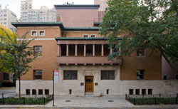
    On April 21, 2016, the SAH staff had its first official meeting to launch a Conservation Management Plan for Charnley-Persky House, SAH’s headquarters. The kick-off meeting, which also included architects from Harboe Associates and all of the contractors who will be gathering data and contributing recommendations to the plan, was the first of many discussions we will have over the next year about the 125-year-old National Historic Landmark. The Conservation Management Plan, which was fully funded by a generous grant from the Alphawood Foundation, will document the current state of the house’s structure and materials, will provide advice on addressing potential problems, and will outline conservation priorities and scheduled maintenance tasks so we at SAH can be proactive stewards of the house.

    CMP-Meeting-01

    For the nearly twenty years that SAH has been headquartered in Charnley-Persky House, we have raised grant funds to undertake many major projects. The largest funding to date was a $381,000 grant from the State’s Illinois First Program which funded a variety of infrastructure and repair projects in and around the house: demolishing the badly deteriorated vaulted sidewalk in front of the house and replacing it with a thick, code-compliant sidewalk; trenching around the entire foundation to install below-grade waterproofing to prevent moisture from seeping through the basement walls; tuck pointing the exterior brick and replacing about one third of the common bricks in the courtyard; repairing the water-damaged balcony and painting exterior wood; and adding new fences around parkway planting areas and new brick pavers in the parking area behind the house. Ironically, most of the work funded by this grant was invisible because it was either below grade or it returned materials and surfaces to a restored state. When neighbors commented that they couldn’t notice any difference, we took it as high praise.

    Trenching around the foundation in the early 2000s revealed a real surprise—a 19th-century midden directly behind the house. In an effort to learn more about the rich deposit of glass bottles, china chards, stoneware jugs, aluminum pots, and more, SAH collaborated with urban archaeologist and anthropologist Dr. Rebecca S. Graff to organize two archaeological field schools with students from DePaul University (2013) and Lake Forest College (2015). Some of the artifacts and their history are documented in a gallery of photographs. The Chicago media covered the digs extensively including this Chicago Tonight segment from WTTW, our local PBS station. As Dr. Graff and her students at Lake Forest College continue to analyze and catalog the artifacts, we are reminded that Charnley-Persky House is a living laboratory facilitating new discoveries about lifeways in well-heeled neighborhoods of 19th-century Chicago and other American cities.

    Despite all of the waterproofing work that SAH commissioned in the early 2000s, in 2014 Charnley-Persky House experienced a series of damaging floods starting on August 19 and continuing the following week. Unknown to us, an underground 19th-century U-shaped valve that connected the house’s interior downspouts with the municipal sewer became completely clogged with 100 years of sediment. The blockage caused rainwater from the roof to back up and discharge as two geysers of storm water in a second floor bathroom. The water cascaded down to the first floor library and basement below. Damage was extensive but through the generosity of Cynthia and Ben Weese, the Richard H. Driehaus Foundation, the Alphawood Foundation, Peterson Aluminum and nearly 100 individual donors, we were able to replace the connection to the sewer and repair the damaged ceiling, walls and woodwork.

    CMP-Meeting-02

    As alarming as the 2014 floods were, they were a catalyst that made us realize the importance of commissioning a full study of the house’s weak points and developing a multiyear Conservation Management Plan. We will document the year-long process of writing the plan through photographs, blog posts and regular updates. As part of the study, we also are collecting archival drawings, photographs and written documents to piece together as complete a history as possible of all the changes and restorations that have been made to the house in its 125 year history. This documentation will include the construction of an addition on the south end of the building in the 1920s, recreation of the balcony by architect John Vinci in the 1970s, demolition of the addition when Skidmore, Owings and Merrill undertook a major restoration in 1987, and continued restoration projects by managed by architect John Eifler in the early 2000s and 2014.  When Seymour H. Persky donated funds to SAH to purchase the house from Skidmore, Owings and Merrill in 1995, the SAH Board gratefully accepted his offer and started a new chapter in SAH history. SAH advances its educational mission by using the house as one tool, among many, to inform our thinking about the importance of balancing the preservation of historic structures and the smart growth of cities.

    Pauline Saliga
    Executive Director
  • Spanish Itineraries Part 2: Madrid, Toledo, Zaragoza

    by User Not Found | Apr 21, 2016
    With this month’s blog post, I am back in Spain, this time in Madrid and the surrounding areas. While in Toledo and Zaragoza, Islamic monuments are part of the discussion, I will generally also focus on the museums that I visited in all three cities although of course, given especially the large number of such institutions in Madrid, this will not be a complete account. 

    In Madrid, the central railway station at Puerta de Atocha quickly became a focal point, as high-speed trains are an easy way to travel around the country. The old station building with its courtyard full of plants (Figures 1 and 2) is particularly attractive, even though the platforms are actually in a new annex building. The way from Madrid to Zaragoza leads eastwards, through landscapes dominated by agriculture and small towns. 

    April-2016_Figure-1

    April-2016_Figure-2
    Figures 1 and 2: Puerta de Atocha railway station, Madrid (P. Blessing) 

    Once arrived in Zaragoza, nothing around the modern train station betrays the view to come: only minutes away, surrounded by apartment buildings likely built in the 1960s and 1970s, is the Aljafería (Figure 3). The palace was built during the Taifa period (after the downfall of the Umayyad caliphate in Spain) by the local Islamic ruler, Ahmad I ibn Sulayman Sayf al-Dawla Imad al-Dawla al-Muqtadir (r. 1049–82). The building now serves as the regional parliament of Aragon. The exterior, with its fortified aspect, does not point to the interior with its garden courtyard, arches, and stucco decoration (Figures 4 and 5). 

    April-2016_Figure-3
    Figure 3: Aljafería, Zaragoza, view (P. Blessing) 

    April-2016_Figure-4
    Figure 4: Aljafería, Zaragoza, courtyard (P. Blessing) 

    April-2016_Figure-5
    Figure 5: Aljafería, Zaragoza, view through arcades at south side of the courtyard (P. Blessing) 


    In the interior, the structure strongly evokes the architecture of Umayyad Cordoba, and especially of the palace city of Madinat al-Zahra: gardens, intersecting arches, stucco with vegetal and geometric motives abound (Figures 6 and 7). The mosque of the Aljafería, a small room to the side of a large hall used for receptions and gatherings, contains references to the Great Mosque of Cordoba in details of the decoration, and in the deep niche of the miḥrāb that forms a small room on its own (Figures 8 and 9). Theses references, at the core of a fortified complex reflect the context of a period in which aspirations to the Umayyad caliphate ran high, and conflicts between local rulers forced the construction of strong walls. 

    April-2016_Figure-6

    April-2016_Figure-7
    Figures 6 and 7: Details of stucco decoration, Aljafería, Zaragoza (P. Blessing) 

    April-2016_Figure-8

    April-2016_Figure-9
    Figures 8 and 9: Mosque and miḥrāb, Aljafería, Zaragoza (P. Blessing) 


    In Toledo, reference to Cordoba are present in an earlier monument, the Bab Mardum Mosque, built in 999, and rededicated as the church of El Cristo de la Luz after the Reconquista of the city in 1085 (Figures 10 and 11). The entrance section of the building consists of the original mosque, a small building with each bays, each covered with a different cross-ribbed vault (Figure 12). An extension was added to the eastern end of the mosque to create the church; wall paintings adorn the apse (Figure 13 and 14), and were added the late twelfth thirteenth century, notably showing inscriptions expression blessings in Arabic. 

    April-2016_Figure-10

    April-2016_Figure-11
    Figures 10 and 11: Exterior views, Bab Mardum Mosque/ El Cristo de la Luz, Toledo (P. Blessing) 

    April-2016_Figure-12
    Figure 12: Vaults of mosque section, Bab Mardum Mosque/ El Cristo de la Luz, Toledo (P. Blessing) 

    April-2016_Figure-13

    April-2016_Figure-14
    Figures 13 and 14: details of wall paintings apse, Bab Mardum Mosque/ El Cristo de la Luz, Toledo, during restoration in March 2014 (P. Blessing) 

    In style, the paintings are similar to those in the church of San Román in Toledo, built in the early thirteenth century (Figures 15 and 16). The church contains a large collection of Visigothic art, comparable to that in the National Museum of Archaeology in Madrid (on which more later). The church and museum reopened in 2015, and the objects on view present a detailed overview of the early medieval archaeological heritage of the region (Figure 17). 

    April-2016_Figure-15

    April-2016_Figure-16
    Figures 15 and 16: Interior views, San Román, Toledo (P. Blessing)

    April-2016_Figure-17
    Figure 17: Detail of display, San Román, Toledo (P. Blessing)


    Moving further through the historical center of Toledo, the cathedral (Figure 18) dominates a large section. Built in the thirteenth and fourteenth centuries, with some later additions, it is one of the largest Gothic cathedrals in Spain, next to the one in Seville. The cathedral is the church of the archbishop of Toledo, the primate of Spain. Burials of the archbishops, some dating to the nineteenth century are located in the cathedral and several of the later ones are marked by cardinals’ hats suspended above them (Figure 19). This is a striking detail that I have not encountered elsewhere, and I have not found background about it so far. Also striking are the foliate arches in the triphorium of the apse (Figure 20), a clear connection to locally engrained forms seen in the Bab Mardum Mosque and Toledo’s Romanesque churches. 

    April-2016_Figure-18
    Figure 18: Cathedral, Toledo, view (P. Blessing)

    April-2016_Figure-19
    Figure 19: Cardinal’s hat suspended above burial of Cardinal Juan de la Cruz Ignacio Moreno y Maisanove (d. 1884), archbishop of Toledo (1875–1884) in Toledo cathedral (P. Blessing)

    April-2016_Figure-20
    Figure 20: Detail of triphorium in apse, cathedral, Toledo (P. Blessing) 


    Not far from the cathedral are two buildings that originally served as synagogues, later as churches, and are now accessible as museums testifying to the Sephardic Jewish heritage of Spain. Santa Maria la Blanca (Figures 21 and 22) was built in the late twelfth century and reconstructed after a fire in 1250; the building became a church in the late fourteenth century. 

    April-2016_Figure-21

    April-2016_Figure-22
    Figures 21 and 22: Interior views, Santa Maria la Blanca, Toledo (P. Blessing)

    The synagogue of Samuel Ha-Levi, a councilor and treasurer at the court of Pedro I (the Cruel) of Aragon, was completed in 1357 and connected to the patron’s palace (no longer extant). The synagogue was turned into the church after the expulsion of Jews from Spain in 1492; first known as San Benito, the church’s dedication was to El Transito by the seventeenth century. The decoration of the monument (Figures 23 and 24) evokes that of the Alhambra, and is part of the Mudéjar style that was used in large parts of Spain in the fourteenth and fifteenth century, including the Alcazar of Seville and chapels added to the Great Mosque of Cordoba after its conversion to a church. 

    April-2016_Figure-23

    April-2016_Figure-24
    Figures 23 and 24: Details of interior stucco decoration, Synagogue of Samuel Ha-Levi, Toledo (P. Blessing) 

    Leaving Toledo, the train station itself is a striking sight (Figures 25 and 26). Built in 1917–1920, it is an example of Islamic revival architecture. (Readers may remember the city hall of Sarajevo from my August 2015 blog). Architect Narciso Clavería y Palacios was joined in the interior design and details of decoration by local master craftsmen Angel Pedraza, responsible for the tiles, and Julio Pascual Martínez who created metal work (Figures 27 and 28). 

    April-2016_Figure-25

    April-2016_Figure-26
    Figures 25 and 26: Views of main train station, Toledo (P. Blessing)

    April-2016_Figure-27

    April-2016_Figure-28
    Figures 27 and 28: Interior, main train station, Toledo (P. Blessing)


    The high-speed train takes travellers to Madrid in just 30 minutes, back to Puerta de Atocha station. This would be a place to close, yet I promised a glimpse at Madrid and so here it is with an account of the Museo Arqueológico Nacional (MAN, National Archaeological Museum), reopened in spring 2014 after a major overhaul of its exhibition spaces. Extending over three floors in two connected section, the exhibition begins with pre-historic artifacts and ends with eighteenth-century objects. Even though the focus is largely on Spain, the museum also as a sequence of rooms dedicated to Pharaonic Egypt and the ancient Near East. In the parts dedicated to the history and archaeology, the Roman period and the Middle Ages are particularly strong. A carefully choreographed transition leads from Roman to late antique, Visigothic, and Umayyad all on one floor. Highlights of this section are mosaics (Figure 29), the Visigothic votive crowns found in Guarrazar near Toledo (Figure 30), and a model of the Great Mosque of Cordoba, suspended above the section presenting Umayyad architectural sculpture (Figure 31 and 32).

    April-2016_Figure-29
    Figure 29: View of room with fourth- to fifth-century mosaics, MAN Madrid (P. Blessing).

    April-2016_Figure-30
    Figure 30: Detail of votive crown of king Recceswinth I (r. 649–672) from the treasure of Guarrazar, MAN Madrid; part of the treasure is in Madrid (MAN and Royal Palace), and other pieces are in the Musée national du Moyen Age, Termes de Cluny in Paris. (P. Blessing) 

    April-2016_Figure-31

    April-2016_Figure-32
    Figures 31 and 32: Model of the Great Mosque of Cordoba, MAN Madrid (P.Blessing)


    Even though the cut off after the Umayyad period to move on to Romanesque and Gothic Iberia on the floor above—and thus squarely into the realm of the Reconquista—gives room to pause, the presentation works remarkably well. It emphasizes the transitions from Roman to late antique Iberia, a world to which the Visigoths and, to some extent, the Umayyads belonged. The question remains whether Umayyad Spain was indeed a part of this late antique Mediterranean world throughout or whether, at least by the tenth century, it had rather absorbed to a large extent the cultural sphere of the Abbasid empire. 

    Recommended books:

    Anderson, Glaire D. The Islamic Villa in Early Medieval Iberia: Architecture and Court Culture in Umayyad Córdoba (Farnham and Burlington, VT: Ashgate, 2013).

    Nickson, Tom. Toledo Cathedral: Building Histories in Medieval Castile (University Park, PA: Pennsylvania State University Press, 2015).

    Robinson, Cynthia. In Praise of Song: the Making of Courtly Culture in al-Andalus and Provence, 1065-1135 A.D. (Leiden: Brill, 2002).
     
  • Byzantium in Istanbul, or: Istanbul is Constantinople (among other things)

    by User Not Found | Mar 28, 2016
    Just hours before I sat down to write this text on March 19, 2016, another suicide bomb claimed victims in Turkey, this time on İstiklal Caddesi, a lively shopping street at the center of Istanbul’s European side. Last week, an attack in one of Ankara’s main public transportation hubs pointed to further troubles, and it is now clearer how soon they are to some. So far, I have only very occasionally touched upon the political reality of the Middle East, and increasingly Europe. Yet now, as I continued research in Turkey and observe how the situation develops locally, I am both at a loss for words. I feel that it is callous to write about architectural history without the larger context of a country that increasingly slides into violence and uncertainty. I ambitiously wanted to write about Bursa, the first Ottoman capital, as well, but given recent events do not have the stomach to venture into a description of monuments that are, on the one hand, ethereally beautiful and, on the other hand, include mausolea and graveyards. I may return to this later, with distance if possible, but for now the first paragraph of my original text below stands without actual continuation. 

    Last month, I wrote about the transformation of Constantinople to Istanbul (although the shifts in naming were not as simple as this sentence suggests). I did not, however, say much about Byzantine architecture in Istanbul, nor did I venture into other cities. This post will do just that: first, it will present Byzantine monuments extant in Istanbul and second, it will show how in Bursa, the first Ottoman capital from 1326 to c. 1368, Byzantine architecture became part and parcel of the new dynasty’s patronage. 

    PBlessing_March-2016_Figure-1
    Figure 1: View of restored section of city walls near the Topkapı (not to be confused with the palace) tramway station, extra muros (P. Blessing)

    PBlessing_March-2016_Figure-2
    Figure 2: City walls and highway at Ayvansarayı (P. Blessing) 

    In Istanbul, a main feature of the Byzantine city that is still preserved are parts of the walls, although heavily restored in some (Figure 1) and badly preserved in other sections (Figure 2). Restoration and urban renewal projects close to the walls have caused controversy in recent years: the entire neighborhood of Sulukule, heavily populated by Roma communities, was demolished and inhabitants relocated. In recent months, the vegetable gardens (bostanlar) that existed along the walls for centuries, providing subsistence to local families and produce to some of Istanbul’s markets, were bulldozed. Often, historical photographs of the walls are now the only reliable sources to study certain sections; the photographs taken by Nicholas V. Artamonoff in the 1930s and 1940s are examples (Figure 3). 

    PBlessing_March-2016_Figure-3
    Figure 3: General view of the Wall of Manuel Komnenos looking from the city. Market garden, orchards, and shed in foreground, Photographer: Nicholas V. Artamonoff, Date: January 1938, Negative Number: RA415, Reaccession Number: 
    ICFA.NA.0240, Nicholas V. Artamonoff Collection, Image Collections and Fieldwork Archives, Dumbarton Oaks Research Library and Collection

    Similarly, former Byzantine churches have often undergone a series of restorations and transformations, from church to mosque, from mosque to museum, and sometimes back to mosque. Many of these monuments are located in an area between the land walls and the Süleymaniye Mosque. They date from the tenth to the fourteenth centuries, although the ruins of the sixth-century Hagious Polyeuktos (Figure 4) can bee seen close to the sixteenth-century Şehzade Mosque and the aqueduct of Valens (Figure 5). The site was excavated in the 1930s, and sculpture is on view at the Istanbul Archaeological Museum, while spolia have been part of the Church of St. Marc in Venice since the thirteenth century (Figure 6). This is one of the instances where several stations of my travels this year form a whole, displaying connections that are not easily understood without first-hand experience. 

    PBlessing_March-2016_Figure-4
    Figure 4: remains of large-scale sculpture from Hagios Polyeuktos, photograph taken in August 2008 (P. Blessing)

    PBlessing_March-2016_Figure-5
    Figure 5: aqueduct of Valens, Şehzade Mosque, near photograph taken in August 2008 (P. Blessing)

    PBlessing_March-2016_Figure-6
    Figure 6: spolia from Hagios Polyeuktos, now on St. Mark’s Cathedral, Venice (P. Blessing)

    Moving away from Hagios Polyeuktos towards the city wall, the next site of interest is the church of the Pantokrator Monastery, known as Zeyrek Mosque since the late fifteenth century (Figure 7). Close by is the Fatih Mosque, one of the monuments that I wrote about in February

    PBlessing_March-2016_Figure-7
    Figure 7: Pantokrator Church/ Zeyrek Mosque (front) and Fatih Mosque (P. Blessing)

    The Pantokrator Church, or rather churches since it was planned as an assembly of structures from the start, was built under the patronage of John II and Eirene Komnenos 1118–36. A main function was that of imperial mausolea, as more of a dozen imperial burials were located there. The structure was restored in a long-term project under the director of Prof. Zeynep Ahunbay, Prof. Metin Ahunbay, and Prof. Robert Ousterhout, beginning in 1997–98, and continued in several seasons until 2005–06. At that point, the Directorate of Pious Foundations (Vakıflar Genel Müdürlüğü) took over the project, which has been continuing in stages (Figures 8, 9, and 10), and it is currently not accessible. 

    PBlessing_March-2016_Figure-8
    Figure 8: Pantokrator Church/ Zeyrek Mosque in 2008 (P. Blessing)

    PBlessing_March-2016_Figure-9
    Figure 9: Pantokrator Church/ Zeyrek Mosque in 2014 (P. Blessing)

    PBlessing_March-2016_Figure-10
    Figure 10: Pantokrator Church/ Zeyrek Mosque in 2016 (P. Blessing)

    Close to the walls, the Chora Church/Kariye Camii (Figure 11) built in the eleventh century and enlarged in 1316–21, has been a museum since the early 1930s. The mosaic decoration of the narthex and naos, and the frescoes in the fourteenth-century funerary chapel are the main attractions of the site. The patron of the fourteenth-century restoration of the church, Theodore Metochites, is shown at the feet of Christ (Figure 12), presenting the restored church—notably with the addition of the mosaics. The extensive program of the narthex, depicting scenes from the life of Christ and the life of the Virgin Mary, culminate in the figure of Christ Pantokrator in the southern dome (Figure 13) and of the Virgin and Child in the northern dome (Figure 14). In the funerary chapel, frescoes dating to c. 1320 show an elaborate program moving towards the Anastasis, and a terrifyingly creative rendering of the 

    PBlessing_March-2016_Figure-11
    Figure 11: Chora Church, exterior in 2008 (P. Blessing) 

    PBlessing_March-2016_Figure-12
    Figure 12: Chora Church, mosaic showing Theodore Metochites as donor (P. Blessing)

    PBlessing_March-2016_Figure-13
    Figure 13: Chora Church, southern dome of narthex with Christ Pantokrator (P. Blessing)

    PBlessing_March-2016_Figure-14
    Figure 14: Chora Church, southern dome of narthex with Christ Pantokrator (P. Blessing)

    [This is where I meant to move on to Bursa, but I will leave this for now. My April blog, planned as a text about Madrid and northern Spain, may return to Bursa instead]. 

    Let me close with a paragraph on some issues indirectly connected to the Byzantine past of Istanbul. The first is the site of Eyüp up the Golden Horn outside the old walls, a landscape of Ottoman mosques, mausolea, and graveyards that are still in use today (Figure 15). At the center of this holy site is the tomb of a figure known as Abu Ayyub al-Ansari (Eyüp Sultan on Turkish); the narrative surrounding the tomb is closely connected to the time of Mehmed the Conqueror. According to legend, Abu Ayyub al-Ansari was companion of the Prophet Muhammad who died during the first Arab siege of Constantinople—and thus served as a (less successful) precedent of Mehmed the Conqueror’s conquest, now conveniently connected to early Islamic times. While the city was under siege just before the Ottoman conquest, Akşemsettin, a Sufi shaykh close to the sultan, found the Abu Ayyub al-Ansari’s previously unknown tomb. A mausoleum and mosque were established and the site firmly became part of Ottoman foundational lore.1 The current mosque is that built after a devastating earthquake in the eighteenth century (Figures 16 and 17), although much of the time decoration on the mausoleum consists of sixteenth- and seventeenth-century pieces (Figures 18 and 19). 

    PBlessing_March-2016_Figure-15
    Figure 15: View over Golden Horn and Eyüp from Pierre Loti Cafe (P. Blessing)

    PBlessing_March-2016_Figure-16
    Figure 16: View of Eyüp Sultan Mosque, with graveyard in the foreground (P. Blessing)

    PBlessing_March-2016_Figure-17
    Figure 17: Courtyard, Eyüp Sultan Mosque (P. Blessing)

    PBlessing_March-2016_Figure-18

    PBlessing_March-2016_Figure-19
    Figures 18 and 19: tiles on façade of mausoleum, Eyüp Sultan Mosque (P. Blessing)

    Turning away from Eyüp and the Golden Horn, moving along the shore towards Eminönü, the neighborhoods of Fener and Balat are the most recent sites of the gentrification that has already taken over areas such as Beyoğlu and Cihangir in the last twenty years. Yet here, towering above neighborhoods full of historical buildings—some restored, others in ruins—is the Greek Orthodox Patriarchate, a poignant reminder of the city’s history but also its present that is not just Turkish and Islamic (Figure 20). 

    PBlessing_March-2016_Figure-20
    Figure 20: Balat, view up the hill with Patriarchate at the top (P. Blessing) 

       
    1. For the details of various sources on these accounts and the early architectural history of the site, see: Kafescioglu, Constantinopolis/ Istanbul, pp. 45-52.
  • Creating an Ottoman Capital: Istanbul in the Late Fifteenth Century

    by User Not Found | Feb 26, 2016
    This blog post will continue last month’s account of Istanbul as a city between past and present, between historical monuments and skyscrapers. The focus this time will be on the second half of the fifteenth century, and on the shaping of the new Ottoman capital following the conquest of Constantinople and the end of the Byzantine Empire in 1453. The conquest was not sudden, and Ottoman sultan Mehmed II, known as the Conqueror, had long prepared it. Fortresses on both sides of the Bosphorus—Rumeli Hisar on the European and Anadolu Hisar on the Asian shore —were built in as part of the Ottoman approach on the Byzantine capital. Nowadays surrounded by restaurants and cut off from the shore by roads, the fortresses are no longer quite as forbidding, yet they still impress when seen from a distance (Figures 1 and 2). 

    February-2016_Figure-1
    February-2016_Figure-2
    Figures 1 and 2: Rumeli Hisar, Istanbul, view and close up (P. Blessing) 

    The Ottomans did not immediately set about fully transforming the city—some steps were taken as soon as the city was in hand, such as the conversion of its cathedral, Hagia Sophia, into a mosque (Figures 3 and 4). The overall changes to the urban fabric, however, including the construction of mosques and a new palace, took place over several decades to come. 

    February-2016_Figure-3Jan-2011
    February-2016_Figure-4_Jan-2011
    Figures 3 and 4: Hagia Sophia, interior, photographs taken in January 2011 when all scaffoldings were down (P. Blessing)

    Only ten years after the conquest, in 1463, was a new mosque built under the sultan’s name: the Fatih Mosque, or Mosque of the Conqueror, named after the victorious ruler. Largely destroyed in a devastating earthquake in 1766, the current building is mostly the result of reconstruction at that time, although the courtyard is still largely original (Figures 5 and 6). The site was well chosen: the Church of the Holy Apostles—the burial place of Byzantine emperors—was torn down and the patriarchate of the Greek Orthodox Church relocated. Seen from the Golden Horn, moreover, the mosque dominates the church of the Pantokrator Monastery, and imperial foundation soon converted into a mosque and still used as such today. Both the mosque and the cistern below (Figure 7) have been the subject of several restoration projects over the years, including most recently in 2014. 

    February-2016_Figure-5
    Figure 5: Fatih Mosque, view, with Pantokrator Church/ Zeyrek Mosque in front (P. Blessing)

    February-2016_Figure-6
    Figure 6: Fatih Mosque, courtyard (P. Blessing)

    February-2016_Figure-7-AUGUST-2008
    Figure 7: Zeyrek Cistern, during restoration in August 2008 (P. Blessing)


    The sultan himself became part of the myth of the conquest: Italian painter Gentile Bellini’s portrait of Mehmed II can be found on advertisements (Figure 8) and the legend of an Ottoman rider leaping over the city walls during the conquest has found its way onto a municipal emblem (Figure 9).

    February-2016_Figure-8_-June-2014
    Figure 8: Advertisement on the façade of an appliance store, using Gentile Bellini’s portrait of Mehmed the Conqueror, photograph taken in the Fatih neighborhood in June 2014 (P. Blessing)

    February-2016_Figure-9
    Figure 9: Emblem of the Faith municipality, opposite the Mahmud Pasha Mosque near the Grand Bazaar (P. Blessing)


    Mehmed II was not the only patron of architecture: in a targeted, long-term project that Çiğdem Kafescioğlu has studied in detail, notables and particularly the sultan’s grand-viziers were responsible for the construction of mosque complexes. In several examples, only the mosques are well preserved and the subsidiary buildings have disappeared or are at various stages of decay, as Kafescioğlu outlines. The new mosque complexes were located in various places throughout the city, on both the European and Asian sides. Located near the Grand Bazaar, the Mosque of Mahmud Pasha was built in 1462–63. The building evokes the small early Ottoman mosques in its plan and exterior aspect (Figures 10 to 12). The patron’s mausoleum, however, located directly behind the mosque, has an exterior decoration of turquoise tile inlaid into a marble covering, forming geometric patterns (Figures 13 to 15). In her study of late fifteenth-century Istanbul, Kafescioğlu designated this decoration as Timurid without further elaborating, yet other references come to mind, including the stone-carved geometric patterns on the portals of thirteenth-century Seljuk monuments in central Anatolia. The building has been undergoing restoration for several years, covered in scaffolding and its surroundings becoming a maze of steel barriers (Figures 16 to 18), and I have not yet been able to visit the interior. 

    February-2016_Figure-10
    February-2016_Figure-11
    February-2016_Figure-12
    Figures 10 to 12: Mahmud Pasha Mosque, Istanbul, views (P. Blessing) 

    February-2016_Figure-13
    February-2016_Figure-14
    February-2016_Figure-15
    Figures 13 to 15: Mahmud Pasha Mausoleum, Istanbul, view and details (P. Blessing)

    February-2016_Figure-16
    February-2016_Figure-17
    February-2016_Figure-18
    Figures 16 to 18: Mahmud Pasha Mosque, Istanbul, porch and surroundings (P. Blessing) 


    Located on the Asian side of the Bosphorus, in Üsküdar, the Rum Mehmed Pasha Mosque, built in 1471, takes on the silhouette of a Byzantine church (Figure 19). It towers on a hillside, visible from afar in the winter but hidden behind the leaves of nearby trees in the summer. Yet the exterior is deceptive, and only superficially points to the aesthetic of churches in converted into mosques. In the interior of the mosque, the dome is painted in scrolls and leaves that point east, and the dome rests on muqarnas pendentives (Figure 20). 

    February-2016_Figure-19
    Figure 19: View of shore at Üsküdar, Istanbul with Rum Mehmed Pasha Mosque, at center and Şemsî Ahmed Pasha Mosque at front left (P. Blessing)

    February-2016_Figure-20
    Figure 20: Rum Mehmed Pasha Mosque, Istanbul, interior (P. Blessing)

    Back on the European shore, near Topkapı Palace, only the mosque and hamam remain from the complex of İshak Pasha, founded in 1483 (Figures 21 and 22). While the mosque is still in use, the hamam is an empty shell; the terrace of a nearby hotel affords a rare glimpse of the interior (Figure 23). This state of preservation is typical in that often mosques continue to be used while other buildings fall into disrepair, are abandoned or used for purposes detrimental to the historical fabric. 

    February-2016_Figure-21
    Figure 21: İshak Pasha Mosque, view (P. Blessing)

    February-2016_Figure-22
    Figure 22: İshak Pasha Hamam, view (P. Blessing) 

    February-2016_Figure-23
    Figure 23: İshak Pasha Hamam, interior (P. Blessing) 


    In addition to these problems in viewing fifteenth-century mosque complexes in their entirety, a further complication is the fact that roads often cut viewpoints, and make access difficult. An example of this is the Has Murad Pasha Mosque (1465–71) in the Aksaray neighborhood, enclosed by highways and tramway lines (Figure 24), so that even taking a good view of the monument becomes a challenge. 

    February-2016_Figure-24
    Figure 24: Has Murad Pasha Mosque, view (P. Blessing)

    While these mosque complexes were important parts of the construction of Constantinople-Istanbul as the Ottoman capital, this overview would not be complete without a glimpse at Topkapı Palace, founded by Mehmed II and inhabited until the late nineteenth century (Figure 25). The building complex and its transformation over the centuries have been studied by Gülru Necipoğlu. Here, I would like to present the so-called Çinili Köşk (Tiled Pavilion), built in 1472 (Figure 26). Nowadays separated from the premises of the palace by the Archaeological Museum (Figure 27), it is an example of the fifteenth-century negotiation between varied influences in Ottoman architecture. The tile-work (Figures 28 and 29), made by tile-makers from Khurasan, points to Timurid architecture, yet in the overall effect is quite different from that of the supposed models in Central Asia, in part also because of the use of cut marble combined with the tiles. I will further explore this question in March, when discussing early Ottoman architecture elsewhere in Turkey. 

    February-2016_Figure-25
    Figure 25: Topkapı Palace, view from the Bosphorus (P. Blessing)

    February-2016_Figure-26
    Figure 26: Çinili Köşk (Tiled Pavilion), view, June 2014 (P. Blessing)

    February-2016_Figure-27
    Figure 27: Istanbul Archaeological Museum, view, June 2014 (P. Blessing) 

    February-2016_Figure-28
    February-2016_Figure-29
    Figures 28 and 29: Çinili Köşk (Tiled Pavilion), detail of exterior tile and marble decoration (P. Blessing)


    Bibliography:

     Çiğdem Kafescioğlu, Constantinopolis/ Istanbul: Cultural encounter, imperial vision, and the construction of the Ottoman capital, University Park, PA: Pennsylvania State University Press, 2009.

    Gülru Necipoğlu, Architecture, Ceremonial, and Power – The Topkapi Palace in the fifteenth and sixteenth centuries, Cambridge, MA: MIT Press, 1991.

    Gülru Necipoğlu, “From International Timurid to Ottoman: A Change of Taste in Sixteenth-Century Ceramic Tiles,” Muqarnas 7 (1990): 136-170.

    Gülru Necipoğlu, “ ‘Virtual Archaeology’ in Light of a New Document on the Topkapı Palace’s Waterworks and Earliest Buildings, ca. 1509,” Muqarnas 30 (2013): 315-350.
  • Istanbul: Sultans' Mosques and Urban Expansion

    by User Not Found | Jan 25, 2016
    In the first of two blogs that I plan to write about Istanbul, a main topic will be Ottoman architecture in the city and current restoration projects. In a city with currently about 15 million inhabitants, expanding highway and public transportation systems, ongoing construction for a third bridge across the Bosporus, and a new airport near the Black Sea, monument preservation is a constant, pressing issue. In addition, impacts on the environment are growing and palpable: wild boars have been seen swimming across the Bosporus fleeing bridge construction, and the controversial airport project poses a threat to migratory birds, including the storks who rest in Sariyer, every spring (Figure 1a). 

    Jan-2016-Figure-1A
    Figure 1a: Migrating storks in Sariyer, in the northern section of Istanbul’s European side, in March 2015 (P. Blessing) 

    Within the city, increasing population, traffic, and construction poses constant challenges to the preservation of historical monuments such as Topkapı Palace, Hagia Sophia, and the many Ottoman mosques, including those founded by Ottoman sultans over the centuries and whose presence in the city’s urban space is undeniable. A few views of the first monument that I will discuss, the Süleymaniye Mosque, confirms this observation. Seen from the Galata Bridge the mosque, built by master architect Sinan in 1550–58 under the patronage of Ottoman sultan Süleyman the Magnificent (r. 1520–66), the mosque towers above the Golden Horn (Figure 1b). Moving away further, the mosque founded in 1561 by Rüstem Pasha, one of sultan Süleyman’s grand viziers and his son-in-law, appears to sit humbly at the feet of the ruler’s much larger mosque (Figure 2a). The rich interior tile decoration of the interior of course required an amount of wealth that betrays this pretense (Figure 2b). Zooming in further—the dome and minaret of the Rüstem Pasha Mosque to the left, the mausolea behind the Süleymaniye Mosque at the center (Figure 3)—it becomes clear how many new buildings are interspersed with the historical construction that includes subsidiary buildings for both mosques. More on this point below.

    Jan-2016-Figure-1B
    Figure 1b: Süleymaniye Mosque, Istanbul, seen from the Galata Bridge (P. Blessing)

    Jan-2016-Figure-2A
    Figure 2a: Rüstem Pasha Mosque, Istanbul, with Süleymaniye Mosque in the background (P. Blessing)

    Jan-2016-Figure-2B
    Figure 2b: Interior, Rüstem Pasha Mosque, Istanbul (P. Blessing, June 2014)

    Jan-2016-Figure-3
    Figure 3: Figure 2a: Dome and minaret of Rüstem Pasha Mosque, Istanbul, with mausolea and cemetery of Süleymaniye Mosque in the background (P. Blessing)


    Approaching the Süleymaniye Mosque in its central axis, the viewer first catches a glimpse through the central portal leading into the courtyard; the floor plan of the complex is useful to grasps the site’s complexity. From the bottom of the stairs, a carefully planned viewpoint allows one to see the inscription panels on the exterior of the courtyard, on the mosque’s porch, and move its main door (Figure 4). Approaching further, the monumental dome emerges, in what is of course by now a classical view of the monument – yet it never fails to stun (Figure 5). The system of the central dome, built upon subsidiary half- and quarter domes allows for the expansive interior space with its four massive pillars (Figure 6). The interior of the dome, recently restored together with the building as a whole shows a nineteenth-century neo-Baroque design (Figure 7), the result of an earlier restoration. Recovered as the oldest fully preserved layer in the recent restoration, this was privileged over the previous reconstruction of what the sixteenth-century decoration might have looked like. 

    Jan-2016-Figure-4
    Figure 4: View from courtyard entrance towards mosque portal, Süleymaniye Mosque, Istanbul (P. Blessing)

    Jan-2016-Figure-5
    Figure 5: View from courtyard, Süleymaniye Mosque, Istanbul (P. Blessing)

    Jan-2016-Figure-6-JUNE-2014
    Figure 6: Interior, Süleymaniye Mosque, Istanbul (P. Blessing, June 2014)

    Jan-2016-Figure-7_june-2014
    Figure 7: Interior view of dome, Süleymaniye Mosque, Istanbul (P. Blessing, June 2014)

    Behind the qibla wall of the mosque, among gravestones from several centuries, the mausolea of sultan Süleyman (Figures 8 and 9) and his wife, Hürrem Sultan (Figure 10, at left), are to be found. In the interior of the sultan’s mausoleum, his oversized cenotaph emerges in front of a backdrop of İznik tiles (Figure 11). These are only two of the many royal mausolea in Istanbul, which create a dynastic imprint on the city’s landscape, as historian of Ottoman architecture, Gülru Necipoğlu, has argued.

    Jan-2016-Figure-8

    Jan-2016-Figure-9
    Figures 8 and 9: Mausoleum of Süleyman the Magnificent, Süleymaniye Mosque Complex, Istanbul (P. Blessing)

    Jan-2016-Figure-10
    Figure 10: Mausoleum of Hürrem Sultan, Süleymaniye Mosque Complex, Istanbul (P. Blessing)

    Jan-2016-Figure-11
    Figure 11: Interior, mausoleum of Süleyman the Magnificent, Süleymaniye Mosque Complex, Istanbul (P. Blessing)


    Seen from the terrace behind the mosque, a view of the Bosporus emerges over the domes of the third of four madrasas that belong to the complex (Figure 12a). Shifting the view slightly to the left, the foreground remains very similar yet the background changes: the skyscrapers of the business centers and malls in Maslak and Levent emerge in the back, and the new metro bridge cutting across the Golden Horn is seen at left (Figure 12b). The changes in the sightlines caused by such construction are considerable, as historian Cemal Kafadar poignantly described; the bridge across the Golden Horn was the subject of much criticism before and during its construction, to little avail. 

    Jan-2016-FIgure-12A

    Jan-2016-Figure-12B
    Figures 12a and 12b: Views from the terrace of the Süleymaniye Mosque Complex, Istanbul, towards the Bosphorus and Golden Horn (P. Blessing)

    Below the supporting wall of the terrace, a street is lined with a series of restaurants and and residential buildings (Figure 13), a great contrast to the perfectly planned views that architect Sinan created in the mosque complex, for instance through a side door to the courtyard that frames the small domes of the courtyard arcades (Figure 14) or even the wall of the cemetery and a glimpse of the mosque on approach (Figure 15). 

    Jan-2016-Figure-13
    Figure 13: View from terrace, Süleymaniye Mosque Complex, Istanbul (P. Blessing)

    Jan-2016-Figure-14
    Figure 14: View into courtyard, Süleymaniye Mosque Complex, Istanbul (P. Blessing)

    Jan-2016-Figure-15
    Figure 15: View of surroundings, Süleymaniye Mosque Complex, Istanbul (P. Blessing)


    Meanwhile restoration work continues on subsidiary buildings such as the guesthouse (Figures 16 and 17). Tarps such as the one in Figure 16, with drawings of the restoration projects and “before and after” photographs of the monuments are familiar sights in Istanbul. Almost continuously, projects are begun while others end, and so one can never quite know what surprising view may emerge on a walk even through the historical peninsula. Currently, the Mosque of Sultan Bayezid II, built in 1501–07, is being restored and offers a sight of scaffoldings, fences, and rather disconcertingly given the cold and wet winter, tarps over some of its courtyard domes (Figure 18). Proceeding further along the Divanyolu (Figure 19), now home to tram tracks but originally a main road from the Byzantine Great Palace to the Golden Gate, similar views emerge for instance at the mausoleum of Sultan Mahmud II (r. 1808–39), now hidden from view (Figure 20). 

    Jan-2016-Figure-16

    Jan-2016-Figure-17
    Figures 16 and 17: Guesthouse (tabhane) during restoration Süleymaniye Mosque Complex, Istanbul (P. Blessing)

    Jan-2016-Figure-18
    Figure 18: Mosque of Sultan Bayezid II, Istanbul (P. Blessing)

    Jan-2016-FIgure-19
    Figure 19: Divanyolu near Mausoleum of Sultan Mahmud II, Istanbul (P. Blessing)

    Jan-2016-Figure-20
    Figure 20: Mausoleum of Sultan Mahmud II during restoration (P. Blessing)

    Jan-2016-Figure-21
    Figure 21: Egyptian Bazaar (Mısır Çarşı) during restoration (P. Blessing)


    Walking from the mausoleum of Mahmud II further along the Divanyolu, monuments such as the mosque of Sultan Ahmed I (better known as the Blue Mosque), Hagia Sophia, and Topkapı Palace are of course some of Istanbul’s most well-known sites. I will include Hagia Sophia and Topkapı Palace in February’s post about the fifteenth-century transformation of Byzantine Constantinople to Ottoman Istanbul, yet for now let us move on to Eminönü. Here, the Egyptian Bazaar (Mısır Çarşı, Figure 21) and surrounding maze of stores offer a great amount of spices and food while in front, road, ferry landings, and tram line make the area a busy transportation hub. Just next to it, the complex of the Yeni Cami (New Mosque) or Yeni Valide Cami expands. First commissioned in 1579 by Safiye Sultan, the mother of Sultan Mehmed III and completed in 1663 by Hadice Turhan Sultan, the mother of Mehmed IV, after nearly fifty years of interruption, the complex today consists of mosque, mausoleum, sultan’s kiosk (hünkar kasrı) and fountain while additional buildings have not survived (Figures 22 to 25). The building complex, while not as closely connected and symmetrically structured as the Süleymaniye Mosque Complex, nevertheless made use of spatial connections and sightlines between the structures, as Lucienne Thys-Şenocak has discussed in detail. Moreover, the relationship between the mosque and the water is important (Figure 26), even though the shoreline has greatly changed due to road construction. 

    Jan-2016-Figure-22
    Figure 22: Mausoleum of Hadice Turhan Sultan during restoration (P. Blessing)

    Jan-2016-Figure-23
    Figure 23: Roof of fountain of Yeni Cami Complex, with mosque in the background (P. Blessing)

    Jan-2016-Figure-24-copy.jgp
    Figure 24: Yeni Cami, Istanbul, view from south-east (P. Blessing)

    Jan-2016-Figure-25
    Figure 25: Sultan’s kiosk (hünkar kasrı) Yeni Cami, Istanbul (P. Blessing)

    Jan-2016-Figure-26-june-2014
    Figure 26: Yeni Cami, Istanbul, view from Golden Horn (P. Blessing, June 2014)


    I will leave the reader with a view of the shore just across from the mosque, where the Galata Tower stands out above the maze of buildings and construction sites below (Figure 27). Istanbul is striking for just that, the constant combination of old and new, of beautiful and ugly, and for the resulting tensions. 

    Jan-2016-Figure-27
    Figure 27: Galata and Karaköy, Istanbul, seen from Galata Bridge (P. Blessing)
     
    Recommended Readings:

    Gülru Necipoğlu, “The Süleymaniye Complex in Istanbul: An Interpretation,” Muqarnas 3 (1986): 92–117.

    Gülru Necipoğlu, The Age of Sinan: Architectural Culture in the Ottoman Empire (Princeton, NJ: Princeton University Press, 2005; paperback London: Reaktion Books, 2010).

    Lucienne Thys-Şenocak, Ottoman Women Builders: The Architectural Patronage of Hadice Turhan Sultan (Aldershot and Burlington, VT: Ashgate, 2006).
     
  • Mirrors of the Orient: Exhibitions of Islamic Art in Europe

    by User Not Found | Jan 04, 2016
    As the year winds down, I would like to take the opportunity to write about a number of museum collections that I have visited since my travels began in July. Specifically, I would like to discuss exhibitions of Islamic art within Europe, several of which have been rearranged in the last few years. Considering the political situation in much of the Middle East, museum collections are becoming more and more important as resources for research and preservation. As for any type of research project that relies on fieldwork, studies of architectural history are strongly affected by conditions of travel, and places that can no longer be visited risk moving to the margins of research. This in turn is a major issue when sites are subsequently destroyed—consider the twelfth-century minaret of the Umayyad Mosque of Aleppo, reduced to a pile of rubble in spring 2013, and the historical covered market of the same city. Initiatives to document monuments have begun to emerge; they include UT Antiquities Action, yet it is hard to image what could be rebuilt if the war in Syria were to end. 

    Over the last ten years, several collections of Islamic art in major collections around the globe received new displays; these include the Metropolitan Museum of Art, the Louvre in Paris, the Victoria and Albert Museum in London, the Ashmolean Museum in Oxford, and the Museum of Turkish and Islamic Art in Istanbul that I will discuss in my next post. The Museum for Islamic Art in Berlin is scheduled to move to a new space within the larger renovation project of the Museum Island and particularly the Pergamon Museum, to be completed by 2025. Admittedly, I have not yet had a chance to visit the David Collection in Copenhagen, which has a strong focus on Islamic art. New museums, such as the Aga Khan Museum in Toronto, opened in 2014, have sprung up as well. At the same time, collections containing large numbers of Islamic objects, such as that of the Musée des Tissus in Lyon, France, are at peril: the museum may close if new options for funding are not found. In this context, the dynamic world of museum collections is closely tied to politics, both at the level of spending cuts for culture, and in the connection to the antiques trade and preservation of cultural heritage from conflict regions. 

    Today, I will focus on collections in Italy, France, and the United Kingdom that I visited in the last few months. Of the collections mentioned above, I am also familiar with the Metropolitan Museum and the Berlin collection. The latter is left out here, because it will reinstalled at a later point; I would, however, like to point to the excellent special exhibition about former director and historian of Islamic art, Friedrich Sarre (1865–1945), on view until January 24, 2016. As I visited the exhibits and later discussed some of them with colleagues, I became more and more aware of the biases of an art historian inherent in my view on these displays. Thus, I find it hard to assess the view of the general public going into the galleries without prior knowledge of Islamic art, and can’t help looking out for the major pieces I know to be located in each collection. 

    This summer, in Rome, I visited for the first time the Museo Nazionale d’Arte Orientale, home to one of the largest collections of Islamic art in Italy. Within this collection, a main focus are objects from the excavations at Ghazni, Afghanistan, the capital of the Ghaznavid dynasty that ruled over present-day Afghanistan, north-eastern Iran, and northern India from the late tenth to the mid-twelfth centuries. Excavations at the sites were conducted by the now-defunct Istituto Italiano per l'Africa e l'Oriente (ISIAO) in the late 1950s and the 1960s (Figure 1). The excavations mostly investigated the palace of Ghaznavid sultan Masud III (r. 1099–1115); major finds include carved marble panels that served as wall decoration (Figure 2). Overall, the collection unfortunately remains on the margins of Rome’s museum circuit, with its masses of visitors streaming into sites such as the Vatican Museums, but bypassing other exhibits such as this. In addition to Islamic art, the collection also has a strong focus on East Asia, including China, Japan, and Korea; the building itself is worth a visit, too (Figure 3). 

    PBlessing_December-2015_Figure-1
    Figure 1: Panel describing the history of the Ghazni excavations, Museo Nazionale d’Arte Orientale, Rome (P. Blessing)

    PBlessing_December-2015_Figure-2
    Figure 2: Detail of marble panel from the Ghazni excavations, Museo Nazionale d’Arte Orientale, Rome (P. Blessing)

    PBlessing_December-2015_Figure-3
    Figure 3: Nineteenth-century chandelier, Museo Nazionale d’Arte Orientale, Rome (P. Blessing)

    Walking through Rome, I came across numerous posters of another exhibition (Figure 4). Objects from the al-Sabah collection of Islamic art, based in the Dar al-Athar al-Islamiyya in Kuwait, happened to be in view in the Scuderie del Quirinale. This traveling exhibition was a chance to see objects that are not often easily accessible; even though photography was not permitted in the show, some of the objects and others from the collection can be viewed on the Google Art Project, although item information on the site, unfortunately, is very limited.

    PBlessing_December-2015_Figure-4
    Figure 4: Poster for the exhibition of the al-Sabah collection in Rome (P. Blessing) 

    PBlessing_December-2015_Figure-5
    Figure 5: Roof over Islamic galleries, Louvre, Paris, seen from above (P. Blessing) 

    PBlessing_December-2015_Figure-6
    Figure 6: Upper floor of Islamic galleries, Louvre, Paris, with eleventh-century stucco inscription frieze from Saveh, Iran (P. Blessing)

    Moving on to Paris, the Louvre opened its new permanent exhibition of Islamic art in fall 2012. A courtyard received a new roof (Figure 5), and two floors of exhibition space were built into it (Figure 6). The space is a first rather overwhelming, and one needs several visits to form a better view of the exhibit. On the upper floor, seen in figure 6, light flows through the roof structure while the lower floor is quite dark. The narrative is largely chronological, beginning with early Islam on the first floor. Thematic cases include the role of calligraphy in Islamic art and the influence of Chinese ceramics on the early Islamic production. Pieces from major sites such as the ninth-century Abbasid palaces of Samarra, and well-known objects such as the tenth-century ivory pyxis of Mughira from Umayyad Spain are shown alongside extensive exhibits from the site of Siraf on the Persian Gulf, including ceramics influenced by Chinese examples. The lower level is harder to navigate, as the trajectory is not quite clear from the start. In effect, it is largely chronological, with the continuation of the medieval exhibits in the room at the far end, and the early modern display—the collection ends at 1800—in the center. Coming down the stairs from the upper floor, however, the visitor is not clearly guided in one or the other direction. The cases with book paintings, placed quite understandably in a little-lit spot, are unfortunately easy to miss due to their location underneath the stairs. Other displays, however, are well presented, such as the selection of images of royal figures on ceramics. A fifteenth-century Mamluk stone porch, taken to Paris from Cairo for the 1889 World Fair and not on view for over a century, was restored and reassembled for the new display as an instructive video explains. Overall, several short videos about production processes—of, for instance, ceramics and inlaid metalwork—are worth the time for their simple and well-designed explanations of techniques. Additionally, replicas of several objects are available to touch. While these displays, featuring labels in Braille writing, are primarily intended for visitors with impaired vision, they are attractive for all. Although the pieces are all made of the same material and don’t provide a sense of texture, small samples of materials are added for that purpose. 

    The Institut du Monde Arabe, research center, library and museum all in one has a permanent exhibit focusing on Islamic art. The narrative here, rather than focusing on the historical trajectory of dynasties, revolves around themes such as medicine and astronomy, in addition to some chronological displays. Highlights are fragments of wall-paintings (Figure 7) from the seventh-century desert castle of Qasr al-Hayr al-Gharbi in Syria, and pieces of mosaic from the Great Mosque of Damascus, on loan from the National Museum in Damascus. While it is wonderful to see these objects in Paris, this does little to distract from the fact that both monuments and the large number of finds from Qasr al-Hayr al-Gharbi in Syria are out of reach. In a recent interview with Swiss newspaper Der Bund, Mohamed Fakhro, deputy director of the National Museum in Aleppo and now living in Germany where he pursues research, pointed out the extent to which the destruction of cultural heritage adds to the human suffering caused by the conflict. 

    PBlessing_December-2015_Figure-7
    Figure 7: Fragment of wall painting from Qasr al-Hayr al-Gharbi, Syria, on loan to the Institut to Monde Arabe, Paris (P. Blessing)

    In the UK, several museums have new displays of Islamic art, while the British Museum recently announced that new Islamic galleries would open in 2018. The Victoria and Albert Museum (V&A) in London opened its Jameel Gallery of Islamic Art in 2008 (Figure 8). The center of the room is dominated by the Ardabil carpet, a very large (10.51m x 5.34m) sixteenth-century piece that comes from the ancestral shrine of the Safavid dynasty in northern Iran. The other exhibits are arranged around the room, both along the walls (Figure 9) and in cases that separate the central space from the circuit around.

    PBlessing_December-2015_Figure-8
    Figure 8: Jameel Gallery of Islamic Art, Victoria and Albert Museum, London (P. Blessing)

    PBlessing_December-2015_Figure-9
    Figure 9: Tiles in carved terracotta technique from tomb of Buyanquli Khan, Bukhara, Uzbekistan, built in 1358; preserved at the Victoria and Albert Museum, London (P. Blessing)

    The Ashmolean Museum in Oxford, in its current state, is the result of an extensive refurbishment that ended in 2009. The galleries for the Islamic Middle East are near the rooms of the Mediterranean World, Medieval Cyprus, and Mughal India. A strong focus lies on ceramics: displays include a range of medieval to early modern ceramics, such as these examples (Figure 10). One particularly interesting case focuses on fake ceramics: some were made in the nineteenth century, such as this Iranian imitation of a sixteenth-century Ottoman Iznik plate (Figure 11), while the date of this thirteenth-century Kashan plate composed of several fragmentary pieces is of an unknown date (Figure 12).

    PBlessing_December-2015_Figure-10
    Figure 10: Examples of Islamic ceramics shown at the Ashmolean Museum. The plate at the center was probably made in Fustat, Cairo, 10th to 12th c., EA1978.2161 (P. Blessing)

    PBlessing_December-2015_Figure-11
    Figure 11: Fake Iznik plate, Iran, 1890s, Ashmolean Museum, Oxford, EA 1978.1483 (P. Blessing) 

    PBlessing_December-2015_Figure-12
    Figure 12: Composite Kashan plate, original pieces dated 1206–07 CE (604 AH) with addition of other fragments (some removed after museum acquisition), Ashmolean Museum, Oxford, EA1978.2320 (P. Blessing) 

    And, last but not least, in the exhibit devoted to textiles, robes made in Saudi Arabia around 1916 and given to T.E. Lawrence—better known as Lawrence of Arabia—are shown (Figure 13).

    PBlessing_December-2015_Figure-13
    Figure 13: Robe, shirt, headdress, sandals, ring and dagger, given to T.E. Lawrence in 1916, on loan from All Souls College, Oxford University, shown as Ashmolean Museum (P. Blessing) 


    Suggested Readings: 

    Demerdash, Nancy. “Review: ‘Arts de l’Islam’ at the Musée du Louvre,” International Journal of Islamic Architecture 2, no. 1 (January, 2013): 226–230. 

    Roxburgh, David. “'Open Sesame!' David J. Roxburgh on the Musee du Louvre's Galleries of Islamic Art,” Art Forum 51, no. 5 (2013): 61–64. 

    Roxburgh, David. “The New Galleries for ‘The Art of the Arab Lands, Turkey, Iran, Central Asia, and Later South Asia,’ Metropolitan Museum of Art, New York,” Art Bulletin 94, no. 4 (December 2012): 643–646.
     
  • Morocco: Reflections on Remembering Andalusia and the Absence of Ottomans

    by User Not Found | Nov 23, 2015


    After my journey through southern Spain, this month finds me on the other side of the Straits of Gibraltar, in Morocco. Despite the fact that I am on a different continent, in a different country and surrounded by a different culture, the medieval and early modern Islamic architecture encountered here are every step evokes the monuments of Andalusia. Therefore, I will include some additional images from Spain that did not find their place in last month’s blog.

    November-2015_Figure-1
    Figure 1: Minaret of the Kutubiyya Mosque, Marrakesh (P. Blessing)

    November-2015_Figure-2
    Figure 2: Ruins of the first Kutubiyya Mosque, Marrakesh (P. Blessing)

    In Marrakesh, on the outskirts of the medina, the old city, one cannot miss the minaret of the Kutubiyya Mosque (Figure 1), towering over the low roofs of the prayer hall visible on the left. As with all mosques in Morocco, access to the Kutubiyya is restricted to Muslims. Strictly enforced, this prohibition has its roots in the colonial period; it was instituted by resident general (head of the French colonial administration) Hubert Lyautey, in 1912, and maintained after Morocco’s independence in 1956. Hence, no chance to view the mosque space inside, except for the rare glimpse through an open door. Returning to the Kutubiyya, an importance aspect of this building is that it was built twice within the space of a few years. Following the conquest of Marrakech in 1147, inflicting a final defeat on the Almoravid dynasty, Almohad sultan Abd al-Mu’min commissioned the construction of the first Kutubiyya (Figure 2). Construction of the first mosque began between 1147 and 1154, and was completed by 1157; the second mosque was probably built between 1154 and 1162, although sources vary on this. Motives for the construction of two adjoining mosques within a few years are unclear; clear is, however, that both buildings remained in use jointly, and that the first mosque only arrived in its ruined state long after. The minbar of the Kutubiyya, now preserved in the ruined sixteenth-century Badi Palace in Marrakesh, was produced in Cordoba in 1137 for the Almoravid sultan, who had it destined for the mosque he founded in his capital. That building was destroyed by the Almohads, but the minbar (pulpit used during Friday prayers) remained in use in the Kutubiyya until 1962; it was carefully restored in the 1990s. This object, produced in Andalusia for a site in Morocco in the twelfth century is a direct testimony to the fact that these regions were closely connected in the Middle Ages.

    November-2015_Figure-3
    Figure 3: Detail of top, minaret of the Kutubiyya Mosque, Marrakesh (P. Blessing)

    November-2015_Figure-4
    Figure 4: Giralda, formerly minaret of the Great Mosque of Seville, Spain (P. Blessing) 

    November-2015_Figure-5
    Figure 5: Tower of Hasan, Rabat (P. Blessing) 

    The minaret of the Kutubiyya, built at the end of construction of the first mosque (hence, roughly around 1154–55) is monumental to the same extent as the Giralda, the minaret of the Great Mosque of Seville, built by Almohad patrons in 1184. The top of the Kutubiyya minaret (Figure 3) allows in fact for a reconstruction of the original state of the Giralda (Figure 4) that now finishes as a bell tower, added in the sixteenth century. The largest of Almohad minarets, that of the so-called Hasan Mosque (Figure 5) in Rabat, begun under the auspices of Ya’qub al-Mansur in 1195, was never finished: construction was abandoned at the sultan’s death in 1199. Standing at 44m in its incomplete state, it was likely to have been planned at twice that height. Currently, the minaret is being restored, and hence I was not able to take detailed photographs of its decoration. Neither of these minarets is accessible, so I am not able to offer the overall views that I had for the remains of the Seville mosque. 

    November-2015_Figure-6
    Figure 6: Qayrawiyin Mosque, Fes, minaret and room seen at center of city view (P. Blessing)

    November-2015_Figure-7
    Figure 7: Qayrawiyin Mosque, Fes, view through portal on Talaa Kabira (P. Blessing) 

    Of the few glimpses of mosques that I can offer, one is of the Qayrawiyin Mosque in Fes (Figures 6 and 7). One of the oldest mosques in Fes, it was founded in 859 and expanded multiple times, particularly under Almoravid rule in the twelfth century; the current form goes back to the fourteenth century. The mosque is located in the middle of the medina of Fes, a living space that is very much inhabited by the local population, full of stores and artisans’ workshops, rather than a tourist site (Figure 8). 

    November-2015_Figure-8
    Figure 8: View of Talaa Kabira street in the medina of Fes, with Bou Inaniya Clock at left (P. Blessing) 

    November-2015_Figure-9
    Figure 9: Bu Inaniya Madrasa, view of courtyard (P. Blessing)

    November-2015_Figure-10
    Figure 10: Bu Inaniya Madrasa, view of prayer hall (P. Blessing)

    This same street view also show what remains of the fourteenth-century water clock that belonged to the Bu Inaniya Madrasa, founded by Merinid sultan Faris ibn Ali Abu Inan al-Mutawakkil in 1350. While the clock no longer functions, the madrasa is still in use, even though it can be visited. Entering into the monument, one is faced with a large courtyard, paved with marble (Figure 9). At the far end, and arcade divides the mosque space from the madrasa; access is restricted to Muslims, yet the open arches allow for a view into this small prayer hall (Figure 10). The decoration of the courtyard is one that is repeated in contemporary and later monuments in Morocco: tiled dadoes, stucco decoration with inscriptions and floral motifs, and carved wood under the eaves (Figures 11, 12, 13). 

    November-2015_FIgure-11
    Figure 11: Bu Inaniya Madrasa, tiled dado (P. Blessing)

    November-2015_Figure-12
    Figure 12: Bu Inaniya Madrasa, detail of stucco decoration with founder’s name (P. Blessing)

    November-2015_Figure-13
    Figure 13: Bu Inaniya Madrasa, detail of carved wood under the eaves (P. Blessing)

    At the center of the courtyard, the reflection of the building is caught in a pool (Figure 14); this recalls the intricate visual effects that I observed in the Alhambra last month. Since the madrasa also serves as a mosque, it has a minaret—visible from the courtyard, but not from the covered street outside (Figure 15). It is useful to remember here that this madrasa, along with the Madrasa al-Attarin that I will discuss next, is a close contemporary to the Nasrid palace complex in the Alhambra. The difference is in context: the abundance of decoration and different materials used for the sultan’s residence in Granada is here transposed into a religious monument. The only base for comparison to a religious monument in Nasrid Spain is the remaining prayer room of the Madrasa in Granada, where stucco decoration abounds but the tiles and wood used in exterior courtyard facades do not exists. This observation makes me think about the fluid nature of an architectural decoration that can serve multiple purposes; of inscription panels that can bear poetry just as well as Qur’an passages. 

    November-2015_Figure-14
    Figure 14: Bu Inaniya Madrasa, reflection of courtyard façade in pool (P. Blessing)

    November-2015_Figure-15
    Figure 15: Bu Inaniya Madrasa, minaret, seen from courtyard (P. Blessing)

    Built slightly earlier, in 1323–25, the smaller Madrasa al-Attarin has a narrow courtyard that is difficult to capture in an overall view (Figure 16). The decorative scheme closely resembles the one in the Bu Inaniya Madrasa: from bottom to top—tiles, stucco, carved wood. The variations lies in the details, in the motifs used for the tiles, especially (Figure 17). In the small prayer room, a bronze chandelier (Figure 18) offers an example of fourteenth-century metalwork, even though it now comes with electrical wires and light bulbs. The entrance (Figure 19) of the madrasa is located that the end of the Talaa Kabira, one of the main streets of the medina; like the other madrasas in Fes, this monument does not strike with a monumental portal, but rather with the splendor of its courtyard. 

    November-2015_Figure-16
    Figure 16: Madrasa al-Attarin, view of courtyard (P. Blessing) 

    November-2015_Figure-17
    Figure 17: Madrasa al-Attarin, detail of tile decoration (P. Blessing) 

    November-2015_Figure-18
    Figure 18: Madrasa al-Attarin, chandelier (P. Blessing) 

    November-2015_Figure-19
    Figure 19: Madrasa al-Attarin, entrance (P. Blessing) 

    This decorative vocabulary neither stopped in the fourteenth century, nor with the end of Merinid rule. It continued to be used into the eighteenth century, and even the nineteenth-century mansions that now often serve as hotels still have recourse to rich tile and stucco decoration. One of the most pertinent examples, since it is also a madrasa like the two monuments just discussed, is the  Ben Youssef (Ibn Yusuf) Madrasa in Marrakesh (Figures 20 and 21). Even though it carries the name of a fifteenth-century Merinid governor, the current monument was built for Saadian sultan Sidi Abdallah al-Ghalib in the mid-sixteenth century. Striking at first sight is its monumental scale, much larger than the Madrasa al-Attarin and the Bu Inaniya. 

    November-2015_Figure-20
    Figure 20: Ben Youssef Madrasa, entrance (P. Blessing)

    November-2015_Figure-21
    Figure 21: Ben Youssef Madrasa, view of courtyard (P. Blessing)

    Considering the date of this structure, and the fact that its decoration is so closely continuing that of monuments built two hundred years earlier, I all of a sudden came to a realization. This was the first time in my travels in the Arab world that I was in a region never conquered by the Ottomans. With the conquest of Greater Syria and Egypt in the winter of 1516–17, these regions were integrated into the Ottoman Empire. Even though local architectural and artistic cultures remained strong, everything was progressively covered, to various degrees, with a layer of Ottoman visual culture. The pencil minarets and large round domes immediately click “Ottoman.” Even when a local technique like ablaq, the striped black-and-white stone technique typical of Ayyubid and Mamluk architecture in Syria, continues to be used, monuments like theDarwishiya Mosque in Damascus, built in 1574 (Figure 22) betray their Ottoman pedigree. 

    November-2015_Figure-22
    Figure 22: Darwishiya Mosque, Damascus, Syria, in a photograph taken in 2005 (P. Blessing)

    I could have used many more examples of Ottoman monuments in the Syria or Egypt, yet this one will stand in here for the ways in which the Ottoman conquest transformed architecture. In Morocco, however, we are faced with—in the words of my friend and colleague Heather Ferguson—non-Ottomanized space. This is a new direction of thinking that I will need to pursue. This is exactly the type of insight emerging from travel in places beyond one’s research focus that the Brooks Fellowship makes possible. 

    Returning to the Ben Youssef Madrasa, the details of the decoration enchant once more with the combination of tile, stucco, and woodcarving. The mosque, located in the axis of the monument, is here a relatively large space. The mihrab, deeply recessed, is covered with a muqarnas dome; the stucco retains some of its original polychromy (Figure 23). 

    November-2015_Figure-23
    Figure 23: Ben Youssef Madrasa, dome over mihrab (P. Blessing)

    Several other monuments also show the continued use of the type of decoration developed in Nasrid Andalusia and Merinid Morocco. Since I have not had the opportunity to write about funerary architecture in my post on Andalusia (where no such monuments remain), let me now turn to two examples. The first is the so-called Saadian Tombs (Figure 24) in Marrakech, the burials of several rulers of dynasty of the Saadians in the second half of the sixteenth century. Hidden behind a large mosque, this funerary garden was closed up in the eighteenth century and, according to local and guidebook lore, not rediscovered until 1917. Numerous burials are placed under slabs decorated with tile mosaic devoid of inscriptions, while others have marble steles embedded in them (Figure 25). Several mausolea—in shape reminiscent of the fourteenth-century pavilions of the Court of the Lions at the Alhambra—are also part of the site (Figures 26 and 27). 

    November-2015_Figure-24
    Figure 24: Saadian Tombs, Marrakesh, entrance (P. Blessing)

    November-2015_Figure-25
    Figure 25: Saadian Tombs, Marrakesh, tomb slabs (P. Blessing)

    November-2015_Figure-26
    Figure 26: Saadian Tombs, Marrakesh, view of small mausoleum (P. Blessing)

    November-2015_Figure-27
    Figure 27: Saadian Tombs, Marrakesh, interior of large mausoleum (P. Blessing)

    A very different view presents itself at the fortified necropolis of Chellah, just outside the walls of Marrakesh (Figure 28). Here, the ruined burials of several Merinid rulers are placed next to a Roman site, dotted with marabouts, the tombs of saints (Figure 29). The Merinid remains consist of the ruins of a mosque, madrasa, bathhouse, and mausoleum, all built in close proximity to each other. On a decidedly un-architectural note, the site is home to a large colony of sedentary storks who have built theirs nests on the minaret (Figure 30) and atop the ruins of the madrasa (Figure 31). I will leave the reader with these images, given the abundance of other sites that could be discussed, and the little space that remains. 

    November-2015_Figure-28
    Figure 28: Necropolis of Chellah, Rabat, portal (P. Blessing)

    November-2015_Figure-29
    Figure 29: Necropolis of Chellah, Rabat, view: Roman ruins in foreground, Merinid mosque at far left, marabout at far right (P. Blessing)

    November-2015_Figure-30
    Figure 30: Necropolis of Chellah, Rabat, Merinid Minaret (P. Blessing)

    November-2015_FIgure-31
    Figure 31: Necropolis of Chellah, Rabat, courtyard of madrasa (P. Blessing)


    Recommended Readings


    Alaoui, Amina El Alami. Ombres sur l’amandier (Rabat: Casa Express, 2013).

    Andalusian Morocco: A Discovery in Living Art, Museum with no Frontiers Series (Rabat: Ministry of Cultural Affairs of the Kingdom of Morocco and Vienna: INGO Museum with no Frontiers, 2002). 

    Behrens-Abouseif, Doris. Egypt's Adjustment to Ottoman Rule: Institutions, Waqf and Architecture in Cairo, 16th and 17th Centuries (Leiden and New York: Brill, 1994)

    Bloom, Jonathan M., Ahmed Toufiq et al. The Minbar from the Kutubiyya (New York: Metropolitan Museum of Art, 1998), out of print, pdf available at: http://www.metmuseum.org/research/metpublications/The_Minbar_from_the_Kutubiyya_Mosque# (accessed 18 November 2015) 

    Ghouirgate, Mehdi. L’ordre almohade (1120-1269): Une nouvelle lecture anthropologique (Toulouse: Presses universitaires du Mirail, 2014). 

    Lintz, Yannick, Claire Déléry and Bulle Tuil Leonetti, eds., Le Maroc médiéval: Un empire de l’Afrique à l’Espagne, exhibition catalog, Paris: Musée du Louvre and Hazan, 2014.

    Rivet, Daniel. Histoire du Maroc (Paris: Fayard, 2012). 

  • Architecture in the Rio de la Plata Basin: Between Tradition and Cosmopolitanism

    by User Not Found | Nov 17, 2015

    A Brief Introduction… 


    The Rio de la Plata (the River Plate) basin, one of the widest in the world, is a region rich in architectural culture. The urban landscapes and architecture of its major cities have largely been shaped by the immense waves of immigration that reached its shores in the early 20th century, resulting in a unique architectural eclecticism. The explosion of Buenos Aires’s export economy in the late 19th century and its rise as a major port city established its prominent position in global modernity, accounting for the overwhelming emphasis on late 19th and 20th century monuments in the tour. The early decades of the 20th century witnessed a constant negotiation between a conservatism (steeped in European academicism and later, a neocolonial ‘national style’) and a radical modernism in architectural trends and culture more broadly. Culturally speaking, in both Buenos Aires and Montevideo there is a strong identification with Europe (due to the influx of European immigrants, mostly from Italy and Spain). We were fortunate to visit Montevideo, Buenos Aires, La Plata, and Córdoba on the heels of the recent exhibition Latin America in Construction: Architecture, 1955–1980 at the Museum of Modern Art, which frequently came up in discussions and several notable figures affiliated with the exhibition generously shared their knowledge of many of the buildings that were featured in the show. 
    My interest in the region runs deep; I have traveled to Buenos Aires on many occasions and my doctoral research focuses broadly on modern art and architecture in the Southern Cone. Although my dissertation examines on a group of ‘poet-architects’ in Valparaíso, Chile, their intellectual and artistic networks within the Rio de la Plata region were rich and manifold (from the influence Joaquín Torres-García’s Americanist pedagogy to their correspondence with Argentine architects and designers such as Tomás Maldonado and Amancio Williams). The SAH tour was an ideal opportunity to focus specifically on architectural culture and visit new sites and cities. 


    Day 1: Sept. 2, Montevideo, Uruguay

    After a red eye flight to Buenos Aires, a long bus transfer between airports, and a very short ½ hour flight over the Rio de la Plata, I finally arrived to Montevideo’s airport (designed by Rafael Viñoly), the largest city and capital of Uruguay. A couple of fellow tour participants and I arrived at the Montevideo airport where we were warmly greeted by our local guide, architect Alexandra Elices. We took the scenic route along the Rambla, the coastal promenade constructed in the 1920s, which influenced most future urban development toward the river. In Montevideo, the city is in greater dialogue with the river than in Buenos Aires, where the river is not as visible within its sprawling urban fabric. 

    As an art historian studying synthesis of the arts in the region, I was thrilled to begin the tour at the Torres-García Museum. Joaquín Torres-García (1874–1949) was a major figure associated with the emergence of geometric abstraction in the Americas and development of the discourse on synthesis of the arts (integración plástica) in the Rio de la Plata region. After nearly 43 years abroad, living in Barcelona, New York, and Paris and experimenting with different avant-garde movements, Torres-García returned to his native Montevideo in 1934; the following year he penned his manifesto “School of the South” and formed the Asociación de Arte Constructivo (AAC) which called for a local and regional American avant-garde. He had already begun to theorize his “Universal Constructivism,” which synthesized the universal symbols of ancient cultures and a modern constructivist aesthetic, combining figuration and abstraction, but his desire to form a distinctively American modern art prompted a stronger identification with the visual culture of ancient American civilizations (particularly ancient Andean cultures). Torres-García was also a very public figure in the cultural scene of Montevideo, a prolific writer, and educator (he established the Taller Torres-García in 1943); thus it came as no surprise to discover the ubiquitous imprint of his American constructivist aesthetic in the visual culture of the city. 

    IMG_7380 
    One of Joaquín Torres-García’s “inverted map” drawings.  

    IMG_7404-(1)
    A Torres-García-style mural in Montevideo. The image became an iconic symbol of Latin American modernity and more broadly challenges hegemonic perceptions of the global south, while forwarding a strategy of inversion employed by Latin American avant-garde artists. 

    After our visit to the museum and an appropriately meat-heavy lunch, we strolled through Ciudad Vieja (Old City). Alexandra pointed out the stylistic variety in the streets, ranging from Art Deco, neoclassical, to modern. I was particularly impressed by the generalized prevalence of Art Deco in this part of the city. 

    Our walking tour eventually led us to the Teatro Solís, a civic theater commissioned in the mid-19th century that reflects Montevideo’s cosmopolitan aspirations and identification with European culture. In 1840, when the population of Montevideo was a mere 40,000 inhabitants, Montevideo’s business and social elites organized a society to construct a public theater. The theater was originally designed by Italian architect Carlos Zucchi and later adapted by Francisco Javier De Garmendia. The central pavilion was completed and opened in 1856, but the side wings were not finished for another three decades, complicated by a financial deficit following Uruguay’s involvement in a war. The theater’s horse-shoe auditorium is celebrated for its acoustics, and is comparable to La Scala in Milan (the overall design references Italian neoclassical theaters). 

    IMG_7410
    IMG_7414
    Exterior and interior views of the Teatro Solís. 

    The next and final stop on the day’s itinerary was the Palacio Salvo (1928), which is one of two early skyscrapers in the Rio de la Plata designed by Italian architect Mario Palanti (1885–1978) (along with its “sibling,” the Palacio Barolo in Buenos Aires, which I discuss in my entry on “Day 4: Buenos Aires”). The Palacio Salvo was the latter commission and was, at the time of its inauguration, the tallest skyscraper in South America until 1935 when it was eclipsed by the Kavanagh building in Buenos Aires. Palanti studied at the Academia di Brera and the Polytechnic of Milan and traveled to Argentina in 1910 with his professor to work on the Italian Pavilion for the 1910 Centennial Exposition. After serving as a volunteer in the Italian armed forces during World War I, he returned to Argentina in 1919 (where he remained until 1929) hoping to find new clients, particularly among the increasingly prosperous Italian immigrant community in the Rio de la Plata. South America also served as a testing ground for Palanti’s ambitions to build a skyscraper of visionary proportions for Mussolini. The Palacio Salvo was commissioned by the Salvo brothers, who were sons of Italian immigrants and entrepreneurs in the textile industry; the skyscraper visualized their commercial success and represented a “gift” to the city. Designed as a multi-use skyscraper, the Palacio Salvo originally housed a hotel, commercial spaces, a restaurant and bar, offices, and a shopping arcade (Currently, the skyscraper is now a mixture of offices and affordable housing.). The contradictions between modern technology and eclectic forms reflect Palanti’s persistent effort to articulate a new architectural language, a “Latinized” skyscraper for the Pampas. Our incredibly knowledgeable SAH local representative, Natalia Muñoa pointed out, and as you will read on my entry on the Palacio Barolo, that there are several myths constructed around Palanti’s skyscrapers that are not necessarily substantiated in historical documents. 

    IMG_7486
    IMG_7423
    IMG_7426

    From the tower of the Palacio Salvo, we were afforded sweeping views of the Plaza Independencia. Designed by Carlos Zucchi in 1937, the plaza marked the border between the Old City and the modernizing northern area of the city. The plaza is surrounded by significant buildings and monuments, including the presidential palace (the Executive Tower), the modern housing block Ciudadela Building (designed by Raúl Sichero), the Ciudadela gate (one of the few remaining sections of the old city walls), and the Palacio Salvo. 

    Although not officially part of the tour, I was interested to learn that our hotel was located right next to the Punta Carretas shopping mall, which was formerly Montevideo’s prison (where the Tupamaros orchestrated their famous prison break in 1971). Scholars such as Susana Draper and Hugo Achugar have written about this shopping mall, which is the earliest example of the phenomenon of converting former prisons and detention centers into places of consumption and spectacle in post-dictatorial societies in Latin America. 


    Day 2: September 3, Montevideo and Atlántida: Julio Vilamajó and Eladio Dieste
     
    On day two we began our tour at the house of Julio Vilamajó (1894–1948), one of key figures of architectural modernism in Uruguay. Vilamajó studied architecture in Montevideo where he received a rigorous academic training based on a traditional Beaux Arts-inspired program. After travels to Europe and North Africa, Vilamajó aspired to modernize Montevideo. At the Casa Vilamajó, the architect was forced to work within the confines of a narrow corner lot and comply with regulatory setbacks laws on both streets. His solution was to create a “domestic tower,” a five story building organized around function and public/private spaces. The top floor, for example, served as his studio space and resembled the captain’s lookout of a ship. Each floor has a distinctive character and decorative scheme. In several of the rooms, our guide commented on the “Loosian” appearance of the interior décor due to the use of rich materials. Many rooms also include his built-in furniture, pictured below. Although Vilamajó was an avid proponent of the modern, he did not entirely dispense with historical references. The house resembles an Italian Renaissance villa, the outdoor pond references the Alhambra, and the small blue and green ceramic pieces that break up the austere façade were inspired by the House of Shells in Salamanca. Vilamajó’s close friend, sculptor Antonio Pena designed these ceramic pieces and the round relief of Medusa (an apotropaic device), which also reference the sea. 

    IMG_7431
    IMG_7440 
    Our guide alluded to symbolism (much of it associated with freemasonry) in the design throughout the house; for example the central golden pillar that runs through the entire house represents geometric proportion and order.

    IMG_7454
    IMG_7458
    The five floors are organized around a central staircase 

    After our visit to the house-studio we continued our Vilamajó-themed morning at the Facultad de Ingenieria (School of Engineering) of the Universidad de la República, considered the architect’s most significant built work. The School is located in the Parque Rodó (where Torres-Garcia’s Monumento Cósmico is also located, but which we unfortunately did not have time to visit) along the Rambla Sur, a site with which Vilmajó was familiar. The land was originally intended to be the location of a football stadium, which Vilamajó was also commissioned to design, but was never realized due to disputes over claims to the site. The president of the Comisión para la Rambla Sur was also president of the Engineering School and fought to preserve the land for this purpose, finally convincing the football club to turn the land over to the School. Since the municipality owned the land, a competition was called and Vilamajó’s proposal was selected. We were fortunate to have a guided tour of the building and its surroundings with Gustavo Scheps, the Dean of the School of Engineering and a contributor to the MoMA catalogue entry on Uruguay. Scheps emphasized how Vilamajó’s design functioned as a pedagogical tool (exposed beams and other structural elements in the building would instruct students in proper construction methods). He also explained that the abstract spatial concept that influenced Vilamajó’s design was St. Mark’s in Venice. The design features blocks of classrooms and laboratories organized around a central corridor; the concrete volumes are supported by pilotis that create an open space for social interactions and pedestrian traffic on the ground level, while also facilitating views of the river from the classrooms and studios. Each block is dedicated to a specific function and is distinguished through exterior design (unique surface textures). The concrete protruding elements on the façade pictured below are similar to the ceramic pieces in his house, and also suggest an attempt at plastic integration. 

    IMG_7483
    IMG_7466
    IMG_7468
    IMG_7470
    Vilamajó’s reputation in Uruguay led him to be one of eleven architects chosen to design the UN headquarters in New York in 1947. Although he traveled to New York and participated in preliminary planning, his ailing health forced him to return to Uruguay. He died in 1948 before the project was completed. 

    In the afternoon, we traveled by bus for about one hour to the seaside resort (or balneario) Atlántida to visit Eladio Dieste’s Iglesia de Cristo Obrero y de la Virgen de Lourdes in nearby Estación Atlántida, the community of workers employed by the resort. The church was commissioned and financed by Alberto Giudice, a relative of the prominent Urioste family, wealthy stockbreeders and members of the local branch of Acción Católica, who also helped develop Estación Atlantida and backed the proposal to construct a church. The wealthy patron approached Dieste (who was recommended by a local builder) about designing a simple, inexpensive structure (a galpón or “warehouse”) for the community, assuming that the workers’ limited or lack of aesthetic sensibility did not require an elaborate design. Although Dieste, an engineer by training, initially suggested Guidice hire an architect for such a complex project, he decided to prove his client wrong by accepting the challenge to work with the limited budget (Dieste was also not compensated for the project) while a creating a highly innovative and expressive design using an inexpensive local material, ladrillo (brick). The structure is a simple brick volume and the nave is spanned by Gaussian vaults, which are in turn supported by undulating support walls (Dieste was familiar with the thin-shell concrete structures of Félix Candela and Antonio Gaudí’s experimentation with catenary arches, which he applied to his design in brick). Although a daring, innovative engineering feat, the overall design is expressive of a more humble, non-hierarchal worshipping experience that facilitated a more direct relationship between clergy and worshippers. In several aspects, certain design features (the spare interior decoration and the low level placement of the altar and pulpit closer to the congregation) paralleled Acción Católica’s more humanist approach to Catholicism and anticipated reforms of the Second Vatican Council in 1963. 

    IMG_7491 
    IMG_7495
    Dieste’s radical interpretations of sacred space include the subterranean baptistery that is separate from the church proper.

    IMG_7507
    IMG_7502
    IMG_7505
    Because the single-shell brick wall could not support large glass windows, Dieste used small rectangle and square pieces of onyx for windows.

    Later in the afternoon, Alexandra facilitated visits to important modernist apartment buildings that were not formally part of the tour, the Edificio Panamericano designed by Raúl Sichero (1958–1964) and the Edificio Pilar (1957–1959) designed by Luis García Pardo and Adolfo Sommer Smith. At the Panamericano, we had the opportunity to meet architect Rodolfo López Rey, who invited us to his apartment and gave us an informal tour of the building. 


    Day 3: September 4, Montevideo-Colonia del Sacramento-Buenos Aires

    In the morning we visited the Columbarium designed by Nelson Bayardo in 1959–62. I was initially struck by the “Paulista” appearance of the structure, but Natalia explained that, although roughly contemporary, no explicit connection has been identified between the Columbarium with the work of the “São Paulo School.” An entirely reinforced concrete monumental structure, the large unfenestrated volume and concrete promenande architecturale are perhaps closer to the postwar béton brut work of Le Corbusier than Bayardo’s Paulista contemporaries.  Natalia also wrote in our tour notes that the Columbarium reflects broader modernization reforms taking place in Montevideo in the late 1950s/early 1960s, which was an economically auspicious time for Uruguay. Designed to accommodate 18,000 funerary urns, the Columbarium broke with traditional funerary architecture and decoration in its radically austere exterior and massive floating volume, which contained the remains of the deceased and which visitors access via ramps at the ground level. In the central courtyard an achromatic mural by Edwin Studer, a disciple of Torres- García, is incorporated into the architecture, an example of the “maestro’s” influence on integración plástica in the region. 

    IMG_7519
    IMG_7523

    From the Columbarium we traveled a few hours by bus to Colonia del Sacramento, a unique urban palimpsest of Portuguese, Spanish and Uruguayan history. Founded by the Portuguese in 1680 history as a commercial and military site, this coastal city later became a contested colonial settlement between the Portuguese and Spanish. Because of the Portuguese occupation, the Historic Quarter is not organized according to the typical checkerboard pattern established by the Spanish Empire’s “Law of the Indies.” We enjoyed the afternoon at our leisure, wandering the distinctive stone streets, observing the colorful single-story buildings, and taking in views of the river. In the afternoon we reconvened to take a one-hour ferry ride across the river to Buenos Aires. As a researcher of the Southern Cone, I have traveled to Buenos Aires on several occasions, but this was my first time arriving to the city by boat, which was, in part, intended to recreate Le Corbusier’s journey across the “flat, limitless” sea in 1929, when he sketched the famous image of his plans for Buenos Aires by night. 

    IMG_7529
    Colonia del Sacramento

    Upon arriving to Buenos Aires, we headed straight for our hotel which was located downtown in Retiro, an area rich in cultural history. Natalia pointed out that we were staying in the heart of the “Manzana loca,” the effervescent cultural scene of the avant-garde di Tella Institute in the 1960s. We were also just a few blocks away from one of Borges’ house (Maipú 994) and the Suipacha and Paraguay Artists Ateliers designed by Antonio Bonet (with Horacio Vera Barros, and Abel López Chas) in 1938. The Atelier (which originally featured retail space on the ground floor and apartments above) is emblematic of the Catalan architect’s attempt to create a surrealist effect in architecture through the juxtaposition of contrasting materials and forms. 

    Le-Corbusier-BA
    manzanaDitella
    Le Corbusier’s sketch for the Administration City, 1929  Map of the “manzana loca” of the di Tella institute (thank you to Natalia Muñoa for sharing this image) in Retiro.
     
    IMG_7640
    Suipacha and Paraguay Artists Ateliers designed by Antonio Bonet (with Horacio Vera Barros, and Abel López Chas), 1938.


    Day 4: September 5, Buenos Aires

    In the morning we walked from our hotel to the former mansion of porteño (inhabitants of Buenos Aires) elites, the Paz family. José C. Paz was the founder and owner of the newspaper La Prensa, as well as the Argentine ambassador to France from 1885–1893, which accounts for the building’s overwhelming Francophile design orientation (for example, there is a scaled-down version of the Hall of Mirrors in Versailles and the majority of the building materials were imported from France). Designed by Louie-Marie Henri Sortai, an established Beaux Arts architect, the facade resembles the Chateau de Chantilly, while the interior is historically and stylistically eclectic, each room representing a distinct European historical style associated with European royalty or nobility. After the Argentine nobility was dissolved in 1913, the government purchased the Paz mansion in 1938 and converted in into the military club (Círculo Militar), an elite social club for the armed forces. The Palacio Paz is one of many French-style palaces in Buenos Aires, reflecting the privileging of French culture among turn-of-the century porteño elites, who used historical pastiche as a way of aliging themselves with European continental culture. 

    IMG_7571
    IMG_7557

    Our next destination was the Biblioteca Nacional (1961–1993) designed by Clorindo Testa, Francisco Bullrich and Alicia Cazzaniga. The commission for the library was conceived in 1958, three years after the coup d’etat that ousted Juan Perón, in a national decree that provided funding for a new national library. Located on the site of Juan and Eva Perón’s residence in the Recoleta neighborhood, the new library would replace the prexisting structure on México Street and would be the third building to house the national library. The decree called for a national competition that was overseen by then-director Jorge Luis Borges. Testa, Bullrich, and Cazzaniga’s winning proposal was selected on the basis of its open planta baja (ground floor) and its creative use of the site’s hilltop location and proximity to the river, which featured a massive concrete structure atop four pillars that would faciliate impressive views of the Rio de la Plata and surrounding landscape (reading rooms are located above and books are housed below). We were accompanied by architect Ana María Miyno, who runs the archive of the library’s architectural history. She drew our attention to architectural devices, such as voids and promenades that frame views of the architecture and the landscape, from sweeping vistas of the river to a close up of outside vegetation on the ground floor. The construction, which was interrupted by dictatorship and economic crisis, took over thirty years to complete. 

    IMG_7574
    IMG_7583
    IMG_7600
    IMG_7593
    IMG_7612
    Recolata Cemetery

    IMG_7608
    Mausoleum of José Paz, owner of La Prensa

    After taking a brief stroll through the Recoleta cementery, we visited the second (but earlier) Palanti skyscraper. The Palacio Barolo (formerly known as the Galeria Presidente Quintana) occupies a promiment location along the Avenida de Mayo, the Haussmannian avenue of Buenos Aires. Like its brother building in Montevideo, the Palacio Barolo was commissioned by an Italian immigrant Luis Barolo, who earned his fortune in the textile industry. The structure is a synthesis of modern and traditional in its structural and ornamental use of reinforced concrete. Although the structure takes advantage of advancements in modern technology, the overall decorative scheme is characteristic of Art Deco and late 19th century eclecticism, combining diverse stylistic motifs ranging such as Gothic and historical references (Palanti was interested in Indian monuments such as the Palace of the Winds in Jaipur). The popular myth surrounding the Palacio Barolo as a modern temple to Dante is very much part of the official tour experience of the building. Vistiors are led through its three programmatic parts—shopping arcade on the ground floor, offices in the lower volume, and tower— on a corresponding journey through hell, earth, and, heaven. Although Palanti’s persisent search for a national style makes the Dante reference seem somewhat plausible, Natalia explained that some scholars have tried to complicate this narrative, arguing that there is no archival documentation of the tripartite Divine Comedy scheme nor any evidence that Dante’s remains were planned to be reinterred at the Palacio Barolo.  A highlight of the tour was our ascent to the very top of the tower (via a series of very narrow sprial staircases, not for the claustrophic or those afraid of heights), where there was a lighthouse that originally communicated with the Palacio Salvo across the river. 

    IMG_7636 
    IMG_7630
    IMG_7621
    IMG_7626
    IMG_7634


    Day 5: September 6, Buenos Aires


    Today was a more historic neighborhood-oriented day, experienced mostly on foot. We checked off several of the most iconic monuments in the city, such as the Plaza de Mayo, the Casa Rosada (the seat of the national government), and the national cathedral. We started off walking around Puerto Madero, an area that was originally developed in the mid-19th century as the city expanded and required new infrastructural development. After widspread debate, the national government decided to develop a new, modern main port (the existing port in La Boca was too shallow for ships to dock). The developer Eduardo Madero forwarded a proposal that relocated the main port closer to the city center, reaffirming its symbolic importance. The construction was overseen by an English firm (likely referred by the London-based firm that financed the project). The new port was inaugurated in 1889 but was plauged with technial problems from the outset, which led to the establishment of the Puerto Nuevo in 1911. Puerto Madero, no longer used as functioning port, fell into a state of decay, and although several plans attempted to revitalize this area of the city, it was not until the 1980s when the Secretary of Urban Planning called for a comphrensive strategy for a waterfront restoration project. The area is now known for it sleek high-rises, refurbished warehouses, and bridge designed by Santiago Calatrava, but vestiges of its history remain, such as the grain silos that Le Corbusier reproduced (based on the images that Gropuis published) in Vers une architecture and the English-style, brick warehouses that reflect the history of English investment in Buenos Aires. 
     
    IMG_7644  
    IMG_7641

    After Buenos Aires was declared Argentina’s capital in 1880 (following many years of internal power struggles among the provinces), the ruling elites of the city began searching for an appropriate architectural expression of the nation. The Italian architect Francesco Tamburini was tasked with unifying two existing structures in the historic city center facing the Plaza de Mayo, the Palacio de Correos and Telegrafos (the central post office, designed by Carlos Kihlberg in 1873) and the Casa de Gobierno (designed by Henrik Äberg in 1882). Tamburini connected the two structures and closed the street between them with a central arch, forming the facade that now faces the Plaza de Mayo. 

    IMG_7699
    A view of the Casa Rosada from the Banco de la Nación (taken the following day). 

    Next we stopped very briefly in a barrio near the city’s old port, La Boca (the mouth), which is where boatloads of, primarily Italian, immigrants arrived in the early 20th century. It is historically a working-class neighborhood and a popular tourist destination known for its colorful tin houses and the pedestrian street Caminito. 
     
    IMG_7647

    We had the afternoon free to explore the historic neighborhood of San Telmo, where layers of Buenos Aires’s colonial past, such as its cobblestone streets and iron lanterns, are still preserved among more modernist houses. Architecturally-speaking, it is a very unique and eclectic neighborhood of the city. Several of us perused the market, enjoyed lunch at an authentic pizza place, and visited the MAMBA (Museo de Arte Modern de Buenos Aires). I was particularly excited that our visit coincided with an exhibition of 1960s Argentine avant-gardes entitled La paradoja del centro (The Paradox of the Center). 

    IMG_7652
    Streets of San Telmo                    

    IMG_7651
    Inside the Mercado de San Telmo


    Day 6: September 7, Buenos Aires: Financial district (“La City”) and a Tale of Two Theaters


    We began the day in the financial district day know as La city. Due to the concentration of foreign capital in Agentina beginning in the mid-19th century, there is a profusion of national architectural styles in this area of the city. We were accompanied by a colleague of Natalia’s named Juan who works for the city and shared his knowledge about La City’s rich architectural history. 

    Our first stop was Galeria Güemes designed by Italian architect Francisco Gianotti (who worked alongside his fellow countryman Mario Palanti on the Italian Pavilion for the 1910 Centennial Exposition) and is considered Buenos Aires’s first skyscraper. It was designed as a mixed-use skyscraper, combining offices, apartments, a cinema, theather, restaurants, a cabaret, a bank, and other businesses all within a single 116 x 29 meter plot. The Güemes was also home and stomping ground to various illustratious literary types: Antoine de Saint-Exupéry lived in the building and Julio Cortázar was known to spend his time there. His allusions to the Güemes in the short story “El Otro Cielo” (“The Other Sky”) capture the bohemian atmosphere that existed alongside the more mainstream commercial activities of the structure. 

    IMG_7686
    IMG_7688
    Narrow streets of the financial district  Commercial arcade on first floor of the Güemes, Buenos Aires’ “Art Nouveu icon.”

    IMG_7697
    Subterranean cabaret theater at the Güemes, in an area where the “forbidden realistic films” alluded to by Cortázar would have been screened. 

    From the Güemes we visited the Banco de la Nación Argentina (National Bank of Argentina) on the site of the former Teatro Colón. The site was strategically selected for its practical location on the edge of the financial district and its symbolic proximity to the Casa Rosada and the Plaza de Mayo. Designed by Alejandro Bustillo, the bank begaun undergoing construction in the midst of World War II, therefore it was built using local materials. Bustillo looked to other federal models in both Washington D.C. and Berlin; its monumental neoclassical facade evidences the influence of the former while the sublime rationalist interior suggests the influence of architecture of the Third Reich. Unforunately I have limited decent photgraphy from this visit since photography/cell phone use is prohibited in banks in Argentina. 
     
    IMG_7702
    Alberto Prebisch’s Obelisco (1936), as seen from the bus ride along the Avenida de 9 de Julio. 

    Next on the itinerary was the Teatro Cólon, which formerly occupied the site of the Banco de la Nación until 1882 when the city refused to renew its lease. The new theater was designed by Italian architect Francesco Tamburini (the architect who unified the pre-exisitng structures of the Casa Rosada), who looked to international models to inform the design, and was modified by his assistant, Vittorio Meano. After the latter’s death, the theater was completed by Jules Dormal who introduced different classical orders and ornamental systems more characteristic of French influences. The resulting architecture is eclectic, consisting of Italian neo-Renaissance and Baroque stylistic motifs. 

    IMG_7704
    IMG_7710
    One of the salons/social spaces where wealthy ticket-holders congregated to see (others) and be seen. 

    IMG_7712 
    Inside the theater: The acoustcs are the same from the most expensive private box to the gallinero (hen house).

    After visiting the Teatro Colón we enjoyed a quick lunch of empanadas and authentic parilla, during which Natalia announced a “surprise” visit to another theater. We walked a short distance to the modernist Teatro San Martín designed by Mario Roberto Álvarez during the Peron era (begun in 1953), and currently under construction. Natalia introduced us to architect Silvio Plotquin, who recently contributed the entry on Argentina to the MoMA catalogue. Silvio generously offered a tour of the building and introduced us to the architects working on its renovation. He explained that the modernist theater was Peron’s strategic attempt to appeal to Argentina’s middle class. The theater was also the site of exhibitions of concrete art and was an important example of integración plástica in Argentina (as exemplified by Luis Seoane’s mural pictured below). The theater’s rather anonymous façade, a curtain wall of glass and steel, is deceiving: the building consists of three programmatic parts within a single city black. The tallest mass contains two performance theaters and a lower level space for exhibitions. Unfortunately since the theater is undergoing massive construction at this point in time, the team of architects lamented that we would not see it in its new and improved finished state. However, we were all very pleased with this exciting last-minute addition to itinerary. 
       
    IMG_7725
    IMG_7722

    Although the behind-the-scenes tour with the architects in charge of the Teatro San Martín’s renovations felt like an experience difficult to top, the “grand finale” that awaited us was the highly anticipated visit to the Banco Londrés y América del Sur (The Bank of London and South America, now the Banco Hipotecario) designed by Clorindo Testa and SEPRA (Sanchez Elia, Federico Peralta Ramos, and Alfredo Agostini). We returned to the financial district for a formal tour of the bank, a symbol of British investment in the Rio de la Plata and architectural monumentality in 20th century Argentina. At the time of its construction in the early 1960s, the Bank of London was one of the preeminent banks of the world. The structure’s daring technological innovation and spatial inventiveness were intended to reflect the bank’s global prominence. The massive concrete structure, however, still responds to and respects the traditional surrounding urban fabric. Although this building is frequently touted as an important example of Brutalism in Latin America, Jorge Francisco Liernur has tried to complicate and nuance the application of this frequently over-used term to this particular building.  

    IMG_7732
    IMG_7754
    IMG_7741
    IMG_7745
    The interior color scheme was adapted after the bank changed ownership, but the original colors were similarly vibrant, typical of Testa’s design aesthetic. 
    Day 7: September 8, La Plata
     

    La Plata was founded in 1882 as the capital city of Buenos Aires province, two years after Buenos Aires was declared the nation’s capital. The city’s plan is a perfectly symmetrical 36x36 square grid, marking a departure from Law of the Indies urban planning, and reflecting more recent late 19th century planning models in North American cities such as Chicago and Philadelphia, and the urban expansion plan in Barcelona. 

    On our excursion to La Plata we were incredibly fortunate to travel with scholar Jorge Francisco (“Pancho”) Liernur, one of the co-curators of the Latin America in Construction exhibition at MoMA and expert in the architectural history of Argentina and Latin America. On our bus ride out to La Plata, Pancho explained the history of the Casa Curutchet, which in addition to the Carpenter Center at Harvard, is the only other project designed by Le Corbusier that was ever realized in the Americas. In his book on La Red Austral, a network of Le Corbusier’s Argentine disciples, Liernur was interested in the question of why Le Corbusier, in the late 1940s, accepted the commission in the first place. The Casa Curutchet was, in many ways is “a transitional house” in the scope of Le Corbusier’s villas. It was commissioned in 1948 by the surgeon Dr. Pedro Curutchet, who was somewhat of an outlier in the medical establishment in Argentina. The combined home and office in La Plata was intended to reflect his forward-thinking approach to the profession and to attract new patients. The project presented a major a design challenge from the start: located within a narrow lot, Le Corbusier also had to respect the two pre-existing houses on both sides. In his chapter on the Casa Curutchet, Liernur suggests that the house needs to be considered in the broader context of Le Corbusier’s proposals for Buenos Aires. He argues that the house demonstrated that he was capable of respecting tradition (after criticisms of his tabula rasa schemes for Buenos Aires) while forwarding an innovative, modern design solution. The street-side of the house, the area covered by the reinforced concrete brise-soleil, is the public area (waiting room, office and surgical space), while the bedrooms and living rooms occupy the taller double-height area at the rear of the house, allowing for greater privacy. Le Corbusier did not travel to Argentina again after accepting the commission and asked Amancio Williams to supervise the construction in La Plata, who also introduced interpretations and modifications to the plan. According to Liernur, Williams’ exactness is what results in some of the more awkward design flaws, but his modifications also corrected and improved some aspects of the design (such as the staircase). 

    IMG_7768
    View of the Casa Curutchet from the park across the street. 

    IMG_7782
    The house conforms to Le Corbusier’s “5 points,” but rather than design a roof top garden, the Casa Curutchet incorporated a tree into the design, as a means of folding landscape into the plan and unifying the composition. 

    After brief visits to La Plata Cathedral (a rare example of Argentine Neo-Gothic style, which also took over 100 years to complete!) and the town hall, we visited La Plata’s Natural History Museum, a quintessential 19th century museum (after the Curutchet house, this visit also represented a continuation of the day’s theme of convergences between scientific/medical and architectural discourses). Founded by scientist, naturalist, explorer and geographer Francisco “Perito” Moreno, the museum was designed to house his collection of anthropological, archeological, and paleontological artifacts and library. The German engineer and Swedish architect designed a neoclassical style building in an elliptical shape. Moreno provided substantial input into the design, which attempted to translate evolutionary theory into architectural form: the elliptical plan and its internal organization, from minerals and stones, to plants and animals, to human beings corresponded to what Moreno called the “biological ring. Also notable in the museum’s design is the incorporation of pre-Columbian decorative motifs that adorn the façade, entryway, and various galleries on the interior, an early example of indigenismo in Argentine art and architecture. 

    IMG_7814
    La Plata Cathedral (1885-1999) 

    IMG_7819 
    A bust of Prussian naturalist, Alexander von Humboldt, sculpted by Venetian artist Victor de Polis on the exterior of the museum. The sculptures of scientific figures alternate with paintings of pre-Columbian objects, such as Moche ceramics seen here. 

    IMG_7825
    View of the interior of the museum. 

    Day 8: September 9, Córdoba

    After our day in La Plata, we returned to Buenos Aires for a final evening of leisure. Although it was difficult to leave Buenos Aires after such a brief visit, we looked forward to our visit to Córdoba, a city where the Jesuit Order had a strong influence in its historical and cultural development, beginning in the beginning of the 17th century. For this reason, the final days of the itinerary were more colonial-focused, in terms of architecture and history. After the short flight, we visited the “Manzana Jesuítica” (Jesuit Block), which along with the five estancias (farming estates), have collectively been designated a UNESCO World Heritage Site. The Jesuit block consists of a church (in a colonial Baroque style), the Colegio Máximo (which is still a functioning school, “Our Lady of Montserrat”), and the university. The entire block is organized like a European convent, organized in a cloister layout. Córdoba is also very important in the history of educational reforms in Argentina; it was the epicenter of the 1918 reform to modernize education, the influence of which reverberated throughout schools in Latin America. 

    IMG_7836
    IMG_7839

     
    Day 9: September 10, Córdoba

    We started the day visiting two fine arts museums that feature recent architectural interventions (reflecting the provincial government’s 2005 marketing campaign to make Córdoba the “cultural capital” of the province): the Museo Provincial de Bellas Artes Emilio Caraffa and the Museo Superior de Bellas Artes Evita (formerly the Palacio Ferreyra). The former, incorporates the neoclassical façade of the original provincial museum, designed by Hungarian architect Johannes Kronfuss in 1915, and connected it to another pre-existing structure, the Physical Education Institute. The former Palacio Ferreyra was the luxurious Beaux-Arts mansion of the surgeon Martín Ferreyra, which was expropriated by the government and now houses a museum of provincial art. The architectural firm hired to refurbish the building opted to preserve the entrance and grand staircase but its intervention understandably provoked debate and controversy: it consists of a cowhide-covered staircase, which was originally incorporated following plans to open a boutique hotel inside the museum. 

    IMG_7851
    View of the Museo Caraffa from across the street  

    IMG_7860
    Interior of the former Palacio Ferreyra/Museo Superior de Bellas Artes Evita
     
    IMG_7858
    The recent intervention at the Museo Superior de Bellas Artes Evita

    After lunch we stopped briefly at another (earlier) building designed by SEPRA, Córdoba’s town hall, which was a result of a 1953 national competition. Unforutnately many of the spaces in the interior have been subdivded and do not reflect the original open interior plan. Overall the project is notable for its monumentality, brise-soleil and regulating lines that adorn the facade. The principals of SEPRA were inspired by Auguste Perret’s 1937 visit to Buenos Aires, which is evident in the fusion of modernist techniques and academic planning. 
     
    IMG_7864
    SEPRA, Municipalidad de Córdoba (Cordoba’s Town Hall), 1953–1961)

    One of the highlights of the entire trip for me was our final site visit of the day to the Escuela Superior de Comercio “Manuel Belgrano.” From the street, the modernist facade and brise-soleil completely defy expectations; upon entering the school, the vast space opens up toward a courtyard on the upper floor opposite a monumental canopy. We happened to visit on a day when class was not in session and there were no students or faculty present (the previous day students had also been marching to defend public education), which heightened the sense of interior expansiveness. Although the use of elements such as béton brut, brise soleil, concrete promenades and sculptural volumes evidence the impact and awareness of of postwar Corbusian motifs (specifically at Chandigarh), the architects add a layer of complexity by extending the open plan to the upper level and creating a dialogue with the surrounding urban context. It was impressive to see and experience such a monumental space designed for a high school in a style that had become more common for government buildings and banks. Like many public schools in Latin America, the walls were plastered with colorful murals and political fliers and pamphlets. A memorial in the lower level garden area is dedicated to students of the school who were disappeared by the dictatorship in the era known as the Dirty War (1976–83). 

    IMG_7869
    IMG_7887
    IMG_7903

     
    Day 10: September 11, Córdoba

    On our final day, we visited two Jesuit estancias, Santa Catalina and Alta Gracia on the outskirts of Córdoba. The estancias were self-sufficient entities that provided food and other important staples for the Order, as well as while financed its missionary and educational activities. Santa Catalina (f. 1622) is the largest of the estancias, and includes a church, which is one of the most well preserved examples of the “colonial baroque” style (which features an immense pulpit and retablo from Alto Perú and paintings in style of the Cusco School), residences for the priest and for the African slaves and indigenous laborers who made up the workforce, the apprentices’ house (now destroyed), a mill, and a reservoir. The Jesuits were expelled from the Spanish Crown in 1767; the estate was then purchased by then-mayor of Córdoba and has remained a family property since 1774. 

    IMG_7911
    IMG_7915
    Alta Gracia estancia 

    IMG_7923
    IMG_7938
    Approaching Santa Catalina

    After our visit to Santa Catalina, we enjoyed a final meal together before parting ways at the Córdoba airport. Several members of the group continued on to Salta in the north of Argentina, but I had to return to New York to begin teaching a course on Latin American modern architecture in Latin America (the experience certainly strengthened my lectures on Argentina and Uruguay!). I am incredibly honored to have been the Scott Opler Fellow on this study tour to the Rio de la Plata and am grateful to SAH, my fellow tour participants, our guides, Sinead Walshe, SAH representative Sandy Isenstadt, and particularly to Natalia Muñoa, for sharing her extensive knowledge with us. 


    Liz-Donato-170x170Liz Donato is a PhD candidate in art history at the Graduate Center, CUNY. Her research focuses on mid-20th century architectural modernisms and pedagogy in Latin America, with an emphasis on the Southern Cone of South America. Her dissertation, “The Intimate City: The School of Valparaíso in the Urban Sphere, 1952–1972” examines collaborations among artists, poets, and architects and the politics surrounding the School’s staging of a vanguard culture in postwar Chile. She has taught courses in Latin American modern and contemporary art and architecture at City College of New York, where she was formerly a Graduate Teaching Fellow, and Parsons School of Design, the New School. 

  • Spanish Itineraries, Part 1: Barcelona to Ronda

    by User Not Found | Oct 29, 2015
    The first part of my travels in Spain led me from Barcelona to Malaga, Granada, Cordoba, Seville, and Ronda. Later in the fellowship year, I will report from Madrid and northern Spain, yet at this stage, Barcelona and Andalusia are the focus. 

    Barcelona, a city I have long wanted to visit, is not related to my research on medieval Islamic architecture, and hence my itinerary began with a destination draws most visitors to Barcelona: the Sagrada Familia. This enormous church, begun by Barcelona architect Antoni Gaudí (1852–1926) in 1883 remained unfinished at its creator’s death and is still a work in progress scheduled to be completed in 2026, although it was consecrated in 2010. In its present stage, the building appears rough and unfinished on the outside, while in the interior appears complete. The central nave with its vault (Figure 1) evokes Gothic architecture and, at the same time, the bone structure of a large animal. The stained glass windows in the side aisles (Figure 2) appear Gothic at first sight while in their details, they again connect to the organic structure of the interior. 

    Oct_Figure_1
    Figure 1: Sagrada Familia, Barcelona, vault of central nave (P. Blessing)

    Oct_Figure_2
    Figure 2: Sagrada Familia, Barcelona, stained glass windows in aisle 

    On the exterior, the sculpted program evolves in a variety of styles ranging from neo-Gothic to the angular figures created by Josep Maria Subirachs (1927–2014), such as the Veronica (Figure 3) on the so-called Passion Façade, on which the Catalan sculptor work from 1986 until 2009. 

    Oct_Figure_3
    Figure 3: Sagrada Familia, Barcelona, Veronica on Passion Façade (P. Blessing)

    Gaudí‘s work is present throughout Barcelona; his most well-known residential building is the Casa Battló, a structure that from far evokes bones, and hence carries the nickname Casas dels Osos (House of Bones). Rather than the Casa Battló itself, however, the contrast between its architecture and that of adjoining Casa Amatller with its neo-Gothic façade, porte cochère, and interior courtyard is striking (Figure 4). Both buildings were completed within years of each other: Gaudí’s Casa Battló in 1906, and Casa Amatller, a work of Josep Puig i Catafalch (1867–1956), in 1900. The tensions inherent in the contrast between the two buildings are part of the larger discussion around Modernista architecture in Barcelona, a topic to be explored in more detail. 

    Oct_Figure_4
    Figure 4: Casa Amatller (left) and Casa Battló, Barcelona, details of facades (P. Blessing) 

    Moving from the center of Barcelona to the hilly area of Montjuic, the Museu Nacional de Arte de Catalunya was one of the centerpieces of my stay. Particularly impressive was the large collection of Romanesque wall paintings from churches in the wider region of Barcelona. Examples include the full decoration of the church of Santa Maria de Taull (c. 1123), which are carefully displayed—just as the other paintings in the collection—in a structure replicating the original architecture (Figure 5). 

    Oct_Figure_5
    Figure 5: The author in front of the apse from Santa Maria de Taull (A. Yaycioglu)

    The move from Barcelona to Andalusia meant a change at many levels: weather, landscape, food, and architecture. For the remainder of this post, I will focus on the remains of Islamic architecture and their later adaptation into Christian structures in some cases.

    After a long train journey from Barcelona, Malaga was the first stop. Dominating this costal city stands the Alcazaba, a fortification that includes a palace last expanded in the fourteenth century when Malaga was under Nasrid rule. Due to the smaller size, the fortifications are always evident while moving through the palace. In the interior, the palace is in many ways an Alhambra on a smaller scale, with a series of courtyards, gardens, and miradors. Water runs through large parts of the complex (Figures 6 and 7) and is gathered in pools that produce mirror effects (Figure 8). 

    Oct_Figure_6

    Oct_Figure_7

    Oct_Figure_8
    Figures 6, 7, 8: Water courses in the Alcazaba, Malaga (P. Blessing)

    Decoration consists of stucco (Figure 9) and carved wood, and sequences of intersecting arches in various shapes and sizes, some elaborately decorated, are used to create varied viewpoints (Figures 10 and 11).

    Oct_Figure_9
    Figure 9: Detail of stucco decoration, Alcazaba, Malaga (P. Blessing)

    Oct_Figure_10

    Oct_Figure_11
    Figures 10 and 11: Details of arches, Alcazaba, Malaga (P. Blessing)

    In Granada, the Alhambra (Figure 12) is an even more prominent focus both due to its location and size, and its prominence. Most striking while visiting are the differences in scale between the overall complex—fortifications, palaces, gardens all included—and the core of the structure, the so-called Nasrid palaces. In the latter, built in the early to mid-fourteenth century by a succession of Granada’s rulers, do we find the famous sections such as the Court of Myrtles (Figure 13), the Court of Lions (Figure 14), and the Hall of the Abencerrajes (Figure 15): structures that have nurtured fantasies of nostalgia since the nineteenth century, when the Alhambra once more came into public view after centuries of neglect. 

    Oct_Figure_12
    Figure 12: Alhambra, Granada, view (P. Blessing)

    Oct_Figure_13
    Figure 13: Alhambra, Granada, reflection of the Comares Tower in the pool of the Court of Myrtles (P. Blessing)

    Oct_Figure_14
    Figure 14: Alhambra, Granada, detail of fountain (copy or original), Court of Lions (P. Blessing)

    Oct_Figure_15
    Figure 15: Alhambra, Granada, Hall of the Abencerrajes, interior view of muqarnas dome (P. Blessing)

    Within the Nasrid palaces, the effect is one of a structure at once intimate and geared to impress; nothing is left to chance, and the smallest element in the architectural decoration in stucco, wood, and tile is employed within the overall program. In the Comares Hall the stucco decoration, combining inscriptions with geometric and vegetal decoration, seemingly hangs from the walls in the guise of fabric (Figure 16). The inscriptions in the monument—Qur’an passages, Nasrid mottoes, but also verses describing the beauty of the palaces, at times making it speak—abound; the full texts are available in José Miguel Puerta Vílchez’s book Reading the Alhambra. In details of the varied techniques used to decorate different sections of the building, visual effects intersect in a complex combination of motifs and material properties (Figures 17 and 18). In addition, mirror images of buildings on water are a consistent feature across the complex, in the Courtyard of Myrtles, but also the Partal Palace (Figure 19).

    Oct_Figure_16
    Figure 16: Alhambra, Granada, Comares Hall, interior view (P. Blessing)

    Oct_Figure_17
    Figure 17: Alhambra, Granada, detail of tile dado in the Courtyard of Myrtles (P.Blessing) 

    Oct_Figure_18
    Figure 18: Alhambra, Granada, detail of stucco on the Comares Façade (P.Blessing) 

    Oct_Figure_19
    Figure 19: Alhambra, Granada, Partal (P. Blessing) 

    The historical center of Granada, at the foot of the Alhambra, offers a different view on the monument, but also the city. A souvenir industry focusing on the Islamic heritage of Andalusia has emerged: copies of stuccoes in the Alhambra are for sale, but also objects—ranging from crafts to kitsch—that would be equally at home in the tourist markets of Morocco, Tunisia, and Turkey. Some restaurants offer halal meat dishes, catering to Muslim tourists, and part of a halal tourism industry that has picked up in the region in recent years.1 Not many Islamic monuments remain; among them, the fourteenth-century Madraza (Figure 20) is remarkable for its original painted decoration, carefully restored between 2007 and 2011. Contemporary to the Alhambra, this monument reflects what the stucco of the Nasrid palaces, which have lost most of their polychromy, would have looked like. Only the small mosque of this madrasa remains behind a Baroque façade. 

    Oct_Figure_20
    Figure 20: Madraza, Granada, detail of painted muqarnas (P. Blessing) 

    In Cordoba, the main monument is of course the Great Mosque, founded in 784 by the Umayyad ruler of al-Andalus and expanded several times in the ninth and tenth century. After the Christian reconquest of Cordoba in 1236, the building became the city’s cathedral, a function it retains until today. In the sixteenth century, a large late Gothic cathedral was built into the center of the prayer hall, effectively destroying the unity of the columns. While standing within the mosque, it is still possible to find viewpoints that obscure the insertions, and provide the impression that a tenth-century visitor might have had (Figure 21). 

    Oct_Figure_21
    Figure 21: Great Mosque, Cordoba, interior view (P. Blessing)

    Oct_Figure_22
    Figure 22: Great Mosque, Cordoba, maqsura, view of dome in front of central mihrab (P. Blessing)

    The maqsura of the mosque, with the mihrab covered in gold mosaic remain intact (Figure 22). Even seen from the point in the prayer hall where the entrance would have been in 965, after the maqsura commissioned by Umayyad caliph al-Hakam II was completed (Figure 22). Nowadays, the interior of the mosque remains dark, yet this may in part be the effect of the transformation into a church, when the arcades opening into the courtyard were closed (Figure 23). Seen from across the Guadalquivir, the major river connecting Cordoba to Seville, where a major trade port was located in the Middle Ages, the cathedral appears above the original roof (Figure 24).

    Oct_Figure_23
    Figure 23: Great Mosque, Cordoba, former entrances to prayer hall (P. Blessing)

    Oct_Figure_24
    Figure 24: Great Mosque, Cordoba, view from Torre de la Qalahorra (P. Blessing) 

    The question of transforming mosques into cathedrals is also pertinent in Seville. Here, the Great Mosque, an Almohad foundation begun in 1172, was transformed into a cathedral in 1248 and used largely unchanged until the early fifteenth century. At that point, the prayer hall was torn down and replaced by a Gothic cathedral (Figure 25). Nevertheless, several elements of the mosque remain: the minaret (Figure 26), known as Giralda, built in 1184, stands complete with only few additions and the walls of the courtyard remain largely intact (Figures 27 and 28). The Almohad architecture visible here will be a central topic in my November post from Morocco. 

    Oct_Figure_25
    Figure 25: Cathedral, Seville, detail of vault (P. Blessing)

    Oct_Figure_26
    Figure 26: Giralda, Seville, as seen from mosque courtyard (P. Blessing)

    Oct_Figure_27
    Figure 27: View of mosque courtyard from Giralda (P. Blessing)

    Oct_Figure_28
    Figure 28: View across mosque courtyard (P. Blessing)

    I leave the reader with an interior view of a less well-known monument, a fourteenth-century hamam in Ronda, a small mountain town between Seville and Malaga. It was one of the surprises that Andalusia had to offer on a trip on which I embarked well prepared for some sites, but as it turned out, not all. 

    Oct_Figure_29
    Figure 29: Hamam, Ronda, interior view of main room (P. Blessing)

    Suggested Readings:

    Grabar, Oleg. The Alhambra (Cambridge, MA: Harvard University Press, 1978).

    Irwin, Robert. The Alhambra (Cambridge, Mass.: Harvard University Press, 2004).

    Khoury, Nuha. “The meaning of the Great Mosque of Cordoba in the tenth century,” Muqarnas 13 (1996): 80–98.

    Puerta Vílchez, José Miguel. Reading the Alhambra: A Visual Guide to the Alhambra through Its Inscriptions (Granada: Patronato de la Alhambra y Generalife, 2011).

    Ruggles, D. Fairchild. Gardens, Landscape, and Vision in the Palaces of Islamic Spain (University Park, PA: Pennsylvania State University Press, 2000).


    1. I thank Dr. Attiya Ahmad, assistant professor of anthropology at The George Washington University for pointing me to the growing importance of this topic. 

  • Beyond Faculty Careers

    by User Not Found | Oct 23, 2015

    This article excerpt from
    Inside Higher Ed is published here with permission.

    Critics have long complained about doctoral education in the humanities, saying that it takes too long and no longer reflects the realities of graduates’ employment prospects. In other words, graduate humanities programs are still largely training students to become professors at major research universities, when the vast majority won’t, given the weak tenure-track job market.

    And in recent years criticism has yielded possible fixes from various colleges, universities and academic groups: reduce time to degree, fund graduate students year-round, increase training on how to teach well, reduce subject matter coverage requirements -- the list goes on. Now the National Endowment for the Humanities is tossing its hat in the ring, offering major grants to programs that better prepare students for nonfaculty careers.

    “We know that the traditional career track in the humanities, in term of numbers of available positions, is diminished -- that scenario has changed quite dramatically over time,” William D. Adams, NEH chairman, said in an interview. “So we’re reacting to that in trying to assist institutions in providing a wider aperture for their students to think about careers beyond [academe].”

    The NEH’s Next Generation Humanities Ph.D. grants program, announced today, seeks to bring together faculty members, graduate students, administrators and other key players in doctoral education to identify ways to transform doctoral-level humanities preparation. Like the NEH’s other challenge-oriented grants, funds must be matched by the applicant institution.

    Read More

  • Study Day: The New York Botanical Garden, "An Oasis in the Metropolis"

    by User Not Found | Oct 21, 2015

    On September 25th, the SAH Study Day at The New York Botanical Garden coincided with Pope Francis events in the city. Tour participants were warned to allow for extra travel time, but thankfully, taking the Metro-North Harlem Line to the Botanical Garden Station from Manhattan proved quick and easy that morning. There were several practicing architects in our group, as well as historians, designers, landscape/garden enthusiasts, and myself, a PhD candidate in landscape architectural history. I was honored to receive a Scott Opler Endowment for New Scholars Fellowship from SAH, which enabled me to attend.  

    “The Study Day offer[ed] participants a comprehensive, insider tour of the New York Botanical Garden, one of America’s most renowned urban green spaces, including its historic buildings and rare collections.” The site covers 250 acres and represents a host of impressive natural and designed features, including the Bronx River and a 50-acre remnant of old-growth forest. “Calvert Vaux created the initial design for the Garden, which was further developed by the Olmsted Brothers and then completed by the landscape engineers and architects [John R.] Brinley and [John Swift] Holbrook in the early 1920s.”1 
     
    While my dissertation about New York State insane asylum landscapes focuses extensively on intersections between nineteenth-century landscape design, architecture, and the history of psychiatric medicine, it also reflects my ongoing scholarly interest in institutional histories more broadly. I enjoy seeking new ways of understanding how various institutions—large or small—curate and disseminate their history while embracing evolving contemporary mores. The New York Botanical Garden achieves this on a large scale, through its management of plant collections, libraries, archives, research facilities, and public programs. 

    1-Thomas
    Figure 1: Mertz Library and Art Gallery building, with the Fountain of Life in midground, Charles E. Tefft, Sculptor.

    Our Study Day group met at the Mosholu Gate entrance, where Vanessa Sellers, coordinator of the Humanities Institute, and Pauline Saliga, Society of Architectural Historians executive director, greeted us before we made our way into the Beaux-Arts-style library building, designed by Richard W. Gibson (1896). In her introduction, Ms. Sellers emphasized past and present missions of the NYBG as a botanical research facility, educational resource, and public green space.  While it once was considered a “living museum,” it is now promoted as an “urban oasis” and national center for plants-based education. The 125th anniversary of the Garden begins in 2016; celebratory events and programming are scheduled throughout the year. 

    Stephen Simon, the head of Information Services and Archives for the Mertz Library, presented an informative overview of the historical development of the Garden, from its inception during the late nineteenth century, to its connectivity to other green spaces in the Bronx, and significant milestones of the 20th century. Botanist Nathaniel Lord Britton (1859–1934), the first director of NYBG, and his wife Elizabeth Gertrude Knight Britton (1858–1934), an accomplished botanical researcher herself, were instrumental in the establishment of the Garden.2 After visiting the Royal Botanical Gardens at Kew in England in 1888, they were impressed with its multifaceted purpose: pleasure grounds, botanic garden, and public park. They “also admired the … recently built Palm House” conservatory building.3 Kew was a precedent model upon which an American version at NYBG was drawn.  

    During the morning presentations, several plan drawings, watercolors and photographs pulled from the Mertz Library Collection covered archive tables: a survey drawing of the grounds by Calvert Vaux and Samuel Parsons (blueprint, 1895); a lithograph of the NYBG General Plan based on work by John R. Brinley (1896); watercolors of conservatory design proposals by Lord & Burnham (ca. 1899); an Olmsted Brothers Guide Map that accompanied a 1924 study of the changing institution; Beatrix Jones Farrand’s 1916 design for the Rose Garden; planting plans by Ellen Biddle Shipman for the Ladies Border (1932), etc. These and many others are featured in Elizabeth Barlow Rogers’ essay, “An American Kew” in Flora Illustrata: Great Works from the LuEsther T. Mertz Library of the New York Botanical Garden (Yale University Press, 2014). I highly recommend it for those interested in a synopsis of the early years of the Garden’s development. I also recommend Peter Mickulas’s Britton’s Botanical Empire: The New York Botanical Garden and American Botany, 1888–1929 (New York Botanical Garden Press, 2007).

    Susan T. Rodriguez, founding partner and design principal at Ennead Architects, discussed her firm’s designs for the Pfizer Plant Research Laboratory (2007), and the new NYBG Parking Garage (2012),4  as well as the addition to the Mertz Library building for the Steere Herbarium and International Plant Science Center, designed by the firm Polshek and Partners Architects (1990s).5  Although we did not tour these buildings as part of the Study Day, Ms. Rodriguez presented a clear sense of each building’s architectural purpose and design strengths. One of the many impressive features of the Plant Research Laboratory is a “floor-to-ceiling glass curtain wall, running the length of the laboratory, [which] blurs the distinction between interior and exterior to visually extend the laboratory beyond the walls of the building.”6 Plant-based design elements for the Parking Garage, including “precast concrete and channel glass with a metal trellis infill—visually link the design of the new facility to buildings within the Garden proper.”7 The concrete forms were inspired by a tree branch drawing, and then abstracted; vines are growing up the garage trellises.  

    The Herbarium and International Plant Science Center addition “is a five-story, 70,000 square-foot facility constructed as an addition to the Beaux-Arts style Museum building.”8 It contains over 7.2 million herbarium specimens, “is the fourth largest in the world, and the largest in the Western Hemisphere (…) all plant groups—flowering plants, conifers, ferns, mosses, fungi, lichens, liverworts and algae—are represented”, a large portion of which come from the Americas.9 Even though this addition added much needed research and storage space, it is set behind the Beaux-Arts style museum building, thus it maintains the aesthetic of the original façade when viewed from the front.  
     
    2-Thomas
    Figure 2: North façade, showing Beaux-Arts Library/Museum Building and Herbarium/International Plant Science Center addition.
     
    3-Thomas
    Figure 3: International Plant Science Center, entrance.

    Next we ventured outside with Todd Forrest, the Arthur Ross Vice President for Horticulture and Living Collections. As we walked, Mr. Forrest highlighted significant specimens and features of the Gardens, including the double Tulip Tree Allée in front of the Mertz Library/Art Gallery entrance. We stopped at the newly completed Native Plant Garden, designed by Oehme, van Sweden & Associates. This area features “northeastern native landscapes and ecosystems in a modern architectural setting” which include glade, meadow, wetlands, and woodlands examples.10    

    4-Thomas
    Figure 4: Walkway along the wetlands area of the Native Plant Garden.
      
    We proceeded into the Thain Family Forest, a 50-acre section of old-growth forest in the Garden. Mr. Forrest explained successes and challenges inherent in managing this sizable tract, tested our forest knowledge with questions, and pointed out interesting features, like evidence of glacier retreat on rock outcroppings. He also went into some detail about the impact Hurricane Sandy (2012) had on the forest. All told, about 170 trees were significantly damaged or lost in the Thain Family Forest, some of them quite old. The larger fallen trees, like the one pictured here, created a significant opening in the forest canopy and “pits and mounds” on the forest floor from large root systems being upended. Unless the fallen trees obstructed visitor walkways, they remained where they fell and are being studied by researchers to learn more about biodiversity and forest transition after major storm events.  

    5-Thomas
    Figure 5: Todd Forrest explaining the “pits and mounds” phenomenon next to a large fallen tree.

    For lunch we dined al fresco next to the Bronx River at the newly refurbished Goldman Stone Mill (1840), originally built by the Lorillard family to process tobacco snuff.11

    6-Thomas
    Figure 6: Back of the Goldman Stone Mill where we dined, Bronx River in midground. 

    7-Thomas 
    Figure 7: Mertz Library materials related to the Stone Mill. 

    After lunch we boarded the Garden Tram for a pleasant meandering tour of the grounds, stopping briefly at the Peggy Rockefeller Rose Garden—designed by Beatrix Jones Farrand (1916)—before heading to our final tour destination, the iconic Enid A. Haupt Conservatory Building (Lord & Burnham, ca. 1899).  

    8-Thomas
    Figure 8: Enid A. Haupt Conservatory, Central Dome.  

    Architect Page Cowley, of Page Ayres Cowley Architects LLC, enthusiastically discussed several key elements of glasshouse construction and function, highlighting both historic and present-day practices. Ms. Cowley remarked that many Lord & Burnham greenhouses did not have labels, but if one observes that the structures are bolted, that is a telltale Lord & Burnham element. As Elizabeth Barlow Rogers noted, the Conservatory has “nearly an acre under glass” and it “remains the largest nineteenth-century conservatory in the Americas.”12 The Mertz Library at NYBG became the repository for the Lord & Burnham Company records after it closed in 1988.13 
     
    9-Thomas
    Figure 9: Enid A. Haupt Conservatory, corner view.

    A wide range of environments are represented inside the Conservatory, from tropical rain forest to desert; a variety of aquatic and carnivorous plants are also on display, as well as rotating special exhibits like Frida Kahlo: Art, Garden, Life or last year’s Groundbreakers: Great American Gardens and the Women Who Designed Them. Special exhibits coordinate with the Mertz Library and Art Gallery, so for example, paintings and drawings by Frida Kahlo were on display at the Mertz Library while in the Conservatory, recreated elements from Kahlo’s garden at Casa Azul (now the Museo Frida Kahlo, Mexico City) were dotted with native and exotic plants similar to those she grew in Mexico.

    The official NYBG Study Day Tour concluded at the Conservatory, although we were encouraged to explore the grounds until closing. I wandered, wanting to photograph the Herbarium building and see the Piet Oudolf planting design for the Seasonal Walk. Much like his planting plans for the Highline (New York) or Lurie Garden (Chicago), the Seasonal Walk reflected the appealing textural dexterity so evident in his work.  

    10-Thomas
    Figure 10: Seasonal Walk, planting plan by Piet Oudolf.

    I would like to thank the Society of Architectural Historians, the Scott Opler Endowment for New Scholars, our wonderful tour leaders, and my fellow Study Day participants for creating a spectacular day of exploration and learning.

    Jennifer-Thomas-250pxJenn Thomas is landscape architecture PhD candidate in the history/theory track at the University of Illinois at Urbana-Champaign and was a 2013–2014 graduate fellow at the Illinois Program for Research in the Humanities. She has a Bachelor of Arts in art history with a minor in French from the University of Oregon and a Masters of Landscape Architecture with a certificate in Historic Preservation from the University of Colorado Denver. Her dissertation, Madness, Landscape and State: The Emerging Nineteenth-Century Insane Asylum System of New York State, focuses on nineteenth-century public insane asylum landscapes in New York as spatial, verbal, and visual expressions of social ideologies, a state-making apparatus, and components of an emerging state-wide mental health treatment system. More broadly, her research interests center around how institutional design, the history of medicine, and visual and material culture influence individual experience and social narratives that inform American identities through landscape.


    1. Quotes from the NYBG Study Day Tour brochure.
    2. Elizabeth Barlow Rogers, “An American Kew,” in Flora Illustrata: Great Works from the LuEsther T. Mertz Library of the New York Botanical Garden, eds. Susan M. Fraser and Vanessa Bezemer Sellers (New Haven: Yale University Press, 2014), 270.
    3. Ibid.
    4. For more information about the NYBG Pfizer Plant Research Laboratory, see the Ennead Architects project website: http://ennead.com/#/projects/new-york-botanical-garden; for information about the new NYBG Parking Garage, see: http://ennead.com/#/projects/nybg-garage.
    5. For more information, see “A New Home for the Steere Herbarium”: http://sciweb.nybg.org/science2/newherbariumbuilding.asp.html
    6. http://ennead.com/#/projects/new-york-botanical-garden
    7. http://ennead.com/#/projects/nybg-garage
    8. http://sciweb.nybg.org/science2/newherbariumbuilding.asp.html
    9. “Overview of the Steere Herbarium,” http://sciweb.nybg.org/science2/OverviewOfTheSteere.asp.html
    10. Quote from the NYBG Study Day Tour brochure.
    11. To see what the building looked like in 1936, see the Historic American Buildings Survey (HABS) “Lorillard Snuff Mill, Botanical Gardens, Bronx Park, Bronx County, NY (HABS NY-462) at http://www.loc.gov/item/ny0101/
    12. Barlow Rogers, 275.
    13. New York Botanical Garden, Glasshouses: The Architecture of Light and Air (New York: NYBG, 2005), 32.
  • “Other” Romanesques and Gothics: Medieval Architecture in Croatia, Bari, and Venice

    by User Not Found | Sep 28, 2015
    Over the course of the past three months, I have had many occasions to think about established narratives of medieval architecture, and how they can be challenged once we move away from well known sites in Germany, France, England, and northern Italy. In this post, I will use sites in several cities in Croatia—Zadar, Split, and Dubrovnik, in Bari in southern Italy and in Venice to illustrate this point. 

    For centuries, Venice was the capital of a sea empire centered on the lagoon in northeastern Italy, but spreading far into the eastern Mediterranean. The coast of Dalmatia, today part of Croatia, was long under Venetian influence, as the large lion of St. Mark, the emblem of Venice, on the city gate of Zadar amply demonstrates (Figure 1).

    Sept-2015_Figure_1
    Figure 1: City gate, Zadar, Croatia (P. Blessing)

    In the interior of the city, however, much of the architecture appears Romanesque, even though the dates do not fit standard definitions. Examples are the ninth-century Church of St. Donatus (Figures 2 and 3) and the Cathedral of St. Anastasia (Figure 4), built in the twelfth and thirteenth centuries. I write “appears Romanesque” because that style of medieval art, as many other categories, responds to specific formal and chronological definitions that are not quite met in a region that generally is not part of the canon of medieval art as taught in survey course. Much of this essay is inspired by a seminar on “The Other Romanesque” that Slobodan Ćurčić and Nino Zchomelidse taught at Princeton when I was a graduate student there. The regions covered in the seminar included part of the Balkans, southern Italy, Spain, and Armenia under the premise of how, through study of architecture and sculpture in these regions, we can reach a new, more flexible understanding of the Romanesque. Roman heritage and its later adaptations play a central role. 

    Sept-2015_Figure_2
    Figure 2: Church of St. Donatus, Zadar, Croatia (P. Blessing)

    Sept-2015_Figure_3
    Figure 3: Church of St. Donatus. The bell tower belongs to the Cathedral of St. Anastasia. (P. Blessing) 

    Sept-2015_Figure_4
    Figure 4: Detail of portal decoration, Cathedral of St. Anastasia, Zadar, Croatia (P. Blessing)

    Further south along the coast, in Split, Roman heritage is strongly present: effectively, the entire old town consists of what remains of the palace of Roman emperor Diocletian (R 284–304). The beginning of construction is disputed; architectural historian Josip Belamarić suggests that the palace was begun in autumn–winter 298, after Diocletian’s campaign to quell a rebellion in Egypt ended. This contrasts with the generally accepted date of 293 for the beginning of construction, once Diocletian has established the Tetrarchy. According to Belamarić and Frane Bullić, the later date would suggest that Diocletian commissioned the palace once reorganization of the empire was complete, and not while is was still in progress. The reconstruction of the complex (Figure 5) shows elements of the complex including Diocletian’s mausoleum, a temple to Jupiter, and strong fortifications, while a photograph of the central section of the complex (Figure 6) shows the peristyle, the mausoleum—now the cathedral of Split, amidst the masses of tourists who visit the city.

    Sept-2015_Figure-5
    Figure 5: reconstruction of Diocletian’s palace as shown on site (in the well-preserved substructures). 

    Sept-2015_Figure-6
    Figure 6: Cathedral of Split—Diocletian’s mausoleum, view from back (P. Blessing)

    A large number of spolia from Egypt (Figures 7 and 8) were used in the mausoleum, the temple, and peristyle, including twelve sphinxes and numerous columns made of various types of marble. The presence of these elements, according to Belamarić, supports the argument that the successful completion of Diocletian’s campaign was the moment when the palace was founded. In addition to the variations in suggested dates, some controversy persists over the function of the site—often it is called a palace or villa. The contemporary aqueduct providing water to the site, however, is large enough to suggest that there was more than just a palace involved. It has been suggested that industrial production of wool fabrics, an activity that would have required large quantities of water, was involved.1 

    Sept-2015_Figure-7
    Figure 7: Sphinx on peristyle, Cathedral—Diocletian’s mausoleum, Split, Croatia (P. Blessing)

    Sept-2015_Figure-8
    Figure 8: Detail of columns around Cathedral—Diocletian’s mausoleum, Split, Croatia (P. Blessing)

    Sept-2015_Figure-9
    Figure 9: Mausoleum of Diocletian, cross-section, reconstruction of original layout, as shown in Split Town Museum 

    Just as fascinating as the issues involved in the construction of the Diocletian’s urban complex is its medieval appropriation. The mausoleum was turned into the city’s cathedral, and very few traces of its funerary function remain—a cross-section (Figure 9) shows the crypt and some changes that were made during its transformation into a church. Parts of the late antique sculpted interior decoration remains (Figure 10) and new sculptural elements were added to its entrance and façade (Figures 11 and 12). Here, issues of periodization once more emerge: sculptures, such as the lions that one might be tempted to classify as Romanesque, date to the thirteenth century, when the campanile was added. Other sculptures shown in the Split Town Museum further open the question of how style and periodization should be approached in order to create a more inclusive view of late antique and medieval art. 

    Sept-2015_Figure-10
    Figure 10: detail of dome, Cathedral—Diocletian’s mausoleum, Split, Croatia (P. Blessing)
     
    Sept-2015_Figure-11
    Sept-2015_Figure-12
    Figures 11 and 12: Lions flanking entrance to Cathedral—Diocletian’s mausoleum, Split, Croatia (P. Blessing)

    Sept-2015_Figure-13
    Figure 13: detail of portal, Temple of Jupiter, Split, Croatia (P. Blessing)

    Sept-2015_Figure-14
    Figure 14: detail of vault, Temple of Jupiter, Split, Croatia (P. Blessing)

    The nearby Temple of Jupiter (Figures 13 and 14) became a baptistery, and retains much of its original sculpture. Even though I have now taken a path through Split that focused on its late antique and medieval monuments, the city is very much alive—not a museum town, but a place where old structures are inhabited and a lively market takes place close to the cathedral. The Museum of Fine Arts provides a detailed overview of art produced in the region from the thirteenth to the twentieth century, along with the work of contemporary Croatian artists. 

    Moving further down the coast to Dubvronik, the setting changes: the architecture of the old town (Figure 15), as it stands today, mostly dates to the fourteenth to eighteenth centuries, and the center is largely home to restaurants and hotels, crowded in summer but deserted in winter. Visiting, several sites were striking, particularly the thirteenth-century Franciscan Monastery (Figure 16), home to one of the world’s oldest working pharmacies, and the Dominican Monastery (Figure 17). In the latter, the fifteenth-century Gothic cloister is a refuge from a hot day, even though for the art historian it once more offers a point of reflection as to the nature of medieval art in this area. Paintings, reliquaries, and jewelry produced in the city from the thirteenth to the nineteenth centuries are also on view in the monastery. 

    Sept-2015_Figure-15
    Figure 15: town center, Dubrovnik (P. Blessing)

    Sept-2015_Figure-16
    Figure 16: cloister, Franciscan Monastery, Dubrovnik, Croatia (P. Blessing)

    Sept-2015_Figure-17
    Figure 17: cloister, Dominican Monastery, Dubrovnik, Croatia (P. Blessing)

    The most striking element of the city, however, is its location that permitted the construction of walls all around on a site exposed to the sea on three sides and with a tall mountain behind. In part, this topography allowed the city state of Ragusa, as it was known then, to maintain a great degree of independence in the face of both Ottoman and Venetian interest in the area. The harbor is important even today with ferries leading to several countries—I chose the one to Bari in southern Italy, mostly as a way to get reasonably close to Rome and Venice. 

    It turned out, however, that Bari itself had a lot more to offer than expected. Its Norman monuments built in the eleventh and twelfth centuries were thoroughly inspiring, particularly after a visit to the medieval buildings in Croatia described above. Having arrived tired and exhausted one evening, the old town with its tiny streets felt like a maze (Figure 18) but a walk around soon yielded new discoveries to be further explored. The monumental façade of the cathedral (Figure 19), built between the late twelfth and late thirteenth century, was intriguing enough, but the interior offered further surprises. 

    Sept-2015_Figure-18
    Figure 18: Bari by night (P. Blessing)

    Sept-2015_Figure-19
    Figure 19: Cathedral, Bari, Italy (P. Blessing)

    Sept-2015_Figure-20
    Figure 20: dome, Cathedral, Bari, Italy (P. Blessing)

    The dome over the crossing, seen from below (Figure 20) summarizes the point that connections across the Mediterranean, between Norman southern Italy and Sicily, and Fatimid Egypt were central in the twelfth century. The construction technique, with deeply recessed squinches forming the transition from dome to circle at the base of the dome, is the same that appears in many Fatimid buildings in Egypt, including the al-Azhar Mosque in Cairo, founded in 970. Thus, in southern Italy, a very different Mediterranean appears on the horizon: not the Adriatic world of Venice and Dalmatia, but rather the connecting sea between Europe and North Africa. I will have occasion to return to this topic as I will travel to southern Spain, Morocco, and Sicily. 

    On the façade of the Bari cathedral, multiple animals, sculpted in stone, watch over the square in front (Figure 21). Animals—cows and elephants, among others, also appear on the twelfth-century Basilica of S. Nicola, dedicated to Bari’s patron saint, St. Nicholas of Myra. Here, they are centered on portals and windows (Figures 22 and 23) 

    Sept-2015_Figure-21
    Figure 21: figures around central rose window on portal façade, Cathedral, Bari, Italy (P. Blessing)

    Sept-2015_Figure-22
    Figure 22: Cow figure on main portal, Basilica of S. Nicola, Bari, Italy (P. Blessing)

    Sept-2015_Figure-23
    Figure 23: Elephant figures on window in rear façade, Basilica of S. Nicola, Bari, Italy (P. Blessing)

    Sept-2015_Figure-24
    Figure 24: Elephant sculpture carrying the obelisk on in front of S. Maria sopra Minerva, Rome (P. Blessing)

    A very different elephant—carved in the seventeenth century in the workshop of Gian Lorenzo Bernini to carry an obelisk from Pharaonic Egypt—stands near the Pantheon in Rome (Figure 24). But fear not, reader: I will not embark on a discussion of sculpted elephants now that this inroads is completed. As everyone who has visited the city knows, Rome has almost too many sites to see, and certainly too many to write about in a single blog post. (I will use some further impressions from Rome in December, when I plan to write about collections of Islamic art in Europe and their display.)

    Sept-2015_Figure-25
    Figure 25: exterior, Ara Pacis Museum, by Richard Meyer, Rome, Italy (P. Blessing)

    Sept-2015_Figure-26
    Figure 26: interior and view of the Ara Pacis, Ara Pacis Museum, by Richard Meyer, Rome, Italy (P. Blessing)

    Now, however, I would like to share an image of a contemporary building, the Museum of the Ara Pacis, designed by architect Richard Meier. The building, completed in 2006, holds the Ara Pacis of Roman emperor Augustus (R 19 BCE—14 CE), a monumental altar covered in sculpted reliefs, dedicated in 9 BCE (Figures 25 and 26). This foray into museum architecture brings me to my next site, Venice, where the Biennale is still in progress. Located in the two main sites in the Arsenale and the Giardini, along with multiple exhibits spread over the city, the Biennale is nothing short of overwhelming, and I spent hours and hours wandering through the displays of contemporary art. Considering that architecture is the main theme of my blog, however, I have decided to select two works that I found particularly relevant. The first is “Plan for Greater Baghdad” by Jordanian artist Ala Younis, a project about which she spoke at length in the context of its appearance at the Biennale. Because of copyright issues, I will point viewers to the photographs included in the artist’s account of her work. Suffice to say that one of the themes, Le Corbusier’s trip to Baghdad in 1957 after he had been commissioned a design for a stadium complex, provides a link to H. Allen Brooks’ work on the Swiss architect’s early years. 

    Sept-2015_Figure-27
    Figure 27: View of S. Marco from Arsenale, one of the sites of the Biennale (P. Blessing)

    Sept-2015_Figure-28
    Figure 28: Sta Maria della Misericordia, Venice, Italy (P. Blessing) 

    Also part of the Biennale is—or rather, was—a project by artist Christoph Büchel to transform the deconsecrated church of Sta Maria della Misericordia (Figure 28) into a temporary mosque (as the Icelandic pavilion). Very soon, the mosque was shut down—officially on the grounds that permits were insufficient, and visitors’ safety not ensured due to overcrowding. I was not able to see the interior before it closed, and hence can only show the exterior of the church; no sign points to it as a site connected to the Biennale. The closure of the site, and the complete rejection of its presence—as small as this may seem within the large context of the Biennale—is perhaps symptomatic as Europe struggles with its identity, in the face of the increasing numbers of refugees arriving from Syria and elsewhere. 

    Arriving at the center of the city, in Piazza S. Marco (Figure 29), I once more do not have photographs of some of my favorites: the interior of the Basilica of S. Marco, and especially its treasury, where photography, alas, it not allowed. At the same time, such restrictions are sometimes useful as it pushes me to observe and remember without having the camera’s lens between the object and me. Within the treasury, many Byzantine objects are the trace of Venetian involvement in the Fourth Crusade and the plundering of Constantinople in 1204. On the face of the basilica, the four famous bronze horses and the porphyry sculpture (Figure 30) of the tetrarchs, the four rulers at the head of the Roman emperor under the system instituted by Diocletian, are testimony to the same event. I will take leave of the reader here; my next blog will focus on the Islamic architecture of al-Andalus, in southern Spain. 

    Sept-2015_Figure-29
    Figure 29: Piazza San Marco, column with lion of St. Mark (P. Blessing) 

    Sept-2015_Figure-30
    Figure 30: Tetrarchi, Basilica of S. Marco, Venice (P. Blessing) 


    Suggested readings: 


    Belamarić, Josip. “The date of foundation and original function of Diocletian’s Palace in Split,” Hortus Artium Medievalium 9 (2003): 173-186

    Brown, Patricia Fortini. Venice & Antiquity: The Venetian Sense of the Past (New Haven, 1996).

    Cambi, N., J. Belamarić, and T. Marasović (eds.) Dioklecijan, tetrarhija i Dioklecijanova palaca o 1700. obljetnici postojanja - Diocletian, Tetrarchy and Diocletian’s Palace on the 1700th Anniversary of Its Existence, proceedings of the International Conference held in Split from September 18th to 22nd 2005 (Split, 2009). 

    Ćurčić, Slobodan. Architecture in the Balkans from Diocletian to Süleyman the Magnificent (New Haven, 2010).

    Et ils s’emerveillèrent: L’art medieval en Croatie, Catalogue de l'exposition présentée au Musée de Cluny, Musée national du Moyen Age, du 10 octobre 2012 au 7 janvier 2013 (Paris, 2012). 

    Harris, Robin. Dubrovnik: A History (London, 2003).

    The Treasury of San Marco, Venice: Exhibition at the Metropolitan Museum of Art ( Milan: Olivetti, 1984), available online at: http://www.metmuseum.org/research/metpublications/The_Treasury_of_San_Marco_Venice#about_the_title, accessed 19 September 2015. 


    1. Belamarić, 176-81.

  • Monuments of Balkan Empires: Ottoman and Habsburg Architecture in Zagreb, Sarajevo and Mostar

    by User Not Found | Aug 27, 2015
    I begin where I left off in my first post a month ago, in the city of Poreč in Croatia, where both fifth-century Byzantine and nineteenth-century Italian heritage are present. The theme of this post is the architectural presence of two of the empires that, over the last 1600 years, have ruled in the Balkans. The conflicted history of the region is particularly present this year, in 2015, with the 20th Anniversary of major events during the Yugoslav wars—most importantly the massacre of Srebrenica (now in Bosnia-Hercegovina) in July 1995. I will return to this point below, in my report on Bosnia’s capital Sarajevo. The anniversary of the beginning of World War I last summer also returned the city to the center of worldwide media attention. 

    From Poreč, my journey took me to Zagreb, the capital of Croatia. The city center, near the main train station, is dominated by the nineteenth-century architecture of the Austro-Hungarian Habsburg Empire. Buildings such as the current home of the Archaeological Museum are part of the monumental aspect of the city in this period (Figures 1 and 2), but also show intricate details such as the stairwell decoration within the museum. Originally the city palace of Baron Dragutin Vranyczany, the building was completed in 1880 and opened as a museum after World War I.1

    PBlessing-Aug-2015_Figure_1
    Figure 1: Detail, Façade of Archaeological Museum, Zagreb (P. Blessing)

    PBlessing-Aug-2015_Figure_2
    Figure 2: Detail of stairwell decoration, Archaeological Museum, Zagreb (P. Blessing)

    PBlessing-Aug-2015_Figure_3
    Figure 3: St. Mark’s Church, Zagreb (P. Blessing)

    In the upper part of the city, the colorful roof of the thirteenth-century St. Mark’s Church (Figure 3) stands out against the sky. More familiar, yet quite similar in its aspect, is the roof of St. Stephen’s cathedral in Vienna, a fourteenth century construction restored in 1831, yet several late 19th- and early 20th-century examples exist within the former Habsburg possessions in the Balkans. According to architectural historian Dragan Damjanović: “These distinctive roofs became symbols of the places and the times in which they were built, and in Croatia and elsewhere, the bright tiles often reflected nationalist aspirations.”2  Effectively, these monuments became symbolic of the cultural development and growing national consciousness in late 19th-century Croatia, but were also part of an increased interest in medieval architecture, as Damjanović further explains. In the 1870s, architect Friedrich Schmidt was commissioned with the restoration of St. Mark’s Church, where he subsequently created the current, multicolored roof that specifically expressed Croatian identity.3 At the same time, the roof project also engaged in contemporary discussions about the revival of folk art, in that traditional embroidery and weaving patterns served as model for some of the motives used on the roof. This aspect of the project also connected it to architect Gottfried Semper’s argument of textiles as Urkunst that was current at the time.4 Overall, the restoration of the roof was symptomatic of Croatia’s position within the Austro-Hungarian Empire, and of the discussions in architecture and design in this period. Nevertheless, the architecture of the period was not exclusively historicist, as buildings such as the Archaeological Museum or the bank building shown in (Figure 4). 

    PBlessing-Aug-2015_Figure_4
    Figure 4: Bank in Zagreb’s city center (P. Blessing)

    Some aspects of the architecture seen in Zagreb also apply in Sarajevo, capital of Bosnia-Hercegovina, yet differences in historical context create major differences. Seen from the top of the citadel hill, Sarajevo today is a combination of the old Ottoman town, Habsburg architecture, Communist era buildings, and newly built skyscrapers and shopping malls (Figure 5).

    PBlessing-Aug-2015_Figure_5
    Figure 5: view of central Sarajevo, with old town at the center of the image (P. Blessing) 

    Even in this overall view, the Ottoman past of Sarajevo is visible in the domes and minarets of several mosques. Most well known are the Gazi Hüsrevbeg Mosque and its adjacent monuments—extant parts of the complex include two mausolea, a madrasa, and a bedesten (marketplace). Founded in 1531 by Gazi Hüsrev Bey (d. 1541), then the Ottoman governor of Bosnia, it is dominates the old Ottoman center of Sarajevo (Figures 6, 7, 8). The mosque was badly damaged during the war and restored in 1996–97. 

    PBlessing-Aug-2015_Figure_6
    Figure 6: Dome and minaret of the Gazi Hüsrevbeg Mosque (P. Blessing)

    PBlessing-Aug-2015_Figure_7
    Figure 7: Roof of the Gazi Hüsrevbeg Madrasa (P. Blessing)

    PBlessing-Aug-2015_Figure_8
    Figure 8: Bedesten, part of Gazi Hüsrevbeg Complex (P. Blessing) 

    Next to the madrasa stands the new building of the Gazi Hüsrev Begova Library; even though large parts of the collection were destroyed during the siege of Sarajevo in the 1990s, it still houses an important collection of Ottoman archival documents and manuscripts, including the collection that belonged to the mosque complex and is an essential resource for scholars. 

    Walking from the Gazi Hüsrevbeg Complex through the old town to the Miljecka river, one observes numerous restaurants, cafés, and souvenir shops in an area frequented by tourists and locals alike. On the waterfront own both sides of the river, nineteenth-century monuments predominate; one of the most striking ones is the Sarajevo City Hall or Vijećnica (Figure 9).

    PBlessing-Aug-2015_Figure_9
    Figure 9: Vijećnica, Sarajevo, view (P. Blessing)

    The building immediately strikes the viewer with its architecture, inspired by an eclectic array of medieval Islamic monuments, ranging from the eleventh-century Fatimid mosques of Cairo to the fourteenth-century Alhambra in Granada. Built in as the city hall 1892–94 based on a project by Austrian architect Alexander Wittek, it is a monumental testimony to late-nineteenth-century interest in Islamic architecture. (For the Ottoman historians among the readers: if anyone knows whether the architect is in anyway related to Paul Wittek, I would love to know). The building is perhaps symptomatic of the Habsburg Empire’s struggles to integrate a region with a predominantly Muslim population, after it had occupied Bosnia-Herzegovina in 1878. 

    PBlessing-Aug-2015_Figure_10
    Figure 10: Vijećnica, Sarajevo, staircase (P. Blessing)

    PBlessing-Aug-2015_Figure_11
    Figure 11: Vijećnica, Sarajevo, stained glass over central courtyard (P. Blessing)

    In 1949, the building became the National and University Library, a function it still helf when it burned down after being shelled by Serbian forces in 1992; nearly 2 million books were destroyed. The building was meticulously restored and reopened to the public in 2014. For a timeline and photos of the construction and restoration until 2008, please visit http://vijecnica.ba/.

    In the interior (Figures 10 and 11) the building is a combination of various elements that are inspired by Islamic architecture, but in no way related to the Ottoman monuments in Sarajevo or elsewhere in the Balkans. To what extent this was a deliberate rejection of the Ottoman heritage of a region now under Hapsburg rule is question that I plan to explore further. Monuments using similar stylistic elements are found elsewhere in the city, along with other elements that might be deemed Orientalist, such as a the figures in Ottoman and local costumes (Figure 12) on a 1902 building along Obala Maršala Tita.

    PBlessing-Aug-2015_Figure_12
    Figure 12: Detail of decoration on a residential building Obala Maršala Tita, Sarajevo (P. Blessing)

    Continuing along the same street, which leads from the historical center towards the train station, the visitor stops before a striking glass structure (Figure 13), the monument to children killed during the siege of Sarajevo. This is only one of the many reminders of the war that are still present in Sarajevo, together with ruined buildings bullet holes on facades. The monument is one of the many signs of the inescapable reality of death in the city—the Ottoman gravestones in the park behind the monument (Figure 14) are another one. 

    PBlessing-Aug-2015_Figure_13
    Figure 13: monument to children killed during the siege of Sarajevo, Veliki Park, Sarajevo (P. Blessing)

    PBlessing-Aug-2015_Figure_14
    Figure 14: Ottoman grave stones in Veliki Park, Sarajevo (P. Blessing)

    Many others of these grave markers are found in the cemeteries around the Ottoman mosques of Sarajevo, where they are joined by new burials often from the Yugoslav wars. One example is the cemetery of the Ali Pasha Mosque (1560–61), a building that is one of the many marks of the Ottoman past of Sarajevo (Figure 15). 

    PBlessing-Aug-2015_Figure_15
    Figure 15: Ali Pasha Mosque and cemetery, Sarajevo (P. Blessing)

    Despite the presence of these cemeteries throughout the city center, nothing prepared me for the cemeteries on the slopes of Kovači, between the old town and old citadel (Figures 16 and 17). Here, on Ottoman cemeteries going back to the fifteenth centuries, graves of those killed during the war in 1992-95 cover large areas in a site that also serves as a war memorial. In a central position, the tomb of Alija Izetbegović (1925–2003), the first president of Bosnia from its independence in 1992 until 2000, is covered by an open dome (visible at the left of figure 17). 

    PBlessing-Aug-2015_Figure_16
    PBlessing-Aug-2015_Figure_17
    Figures 16 and 17: cemeteries, Kovači, Sarajevo (P. Blessing)

    These cemeteries are among the sites that leave the visitor unsettled, and I have certainly grappled whether to include photographs of the graves. The easy way out of course would have been to say that the cemeteries are not strictly speaking architecture, and hence not closely related to the theme of my fellowship and travels. I decided against this excuse since it is impossible to visit Sarajevo today without encountering reminders of its painful past. 

    PBlessing-Aug-2015_Figure_18
    Figure 18: Old Bridge (Stari Most), Mostar (P. Blessing)

    The same was true in Mostar, where the famous sixteenth-century Old Bridge over the Neretva river (Figure 18) is the central monument to be viewed. The site is a major tourist attraction offered as a daytrip for the vacationers on Croatia’s beaches, some of them less than 100km away. Destroyed in 1992 during fighting between Croats and Bosnians, the bridge was completely rebuilt and completed in 2004. The arch, built by a pupil of sixteenth-century architect Sinan, is one of the masterpieces of Ottoman architecture (Figure 19). At the same time, other monuments in the old town were reconstructed as part of a major project involving the World Monuments Fund and the Aga Khan Trust for Culture

    PBlessing-Aug-2015_Figure_19
    Figure 19: detail of arch, Old Bridge (Stari Most), Mostar (P. Blessing)

    Also damaged in the war and subsequently restored was the Koski Mehmed Pasha Mosque (Figure 20), built in 1618. Located at very edge of the cliff above the river, the mosque is best viewed from the Old Bridge, and itself offers a great perspective on the latter. 

    PBlessing-Aug-2015_Figure_20
    Figure 20: Koski Mehmed Pasha Mosque, Mostar (P. Blessing) 

    Nearby, the Karadjoz Beg Mosque, built in 1557 (Figures 21 and 22) was also restored, although other sites in the city still need to be completed; it is here that I take leave from the reader with much still to think about. 

    PBlessing-Aug-2015_Figure_21
    PBlessing-Aug-2015_Figure_22
    Figures 21 and 22: Karadjoz Beg Mosque, Mostar (P. Blessing)


    Selected Bibliography


    Damjanović, Dragan, “Polychrome Roof Tiles and National Style in Nineteenth-century Croatia,” Journal of the Society of Architectural Historians, Vol. 70, No. 4 (December 2011), pp. 466–491, accessed 27 June 2015. 
    Donia, Robert J. Sarajevo, A biography (London: Hurst & Co., 2006)
    Eren, Halit, Amir Pašić and Aida Idrizbegović Zgonić, Restoration of Mosques in Bosnia and Herzegovina (Istanbul: IRCICA, 2013)

    Kreševljaković, Hamdija. Sarajevo Za Vrijeme Austrougarske Uprave (1878–1918) (Sarajevo: Arhiv Grada, 1969), English abstract in: Aptin Khanbaghi (ed.) Cities as Built and Lived Environments: Scholarship from Muslim Contexts, 1875 to 2011 (Edinburgh: Edinburgh University in Association with The Aga Khan University, Institute for the Study of Muslim Civilisations, 2014), p. 115.


    1. U Arheološkom muzeju otvorena izložba ''i Palača i Muzej,” accessed 26 August 2015. 
    2. Damjanović, “Polychrome Roof Tiles,” 467. 
    3. Damjanović, “Polychrome Roof Tiles,” 472–76. 
    4. Damjanović, “Polychrome Roof Tiles,” 476–78.
  • Byzantium on the Adriatic: From Ravenna to Poreč

    by User Not Found | Aug 04, 2015
    My journey begins in Italy, in the city of Ravenna where I have spent time before. Planning my itinerary for July and August, it was a convenient point of departure for a round-trip overland (except for a ferry ride) that will take me to Croatia and Bosnia and will end in Venice. This is the first stop of an Adriatic itinerary that will take me from Italy to Poreč, inland to Zagreb, back to the coast in Split (Spalato), inland to Bosnia, to the coast in Dubrovnik (Ragusa), across the Adriatic to Bari, from there to Rome and finally to Venice. I will write about most of this journey in my post at the end of August, but now will start with Ravenna and Poreč, setting out some of the premises for my travels over the following weeks. Even though I specialize in Islamic art, I have strong interests in Byzantine and medieval architecture and hence have planned this trip which will allow me to see monuments that are not directly related to my research and have hence had to remain by the wayside so far. For this first blog entry, I will focus on monuments that are easily labeled late antique or Byzantine but, perhaps due to their respective locations in Italy and Croatia, are not such much at the center of attention as Byzantine architecture in Istanbul—Constantinople, the capital of the Eastern Roman empire from the fourth century until 1453. But more about this later, in my winter 2016 posts from Turkey— now, I will turn to the fifth- and sixth-century monuments of Ravenna, many of which are part of the UNESCO World Heritage. From 540 until 752, Ravenna was the center of Byzantine territories in Italy. The city was closely connected to Constantinople, where mosaics predating the tenth century are exceedingly scarce. Hence, the monuments of Ravenna are essential for any study of fifth- and sixth-century Byzantine mosaics and their restoration, and they have in fact been the subject of many studies.

    PBlessing_July-2015_Figure-1

    Figure 1: San Vitale, Ravenna, view (P. Blessing)

    Visiting Ravenna, I move around the city and its major monuments with a fresh eye. The first stop is the sixth-century church of San Vitale (Figure 1). Inside church, the mosaic decoration has been preserved in the apse, but not in the dome (Figure 2).

    PBlessing_July-2015_Figure-2

    Figure 2: San Vitale, Ravenna, part of apse mosaic (left) and 18th-century paintings inside the dome (right)

    In both sides of the apse, mosaics show, to the left, the court of Byzantine emperor Justinian (r. 527–565) and, to the right, of his wife Theodora. Accompanying Justinian, we see bishop Maximianus during whose tenure (546–556) the basilica, commissioned by his predecessor Victor in 528, was completed (Figure 3). A detail of the court of empress Theodora shows the elaborate dresses and jewels with which both men and women of the court were represented (Figure 4).

    PBlessing_July-2015_Figure-3

    Figure 3: San Vitale, Ravenna, mosaic showing Justinian’s court (P. Blessing)

    PBlessing_July-2015_Figure-4

    Figure 4: San Vitale, Ravenna, mosaic showing detail of Theodora’s court; the empress is shown at far left (P. Blessing)

    The next stop, just behind San Vitale, is the mausoleum of Galla Placidia (Figure 5), a small structure that houses another example of the splendid mosaics that Ravenna is famous for, although this is even earlier than San Vitale. The mausoleum was built for Galla Placidia, a sister of Roman emperor Honorius who moved his capital to Ravenna. According to local lore, she died in Ravenna in 452 and her sarcophagus was placed in the small structure, under a mosaic sky with gold stars (Figure 6).

    PBlessing_July-2015_Figure-5
    Figure 5: Mausoleum of Galla Placidia, Ravenna, view (P. Blessing) 

    PBlessing_July-2015_Figure-6

    Figure 6: Mausoleum of Galla Placidia, interior view of dome (P. Blessing)

    At the basilica of Sant’Apollinare Nuovo, mosaics extend along the upper section of the central nave and into the apse. Begun in 493, construction of the church now dedicated to Ravenna’s patron continued into the early sixth century. The initial dedication to the Saviour was not changed until the early sixteenth century. Most notable—at least for historians of architecture— are the two representations of monuments that are included in these monuments. The first, to the right as one enters the church at its western end, is a symbolically complex representation of an imperial palace, one of many found in late antique and Byzantine art.1 Clearly labeled “Palatium” (palace, in Latin), the structure has open doors and windows with curtains flying in a light breeze (Figure 7).

    PBlessing_July-2015_Figure-7

    Figure 7: Detail of mosaics in Sant’Apollinare Nuovo, showing palace (P. Blessing)

    PBlessing_July-2015_Figure-8

    Figure 8: Detail of mosaics in Sant’Apollinare Nuovo, showing harbor of Classe (P. Blessing)

    Facing the representation of the palace is one of a fortified city and harbor (Figure 8). Shown here is the harbor of Classe, near Ravenna. Even though it is no longer directly on the sea nowadays due to changes in water levels and silting, Ravenna and its port of Classe were important naval bases in the fifth and sixth centuries. The port of Classe, a 15-minute drive from central Ravenna, is a major archaeological site. Together with local art historian and archaeologist Maria Cristina Carile, I was able to attend the opening of the Archaeological Park of Classe (Parco Archaeologico di Classe) (Figure 9).

     PBlessing_July-2015_Figure-9
    Figure 9: Poster for Parco Archaeologico di Classe, opening events summer 2015.

    After viewing a brief video about the history of the site, visitors are able to walk along a path leading through the site. Illuminated at night, foundations of storage magazines in the port are visible, and reconstruction drawings printed on glass panels allow for an impression of the buildings as they may have stood (Figures 10 and 11). Due to summer heat, the site is only open in the evenings, but will be accessible during the day as of September 1.

    PBlessing_July-2015_Figure-10

    Figure 10: Parco Archaeologico di Classe, view of site from visitor center (P. Blessing)

    PBlessing_July-2015_Figure-11

    Figure 11: Parco Archaeologico di Classe, informative panel with architectural reconstruction (P. Blessing)

    Further down the road stands the basilica of Sant’Apollinare in Classe, another sixth-century monument with rich mosaic decoration (Figure 12). With this, I take leave from Ravenna to move on to Croatia.

    PBlessing_July-2015_Figure-12

    Figure 12: Sant’Apollinare in Classe, Ravenna, view towards apse (P. Blessing)

    From Ravenna, by train and bus, I travelled to Poreč, a seaside town that is brimming with visitors in the summer months, many of them attracted by the beaches and islands of Istria. The promenade along the peninsula where the old town is located features both remains of city-walls and late nineteenth-century villas and hotels (Figure 13). My main reason for visiting, however, was the Euphrasian Basilica and nearby episcopal palace (Figure 14). Originally built in the fourth century, the basilica received its current form and rich mosaic decoration (Figure 15) in the sixth century, during the tenure of bishop Euphrasisus. The palace was the residence of the bishop for Poreč
    for over 1300 years. Conservation and restoration program begun in 1989 when bishop’s residence and offices were moved to a new building nearby.2

    PBlessing_July-2015_Figure-13

    Figure 13: Poreč, promenade along the old town (P. Blessing)

    PBlessing_July-2015_Figure-14

    Figure 14: Euphrasian Basilica, Poreč, interior towards apse (P. Blessing)

    Henry Maguire and Ann Terry studied the mosaics were studied in detail beginning in 1997; one major difficulty was to determine the extent of several nineteenth-century restoration campaigns.3 As I was sitting in the basilica during a piano concert and recital that I had happened upon, I could not help admiring both the structure, and the gleaming gold of the mosaics, effective even with electric lighting, and think what the basilica would have looked like 1500 years ago.

    PBlessing_July-2015_Figure-15

    Figure 15: Euphrasian Basilica, Poreč, detail of sixth-century apse mosaic and thirteenth-century ciborium (P. Blessing)

    Selected Bibliography

    Carile, Maria Cristina. The Vision of the Palace of the Byzantine Emperors as a Heavenly Jerusalem. Studi e ricerche di archeologia e storia dell'art, 12. Spoleto: Fondazione Centro Italiano di Studi sull'alto Medioevo, 2012.

    Jäggi, Carola. Ravenna: Kunst und Kultur einer spätantiken Residenzstadt: Die Bauten Und Mosaiken des 5. und 6. Jahrhunderts. Regensburg: Schnell Steiner, 2013.

    Matejčić, Ivan. “The episcopal palace at Poreč: results of recent excavation and restauration,” Hortus Artium Medievalium 1 (1995): 84-89.

    Prelog, Milan. The Basilica of Euphrasius in Poreč. Zagreb: Associated Publishers, 1986.

    Terry, Ann and Henry Maguire. Dynamic Splendor: The Wall Mosaics in the Cathedral of Euphrasius in Porec, University Park, PA: Pennsylvania State University Press, 2007. 

    Terry, Ann and Henry Maguire, “The Wall Mosaics of the Cathedral of Eufrasius in Poreč: Third Preliminary Report,” Hortus Artium Medievalium 7 (2001): 131-166.

    Terry, Ann and Henry Maguire, “The Wall Mosaics of the Cathedral of Eufrasius in Poreč: Second Preliminary Report,” Hortus Artium Medievalium 6 (2000): 159-182.

    Terry, Ann and Fiona Gilmore Eaves. A Century of Archaeology at Poreč (1847–1947), Zagreb: University of Zagreb, 2001.


    1. See Carile, The Vision of the Palace.
    2. Matejčić, “The Episcopal Palace at Poreč,” 84-85. 
    3. Terry and Maguire, “The Wall Mosaics of the Cathedral of Eufrasius,” 159-162.
  • On Teaching, Traveling, and Learning: Brooks Fellowship Summary

    by User Not Found | Jul 13, 2015
    When I began my teaching career at the Tulane School of Architecture I had a specific challenge ahead of me: re-fashioning a course entitled “History of Architecture: Ancient to Medieval” that previously centered on the Western tradition to one that had a global focus. This meant including more sites outside Europe: those found in Central and South America, sub-Saharan Africa, and Asia. Suddenly the textbooks I was most familiar with, from surveys in undergrad and pursuing my masters, would not suffice. My first hurdle was to find the literature that would work for such a major undertaking. I searched for online course syllabi that dealt with the same topics and time span, reviewed their readings, and created my own patchwork of readings from various publications. Even after giving myself the proper framework (in the form of course readings) to begin to talk about a global history of architecture I still had to think about organization—would it regional or thematic? Chronological or based on common climates? In the end I divided the course into two sections: Western and non-Western. I was not satisfied with the decision, but it was useful for practical purposes.

    The course transformed again the second time I taught it, to become “History and Theory of Architecture and Urbanism I: World Architecture to the Enlightenment (Global Settlements).” Yes, I realize the length of the title was unconscionable. I shortened the subtitle the third year I taught the course, dropping “to the Enlightenment,” the only hint at a time frame. Certain aspects of the course were growing clearer, even as the course title became more vague. I adopted three texts that would inform my new way of thinking about the course. These texts would also inform the itinerary I created when submitting an application for the H. Allen Brooks Travelling Fellowship. The texts were Richard Ingersoll and Spiro Kostof, World Architecture: A Cross-Cultural History, Dora P. Crouch and June G. Johnson, Traditions in Architecture: Africa, America, Asia, and Oceania, and Raymond Williams, Keywords: A Vocabulary of Culture and Society. I wanted several themes to come to the fore in my teaching. First, that we (as a class) were examining the built environment on a variety of scales, from individual buildings to patterns of settlement, and then looking at the relationship of the settlements to the surrounding landscape. Central to our architectural analysis was how different cultures and communities made meaning in their everyday lives through design, discussion on what architecture reveals about societal concerns and hierarchies, and the ways in which natural settings are exploited for sustenance and protection.

    Figure-1
    Figure 1. Slide from introduction lecture in “History and Theory of Architecture and Urbanism I.”

    Figure-2
    Figure 2. Another slide from the course introduction lecture.

    These ideas underlined the creation of my itinerary and the various aspects of design that I would investigate over the course of a year with the H. Allen Brooks Travelling Fellowship. I selected sites that were not a part of the Western canon. The sites I visited are in the Americas, Africa, and Asia, specifically Mexico, Guatemala, Ghana, Ethiopia, India, and Vietnam. I wanted to see not only the ways that communities create, inhabit, and think about space, but what these interactions reveal about the society in which the space is produced. As a result, while I gained a greater understanding of individual structures, cities, and landscapes themselves, I also thought deeply about the intersections of culture, geography, design, preservation, and public history. The places I visited have complicated histories, and are located in countries that face a variety of challenges. Public history and preservation practices have to acknowledge strong indigenous cultural traditions and reconcile a colonial past with a post-colonial present. Additionally, these sites and cities struggle with political corruption and/or instability, and, in some cases, burgeoning populations and a high premium for real estate in historically significant areas.

    These themes came up time and again in my blog entries, as well as many of the readings I chose to highlight in the blog. Every country I visited was considered “Third World” in the traditional sense of the word. The desire to classify these countries persists, and most of them now fall under the banner of the “Global South.”1 The terms Third World and Global South, while both contested and fluid, do evoke very specific negative connotations: those of poverty, heavy industrialization, pollution, public health crises, and overpopulation. The term Global South, however, seems to be a rebranding and repositioning tool that allows for more positive connotations as well. I have found many scholars of the Global South describing urban conglomerations such as Mumbai as cities of the future, with emergent economies. As political alignments have shifted, and as economies have diversified from agricultural and industrial-based, some of these countries no longer fit in that outdated mode of Third World categorization: Mexico and India are prime examples. All of these issues put pressure on the tourism industry. They also inform how historic preservation works and how culture—as a quantifiable and tangible product—is constructed. These are some of the issues that added richness and complexity to my investigation of specific sites throughout the Americas, Africa, and Asia.

    In addition to learning about the world and seeing sites firsthand, my time abroad also forced me to learn new technologies (or at least technologies that were new to me) and think about how I would deliver my thoughts and experiences to a wider audience. The fellowship required that I upload images to SAHARA, so automatically I was adding to the SAH commitment to the digital humanities.2 I also worked with Adobe Photoshop Lightroom, Galileo Offline Maps, Google Maps, Instagram, Wordpress, and Prezi. Lightroom allowed me to edit and organize photos en masse, Galileo was great for navigating each city and town, Google Maps for recording the various sites and cities I visited, Instagram for keeping me engaged in daily photographic documentation via my iPhone, and Wordpress for my personal blog.

    Although I had learned about Prezi several years ago while serving as a teaching fellow at the Center for Engaged Learning and Teaching at Tulane, I only began working with the platform after my trip was finished. Prezi offers free account services for educators and students, so I signed up to teach myself how to use the presentation platform. I visited my 11-year-old niece in South Korea at the end of my trip and I wanted her to understand the trajectory and geography of my travels. I thought a regular PowerPoint would not do, and found a World Geography template through Prezi that was perfect for my purposes. The first Prezi I created was entitled “2014–2015: Auntie Amber’s Travels.” While I do not intend to rely solely on this tool for teaching (I do prefer PowerPoint), after my initial experience with it I can easily imagine using both Prezi and PowerPoint throughout the school year, as needed.


    Another venture into digital humanities during my travels was my reliance on databases such as the Library of Congress Prints and Photographs online collection, Flickr: The Commons, and the Canadian Centre for Architecture for historical photographs and maps of the sites I visited. This allowed me to acquire digital images in the public domain from a wealth of archives such as the LOC, CCA, the British Library, Internet Archive Book Images, the Cornell University Library, the National Archives UK, the New York Public Library, the Smithsonian Institution, and the Nationaal Archief to supplement my understanding of the history of the sites and cities. Many historical images I used in the blog, from cities as distant as Antigua, Delhi, and Hanoi, were from these online sources.

    Figure-3
    Figure 3. Screen capture of Flickr: The Commons and a few of the archives included in the online image collection.

    Moving forward, my immediate plans after the fellowship include readjustment back to the States, taking care of various writing projects and deadlines, board duties for two organizations, as well as seeing friends and family after a year absence. I will begin a new position as assistant professor of American studies at Skidmore College in Saratoga Springs, New York. I teach two courses in the fall, “Introduction to American Studies: The American City,” and “Themes in American Culture: African-American Experience.” While my early background is strictly architecture—undergraduate degree in architecture, master’s in architectural history—my doctorate is in American studies. My specializations within the field are architectural history, urban history, and African-American cultural studies. My research interests focus on the built environment, but expand beyond that to take into consideration social issues that relate to design. I often joke that I am a “Professor of Place.” The travel that I completed over the course of this year has significantly impacted not only my understanding of architectural sites across the world, but also my understanding of the particularities of place. New understandings of place and ways to talk about our lived experiences within spaces will inform how I teach my fall courses. Teaching is a creative endeavor, and my experiences have sharpened my ability to make cross-disciplinary connections in the examination of place. Therefore my “American City” course provides snapshots of the nation’s history through an investigation of communal and urban sites. Topics include pre-colonial beginnings, European colonies, the new nation, westward expansion, the industrial city, changing technologies, changes in urban social and spatial structure, urban politics, migration and immigration, and suburbanization. Meanwhile, my “African-American Experience” course pays particular attention to migratory patterns of African-Americans within and outside of the United States. This consideration illustrates how industry, war, social segregation, international diplomacy, and family ties helped shape the relationship between the rural and urban African-American experiences.

    Figure-4
    Figure 4. Illustrations on my fall course syllabi. Top illustration is for the “American City” course with Daniel Burnham’s plan for Chicago. Bottom illustration is for the “African-American Experience” course with Jacob Lawrence’s Migration Series.

    Figure-5
    Figure 5. Seeing the U.S. with new eyes: exploring the Film Exchange District in downtown Oklahoma City, Oklahoma.

    Just recently a friend of mine commented on an Instagram picture I posted while visiting family in Oklahoma City. I was exploring the major changes happening downtown. I walked around the Film Exchange District, a historic section that focuses on art production and celebrates various western architecture and art deco motifs in the area through ongoing preservation efforts. The picture I posted was a reflection of a store window that captured items for sale as well as Devon Tower, a symbol of the emergent skyline that is a result of a booming energy economy in the state. The friend exclaimed, “I love that you're continuing to wander and take pictures and think like your trip hasn't ended. Maybe that's the key!” I am seeing everything with fresh eyes—including places I know well, like my hometown of Oklahoma City. These fresh eyes will help me be a better researcher, writer, and a professor. In fact, that is the key.

    1. See Martin W. Lewis, “There Is No Third World; There Is No Global South,” GeoCurrents November 15, 2010 Dayo Olopade, “The End of the ‘Developing World,’” New York Times February 28, 2014; Marc Silver, “If You Shouldn't Call It The Third World, What Should You Call It?NPR January 4, 2015
    2. See Dianne Harris, “Learned Society 2.0,” SAH Blog September 1, 2011
  • Hanoi: An Evolving Capital

    by User Not Found | Jun 19, 2015
    Saigon is to New York City as Hanoi is to Washington, D.C. Or at least that was what I was told. Yes, Hanoi and Washington, D.C., are both capital cities. Ho Chi Minh City (commonly referred to as Saigon in Vietnam) and New York City are booming financial centers for their respective countries. This analogy, while seemingly straightforward, implies heavy cultural criticism and assumptions that were later elucidated in conversation. The main assumption was that the capital cities were stagnant and dragging behind socio-cultural and financial development because of their heavy bureaucratic functions as seats of national government. What was often articulated to me was that, in addition to its lack of sophistication due to government hegemony, Hanoi was especially dry because it was closer to China than its southern counterpart Saigon, and that it has been long shaped by communist ideals that drained the vitality of the city’s cultural heritage.

    These types of comparisons do not truly capture the life in any of the aforementioned cities. First, Washington and Hanoi are not cities where culture goes to die. As historian William S. Logan notes:

    One of the key additional roles a capital city plays is as the symbolic head (though perhaps not always sentimental heart) of the political territory and nation. The government and the people expect the capital to represent them—that is, to reflect their achievements, not just for themselves but, on the international stage, to the governments and peoples of other countries.1

    It is true that the projection of a united front, in the form of national culture, often overshadows the idiosyncrasies of local traditions. It is equally true that local traditions exist in spite of this. Many of the cities I have visited throughout my journey were capital cities. Some of them had only a short history in the modern era, such as Addis Ababa. Others, their status as the primary city of a particular region, city-state, and later nation had roots back to antiquity, such as Mexico City. All were laboratories where culture was produced, contested, recycled, and reinterpreted to the whims of various political administrations. This is the reality of a city like Hanoi, which was the capital of North Vietnam during the most tumultuous period of the country’s history, and which became the capital of a united Vietnam after the war.

    Cultural Practice and the Challenge of Heritage Planning

    The Old Quarter of Hanoi is touted as one of the city's top tourist and heritage attractions. Cultural heritage specialist Alexandra Sauvegrain proclaims the government is promoting the city’s Old Quarter, as “an untainted representation of true Vietnamese identity.”2 I stayed in the Hoan Kiem Lake area, on the western edge of the Old Quarter proper. I was initially disappointed while walking through the heart of the Old Quarter. I had hoped to explore remnants of the historic fabric of Hanoi. Instead I experienced a twentieth-century agglomeration of modern facades and tight thoroughfares riddled with traffic. I imagined something more quaint, perhaps along the lines of historic Hoi An. The reality is that what is old about the Old Quarter is less the buildings themselves, and more the place names, street patterns, and cultural practices. This makes for a very complicated heritage preservation issue in the heart of Hanoi. Several scholars have researched the built environment of the Old Quarter in efforts to document the structures and, perhaps sometime in the next decade, inform the development of a cohesive heritage preservation program for the neighborhood.3

    Figure-1

    Figure 1. Map of Hanoi, 1873, Pham Dinh Bach. This section of the map shows the Thang Long, the imperial citadel to the left, and the Old Quarter to the right. Source: Flickr.

    The Old Quarter formed as a commercial and market counterpart to Thang Long, the imperial citadel. Thang Long was constructed in 1010, and the city served as an important political center for most of its thousand-year history.4

    Craftsmen from various villages migrated to the capital, and settled near the citadel. Members of the villages were skilled in numerous trades. Those of the same village and trade settled in close proximity to each other and soon developed craft guilds. The Old Quarter comprised of 36 streets, each of which was named after a particular trade guild—Hang Bac (silver), Hang Gai (silk), Hang Bo (baskets), and so on. The built environment of the Old Quarter morphed over time, changing most drastically in the twentieth century. What is particularly meaningful in the space is not necessarily the construction—it would be difficult to craft a statement of authenticity (along Western standards, that is) for these properties. Instead, it is the fact that commercial and craft trades are still practiced in the quarter today, though not to the same magnitude as in the past. Scholars Hoang Huu Phe and Yukio Nishimura note in their 1991 study of housing in central Hanoi “handicrafts still survive, but are in decline.” They continue by observing, “services, including restaurants, cafes and hairdressers are on the rise.5 The service industry now includes a proliferation of hotels, hostels, and tour agencies, which cater to the increasing tourist population in Vietnam.

    Figure-2

    Figure 2. Tan My Design, a designer store that sells high-end artwork, clothes, and furnishings. This business is located on Hang Gai, the silk guild street, and grew from crafting silk works to its current expanded offerings.

    As preservationists take on the task of planning and creating policy for the Old Quarter, several issues weigh heavily in the planning process. The first challenge for preservation planning is that individual property ownership is low. The state owns most of the residences in the Old Quarter, and in the country for that matter. Property ownership was brought to the fore of urban planning concerns as Vietnam pushed forward economic reform in the Doi Moi policies. Moving individual properties from state to privately owned status is, and will continue to be, exceedingly difficult given the current economy of Vietnam.6 The second challenge is the fact that the history in the Old Quarter lies primarily in the cultural practices and the street pattern. Sauvegrain notes, “although its shop houses mostly date to the late nineteenth century the quarter is the only area of Hanoi that resembles in plan the older, precolonial city.”7 International development and design specialist Danielle Labbé recently studied the changes in preservation policy in the Old Quarter, observing how preservation projects have widened from a focusing on architecture to broader topics of tradition, including “the preservation of immaterial heritages such as traditional economic activities and lifestyles.8

    Art, Culture, Everywhere!

    The state has repurposed many of Hanoi’s French colonial public buildings for its own needs. Logan has observed these buildings “were given new capital-city but socialist and/ or nationalist functions, such as the old customs house, which became the Revolutionary Museum, the colonial army barracks, now the Army Museum, or the Lycee Albert Sarraut, now the Communist Party of Vietnam's Central Committee headquarters.9” Numerous grand French colonial villas, smaller in scale (though still quite large) were adapted for use as international cultural institutions. Casa Italia, for instance, an “Italian Country Promotion Center,” is situated on Le Phung Hieu Street, around the corner from the Hotel Metropole, the Hanoi Opera House, and the museums of Vietnamese History and Revolution. Several embassies occupy French colonial villas on the same street as Casa Italia. L’Espace, a French cultural center in Hanoi, offers a range of programming—exhibits, performance, education. This institution is housed in a former printing house that was constructed in 1907.

    Figure-3Figure 3. Casa Italia, housed in a French colonial villa.

    Figure-4
    Figure 4. L’Espace is located in a former printing house.

    Hanoi is connecting to other countries and growing its international prominence through cultural exchange. It has teamed up with Cambodia and Laos in a “Common Heritage” initiative promoted through UNESCO. The city has formed numerous educational, cultural, and architectural partnerships with French cities and organizations. By expanding its sociopolitical dealings in Southeast Asia and in Europe, the city hopes to benefit from mutual support and promotion leading to increased tourism, research, and status.

    Additionally, Hanoi has a vibrant art scene, one that captures the imagination, all the while reflecting on the past. I discovered this after a long day full of cultural and historical exploration. I wound my way west through the French Quarter, heading north to the Old Quarter on Nha Chung Street. I stopped to do photo documentation of St. Joseph’s Cathedral, then continued toward my hotel. A few blocks up, on my left, I saw a sign that read “Ly Quoc Su Art Cafe Area.” I was exhausted from my wanderings, however my curiosity got the best of me. I walked into an alley where I came across another sign for the Art Vietnam Gallery.

    I walked up the stairs and went into the gallery. It was one of many magical moments of serendipity during my fellowship travels. The gallery was hosting a photography exhibit entitled “Vietnam – 25 Years Documenting a Changing Country.” Catherine Karnow was the featured artist—I had only discovered her work a month before, when my mom’s college friend Rosetta sent me a link to the Brown Alumni Monthly magazine cover story, “Vietnam Through a Lens.”

    Figure-5
    Figure 5. Screen capture from Hanoi Grapevine for Nguyen The Son exhibition “Hanoi - A Living Museum.”

    While at the Art Vietnam Gallery I met Suzanne Lecht, art director for the space. Lecht has lived in Hanoi for more than two decades, and has tirelessly promoted the contemporary art scene with purpose and pizazz. It was Lecht who introduced me to the work of Nguyen The Son, a resident artist of Art Vietnam Gallery. Son’s most recent work, displayed at the gallery as well as the recently opened Hanoi Old Quarter Cultural Exchange Center investigates Hanoi as a “living museum.” As Son explains:

    As if a debtor to the city, I tirelessly seek out and decipher the tenuous linkages between the remaining visual signs of the past etched upon the facades of the structures and thing that arrive all at once, then all of disappear in the relentless spiraling circle of today’s consumption society.”10

    Son’s work is important in that it critically investigates changes over time in this capital city. It is honest, dynamic, and necessary. Son’s work completely destroys the false assumptions of the “stagnant culture” I was warned about when I planned my visit to Hanoi. Viewing the work I was introduced to the complexities that face the city in the twenty-first century—those of crumbling architectural stock, heavy motor traffic, and a vitality of fast-paces everyday life that shapes the spaces of the city.

    H. Allen Brooks Travelling Fellowship Google Map

    Recommended Readings

    Mike Ives, “Folk History of Vietnam in Buildings; A Local Artist Assembles a Tourist Attraction to Protect Country's Heritage,” International Herald Tribune

    June 20, 2012: 202

    William S. Logan, “Russians on the Red River: The Soviet Impact on Hanoi's Townscape, 1955-90,” Europe-Asia Studies 47 no. 3 (May 1995): 443-468

    Le To Luong and Wilhelm Steingrube, “Hanoi’s Population Claims for More Public Parks!” Journal of Settlements and Spatial Planning 2 no. 2 (2011): 95-99

    René Parenteau, François Charbonneau, Pham Khanh Toan,

    Nguyen Ba Dang, Tran Hung, Hoang Manh Nguyen and Vu Thuy

    Hang with the assistance of Hoang Ngoc Hung, Qui An Thanh Binh and Nghiem Hong Hanh, “Impact of Restoration in Hanoi's French Colonial Quarter,” Cities 12 no. 3 (1995): 163-173

    Dinh Quoc Phuong and Derham Groves, “Sense of Place in Hanoi’s Shop-House: The Influences of Local Belief on Interior Architecture,” Journal of Interior Design 36 no. 1 (2010): 1-20

    Nguyen Quang and Hans Detlef Kammeier, “Changes in the Political Economy of Vietnam and Their Impacts on the Built Environment of Hanoi,” Cities19 no. 6 (2002): 373-388

    Sarah Turner and Laura Schoenberger, “Street Vendor Livelihoods and Everyday Politics in Hanoi, Vietnam: The Seeds of a Diverse Economy?” Urban Studies 49 no. 5 (April 2012): 1027–1044


    1. William S. Logan, “The Cultural Role of Capital Cities: Hanoi and Hue, Vietnam,” Pacific Affairs 78 no. 4 (Winter 2005/2006), 560.
    2. Alexandra Sauvegrain, “Dialogues of Architectural Preservation in Modern Vietnam: The 36 Streets Commercial Quarter of Hanoi,” Traditional Dwellings and Settlements Review 13 no. 1 (FALL 2001): 23.
    3. See Danielle Labbé, “Facing the Urban Transition in Hanoi: Recent Urban Planning Issues and Initiatives,” Institut National de la Recherche Scientifique Centre – Urbanisation Culture Société (January 2010), Hoang Huu Phe and Yukio Nishimura, “Housing in Central Hanoi,” Habitat International 15 no. 1/2 (1991): 101-126, and Sauvegrain.
    4. See Ho Dinh Duan and Shibayama Mamoru, “Studies on Hanoi Urban Transition in the Late 20th Century Based on GIS/RS,” Southeast Asian Studies 46 no. 4 (March 2009): 532.
    5. Hoang Huu Phe and Yukio Nishimura, “Housing in Central Hanoi,” Habitat International 15 no. 1/2 (1991): 103.
    6. Basil Van Horen, “Hanoi,” Cities 22 no. 2 (2005): 165
    7. Sauvegrain, 26.
    8. Danielle Labbé, “Facing the Urban Transition in Hanoi: Recent Urban Planning Issues and Initiatives,” Institut National de la Recherche Scientifique Centre – Urbanisation Culture Société (January 2010), 15.
    9. Logan, 563.
    10. Exhibition “Hanoi – a Living Museum” of Nguyen The Son,” Hanoi Grapevine. April 24, 2015. 


  • An American in Saigon

    by User Not Found | May 06, 2015

    April 30, 2015 marked the 40th anniversary of the Fall of Saigon. This event was highlighted in posters all throughout Vietnam, from Ho Chi Minh City in the south, to Hue in central Vietnam, and Hanoi in the north. The posters displayed images of proud men, women, and children—farmers, graduates, businessmen, and servicemen.1 I was in the capital city of Hanoi on April 30, and expected to witness festivities that celebrated Reunification Day, as the event is officially known in Vietnam.2 This would not be the case, since the activities were directed south toward Ho Chi Minh City—Saigon, the former capital of the Republic of Vietnam. In fact, halfway through the day I forgot it was a holiday at all. I was reminded when the fireworks display above Hoan Kiem Lake commenced promptly at 9:00 pm.

    When I got up that morning I switched back and forth between channels showing the parade in Ho Chi Minh City celebrating reunification and CNN’s coverage of the unrest in Baltimore. As an American who has loved the time I have spent in Vietnam and also my visits to Baltimore, the irony cut like a knife. Physical and emotional scars from the Fall of Saigon still exist in Vietnam and its diaspora. They were hidden under the veil of unity, while the freshly reopened wounds of disunity in Baltimore were being laid bare for the world to see.

    On April 30, 1975, the People’s Army of Vietnam and the National Liberation Front captured Saigon as the remaining U.S. Marines evacuated, along with thousands of South Vietnamese in Operation Frequent Wind. There are many lasting images of the final days of the Vietnam War (or the American War as it is called in Vietnam). Hopeful evacuees rushing the U.S. Embassy grounds, overloaded helicopters lifting up precariously from rooftops. The image of the North Vietnamese tank crashing through the front gates of the Independence Palace is iconic for the Reunification holiday. 

    Vietnam-Figure-1
    Figure 1. Reunification Day poster in Hue, Vietnam. Image of tank at the Independence Palace is superimposed on the number 40.

    HCMC

    Modern Ho Chi Minh City is fast-paced, bustling, and cosmopolitan. It is similar to Addis Ababa in that none of the places I visited in the city were listed as World Heritage sites. This does not mean that the city’s heritage is based solely on the image of a modern metropolis, as it is in Addis Ababa. In fact, the two major centers I visited in Ho Chi Minh City are referred to as historic Cholon (Ho Chi Minh City’s Chinatown) and Saigon. Both of these neighborhoods were previously independent cities that date back to the late 17th and 18th centuries, respectively.3 Chinese merchants settled Cholon, while Saigon was the Viet area. A Khmer minority was also present in the region.

    Vietnam-Figure-2
    Figure 2. Cholon and its waterways. Source: Elisee Reclus, Nouvelle Geographie Universelle. La terre et les hommes (Paris, 1876): 923. The British Library, The Flickr Commons.

    Cholon and Saigon were industrious ports located along the canals of the Saigon River. “HCMC is among SE Asian cities whose first civilizations were founded at water intersection areas,” notes geographer Vu Thi Hong Hanh. Hanh continues “The navigable rivers and canals have served in the past as an important route into the city, often being the main approach to city.”4 The Museum of Ho Chi Minh City (formerly Gia Long Palace) covers this early history and geography, emphasizing the various commercial trades of neighborhoods within Cholon and Saigon.5

    Vietnam-Figure-3
    Figure 3. Binh Tay Market in Cholon. “Cho Lon” literally means “big market” in Vietnamese. The original Chinese (in both Mandarin and Cantonese) name for the area meant “embankment.”

    Vietnam-Figure-4
    Figure 4. Exhibit on commercial and artistic trades. Museum of Ho Chi Minh City.

    The Museum of Ho Chi Minh City is one of the lesser-visited sites in the city, but I would argue it is imperative to understanding the complex history of the former capital of South Vietnam. The official mission of the museum has evolved over the years from focusing on the revolutionary past to the city’s past. The revolutionary past still takes a prominent position in the exhibition space; however, efforts have been made to focus on other cultural aspects such as arts, family life, and technology.

    Another important aspect of the museum is the history of the building itself. This is not covered in a thorough manner in the museum, but it certainly should be. The building is an artifact that could aid in one’s understanding of the various political forces that shaped the history of the city. Built by French architect Marie-Alfred Foulhoux during the time of French colonization, the building passed hands from the French to Japanese imperialists back to the French, to the State of Vietnam to the Republic of Vietnam to the Socialist Republic of Vietnam. It was a residence, administrative office, courthouse, and museum. Today it also serves as occasional backdrop for wedding photographs. All of this in less than 100 years.

    Vietnam-Figure-5
    Figure 5. Passageway to bunker that was constructed in 1962 during Diem presidency.

    This schizophrenic past is only lightly interpreted in the building, and focuses on the additions completed during the time of Ngo Dinh Diem, president of the Republic of Vietnam. Diem had a bunker and underground tunnel system constructed under the building when he used it as a residence in 1962. His previous residence, the Norodom Palace, had been bombed and partially destroyed.

    On Reunification

    My favorite singular building in Ho Chi Minh City was the Reunification Palace, formerly known as Independence Palace. Similar to the site of the Museum of Ho Chi Minh City, this building, its garden complex, and its geographical setting within the larger area of historic Saigon are all imbued with the complicated narrative of the history of the city. This 1966 building was constructed on the site of the Norodom Palace, an extravagant building completed in 1875 meant to serve as the residence of the Admiral-Governor of Cochinchina. With the reconfiguration of the French colonies in Southeast Asia the Norodom Palace played a lesser role than originally intended, and sat vacant for several decades, used only occasionally for ceremonial events. It wasn’t until 1955 that the building was renamed Independence Palace, and was later used by Diem as his presidential palace.

    Vietnam-Figure-6
    Figure 6. Palais du Gouverneur General a Saigon (Norodom Palace, later Independence Palace) 1875. Photograph by Emile Gsell. Architect: Georges L'Hermitte. Constructed between 1868-1875. Source: Flickr.

    Members of the Vietnam Air Force bombed Norodom Palace in an unsuccessful assassination attempt on Diem in 1962. Diem survived and moved his residence to the Gia Long Palace, where he constructed the shelter and underground tunnels. The damage to Norodom Palace was significant, and Diem ordered demolition of the building and replacement with a modern palatial structure. Diem was eventually assassinated before the new building was completed.

    Vietnam-Figure-7
    Figure 7. Reunification palace today. Architect: Ngo Viet Thu, 1966.

    French-trained Vietnamese architect Ngo Viet Thu designed the new Independence Palace, which still stands today. Thu studied architecture at École Supérieure d'architecture in Đà Lạt, and later the École des Beaux-Arts in Paris, where he won the Grand Prix de Rome in 1955. There is a dearth of literature on Thu and his work, although it appears he had a successful career and international recognition—he was the first Asian architect designated an honorary fellow of the American Institute of Architects.

    Vietnam-Figure-8
    Figure 8. Game room in Reunification Palace.

    Architectural critic Mitchell Owens describes the interior design of the building and its symbolic layout in flowery prose befitting of the amount of opulence and careful contemplation put into the edifice:

    The palace that Thu built is deliriously glamorous, a lip-smacking mix of Turandot melodrama and James Bond cool. Walls sprout gilded sconces the size of industrial-strength woks. Ceilings drip with blocky chandeliers. A reception room is sheathed in gold lacquer and scattered with Parsons tables, while the den is a 1960's rec room writ large, right down to the barrel-shaped wet bar and king-size sectional sofa.6

    Photographer Richard Ross chooses to highlight the other, more sinister side of the building’s design in his visually stunning book Architecture of Authority. He includes bleak images of a communications bunker and underground passageway, necessary components of the design in the fragile status of the Republic of Vietnam.

    Thu’s design for the structure is explained in the display boards throughout the structure. This building is exceptionally well maintained (Owens describes it as preserved in “curatorial amber”—obviously this made me chuckle) and interpreted in a straightforward and explanatory manner, in contrast to its close neighbors the Museum of Ho Chi Minh City and the War Remnants Museum. Most of the interpretation is given over to the history of the building itself, the use of its various rooms, and its design. Explanatory boards offer interpretations in Vietnamese, English, and French.

    Vietnam-Figure-9
    Figure 9. Display board in Reunification Palace.

    The Reunification Palace is a central landmark to the festivities on Reunification Day. The giant government-organized parade that happens in Ho Chi Minh City starts at the Saigon Zoo, runs down Le Duan Street, and symbolically passes through Reunification Palace. Legions of military men march through the streets of Ho Chi Minh City, followed by civilians in colorful outfits celebrating Vietnam’s heritage. The heavy military representation, however, along with the symbolic encounter with Reunification Palace is an annual re-enactment of conquest, a reminder that old Saigon is no more.

    On Remnants

    It was on my visit to the Taj Mahal that I had one of many deep conversations with my friend Roshida about cultural heritage and destruction. Roshida also studied at the University of Virginia, although she was pursuing a law degree while I was pursuing my master’s in architectural history. Our tour guide had just explained that the Taj Mahal was covered with bamboo scaffolding during World War II as a means to divert potential bombing by the Axis Powers.7

    “But it’s the TAJ!” I exclaimed. “Who would bomb the TAJ??!! Someone would actually bomb the Taj??”
    Roshida, slowly and patiently, as if explaining to a five-year-old, “Yes, Amber, someone would bomb the Taj.”
    “I just can’t believe it, I mean, it’s the symbol of India!”
    “Amber, we would bomb the Taj.”

    This was a hypothetical, of course, and I understood the point she was making. U.S.-India relationships have warmed since the Cold War, and President Obama and Prime Minister Modi have committed to supporting each other on several key foreign policy issues. It is highly unlikely that United States would have to take an aggressive military stance towards India, but the comment made me reflect on what I hold as infallible truths. I do not think I operate under a cloak of naiveté when it comes to pondering the extent of man’s capacity to destroy objects of intrinsic, universal value. While I was in India, for instance, news of Islamic State militants destroying historic sites and artifacts in Iraq went viral. Cultural preservationists and lay people alike know of the Taliban’s destruction of the Buddhas in Bamiyan in 2001. I am well aware of the U.S. nuclear attacks on Hiroshima and Nagasaki in 1945, and also the looting of the National Museum of Iraq after the U.S. invasion of the country. The U.S. military presence added a degree of destabilization that left cultural artifacts vulnerable. The list of World Heritage sites destroyed in the Syrian civil war continues to grow. We have ancient examples, millennia worth, of structures destroyed in the name of war and conquest. It still is unfathomable for me to believe that in this day and age, destruction of irreplaceable heritage is considered a viable strategy for various parties in conflict. My time in Vietnam, however, has been eye opening, pushing me to confront the realities of war.

    Ho Chi Minh City, while retaining the historic infrastructure of canals and prominent streets, does not retain much of its historic urban fabric. This was annihilated during the Tet Offensive of 1968—Cholon suffered heavy damage, the whole neighborhood was practically razed. The Vietnam War was not fought on traditional rules of “warfare” (I have a very hard time understanding how war even has rules, it is all destruction to me, but that is a different blog post for a different day), and forces on both sides of the conflict wreaked extreme havoc on cities and civilians. It took a lot of effort on my part to reimagine historic Cholon while I was visiting. There is very little in the way of interpretation in the neighborhood itself.

    Vietnam-Figure-10
    Figure 10. Cholon after Tet Offensive. Source: www.history.com.

    Two World Heritage sites that were particularly poignant in juxtaposing the remnants of war with the present were the My Son Sanctuary outside Hoi An, and the Citadel in Hue, another site of a major battle during the Tet Offensive. At My Son there are signs marking craters that were telltale emblems of the carpet-bombing by American forces in 1969. In Hue there was a concerted effort to present to the public the vast amount of damage that the Citadel complex suffered during the Tet Offensive, and the tremendous amount of work done to reconstruct the buildings in the complex. A number of natural World Heritage sites in Vietnam were also physically altered by the war, these include Phong Nha-Ke Bang National Park, and Ha Long Bay. From the obliteration of cultural sites, to neighborhoods, to whole towns, to forests and farms, to the lasting environmental and human effects of Agent Orange, the amount of destruction in the country by both North and South Vietnamese forces and their allies is almost immeasurable.

    Vietnam-Figure-11
    Figure 11. Ruins of My Son Sanctuary. The green space in the foreground is one-fourth of a bomb crater from a U.S. carpet-bombing campaign during the Vietnam War.

    Vietnam-Figure-12
    Figure 12. Exhibit in Citadel at Hue that documents the post-war restoration process throughout the city.

    I felt a manner and degree of shame I was not accustomed to when visiting these complexes. This is where the “we” that my friend Roshida referred to in India comes in. As an American I am a part of that “we.” That “we,” of course, did not refer to Roshida or myself, per se. We, as Roshida implied, was the United States government and military, and as such, we, the civilians, are implicated in the destruction. Or are we? I have spent much time in Vietnam thinking about this question. Wondering if my shame was warranted—I wasn’t even alive during the war. Wondering if my shame was instructive—could these remnants of war be lessons I could teach my students, could they be things I take with me on my day-to-day activities as both scholar and preservationist?

    There is much work to be done in Vietnam around issues of cultural preservation and heritage, particularly as it relates to the “American War.” One could write a book, or several books, on interpretation of historic sites related to the drastic socio-political changes that swept the country, sites like the Museum of Ho Chi Minh City (Gia Long Palace) and the Reunification Palace, about purpose-built sites such as the War Remnants Museum (which will be discussed shortly) and about the UNESCO World Heritage sites that are currently being reconstructed as a response to the growing tourism in Vietnam, such as the My Son Sanctuary and the Citadel of Hue.


    The War Remnants Museum was formerly called “Exhibition House for U.S. and Puppet Crimes” as well as the “Exhibition House for Crimes of War and Aggression,” and “Museum of American Atrocities.” It is important to go into the museum with an understanding of that information, since the narrative of the museum still follows those lines. Cultural geographer Jamie Gillen, who is my contemporary in age, notes:

    I was born after the war ended and in the eyes of the Party I have only a patchwork and biased understanding of the Vietnam War and no understanding of the American War. The narrative driving the museum is of such targeted force and with such contemporary relevance that it is arguably one of the goals of the museum to create a sense of personal responsibility about the American War among tourists like myself who would not ordinarily give it much sustained thought.8

    This is one of the many goals of the museum. It is successful in that endeavor. As cultural critic Mark Edmunson notes, “The museum has an effect on people. American students break down in tears; they talk about being ashamed to be Americans."9 I went as an observer, as a public historian, as a professor of American studies. Certainly I went as an American too, but one with a personally informed view of the events as a black American, and as someone who is close to an uncle who served with the 82nd Airborne in Vietnam.

    Vietnam-Figure-13
    Figure 13. War Remnants Museum.

    There were a few actual war remnants in the front lawn of the museum complex, mainly airplanes, helicopters, and tanks. There was a replica prison and torture cell off to the left. Upon entering one goes to the top floor to follow the exhibit sequence down to the ground floor. The first exhibit room is entitled “Historical Truths” as a means to either: set the record straight, or push forward propaganda, depending on your own interpretation of the events that led to the American War.

    The photography exhibit entitled “Requiem” is striking—it is aesthetically poignant, moving and compelling, at the same time that it leaves one stunned. Stunned from the horror of it all. The museum is light in the way of artifacts, and perhaps this is because the pictures speak for themselves. They are absolutely shocking. There is little contextual interpretation though there are lots of captions. Some are speculative. I found the photography exhibit interesting as a photographer myself. It was captivating to see which countries the photojournalists came from—Vietnam, the U.S., France, Japan, Australia, Austria, England, Germany, Switzerland, Cambodia, and Singapore. These are men who put their lives on the line to document one of the most gruesome chapters in world history.

    Vietnam-Figure-14
    Figure 14. Cover of Bunyo Ishikawa's book Vietnam War Through a Photographer's Eyes. Source: http://mikitimi-books-prints.highwire.com/

    The number of black faces I saw in the museum struck me. And I don’t mean other visitors; I mean black faces on the walls, in the pictures, on the American side. One doesn’t often see black faces in museums unless they are African or African-American themed museums. Here it was clear there was an overrepresentation of black faces. One of the photographers, Bunyo Ishikawa from Japan, even had a black soldier as the cover image of his book, Vietnam War Through a Photographer’s Eyes. I saw my 82nd Airborne veteran uncle’s face on every black soldier in the exhibit. It hurt me to the core to think that these were some of the memories he had hidden deep within his psyche. Things he still won’t talk about to this day.

    When I got back to my hostel that evening, I did a bit of research on the percentage of black soldiers serving in Vietnam. Blacks were overrepresented on the front lines, and a higher percentage of blacks were serving in the war than the percentage of blacks in the States at that time. Part of this is due to the draft, and part of this is due to the dire situation in inner-city communities in the United States—men enlisting to complete a tour of duty and hopefully come home with military benefits granted to veterans. I came across a book while in the museum entitled Memphis Nam Sweden: The Story of a Black Deserter. It made me think of the perilous situation that black active military and veterans faced in the twentieth century, putting their lives on the line in war and facing discrimination at home.

    These observations relate back to the current situation of urban unrest in Baltimore in very real ways. While doing research on architecture in Vietnam I came across an article in the Journal of Architectural Education by urban planner and peace activist Robert J. Heifetz. It was eerily relevant to me as an American visiting Vietnam during the anniversary of the Fall of Saigon, and as a black American watching Baltimore burn while I am abroad. The article, entitled “The Urban Crisis,” was published in October 1969. It was adapted from an address Heifetz gave at the ACSA conference earlier that year. In it, Heifetz calls for a radical new approach to architectural education that is critical of Band-Aid fixes to urban issues and that continually reinforces the architecture profession’s social responsibilities. Additionally, he argues that the organizational structures that govern the profession should be committed to supporting activities meant to “end poverty and discrimination and to improve the quality of the physical, social and economic environment.”10 Heifetz argues that organizations such as the ACSA should protest “the misallocation of over 80 billion dollars to support an enormously inflated military machine … thereby draining the energies and resources away from the essential social, economic and physical reconstruction so essential both at home and abroad.”11 Here, of course, he is talking about American military investment in the Vietnam War. Heifetz quotes Lewis Mumford, who gave an address entitled “Vietnam Before and After” to the Ethical Culture Society in New York City on May 3, 1968, for the Committee of the Planning Professions to End the War in Vietnam:

    What right has the American government to preach law and order, respect for life and property, in American cities, when it has carried lawlessness and disorder, dehumanization and moral degradation to their ultimate limits in Vietnam? The group of architects, planners, engineers and technicians that have come here tonight are right in believing that the state of our cities today is directly connected with the shame of our presence and our actions in Vietnam. They are right, likewise, in believing that the tens of billions of dollars that have been squandered on putting a huge military establishment into Vietnam, and on poisoning crops, burning villages, defoliating vegetation, spraying napalm on innocent civilians, or saturating North Vietnam with TNT bombs by the multimegaton, should have been invested in permanent works of construction and education in the United States. Our moral bankruptcy, our political bankruptcy and our economic bankruptcy have gone hand in hand, one re-enforcing the other.12

    The historical context of Mumford’s statement is crucial. His address was given almost a month to the day after the assassination of Dr. Martin Luther King, Jr. The anguish of that event was felt around the world, and particularly in the United States as predominately African-American communities in Washington, D.C., Wilmington, Delaware, Chicago, Detroit, Kansas City, Louisville, and yes, Baltimore, were scenes of civil unrest and riots. It does not take a major leap to see how these issues are connected and still relevant in April 2015—in Baltimore and Ho Chi Minh City, former Saigon.

    I have a few more weeks here in Vietnam, and my time will certainly not always be spent looking into the horrific legacy of the war. For a part of me, thinking about these things is natural—I am a historian, I focus on public interpretations of the past, and quite frankly I’m traveling to do just that—to undertake a study of various preservation practices on the international level. The sites I have examined throughout this trip have complicated histories, and are located in countries that face a variety of challenges including reconciling a colonial past with a post-colonial present, struggles with political corruption and/or instability, and, in some cases, burgeoning populations and a high premium for real estate in historically significant areas. 

    In a sense, it is my job to think through the ugly, mangled portions of our collective past, but I like Vietnam too much to continuously go back to the war. Plus, this country has millennia worth of history to examine, and I intend to check out ancient architectural sites that had nothing to do with the ugliness of the Vietnam War. It does not mean I will avoid the topic—it would be intellectually lazy and dishonest of me to do so. I will maintain reverence for the fallen at the sites I visit. I will also enjoy what Vietnam is today—a beautiful, tropical, and lively destination with a friendly, welcoming population and a lot of gorgeous things to offer in the way of culture and history.

    H. Allen Brooks Travelling Fellowship Google Map

    Recommended Readings

    Jonathan Burton, “Mobile Guide: Saigon, Then and Now,” Wall Street Journal September 3, 1991: A16

    Jeanne Conte, “Southern Vietnam Today: Where Healing Goes On — Slowly,” World & I 20 no. 11 (November 2005): 5

    Jennifer W. Dickey, “Review: Reunification Palace,” The Public Historian 33 no. 2 (Spring 2011): 152-162

    Elena Givental, “Ho Chi Minh City: Contested Public and Private Space in the Vietnamese Metropolis,” Focus on Geography 56 no. 1 (2013): 32-44

    Erik Harms, “Eviction Time in the New Saigon: Temporalities of Displacement in the Rubble of Development,” Cultural Anthropology 28 no. 2 (2013): 344-368

    Gregg Huff and Luis Angeles, “Globalization, Industrialization and Urbanization in Pre-World War II Southeast Asia,” Explorations in Economic History 48 (2011): 20–36

    Du Huynh, “The Misuse of Urban Planning in Ho Chi Minh City,” Habitat International 48 (2015): 11-19

    Annette M. Kim, “The Mixed-Use Sidewalk,” Journal of the American Planning Association 78 no. 3 (2012): 225-238

    Priscilla Koh, “You Can Come Home Again: Narratives of Home and Belonging among Second-Generation Viet Kieu in Vietnam,” Sojourn: Journal o f Social Issues in Southeast Asia 30 no. 1 (2015): 173-214

    Chee-Kien Lai, “Beyond Colonial and National Frameworks Some Thoughts on the Writing of Southeast Asian Architecture,” Journal of Architectural Education 63 n. 2 (2010): 74-75

    Ann Marie Leshkowich, “Wandering Ghosts of Late Socialism: Conflict, Metaphor, and Memory in a Southern Vietnamese Marketplace,” The Journal of Asian Studies 67 no. 1 (February 2008): 5-41

    John Martone, “Historic Truths / Looking at Earth,” Public Culture 14 no. 3 (Fall 2002): 477-492

    Simon Montlake, “Will Urban Growth Trample Vietnam's Charm?” Christian Science Monitor 99 no. 75 March 15, 2007: 7

    Srilata Ravi, “Modernity, Imperialism and the Pleasures of Travel: The Continental Hotel in Saigon,” Asian Studies Review 32 no. 4 (2008): 475-490

    Carl Robinson, “A Time-Out,” Metropolis Magazine (September 2013) http://www.metropolismag.com/September-2013/A-Time-Out/

    Hue-Tam Ho Tai, “Representing the Past in Vietnamese Museums,” Curator 41 no. 3 (September 1998): 187-199

    Gwendolyn Wright, The Politics of Design in French Colonial Urbanism (Chicago: University of Chicago Press, 1991)


    1. I will refer to the city as “Ho Chi Minh City” when discussing present context and “Saigon” in the historical context.
    2. Due to the very complex nature of the war, the day is also known in various Vietnamese communities as Black April, Day We Lost the Country, Liberation Day, National Day of Shame, National Day of Resentment, and Victory Day.
    3. Before the city was known as Saigon, it was Prey Nokor, part of the ancient Khmer Empire.
    4. Vu Thi Hong Hanh, “Canal-side Highway in Ho Chi Minh City (HCMC), Vietnam – Issues of Urban Cultural Conservation and Tourism Development,” GeoJournal Special Issue: Heritage, Politics and Identity in Southeast Asia 66 no. 3 (2006): 172.
    5. The structure was originally meant to serve as a commercial trade exhibition space, but never fulfilled that purpose. Instead it was retrofitted for the residence of the Lieutenant-Governor of Cochinchina.
    6. Mitchell Owens, “Madame Nhu Almost Slept Here,” New York Times January 12, 2003 http://www.nytimes.com/2003/01/12/magazine/style-madame-nhu-almost-slept-here.html.
    7. The Taj Mahal was covered several other times, during the Indian-Pakistani Wars of 1965 and 1971, and shortly after the September 11, 2001 attacks.
    8. Jamie Gillen, “Tourism and Nation Building at the War Remnants Museum in Ho Chi Minh City, Vietnam,” Annals of the Association of American Geographers 104 no. 6 (2014): 1313.
    9. Mark Edmundson, “In the New Vietnam,” Raritan: A Quarterly Review 28 no. 2 (2008): 160.
    10. Robert J. Heifetz, “The Urban Crisis,” Journal of Architectural Education 23 no. 4 (October 1969): 33.
    11. Ibid.
    12. Ibid., 33-34.
  • Notes on the SAH Roundtable, "The Built Environment: Resources for the Next 75 Years"

    by User Not Found | May 04, 2015

    At the 2015 annual conference of the Society of Architectural Historians, members from across the globe could be seen taking notes on paper while juggling their tablets and smartphones—a typical mix of analog and digital practices in a world filled with print and digital media options. On Friday afternoon, a group joined a panel convened by SAH’s Digital Humanities Task Force to imagine and plan for how architects, students, and scholars will be working 75 years from now and in particular, how to prepare the source materials of today for the research environment of the future. 

    Panelists:

    • Dianne Harris, Director of the Illinois Program for Research in the Humanities (IPRH) and Professor of Landscape Architecture, Architecture, Art History, and History, University of Illinois, Urbana-Champaign
    • William Whitaker, Curator and Collections Manager of the Architectural Archives   of the School of Design, University of Pennsylvania
    • Ann Baird Whiteside, Librarian and Assistant Dean for Information Services, Frances Loeb Library, Graduate School of Design, Harvard University
    • Tamar Zinguer, Associate Professor of Architecture, The Cooper Union  

    Chair: Abby Smith Rumsey, SAH Board Member, Chair of the Digital Humanities Task Force

    The panelists represented a range SAH members’ interests: pedagogy, libraries and archives, conservation and historic preservation, research and architectural practice.

    Panelists addressed three questions:

    • What is the full scope of resources we need to collect, both digital and analog, to study the built environment?
    • What tools and technologies, such as GIS or text mining, will lead to new understandings and innovative questions?
    • What skills will students, scholars, and practitioners need to work with the resources of the 21st century?

    The first question about the scope of future collections called for speculation about what scholars will be studying in the future. Acknowledging that we simply cannot predict what will interest our successors in 25, 50, let alone 75 years, Dianne Harris noted wryly that we should “keep everything.” But she also noted that the issue of scale will be the critical challenge in the coming decades. Tamar Zinguer and Bill Whitaker noted despite the existing wealth of documentation, we also should be creating some where none now exists—in particular, documenting architects’ practice and even how buildings are used. Creating documentation of a design studio’s working practices, for example, has become relatively easy, considering everyone carries a video camera on their smart phone these days. Graduate students and postdocs could be trained in video documentation and oral history to capture contemporary practices.

    The panel acknowledged the need to step up collecting born-digital sources, as that is the default mode of documentation now in text, image, sound, and also in the design process itself (CAD). The mention of proprietary software used by design firms prompted expressions of dismay about how to deal with rapidly changing software formats and complicated analytical and presentation packages, such as GIS. They are expensive to handle today and will be difficult to render in the future. This is not a problem that the field can solve on its own, but it is widely shared by other disciplines and in professional and for-profit sectors as well. We should look to those sectors for solutions to what is destined to be a universal access problem within a decade or two. That said, it will be very important that digital archives exist alongside complementary inventories of physical artifacts (such as rubber stamps and 35mm slides) for a more comprehensive view of architectural practice. The tools and media of the past will themselves become subjects of study.  

    Ann Whiteside noted that scale—the sheer size of the documentary record—is far from the only challenge the profession will face. Due to the overwhelming amount of data generated each day, the field will need to sort through what new genres, such as blogs and websites, have long-term scholarly value. Moreover, in the digital realm, there’s virtually nothing created that does not come entangled in a thicket of rights issues. These are primarily copyright issues, pertaining to the ownership of underlying legal rights for created works. At present, being able to consult such documents online is virtually impossible. The rights issues will be sorted out over time. But it is difficult to commit to collecting vast amounts of materials that are complicated to manage when their current accessibility to researchers is moot.

    The panels discuss the issues of which tools and technologies to use together with the skills necessary to do research in the digital age—again underscoring that “the digital age” will always be a hybrid environment a mix of analog and digital sources and skills. All panelists called for widening the field’s collaboration with people in other disciplines who are developing, using, and also having to archive suites of digital tools and technologies. Everyone anticipated the growth of scholarly teams to investigate and publish research topics, collaborations that will extend well beyond the field of architectural history to include archaeologists, programmers and software designers, IT professionals, materials scientists, other cultural historians, and so forth. Collaboration is both a resource to use as skill that needs to be cultivated.

    Whiteside and Harris suggested that collaborative partnerships and shared collections (such as SAHARA) are likely to be the only practical way to handle the exponential growth of data. Whitaker talked about the benefits of large data sets and current digital tools, such as analyzing the DNA of building materials, to inspire new scholarly and professional insights—yes, we will be working with geneticists as well!—but worried about the potentially prohibitive cost and complexity of their use. Zinguer alluded to the data visualizations used by surgeons and airline pilots, which are able to quickly and effectively communicate vast amounts of data. Humanists, she argued, should borrow from the perceptual learning technologies in those fields and engage in similar training so their work with data becomes second nature. Echoing Harris and Whiteside, she further encouraged those in architectural history to look outside their discipline and forge alliances with others in the social sciences, computer science, and other professions.  

    At present, the profession has difficulty acknowledging and appropriately rewarding collaborative work, no matter how significant the results of collaborations may be. As Harris noted, this obstacle is a remnant of the traditional nature of academic work, in which many have entered specifically due to the prospect of working independently. However, there does seem to be a cultural shift towards collaboration, which must be acknowledged in teaching practices and by the administration. To address this very issue, SAH is collaborating with the College Art Association (CAA) on developing criteria for assessing digital work, and Abby Rumsey noted that collaboration looms large on their agenda. Panelists were unanimous in agreeing that academics must teach themselves and their students to be effective collaborators, especially in dealing with those in very different disciplines, such as engineering and computer science. 

    Harris discussed the imperative of teaching students how to think critically about digital collections. While the current generation of professors have lived through a transition from an analog to an analog-and-digital world, their students have not, and may lack the perspective to distinguish the digital artifact from "the real thing." For that reason, she argues, students must learn how to digitize and curate collections themselves, so they can recognize and consider what is lost in translation, and how those omissions can be made transparent. Zinguer added that students must also learn the "mastery of language," (i.e., good reading, writing and peer-editing). Skills in reading and drafting plans, she argues, including those on created on older software and on paper, are fading and must not be lost. 

    From a librarian/archivist's perspective, Whiteside argued that learning the necessary technology is far less of a problem for libraries and scholars than a solid understanding of copyright law—to which the audience vocally concurred. To confront the scale of the problem, Harvard has implemented a copyright "First Responder" hotline as part of the services provided by their libraries. In addition to legal issues, Whiteside believes that librarians need a stronger understanding of metadata and data management skills (beyond bibliographic citations) and must think increasingly with a mindset towards collaboration and preservation. 

    The panel was in agreement that the role of scholars, archivists, and students is changing too quickly to master here and now. Each acknowledged their struggle with new roles and responsibilities, and the tug-of-war between excitement and apprehension over what the current generation will leave behind for their discipline. While there were many valuable suggestions offered to the questions posed, the session ultimately underscored the monumental nature of the task. Adjustment to new ways of working demands the attention and commitment of each generation as they not only make their careers, but shape the field as they do so. We should anticipate that each generation of students will arrive with a new set of technological skills but still lacking in the critical skills of architectural literacy that will become more important in undergraduate and graduate education, rather than less, in the next 75 years. The complicated processes of adaptation to and adoption of new information technologies will be one of trial and error, in which our students should be encouraged to experiment, even at the risk of failure, in order to learn and share own knowledge with others. The time to begin is now.

Driehaus_SH_Horizontal_RGB_275_100

SAH thanks The Richard H. Driehaus Foundation
for its operating support.
Society of Architectural Historians
1365 N. Astor Street
Chicago, Illinois 60610
312.573.1365