-
Membership
Membership
Anyone with an interest in the history of the built environment is welcome to join the Society of Architectural Historians -
Conferences
Conferences
SAH Annual International Conferences bring members together for scholarly exchange and networking -
Publications
Publications
Through print and digital publications, SAH documents the history of the built environment and disseminates scholarship -
Programs
Programs
SAH promotes meaningful engagement with the history of the built environment through its programs -
Jobs & Opportunities
Jobs & Opportunities
SAH provides resources, fellowships, and grants to help further your career and professional life -
Support
Support
We invite you to support the educational mission of SAH by making a gift, becoming a member, or volunteering -
About
About
SAH promotes the study, interpretation, and conservation of the built environment worldwide for the benefit of all
Finding the Landscape in Japan’s Sites of the Meiji Industrial Revolution
Sarah Rovang is the 2017 recipient of the H. Allen Brooks Travelling Fellowship. All photographs are by the author, except where otherwise specified.
A Trip to Nagasaki’s Coal Mine Islands
Occasionally, in South Africa, when a well-meaning AirBnB host would ask where I was headed, and I’d tell them that I was going to look at this mine or that old forestry town, I’d be met with the full force of South African bluntness, “Why would you want to go there?” Reactions to my insistence on touring Japan’s industrial heritage sites have been a bit more subdued. There’s the language barrier, of course, but then there’s also the unflagging politeness of Japanese verbal expression that prevents people from questioning your sanity when you insist that yes, you do want to take that hour-long bus ride to see that particular pile of cut stones in the middle of a rice paddy. So when the attendant at the Nagasaki port terminal raised her eyebrows and deliberately articulated, “Takashima?” with more than a hint of incredulity, I knew this was going to be an adventure.
Takashima is an island near Nagasaki, and is home the remains of a 1869 coal mine called Hokkei Pit, one of twenty-three new sites inscribed on the UNESCO World Heritage list in 2015 as part of an expansive group nomination entitled “Japan’s Sites of the Meiji Industrial Revolution” (I’ve taken to abbreviating it as JMIR). Over the course of about three weeks in September and October I’ve had the opportunity to visit 17 out of 25 sites and sub-sites that are currently open to the public. (For more background information, I’ve written a short intro to the sites on my personal blog that provides basic data about the nomination and the organization of the sites themselves.).
JMIR UNESCO sites I visited are marked in blue, those I did not visit are marked in grey, and other sites I visited with some relation to Japanese industrial heritage are marked in maroon.
As an architectural historian, I have pretty well formed ideas about what constitutes industrial architecture, born out of a dissertation about rural electrification and two years of teaching in southeast Michigan, where the legacy of the auto industry still exerts a powerful influence on the urban landscape. Would these architectural preconceptions hold true in Japan, where industrialization took a very different course? To what extent is industrial architecture universal and rational versus local, contingent, and idiosyncratic? And as a public historian, I was curious to discover what kinds of stories are being told about these places. The UNESCO inscription that ties all 23 sites together proposes at least a somewhat contiguous narrative around shipbuilding, steel, and coal, but the sites themselves are geographically dispersed and range from ruinous foundations to well-preserved structures. How would the site by site interpretation address this disparity? This inscription is based upon the notion that when taken together, the whole of these 23 historic places is greater than the sum of its individual parts—would this hold true for the public history presented at the sites?
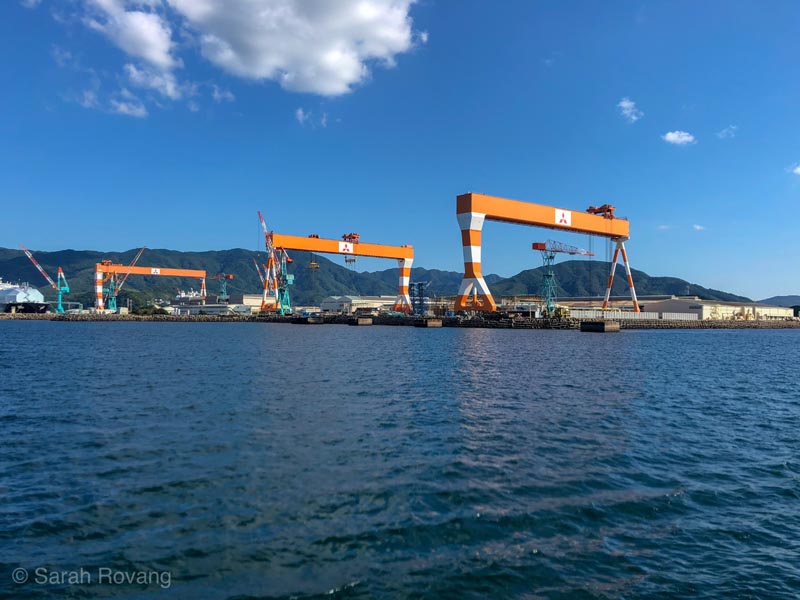

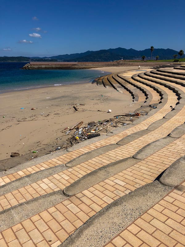
Today, Takashima is accessible from Nagasaki harbor via a short ferry ride. On the sunny Thursday afternoon when I made the trek, there were about a dozen other passengers on a boat that could comfortably seat several hundred. The island’s tourism website promised a gleaming white crescent of sand and crystal blue waters—a family-friendly swimming beach teeming with happy day trippers. “I am sure,” I reassured my spousal traveling companion, “That an island with a beach that good is going to have some decent lunch options.” When we arrived, there was nary a swimmer in sight. The beachfront shops were shuttered and the sand had collected a raft of plastic detritus. Lunch evidently wasn’t happening so we marched past the beach and onwards towards the coal mine.
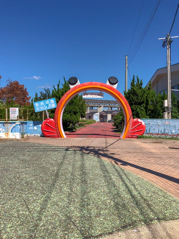
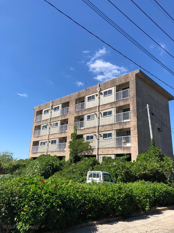
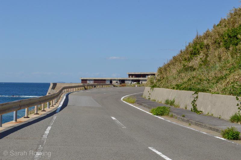
Following the perimeter road on Takashima, the only evidence of economic activity was a hot-house tomato farm; a lone tractor tilled the soil in preparation for the next round of crops. Behind the hot-houses’ skeletal ribs loomed the concrete tenements that at some point in the past housed coal mine workers. Today they appear almost entirely deserted.
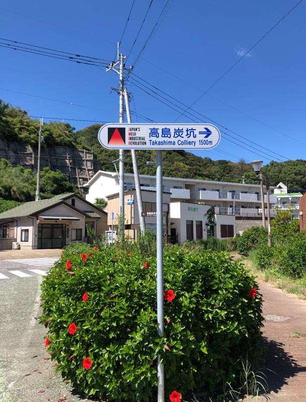
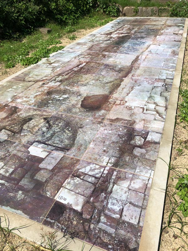
There was, perhaps surprisingly, signage urging us on down the road. The triangular, gradient-laden JMIR logo has become a most welcome and reassuring sight to me, whether I’m on a bus through the hinterlands around Kagoshima or stepping off a train in the ailing coal town of Omuta. The houses that lined the main road seemed kept up but also strangely vacant. Where were the people who live on this island? Finally, we arrived at the UNESCO site. There was the official JMIR plaque, a familiar presence from other sites I’ve visited—one of the very few standardized interpretive elements. And there was the coal mine—little more than a stack of bricks with a grate over it. The one other major notable feature at the site was the remnant of the recently excavated boiler house. The archaeological site has been covered over by a weather-proofed platform with a full-scale photograph of the boiler house foundations created during the excavation process. That’s all the remains of a whole sequence of support buildings that existed at the end of the nineteenth century.
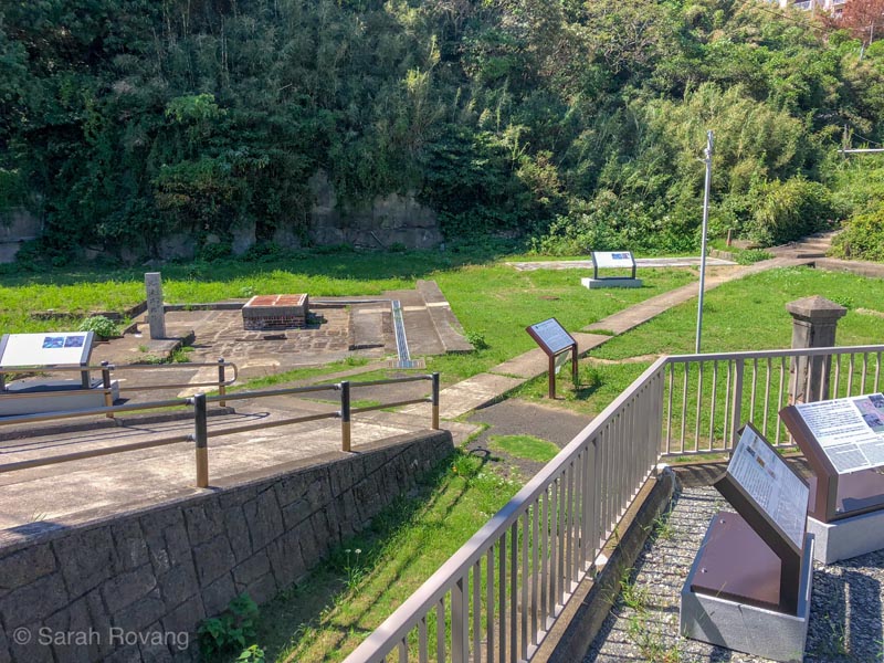

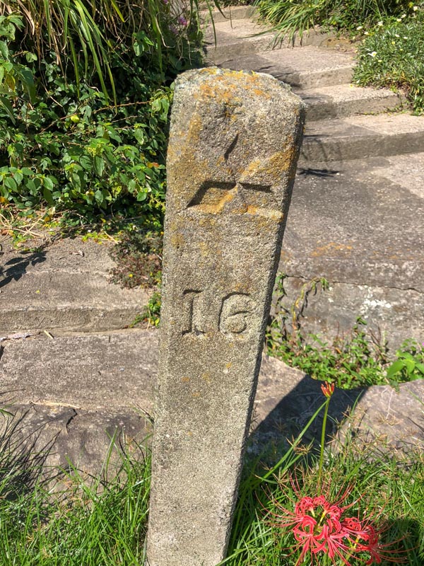
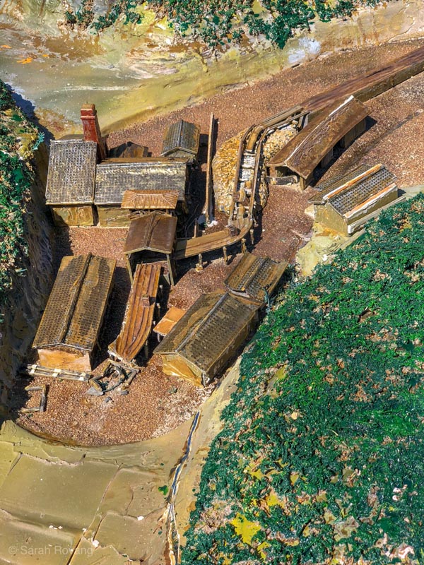
There are a few plaques (added in 2015) with historical information in Japanese, English, Korean, and Chinese, and a small selection of historic photographs. There’s even a 1/100 scale model showing the support buildings around the mine, though it’s hard to imagine this sequence of wooden buildings occupying what today seems like little more than a flat, grassy depression. Most of the JMIR sites I’ve encountered, even the remote and relatively obscure ones, have had a docent, a human presence I have come to appreciate despite any language barrier. The lack of any other human presence here feels particularly palpable.
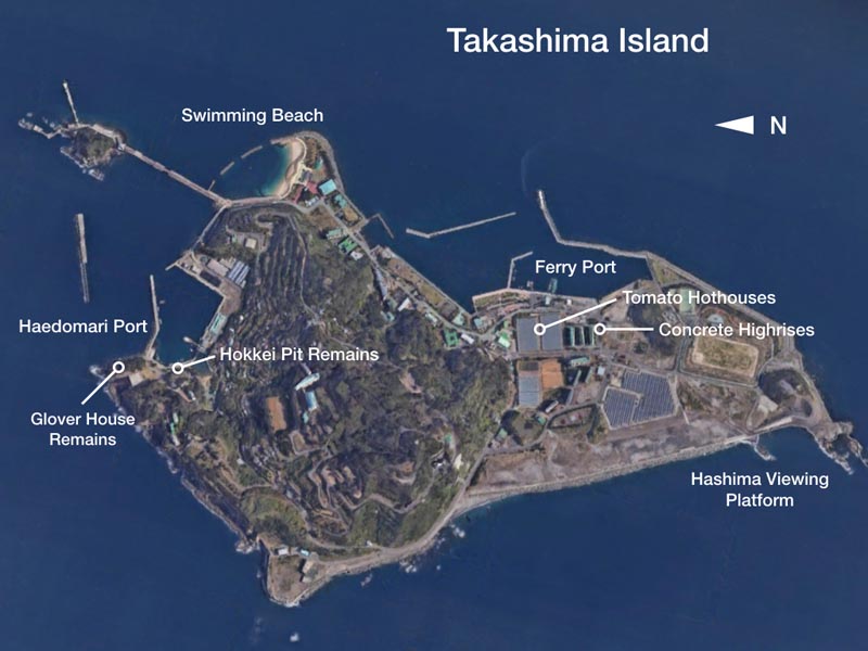
There’s a related historic site up the road—perched on a scenic outcropping looking back towards Nagasaki are the remains of a house once owned by Scottish mine manager Thomas Glover. Like the coal mine, however, this site proved to be more archaeologically fascinating than anything else. An interpretive sign pointed to the location of the toilet, which indeed, was the most evident built remnant. Glover’s primary residence and its gardens constitute yet another JMIR site, immaculately preserved in Nagasaki proper. Overrun with school groups and set against the sonic background of piped-in bagpipe music, Glover House and Gardens is a fully-developed open air architectural museum. (I’ll return to the colonial extravaganza of the Glover complex and how the JMIR sites engage Western architectural influence more generally in my next post.)
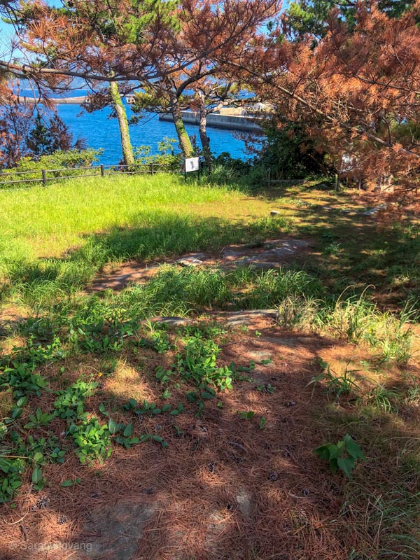
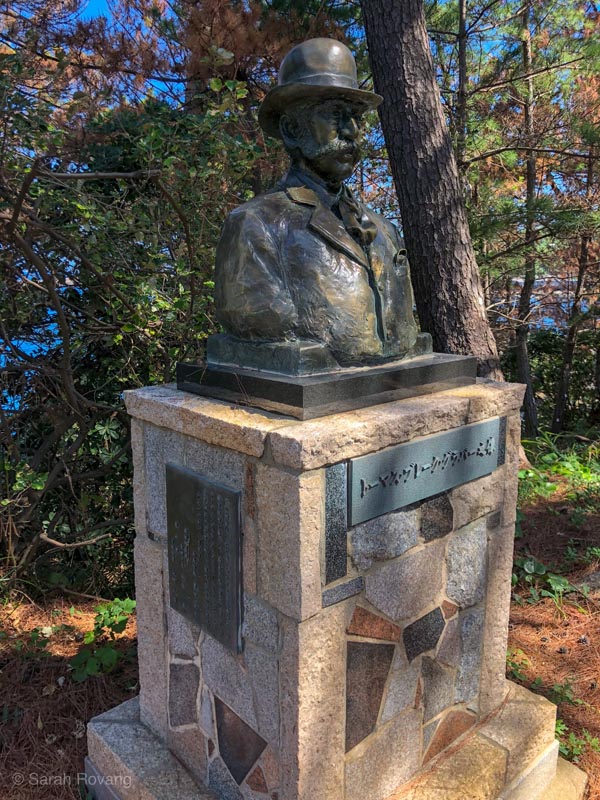
Poking around for the lichen-encrusted remains of the original foundations, I had flashbacks to learning about the excavations of early Virginian post-hole houses as an undergraduate. There is also a bust of Thomas Glover, just in case there was any doubt that you’d come to the right place.
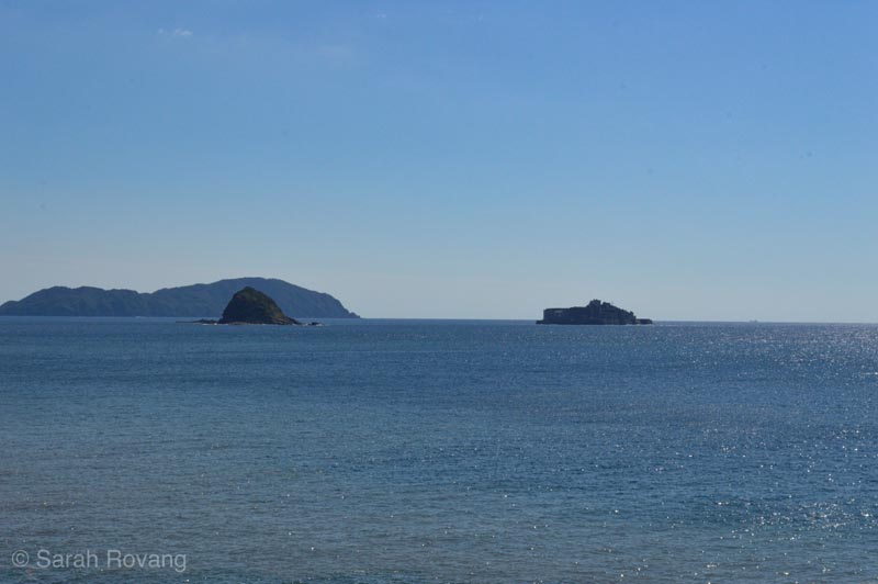
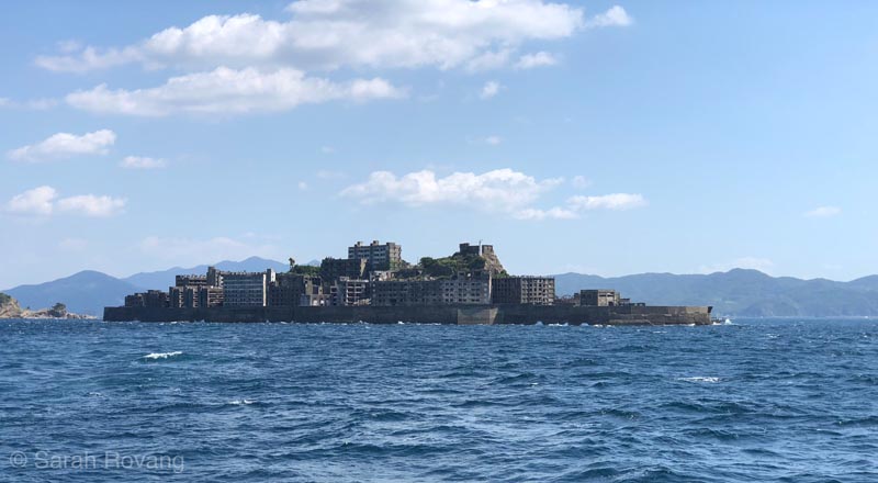
Moving on, we rounded the tip of the island and continued on the winding perimeter road past more ramshackle concrete buildings. In the distance, the unmistakable shape of Hashima Island appeared, silhouetted on the sea in the mid-afternoon haze. Hashima, better known as “Gunkanjima” (or Battleship Island), is also a UNESCO JMIR site, and like Takashima, an island created largely of reclaimed land to support a lucrative coal-mining economy. However, unlike Takashima, Hashima has developed an iconic status and has evolved into a sought-after tourist attraction. During the remainder of my afternoon on Takashima, Hashima proved to be a constant and inescapable presence—there’s an elaborate scale model of the Battleship Island near the ferry station, and a special Hashima viewing area further on down the road. For all of its coal-mining credentials, Takashima has become little more than a glorified viewing platform for its purportedly more fascinating neighbor.
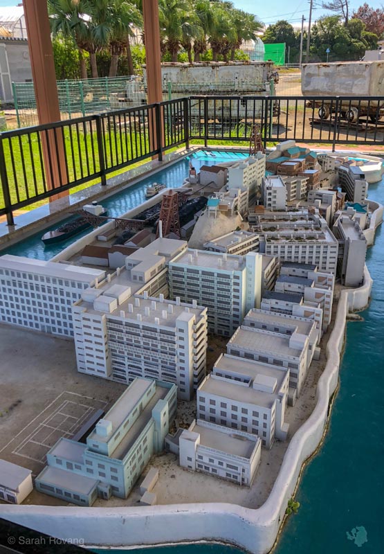
The following Monday, I had booked the full Hashima experience: a boat ride out to the island, tickets to the Gunkanjima Digital Museum, and something called the “Hololens Experience.” The Digital Museum is not far from Glover Gardens and the Dutch Slope, a part of Nagasaki known for its historic Western architecture. Once we checked in, we had about an hour to explore the museum before the ferry departed. On the second and third floors are about a dozen digital exhibits—screens (large and small, flat and wraparound), VR headsets, and models with overhead projections abound. Gunkanjima, though it has been officially open to visitors since 2009, doesn’t actually allow tourists a lot of free rein around the island. Due to weather, only about 50% of tourism boats are able to make the landing. Once on the island, there are exactly three viewing points, strung together by a walkway on the southern part of the island. To compensate, and provide a fuller, more nuanced picture of the site, the Digital Museum evokes both the lived experience of the island during the twentieth century (up until Hashima coal mine was closed in 1974 and the island abandoned), and its current status as a fantastical concrete ruin.
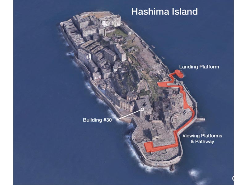
At the Digital Museum, I bounced between a number of the VR displays and immersive digital installations. There were a few compelling analog displays to supplement the digital festivities, including a recreation of a living room from one of the tenements where Hashima’s families lived, and a model of Building #30, Japan’s first reinforced concrete structure (1916).
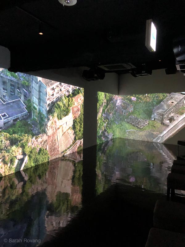
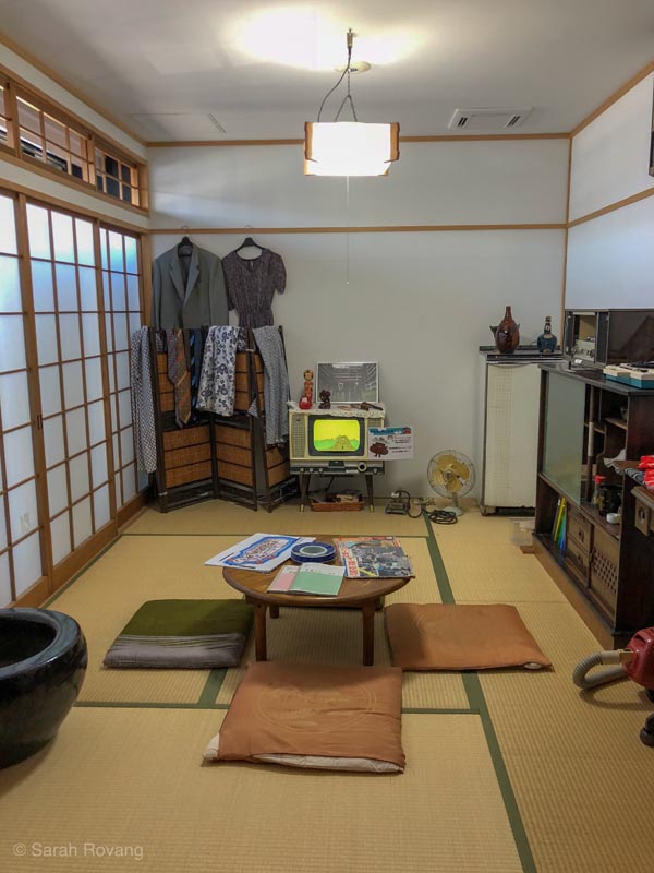
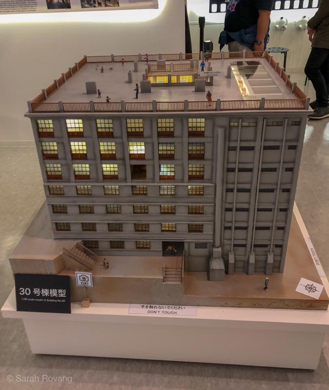
Soon, it was time to board the (completely packed) boat that would take us out to Hashima. On our way, Takashima was briefly visible off the starboard bow. We didn’t stop however, and the island received only a fleeting mention in the English audio guide. During our approach to Hashima, the boat circled the island, venturing into an expanse of choppy water, allowing passengers to get that iconic shot of the “battleship” in all its glory. Once we docked, a tour guide led the group, narrating in Japanese while several assisants showed printed, laminated pictures of historical Hashima. The non-Japanese speakers huddled to one side, listening intently to our intermittently functioning radio audio guides.
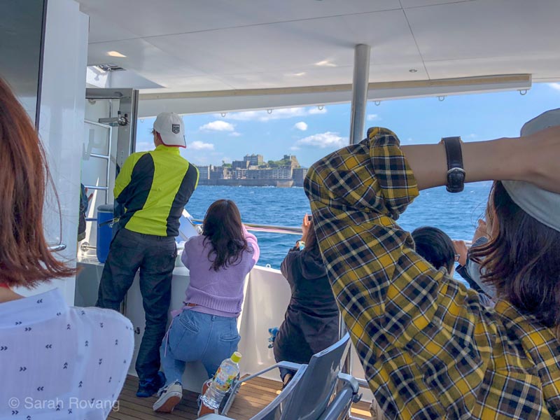
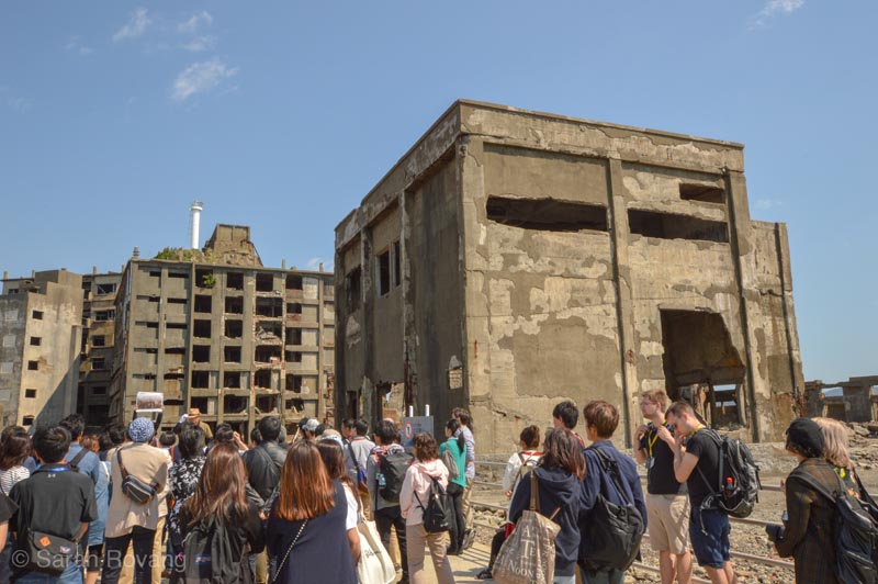
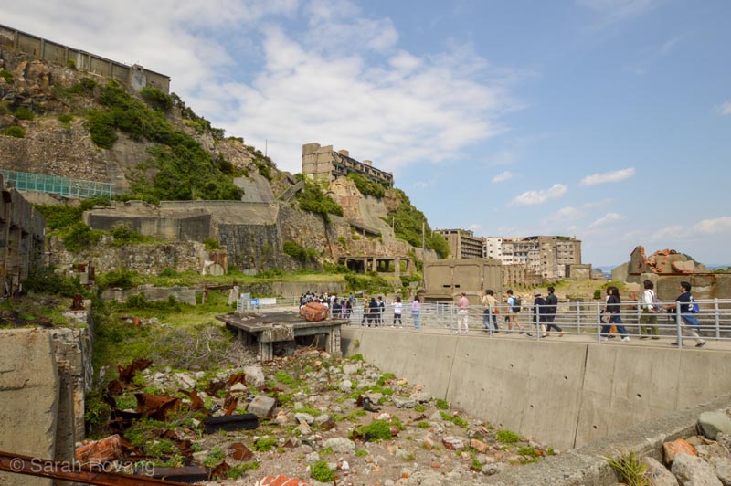
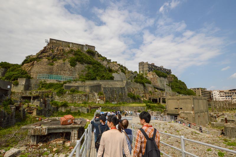
The strange capper to the day was back at the Digital Museum, where John and I participated in the “HoloLens” experience. To describe the full extent and goals of this surreal augmented reality game would be like trying to narrate a fever dream, but in short, players are tasked with “mining” the walls and exhibitions of the museum. As play progresses and players succeed in locating and “mining” these objects, their virtual mining implement is automatically upgraded, becoming more powerful and more efficient. In addition to coal, “mined objects” that come flying out of the walls include consumer appliances and animals. Whether this was intentional commentary on the relationship between Hashima’s coal mining, Japan’s postwar economic prosperity, and the environment, or just a bizarre palimpsest of cultural detritus was entirely unclear.

Brochure for the HoloLens Experience at the Gunkanjima Digital Museum.
The Takashima/Hashima Paradox
The public history experiences of Takashima and Hashima both had redeeming elements, but at the end of the day, left me discomfited and more than a little unsatisfied. In large part, this sense of dissatisfaction stemmed from the fact that historically, the architectural remains on Takashima and Hashima are outcomes of the same larger story of Japan’s industrial modernization. To my mind, the relationship and contrast between these two sites creates a more relevant and useful public history narrative than either site taken individually. What might be learned by putting these two sites into dialogue with one another, and examining both their historical parallels as well as their contemporary divergences? Further, how might these sites be more effectively interpreted as part of even more encompassing architectural and technological trends across Japan during its period of intensive modernization, or even within the emerging world capitalist order more broadly?
Geologically, culturally, and architecturally, the stories of Takashima and Hashima are very much intertwined. Both islands can be read as artifacts in themselves of Japan’s Industrial Age, formed largely out of reclaimed land from the coal slag dredged up from their mines.1 In terms of mining technologies, Takashima set a precedent for the logistically more complicated undersea mining that would later take place at Hashima—Hokkei Pit, after all, was the first coal mine in Japan to employ Western, industrial technology in the mining process.2 Indeed, the development of Hokkei Pit began as a collaboration between the local Saga Clan and Thomas Glover, the aforementioned Scotsman who had relocated to Nagasaki following the Meiji Restoration (1868). Glover and his collaborators used modern technologies developed in Europe, such as a steam drain pump and steam-powered winch. At its peak in the 1880s, the 43 meter-deep shaft was producing 300 tons of coal each day and was the most productive coal mine in Japan.3
Eventually, however, as Takashima’s reserves dwindled, attention turned to the underseas coal deposits accessible from the nearby island of Hashima. Hashima’s coal mine was opened the same year as Takashima (1869), and by 1897, Hashima had outstripped the coal production of its neighbor as its mine was extended further down into the sea bed.4 By 1959, Hashima was home to over 5,000 residents, and had become one of the most densely populated places on earth. In the early twentieth century, a whole host of support structures sprung up, many using new construction technologies such as reinforced concrete to help the “Battleship Island” withstand fierce typhoons.5 More than a place of work, Hashima quickly grew into a true community, including schools, public baths, and rooftop gardens. All of those facilities were abandoned in 1974, almost overnight, after the mines were closed in response to both Hashima’s lagging coal supply and a new federal energy policy that favored oil over coal.
Today, Hashima is an uninhabited ruin, whose fascination and attraction has been fueled by pop culture representations, including the inclusion of external shots of the island in the 2012 James Bond flick Skyfall. As bewitched by its modernist credentials as the odd Brooks Fellow might be, it thrives mainly on the current vogue for ruin porn and the schadenfreude of dark tourism (more on that next month). Takashima, by contrast, has thus far resisted the full out abandonment seen at Hashima. Its remaining population could materially benefit from a more developed tourist economy, to supplement that brought in by the beachfront in summer.
Sites like Takashima are hard to engage, even for an architectural historian. Without substantive built remnants or sufficient interpretation to help the visitor envision what the site was like in the past, it is still challenging to really feel connected to the site. Interpretation that explicitly connected Takashima to Hashima, casting the former as a crucial technological/architectural precedent to the concrete menagerie of Gunkanjima, could do a lot to build interest in Hokkei Pit and the island’s other historic sites. Takashima, in other words, could be so much more than just a viewing platform for its more “glamorous” neighbor.
Additionally, Takashima might follow the lead of Hashima’s storytelling apparatus in at least one regard—by providing interpretation that connects the site to broader national (or even global) themes with significant public interest. One of the most interesting and effective sections of the Gunkanjima Digital Museum was paradoxically also one of the least digital: the display about how Building 30, the first reinforced concrete structure in Japan, fits into the global development of architectural modernism. On one wall there is a detailed timeline that shows how Building 30 and the primary construction period of Gunkanjima aligns with other major events in the histories of architecture and building technology (Gottfried Semper, Auguste Perret, etc.). This was one of the very few attempts I’ve seen at the JMIR sites to situate the architecture of Japan’s industrial heritage within worldwide architectural trends. Judging by the number of local and international visitors clustered in this area of the museum on the day I visited, other architecture fans also found this argument to be unique and compelling.
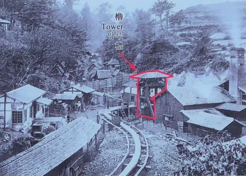
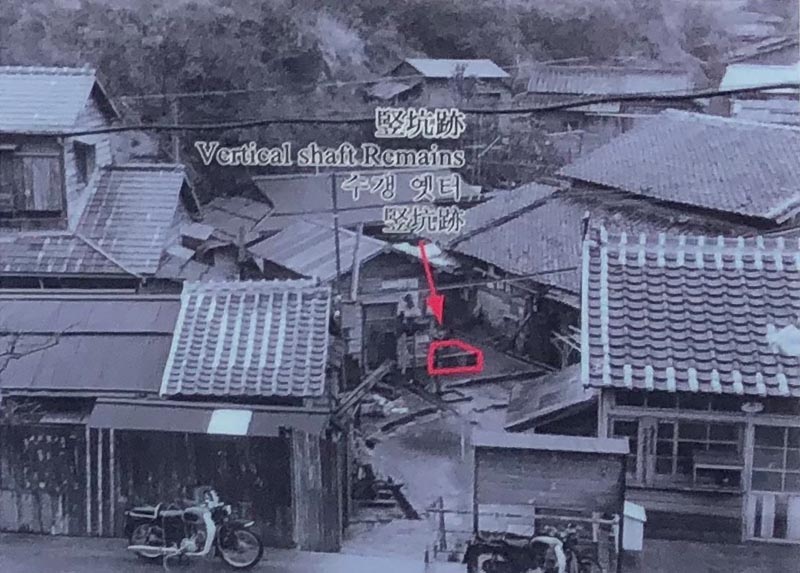
Above, a photo from the operational Hokkei Pit (circa late nineteenth century, photo from the Nixon University College of Art). Also visible is the short rail path adjacent to the shaft that was used to transport coal via handcarts down to Haedomari Coal Shipping Port on the north end of the island, where it was then shipped back to fuel the heavy industries growing up in Nagasaki harbor.
Below, the pit as it stood in 1974 (photo from the historic plaque at the site).
Even though the support buildings for Hokkei Pit on Takashima have not been preserved, they too participated in the development of industrial architecture. Takashima’s array of mostly wooden and stone support buildings from the 1860s through 1880s date to a period in Japanese industrial history when traditional Japanese craftsmanship was fused with functional Western materials and techniques, resulting in a hybrid industrial architecture distinct from that found in Europe or the United States. Well-preserved examples of this phenomenon can be seen throughout the JMIR sites (such as at Shuseikan in Kagoshima and the Imperial Steel Works in Kitakyushu), as well as at many non-JMIR industrial sites, including the Tomioka Silk Mill, the Sapporo Beer Factory, and Hakodate’s warehouse district. These stone, wood, and brick buildings from between roughly 1860 and 1910 are just as much a part of Japan’s industrial architectural history as the standardized, concrete high rises of Gunkanjima. Thinking back to that architectural timeline at the Digital Museum, I wonder now how it might be possible to incorporate Takashima into that evolutionary narrative, as an earlier but integral component of the larger architectural story surrounding Hashima.
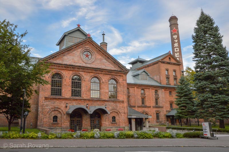
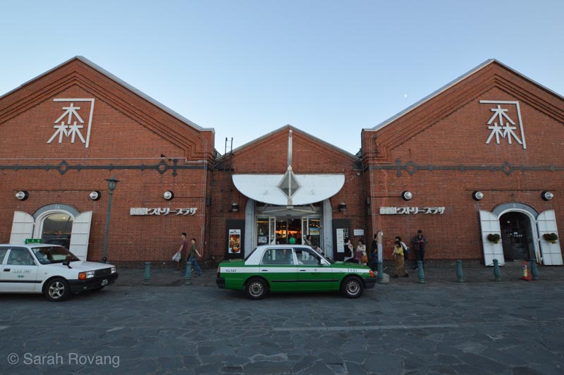
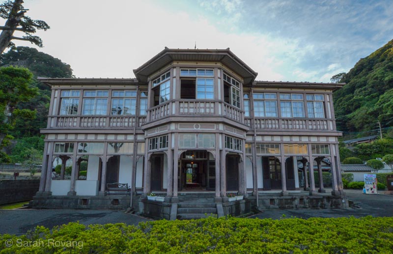
Different examples of architectural hybridity in early industrial Japan: Sapporo Beer Factory (1890), Hakodate Warehouses (1887-1909), and the Foreign Engineers’ House in Shuseikan (1867).
Yet I want to resist the idea that a tighter interpretive relationship between these two coal islands would benefit Takashima exclusively. There’s also an extent to which incorporating Takashima might complicate the utopian narrative of Hashima currently perpetuated at the Digital Museum. Abandoned Hashima in some ways is less powerful as a symbol of de-industrializing Japan. For all of its picturesque concrete ruination, the total touristification of Hashima makes it surprisingly easy to forget what happened to all of the people who lost jobs when Japan’s energy policy pivoted from coal to oil. The Digital Museum does little to address the legacy of de-industrialization, wrapping the history of the island’s productive years in a surprisingly idealistic mythos. Even where organized labor struggles, health issues, chronic overcrowding, forced wartime labor, and natural disasters are acknowledged, they are packaged in the feel-good rhetoric of “but the islanders overcame these challenges with community spirit.”
Based on what I’ve seen in my industrial heritage tour of Japan, the experience of Takashima is by far the more common one—post-industrial cities and towns struggling to find new avenues of economic development; cheaply built post-war architecture now in a state of disrepair. This is a side of Japan that you don’t see in Lonely Planet or on japan-guide.com. Most tourists who confine themselves to the Tokyo-Kyoto corridor can avoid this kind of architectural landscape. The one reliable source for industrial decrepitude, population decline, and urban decay I’ve come across is a site a historian friend recommended called Spike Japan. This blog, which explores Japan’s de-industrializing built environment through the lens of economics has become my cynical, snarky decoder ring for the baffling, sometimes disconcerting landscapes I’ve encountered here. Underneath Japan’s outward projection of technological prowess and economic prosperity there’s another story to be told. And outside of bustling Tokyo neighborhoods and tranquil Kyoto shrines there are plenty of communities akin to Takashima—places that one can potentially gloss over. Hashima allows twentieth-century energy technologies and architecture to live quarantined in the past. Takashima forces its visitors to reckon with the very real aftermath of Japan’s rapid industrialization.
Interpreting Japan’s Industrial Sites as Landscape
For me, the current disconnect between the visitor experience of Takashima and Hashima is indicative of a larger challenge presented by this still very new and unprecedented UNESCO inscription. Although in terms of their protected status, these sites are technically equals, the lived experience for an industrial heritage tourist could not be more different. Certainly not every JMIR site is created equal; some have legitimately more interesting and better preserved built remains, and some are based out of existing visitor attractions with well-developed visitor infrastructure. But navigating this collection of sites, even as a postdoctoral architectural historian, often proved flummoxing. With a little bit of distance, and having visited a good cross-section of other sites at this point in my travel year, I’ve come to the conclusion that a lot of this has to do with the way that the JMIR sites are presented and interpreted in relationship to one another (or not, as the case may be).
On the way to Japan, I spent a three day “relaxing” layover in Singapore. I hadn’t planned on doing a lot of architectural history sight-seeing during my time there, but history found me anyway. Singapore is chock-full of heritage trails, ranging from neighborhood walking routes to city-wide paths requiring public transportation.6 While many buildings had plaques explaining their unique characteristics, there seemed to be a push in most of the signage I encountered to understand each structure in relationship to other buildings and to the broader urban landscape. For example, Singapore’s popular hawker centers are surprisingly well-interpreted, particularly for an architectural typology that emerged largely out of civic zoning regulations, and to which no famous architect names are attached. As I ate my way through Singapore, I kept stumbling upon signage that allowed me to build up a coherent but complex historical narrative about the emergence of the hawker center as an architectural type. By the time I departed, I had pieced together an understanding of the ways in which the physical structure of the hawker centers materialized many deeper historical narratives, such as the British colonial regime’s desire to rationalize Singapore’s streetscape, and food safety regulations that were driven both by concern for public health and xenophobic anxieties about immigrant street vendors.
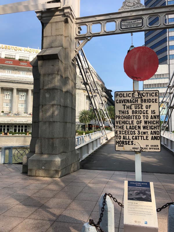
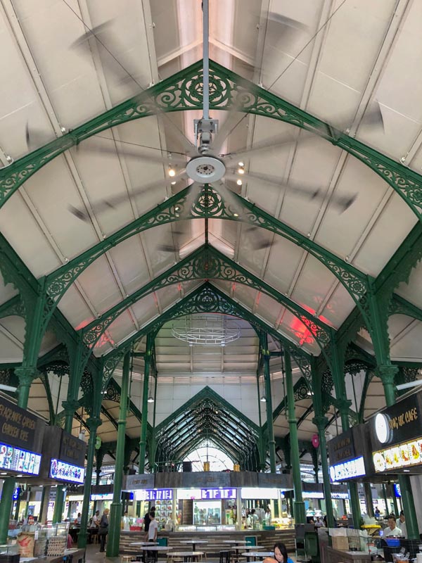
Above, a sign at a historic bridge site for one of Singapore’s many heritage trails. Below, one of the hawker centers in Singapore’s downtown business district.
Japan, from what I’ve seen, prefers lists of independent and ostensibly equal sites to trails, routes, or landscapes when it comes to heritage interpretation. This is a country, after all, that maintains a list of its most scenic waterfalls and most picturesque streets. Here, visiting heritage sites has felt more like collecting stamps, a feeling which is magnified by the JMIR smartphone app. This GPS-connected app turns industrial heritage into a game, in which everything from watching a video or reading an article wins the user a certain number of “points” (interacting with media off-site scores about 500 points, e.g.). Visiting a site, however, is where the big points are at. I’m a bit embarrassed to admit the thrill of pride I felt on receiving the 30,000 points at Takashima that elevated me to this month’s reigning champion on the app’s live ranking of “players.” On site, the app makes use of augmented reality, tapping into the smartphone’s camera to show the site tagged with clickable banners and exclusive on-site material. It’s been a diverting, if not vital aspect of my public history experience. At Shuseikan, where I used the app extensively, John seemed concerned that I was going to trip and fall while walking with my phone in front of my face. (Although at that site, the app did save me from missing another built component that was not part of the main complex). When I visited Gunkanjima, time on the island was so limited that I forgot to use the app altogether. And there were some sites that had their own augmented or virtual reality features, separate from the main JMIR app.
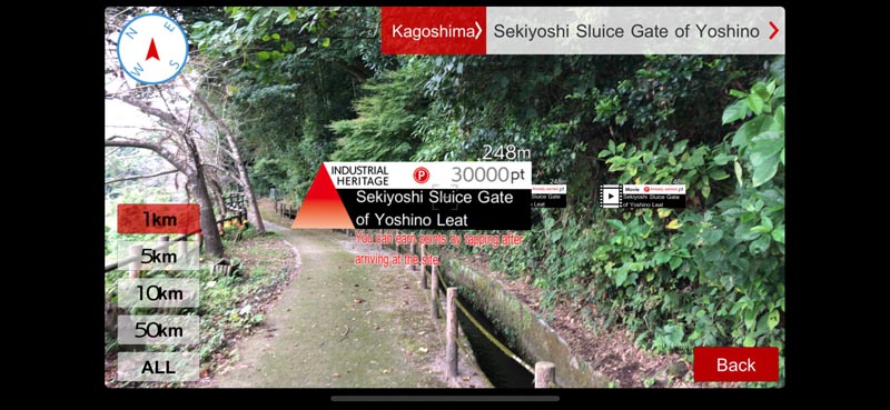

The digital experience of the smartphone app was echoed in what I witnessed as a visitor on the ground as well. At the vast majority of sites, there was no information about how to access other related sites (if related sites were mentioned at all). The entire basis of this UNESCO nomination, which highlights sites of “shipbuilding, coal, and steel,” rests on the integral relationships between these sites (i.e. without steel and coal there were no ships), many of which would not pass muster as individual UNESCO sites and only have historical integrity or meaning when understood within the context of all the other inscribed sites. The close connection between Takashima and Hashima was just one of many compelling relationships between other JMIR sites, which together constitute complex networks of technical expertise, natural resources, and architectural knowledge.
In teaching and writing about architecture, I’ve grown accustomed and even reliant on the concept of “landscape,” a term that has become increasingly ubiquitous across scholarship in architectural history and adjacent disciplines, particularly concerning industrialization and urbanization. Landscape as a concept plugs into so many other current ways of understanding how planet earth has been shaped and altered by human intervention. Network theory, the Anthropocene, world systems analysis, etc. all can work within the same paradigm of underlying relational assumptions contained within the term “landscape.”
In elucidating the unique relationship between industrialization and landscape, I always come back to Lewis Mumford’s remarkably prescient writing in Technics and Civilization (1934) on the Paleotechnic Era. Mumford perceived that some of the hallmark technological “advances” of the early nineteenth century in Western Europe, the United States, and then elsewhere in the world (an “elsewhere” that I’ve been immersed in for the past three months), fundamentally reordered the way that humanity harnessed energy and then expended that energy. Rather than relying on the geographically-contingent “eotechnics” of sunlight, wind, and water, Paleotechnic humanity could mine coal, transport it, and use its energy at a remote location. Industrialization, to my mind, is all about relational networks between sites, whether those networks are formed by the transfer of tangible products (raw materials or finished goods), the travel of human laborers, the conveyance of energy through railways bearing coal or wires carrying electricity, or the movement of abstracted capital investment. This is palpably true at so many of the clusters of JMIR sites. Near modern day Kagoshima, charcoal fired at the Terayama Charcoal Kiln and water channeled from the Sekiyoshi Sluice Gate of Yoshino Leat provided the heat and power to forge cannons and warship plating at the Shuseikan site. The coal mined at the Miike pits was transported to the Misumi West Port, and later to Miike Port, where it was then shipped to other Japanese industrial sites.
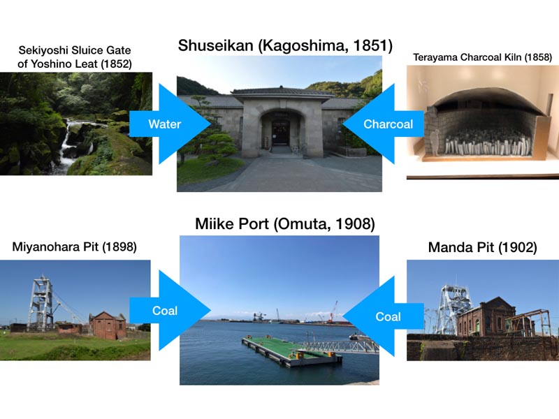
Whether or not the word “landscape” was used specifically, the Singaporean approach to public architectural history engaged this methodological lens effectively and consistently. Perhaps it was going immediately from Singapore to Japan that, for me, rendered the lack of any equivalent acknowledgement at the JMIR sites of the “industrial landscape” even more glaring. Expanding and explaining the relationships between the sites through public history storytelling would give crucial context that could help give meaning and purpose to (and perhaps generate more tourism for) the sites like Takashima with less obvious touristic appeal.
The Potential of Japan’s Industrial Heritage as Landscape
But what would the implementation of a public history narrative rooted in the idea of landscape look like at the JMIR sites, practically speaking?
- More interpretation of the architecture/material remnants of the sites. Maybe it’s disciplinary bias, but I was honestly surprised that more of the JMIR site interpretation didn’t explicitly address the built components from an architectural perspective. There were certainly some striking counter-examples, but the lack of architectural interpretation overall was thrown into sharp relief when I visited the Tomioka Silk Mill (another Japanese, industrial UNESCO site, inscribed 2014, that isn’t part of the JMIR complex). Here, the audio guide explicitly started with the built framework of the site and helped the visitor interpret the architectural components in terms of what they meant for late nineteenth-century sericulture. The guide addressed, for instance, the organization of the site to provide maximum ventilation for the two cocoon houses (first image below), and the introduction of a truss roof construction in the silk-reeling plant to provide for a greater horizontal span (second image below). Addressing the practical architectural elements and the functional relationships between the diverse buildings on the site also gave the visitor significant insight into the kinds of technological challenges and cultural assumptions that the Japanese-French collaborators who designed this modern factory were confronting.
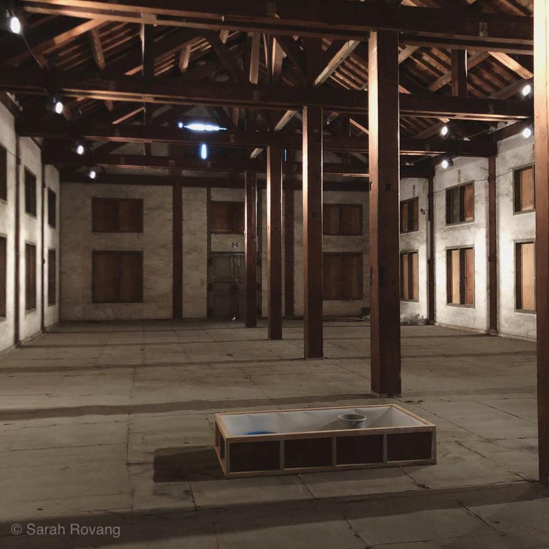
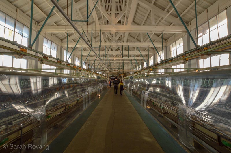
Images from Tomioka Silk Mill (established 1872). Above, Tomioka East Cocoon House; below the Silk Reeling Plant.
- Tighter interpretive networks between the JMIR Sites. The JMIR UNESCO nomination categorizes the sites according to geographic area and time period, but there’s surprisingly little interpretation about how the sites would have interacted from a functional, industrial standpoint. Where, for example, was the coal mined at Takashima and Hashima shipped? Did the destination and purpose of the exported coal change over time? Or, consider the three different reverberatory furnaces included in the JMIR sites—what was the architectural progression of their design? Was there any interaction between the designers and engineers who developed these furnaces? The new municipal museum at Hagi (home to one of the three furnaces) at least references the furnace at Shuseikan in Kagoshima, but this relationship could be unpacked and explored further.
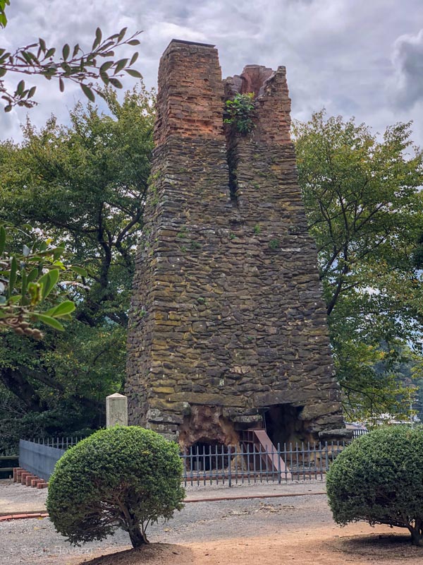
Hagi Reverberatory Furnace (1856)
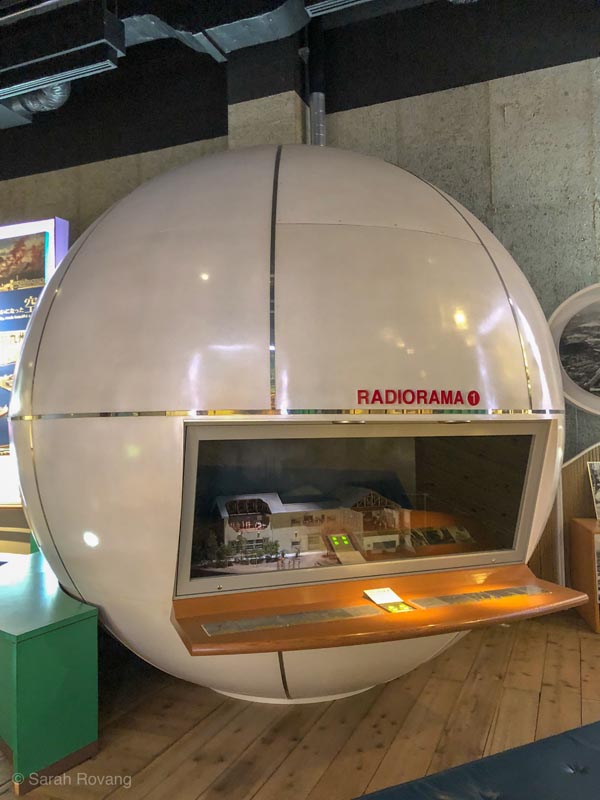
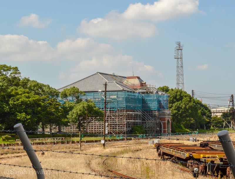
- Better connections between JMIR sites and existing/developed historical sites and museum institutions. The principal map document for the JMIR sites does include related historical institutions and heritage sites, but it would be helpful to expand this and give visitors a fuller sense of how these other experiences might relate to or enhance the JMIR experience. Additionally, acknowledging sites and experiences that address a longer historic arc (i.e. outside the fifty years of Japan’s most intensive modernization) would help give context to the JMIR sites. The need to for more capacious historical context was something I was reminded of at the Kitakyushu Eco Museum’s Radiorama (that’s audio + diorama, seen in the first image below), which recounts the environmental history of the town of Yamata, with particular emphasis on the 1960s and ‘70s. The Radiorama told the story of grassroots activism in a town known for having industrial exhaust in “all colors of the rainbow” (and later for the ensuing respiratory illness). Thanks to the research and advocacy of a coalition of local women work, the surrounding area of Yamata has been rehabilitated and today is home to a number of excellent museums, that coexist with the cleaned-up industry still present in the area. When I saw this display, I just had walked from the JMIR site of the Imperial Steelworks (1902, second image below). To me, the early development of steel foundries in Yamata cannot be untangled from the environmental outcomes of the 1960s. The JMIR sites have the potential to engage with a range of current issues, including those around climate change, pollution, and public health—it’s just a matter of setting up an interpretive infrastructure that allows for those broader stories to come through. This would involve a great deal of coordination at the municipal, prefectural, and national level. Some municipalities on the JMIR trail, especially smaller ones such as Hagi and Omuta, have started to engage this mode by promoting their JMIR sites at local history museums.
- Inclusion of Japan’s less developed or distant industrial heritage sites. With the understanding of Japan’s modernization as something that contributed to the country’s new formulation as a modern nation state, it also seems critical to recognize how the JMIR sites participated in a story that extended geographically beyond the cluster of sites in Kyushu and southern Honshu. When I visited Hokkaido, for instance, modernization and the industrialization of agriculture, were frequent topics addressed at sites including the Sapporo Beer Factory, Hokkaido Historic Village (see the barn built from an American pattern in the first image below), and the Shimizusawa Power Plant (second image below). These sites, while lacking a UNESCO inscription, are still essential to the story of Japan’s emergence as a modern, imperial power.
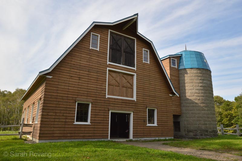
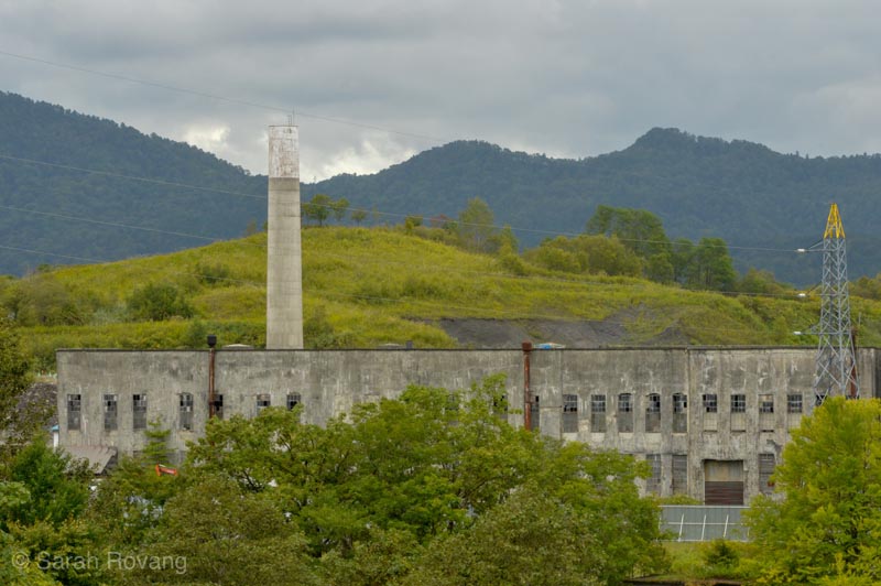
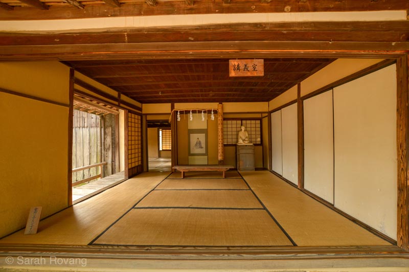
- Addressing the tensions between local identity and national identity. A number of the cities proximate to JMIR sites have adopted and promoted these new UNESCO properties with a fierce civic pride. Each city is eager to lay claim to a unique part of the story or an outstanding contribution: Hagi as the intellectual cradle of modernization (see Shokasonjuku Academy in Hagi, 1857, below), Nagasaki as the birthplace of modern shipbuilding, and Kitakyushu as the home of the modern steel industry. This is often tied back to whatever clan led the initial modernization charge in that city—it’s hard to avoid mention of the Satsuma Clan in Kagoshima, or the Hagi Clan in Hagi. At the same time though, in narratives at the individual sites and through the various media (pamphlets, apps, websites) meant to tie the sites together, the focus has largely been on what these individual sites contributed to Japan’s national industrialization and modernization more broadly. The conception of Japan as a modern nation state came out of the modernizing reforms of the Meiji Restoration, a political transformation that effectively ended the clan system of shogunate Japan. Through the lens of landscape, the tension between local and national identities might be put into a productive dialogue, acknowledging that these conceptions of modern self-hood did not always coexist easily.
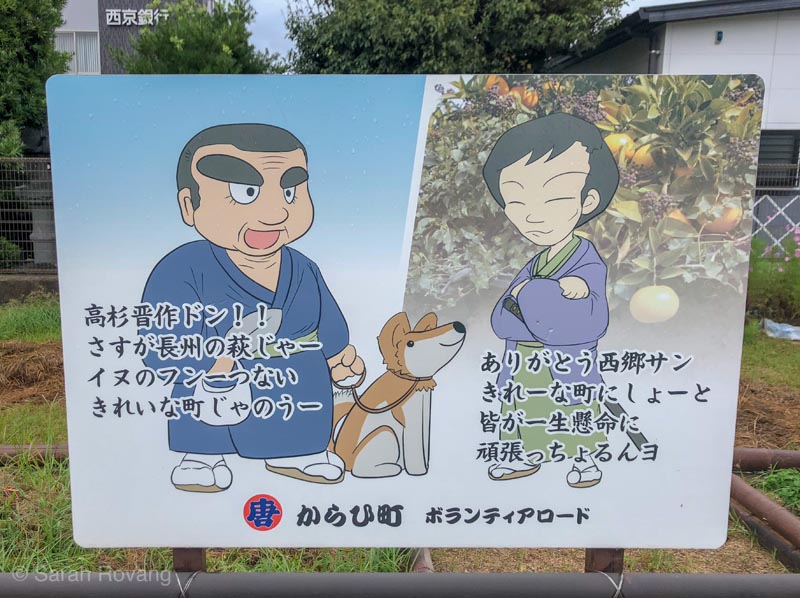
- Moving from “Great Man” history to a more inclusive narrative of modernization. Adding interpretation addressing the flow of resources, architectural/engineering technologies, and labor, to complement that which already exists would add nuance and enable alternative readings of the sites. Many of the JMIR sites’ existing interpretation emphasizes the role of elite actors—principally the leaders of clans, Meiji government officials, and Western engineers (below, in an epic JMIR crossover on a sign in Hagi, Kagoshima’s local hero, Saigo Takamori, meets Hagi’s own Yoshida Shoin). By focusing on the experiences of predominantly wealthy male actors, a whole range of other experiences are currently being neglected.
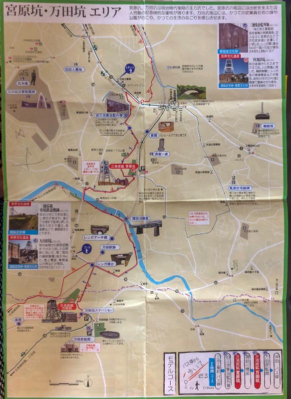
- The development of thematic itineraries for visitors. Currently, many of the JMIR sites are quite difficult to access, and it’s unclear based on the publications available why visitors would want to.7 The central JMIR site and map presents separate driving and public transportation directions. What is lacking is some kind of integral itinerary that links together related sites. The only place where I saw any attempt to help visitors see sites in sequence was in the town of Omuta, where the municipal tourism center hands out a map with biking directions between its three JMIR sites (see below). There’s been really no effort to provide a hierarchy or suggestions for how to prioritize sites on a limited visit. For instance, in Kagoshima, the factory complex at Shuseikan is undoubtedly the hub of JMIR activity, and the charcoal kiln and sluice gate a few miles away are “satellites”. In Nagasaki, the Glover Garden and the Gunkanjima Digital Museum are the most visitor-friendly sites, but a visit to the Mitsubishi Pattern Factory (which currently requires a phone call in Japanese), would provide an interesting link between the two. More transparency with this information would go a long way to making these sites more accessible, particularly to international visitors and those who don’t read Japanese.
In this post, I’ve touched briefly on some of the “darker” aspects of industrial tourism, i.e. the complicity of early industrial sites in pollution and climate change. In the next post, I’ll address the connection between industrial tourism and “dark” tourism at greater length, turning the focus specifically to the often problematic ways in which the JMIR sites’ interpretation confront Japanese imperial expansion, Westerners’ contributions, and forced labor.
- Originally three separate islands, the Takashima of today was formed by coal-slack land reclamation, which was completed by 1935. UNESCO Doc 129 ↩︎
- When the pit first began producing coal in 1869, it represented a transitional moment in Japan, both technologically and politically. Much of Japan’s early industrialization (1850s-1860s) was fueled by the demand for warships, spurred largely by the landing of Commodore Matthew Perry’s fleet of smoke-spewing steamships in 1853 and again in 1854. In these early years, the development of warships was spearheaded by several of the powerful clans of Kyushu and southern Honshu, including Saga, Hagi, and Satsuma (who ruled the area around what is today Kagoshima). In order to forge the necessary iron to build a modern, Western-style warship, the clans required (among other resources) vast amounts of coal. The clans engineered whole infrastructural networks to serve the ship-building enterprise, forming a constellation of interlinked protoindustrial sites across Kyushu and southern Honshu. More about the technological/political development of Japan’s industry can be found at http://www.japansmeijiindustrialrevolution.com/en/ ↩︎
- Sites of Japan’s Meiji Industrial Revolution: Kyushu-Yamaguchi and Related Areas, World Heritage Nomination, (Japan, 2014): 121. The Meiji Restoration that unified Japan under imperial rule also led to the abolishment of the domain system in 1871 and the effective disbandment of the clans. Clan control gave way to centralized government control, and then in many cases, to corporate ownership. Even though Hokkei Pit was exhausted by 1876, mining on Takashima continued to be profitable. Mitsubishi took over the Takashima mines in 1881 and hired Glover as a manager. The story of all of the Nagasaki JMIR sites, Takashima and Hashima included, is the story also of Mitsubishi’s rise as a heavy industries leader in Japan. ↩︎
- Sites of Japan’s Meiji Industrial Revolution, 130. ↩︎
- See former Brooks Fellow Danielle S. Willken’s excellent 2017 report Reclaimed: Sites of Conflict, Industry and Population Change in Japan concerning Hashima for more about the history and development of the island. ↩︎
- Read more about my public history experience in Singapore on my personal blog. ↩︎
- For a more detailed account of what it’s like to travel to one of the more obscure JMIR sites, see my personal blog entry “In the Land of the Forest Docents.” ↩︎

Leave a commentOrder by
Newest on top Oldest on top