-
Conferences
Conferences
SAH Annual International Conferences bring members together for scholarly exchange and networking
-
Publications
Publications
Through print and digital publications, SAH documents the history of the built environment and disseminates scholarshipLatest Issue:
-
About
About
SAH promotes the study, interpretation, and conservation of the built environment worldwide for the benefit of all

On Invisibility: Chemification and Material Movements
Jasper Ludewig is a 2023 recipient of the H. Allen Brooks Travelling Fellowship. All photographs are by the author, except where otherwise specified.
After 2000 kilometers of circuitous driving, I have finally arrived in central narrm/Melbourne, amused as always by the contrast of its orderly, gridded streets and the tortured bombast of so much of its architecture. Today alone I have driven for close to 10 hours, from the far north-western corner of the state, descending after dark onto the plain across which the city unravels. The two-laned road doubles, triples, and then quadruples in quick succession before I eventually pull into a parking facility and scurry through the drizzle to my accommodation. It’s here that I begin this first report of my H. Allen Brooks Travelling Fellowship: in a room in a city I now see as an important threshold in the historical geography my travel attempts to retrace.

Fig. 1. Panoramic view of the Paterson Valley from Mount George. Property boundaries, nature reserves and the curving river are clearly visible.
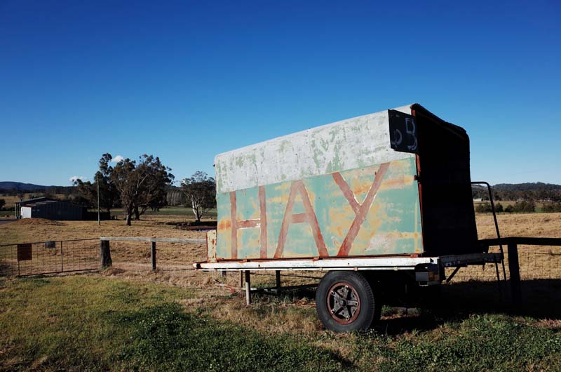
Fig. 2. One of the many agricultural relics on display along the roadsides of the Paterson Valley.
Over the past month, I have visited different regions along the eastern seaboard of what is now known as Australia looking for evidence of its systematic transformation as Country—the term used by Indigenous Australians to describe the lands, waterways, seas and skies with which they are intimately connected—into the landscapes of colonial agriculture. This transformation commenced in the late eighteenth century, radiating inland from a string of settlements established at river mouths and natural harbours in the colony of New South Wales before accelerating over the course of the nineteenth century, propelled by a growing population, global commodity markets, and the advent of political self-governance. Throughout this process, agricultural expansion was colonial expansion—both in the geographical sense of the actual material dispossession and occupation of Indigenous land (clearing, fencing, planting, building), and in the political economic and juridical sense of state formation and the reification of systems of colonial governance (land regulation, taxation, policing, establishing institutions, etc.). Of course, the supposed absence of agricultural systems—a cynical interpretation of well-documented Aboriginal land management practices—was also used by the British state and its representatives as moral and legal justification for the invasion and violent dispossession of Indigenous land in keeping with the doctrine of terra nullius. One assumption I have therefore made over the past month of traveling is that to interrogate the material history of Australia’s agricultural development is also to consider something essential to the manner in which colonial sovereignty was purported and enacted.
More specifically, my travels are based on my emerging understanding that the viability of the colonial project in Australia—given this imbrication with agriculture—depended to a large extent on the biological work performed by fertilizer. Sovereignty and fertilizer may seem an incongruent pairing, but their relation encompasses an approach to the organization of people, land, and materials (and eventually also buildings) that both recasts prevailing understandings of the environmental effects of colonization, as well the forms of governance that were elaborated in their service. The sociologist Marion W. Dixon terms this relation—referring to its twentieth-century incarnation—“chemification,” or “the processes by which imperial states gained territories (and land, labour, etc.) through industrial power built on assemblages of production, energy, and materials connected via a handful of chemicals.”1 This fellowship project is something of a meditation on chemification understood as a discrete historical process; from its pre-industrial, colonial origins to its fuller expression in the early twentieth century. What is the historical geography of chemification? What were its spatial—agricultural, infrastructural, technological, architectural, rural, urban—modes of articulation? What kinds of political order did it give rise to? Whose futures did it secure? Whose did it foreclose? And how does chemification, as a methodological lens, enable us to better collocate colonialism and capitalism as interlinked systems that have facilitated humans’ intervention in the processes that govern life within the biosphere?

Fig. 3. An abandoned turn-of-the-century homestead in the Paterson Valley.
Evidence in service of my questions is admittedly difficult to recover through travel. Fertilizers leave no visible trace in the places they are applied; and, unlike other agricultural technologies, they are meant, by design, to dissolve and disappear into other things—soil, water, roots, stems, flowers and fruits—which are themselves routinely removed or replenished. The result, I have learned, is that one struggles to find much (any) information about the use and effects of chemical fertilizers in the (many) local history museums dotted throughout the agricultural districts between meanjin/Brisbane and narrm/Melbourne. Instead, it seems that chemification is best approached indirectly, by seeking out its epiphenomena: the statistics of increased crop yields recorded at nineteenth-century experimental farms; importation rates of the raw materials purchased by fertiliser manufactures; the almost total devastation of the landscapes at which these raw materials were extracted; and the land-use patterns and forms of living that fertilizers have sustained in a radically different ecology to those in which European farming systems were originally devised.
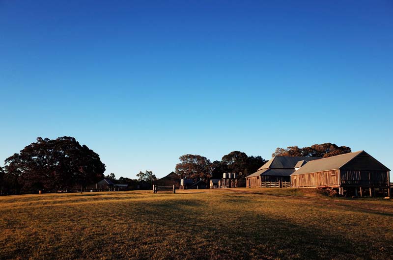
Fig. 4. The main buildings of Tocal Estate at sunset.

Fig. 5. Tocal’s stone barn, constructed in 1830 using convict labour to dry tobacco.
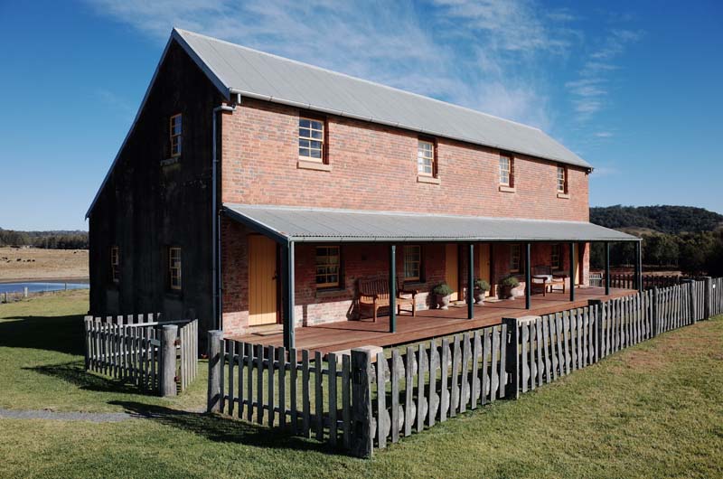
Fig. 6. The barracks built to house Tocal’s 35 convict laborers during its development in the 1830s.

Fig. 7. Tocal Homestead was built to the 1841 design of the Scottish architect William Moir. It was constructed from sandstone with a slate roof, most of which was quarried directly from the Tocal site.

Fig. 8. Tocal Homestead is sited at the top of a slight rise on the property, elevating its legibility within the landscape.
Three weeks prior to my arrival in narrm/Melbourne, I arrived in the Paterson Valley, on Wonnarua and Worimi Country, in the Hunter Region of New South Wales. The Paterson Valley is one of the oldest European agricultural districts in Australia, occupied from the early nineteenth century by small-scale farmers supplying Sydney and Newcastle. James Webber was one such colonist, arriving from Britain to take up a land grant in 1822, which he subsequently developed into one of the most successful farms in the colony: Tocal. The main buildings and grounds of Tocal have been carefully preserved, embodying the changing regimes of political order and colonial land use in the district, from the erstwhile tobacco shed (1830) and convict barracks (1835), to the late-Colonial Georgian homestead (1841) and the famous Blacket Barn (1867). Today, Tocal strikes an uneasy balance between its dual role as part open-air colonial heritage display and part bucolic wedding venue—its overabundance of pithy interpretive plaques, affixed to its photogenic buildings, counterposed by the glaring omission of any meaningful engagement with the Indigenous history of the valley. Even the word “tocal,” which the plaques purport to mean “plenty” in the Wonnarua language (the Wonnarua Nation Aboriginal Corporation’s official dictionary suggests otherwise), operates at the level of simulacrum: naturalizing the colonial history of the estate by establishing a false continuity with its Indigenous “past.” Axe-grinding grooves formed by members of the Gringai clan, located on a sandstone outcrop in the middle of a pasture separating Tocal’s main buildings, seem like the only authentic historical remnant on the entire estate.

Fig. 9. The Blacket Barn owes its name to the celebrated nineteenth-century colonial architect Edmund Thomas Blacket, known for his churches and public buildings throughout the colony of New South Wales.

Fig. 10. The symmetrical floorplan and timber roof trusses have earned Blacket Barn the mantle of the “Cathedral of Barns” from the contemporary architect Philip Cox, commissioned to design nearby Tocal Agricultural College in 1963.
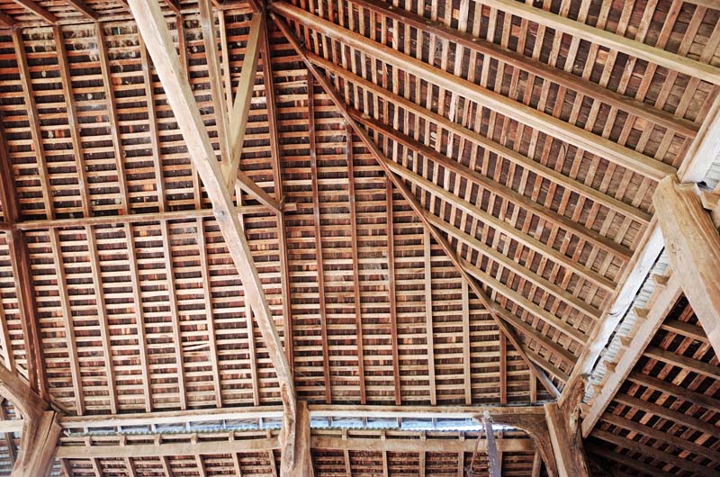
Fig. 11. The fine detailing of the Blacket Barn plays a central role in Tocal’s state heritage listing.
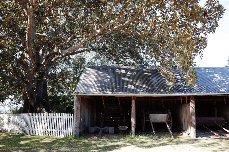
Fig. 12. Today, Tocal Estate caters as much to wedding guests as history enthusiasts. Its buildings and grounds are presented to emulate nineteenth-century rural life in the colony.
The history of Tocal, like so much of Australia’s European history, is largely reducible to its geology. Australian soils are among the most nutrient poor in the world and are especially lacking in phosphorous, which promotes plant growth and improves fruiting. Where government officials such as James Grant, writing from the Paterson Valley in 1801, saw “long luxuriant grass” and “plenty of land for agriculture,” they therefore projected a cultural and ecological imaginary onto the landscape—and into its soils—that anticipated, erroneously, an equivalence with the soils of Britain.2 Invisible to Grant and his contemporaries was the work of the Wonnarua and the Worimi, undertaken over millennia, to manage the non-alluvial areas of this landscape through fire. The famous open forest of the New South Wales hinterland, described by Peter Cunningham in 1827 as in “every way suitable for pasture without cutting down a single tree,” was in fact the intentional result of routine cool burning, which supressed the growth of saplings and thickets, encouraging the germination of native perennial grasses instead.3 Fleet-footed kangaroos, wallabies, emus, and other animals flocked into the forest clearings the fire left behind, providing a reliable food supply alongside native tubers, lilies, flaxes, and sorghums. Mistaking grasses for signs of fecundity, colonists such as Webber poured into the Paterson Valley, stocking the once soft and spongy land with hard-hooved sheep and cattle, and planting cash crops—tobacco, grapes, hops, and maize—along the alluvial corridors. Within only a few years, the colonists had ringbarked the eucalypts for timber while their livestock compacted the earth and razed the grasses, causing widespread erosion and degradation of the already poor soil.
In search of more fertile tracts of land, colonists quickly moved throughout the Paterson Valley, practicing a land-extensive agricultural system known as “soil mining.” “The consequence of this miserable system,” observed James Atkinson in 1826:
is that the land in a few years gets exhausted, and having very little tillage, is entirely covered with weeds. […] The plan then adopted is to let this lie fallow, as it is termed, that is, to suffer it to lie untouched for several years, to be overgrown with mimosas, and to become a nursery for rank and noxious weeds of every description; in the mean time, the Settler clears another piece of fresh land, and with this proceeds as before.4
For the soil miner, managing soil fertility was of secondary importance to the availability of an inexhaustible supply of more land nearby. Attempting to constrain colonial settlement, which was rapidly expanding due to the activities of soil miners and others, the government imposed what became known as the Limits of Location in 1829—a semi-circular perimeter radiating 400 km outwards from Sydney that delineated the area in which settlement was legally permitted. The territory within the Limits was broken into 19 counties, which were surveyed and valued in turn; the available land was organized into different classes, each attracting a different rate per acre based on its agricultural potential; and crops were used as collateral against mortgages to enable capital-poor farmers to take up land within farming districts such as Paterson. In effect, the Limits of Location transformed the interior of the colony into a patchworked, “improved” landscape, still clearly legible in the view over the Paterson Valley from Mount George (Figure 1).5 The Limits are particularly fascinating when understood in relation to contemporary political economic theories of land price, rent, and soil fertility. As David Ricardo notes in his 1817 treatise, On the Principles of Political Economy and Taxation:
Rent increases most rapidly, as the disposable land decreases in its productive powers. Wealth increases most rapidly in those countries where the disposable land is most fertile, where importation is least restricted, and where through agricultural improvements, productions can be multiplied without any increase in the proportional quantity of labour, and where consequently the progress of rent is slow.6
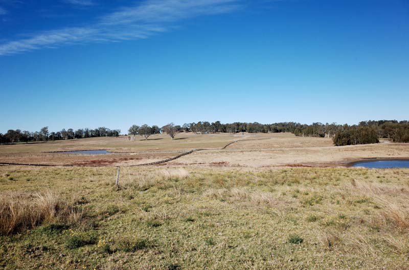
Fig. 13. One of Tocal’s many pastures, heavily transformed through land clearing, grazing, and chemical fertilizers. The main building of Tocal Agricultural College can be seen in the distant background.
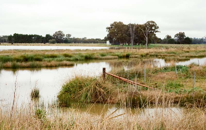
Fig. 14. Widespread grazing has suppressed native grasses, compacted the soil, and made large swathes of land highly susceptible to flash flooding and erosion.
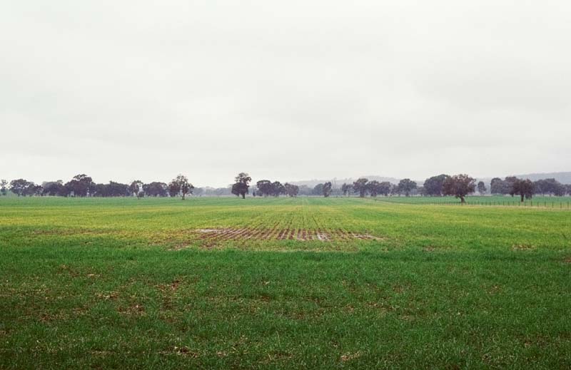
Fig. 15. A field in the vicinity of the former Rutherglen Experimental Farm in northern Victoria.
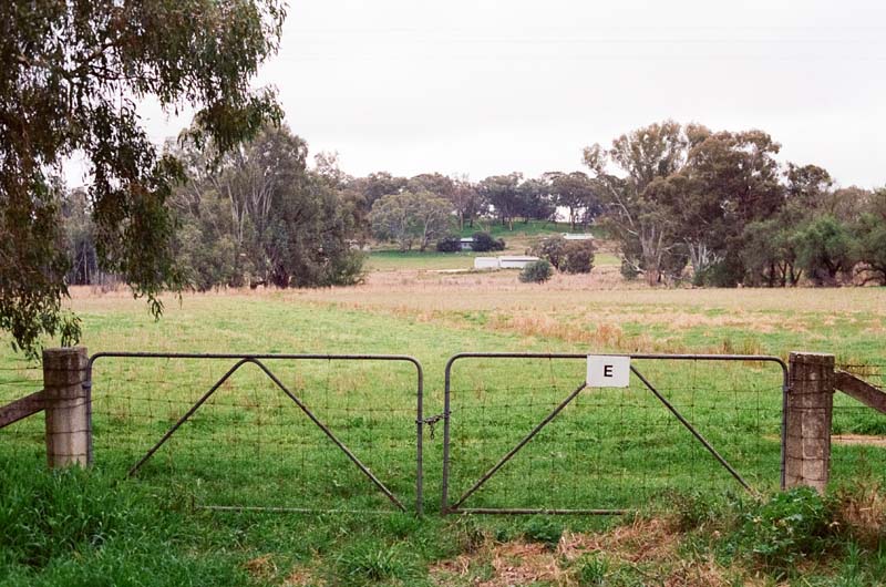
Fig. 16. “Field E” at the former Rutherglen Experimental Farm in northern Victoria, later the Rutherglen Viticulture College and then Rutherglen Research Institute.
Augmenting the productive powers of a more limited supply of land through the use of fertilizer was therefore not only a question of agricultural production, but also formed part of an incipient colonial property regime in which the value of land was—at least initially—determined by the “indestructible powers of the soil” and the amount of capital/labor required to exploit it. In the Paterson Valley, and throughout the territory delineated by the Limits of Location more broadly, a land-extensive frontier model of soil mining thus gave over to an incipient yeoman ideal focused on regimes of improvement. Tocal occupies a unique position within this history. Its buildings—or, more accurately, what lies beneath them—testify to how the more tightly controlled system of land allocation established by the Limits ultimately reconfigured the biological profiles of Australian soils. Although “hardly a single pre-[European]-contact soil profile survives intact anywhere across the nation,” observes the geographer Stephen Gale, “a rare exception to this generalisation comes from Tocal.”7 Rather than the “well structured, strongly stable” soils found throughout the Paterson Valley today, the soils beneath the original Tocal homestead are “very friable, poorly structured and have a weak aggregate stability.”8 The comparison reveals the cumulative effects of more than a century of colonial attempts to transform Australia’s Indigenous landscape—the sum total of myriad entanglements between the law, capital, agricultural development, and ecological violence descending upon the value latent in the soil. Leaving the valley along the old Paterson Road, which traces a double of Yimmang (Paterson River) along the intensively farmed floodplain, I recall the words of the Gurindji man Daly Pulkara who, when asked by the anthropologist Deborah Bird-Rose what he thought of the denuded—but heavily “improved”—landscape of a cattle station in the Northern Territory, simply remarked: “It’s the wild. Just the wild.”9
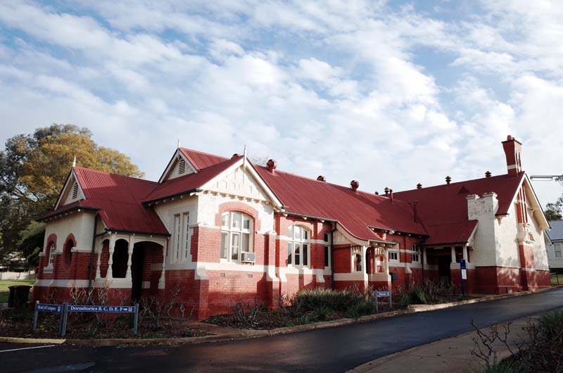
Fig. 17. Dookie College administration building and museum, formerly the college laboratory.
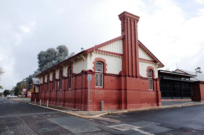
Fig. 18. The Dookie College buildings were designed by the Victorian Public Works Department, which provided similar facilities at the Rutherglen and Longerenong colleges.
Fertilizers quickly followed the intensification of agriculture in nineteenth-century Australia. They were used to more reliably extract larger harvests from smaller properties on aberrant soils year after year, but also—as Tocal demonstrates—to drastically transform the chemical composition of those soils over time. On my way to the Wimmera district in western Victoria—one of the country’s most diverse grain growing regions—I was fortunate to visit an important site in the uptake of chemical fertilizers in Australia. Dookie Agricultural College and Experimental Farm is the oldest agricultural college in Victoria and today forms part of the University of Melbourne, specializing in land management and restoration, viticulture, and food security research. Dookie seemingly appears out of nowhere, nestled into rolling hills on Yorta Yorta Country in the lee of Mount Major; a distinctly proto-urban setting amidst a sea of serried fields and empty gravel roads. Its history dates to 1877 when the Victorian Board of Agriculture established the Cashel Experimental Farm, tasked with training colonists in the latest scientific methods of rational agriculture. Ten years later, 50 people were on the waiting list to enroll in Dookie, where students tended to the almost 5,000 acres as part of a rigorous program housed in state-of-the-art buildings—laboratories, cellars, and greenhouses—designed by the Public Works Department.10 As reported by a journalist following an inspection tour of Dookie in 1888, “the curriculum includes chemistry, botany, geology, entomology, English, mathematics, surveying, bookkeeping, besides practical farm work in all its branches.”11 Formal training in agriculture was viewed as a matter of economic security in a globalizing world, as well as a domain for state intervention given the value of export duties to annual revenue. “In these days of competition and rapid progress,” proclaimed one local newspaper, “the advantage is with those who know how to make the best of their opportunities, and are acquainted with the latest discoveries in science as applied to the cultivation of the soil.”12 Dookie moved the colony of Victoria in this direction, following the examples set by experimental farms throughout the anglosphere in the United States, Canada, and New Zealand, and demonstrating a more modern approach to agricultural science later emulated throughout the colony at Rutherglen in the northeast (viticulture) and Longerenong in the northwest (wheat growing).
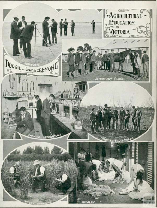
Fig. 19. “Agricultural Education in Victoria.” Poster promoting Dookie and Longerenong colleges, c.1895. Source: Victorian Places.
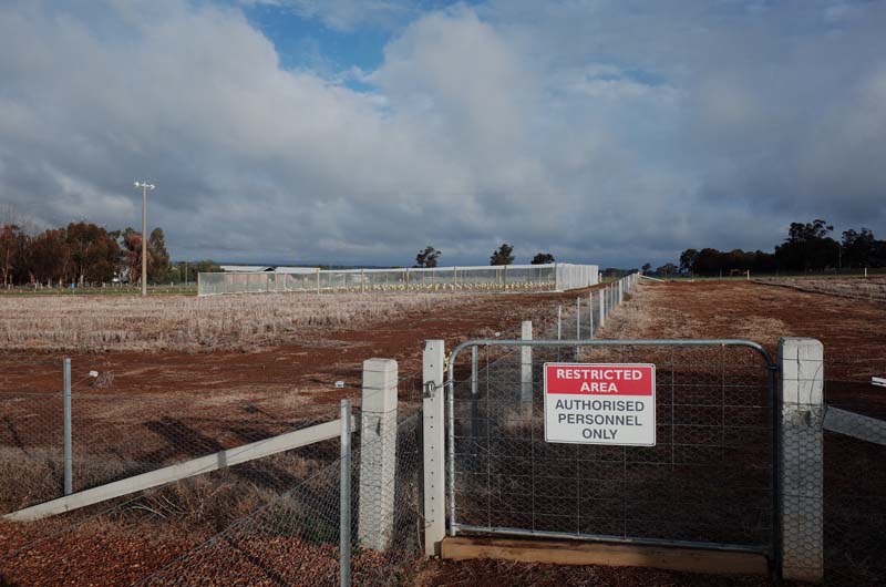
Fig. 20. Experimentation continues at Dookie College today as part of the University of Melbourne.
The archive at Dookie remains beautifully chaotic, its records distributed between a small campus museum—the college’s former laboratory building—and a windowless storage room in which I was permitted to spend multiple hours sifting through boxes. Amidst changing curricula, new pupils, upgraded facilities, and annual reports, the records evince two things in particular: the overwhelming predominance of failed experiments over successful ones, and an obsessional commitment to understanding the natural capacities of the soil:
Plot 42 – Buck Wheat – Sown August 3rd, came up very well but progressed slowly… Consider this a most useless crop in this dry district. …Plot 43 – Brown Corn – Sown in drills 24 inches apart, August 4th, 1879. Came up very indifferently… Consider this district unsuitable for this crop, as it requires a deep black soil. …Plot 44 – Flax – Sown broad cast in finely prepared soil, 5th August. …The fibre is not of sufficient length to be of any value as a marketable product. This crop certainly cannot be recommended as a sure and profitable one in this district.13
As the experiments tick over into the 1880s, more and more appear in which traditional fertilizers—bonedust, saltpetre (potassium nitrate), and cow and chicken manure—were being replaced by imported guanos. Although guano can refer to the dried excrement of a wide variety of animals, only seabird guano was used at Dookie. It had been extracted and shipped there from three vastly different island groups spread across two different oceans: the Chincha Islands in the Pacific Ocean near Peru; Malden Island in the Central Pacific Ocean; and the Lacepede Islands off the coast of Western Australia in the Indian Ocean. This geography becomes almost unfathomable when encountered in the abstract on a 150-year-old spreadsheet in an anonymous storage room on an isolated experimental farm in central Victoria. The collapse of physical distance presented in the spreadsheet, however, more clearly frames the historical movement of the guano itself: from the sites of its extraction to those of its application, which, in this case, are the fields that stretch out in every direction from the building in which I am sitting. Guanos quickly appear in almost every experiment I now come across: wheat, potato oats, Norway oats, white Tartarian oats, English barley, Cape barley—all are pickled and mixed with different blends of imported bird excrement, the results recorded as reliable increases in the yield of each crop per acre.
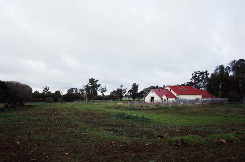
Fig. 21. An original timber barn sited opposite Dookie’s historic olive grove from the late 1890s.

Fig. 22. “The Dookie Agricultural College – Drilling and Rolling.” Drilling typically involved so-called “combines,” which deposited both seeds and superphosphate in furrows at regular intervals and set depths. Source: Victorian Places.
Guano is much more potent than other manures and immediately delivers more highly concentrated nutrients to plants, as well as protecting them against drought by promoting root development.14 As research stations such as Dookie confirmed these characteristics, nineteenth-century guano traders pushed further into the Central Pacific, as well as onto the Great Barrier Reef Islands off the coast of Queensland, deploying mobile mining infrastructure and contracting indentured laborers into a frontier industry established to serve the growing demand of farmers throughout the Tasman world and beyond.15 By the turn of the twentieth century, the surface guano deposits on most islands had been exhausted. In the interim, however, fertilizer manufacturers had shifted their focus from the importation of guano to the production of a synthetic compound known as superphosphate—or, in typical Australian fashion, simply as “super.” Dookie seems to have been an early adopter of this new agricultural technology, stating that of the manure experiments conducted in 1888, “the greatest results… were obtained from superphosphate for 30 [shillings] worth of which a yield of 35 bushels per acre was obtained,” far outperforming bonedust, Malden Island guano and saltpetre.16 By the late 1800s, super was made by mixing sulphuric acid with roughly equal parts pulverised rock phosphate ore—a kind of geological fusion of weathered surface guano, dead marine life and coral substrate—which delivers a much higher concentration of phosphorous into the soil than guano while remaining soluble enough to nourish plants. Returning to the Pacific and Indian Oceans in search of rock phosphate, a new cast of European companies advanced a second wave of phosphate imperialism on a handful of remote islands boasting the world’s purest deposits: Christmas Island, south of Java; Nauru and Banaba (Ocean Island) in the Central Pacific; Angaur in Palau; and Makatea in French Polynesia.
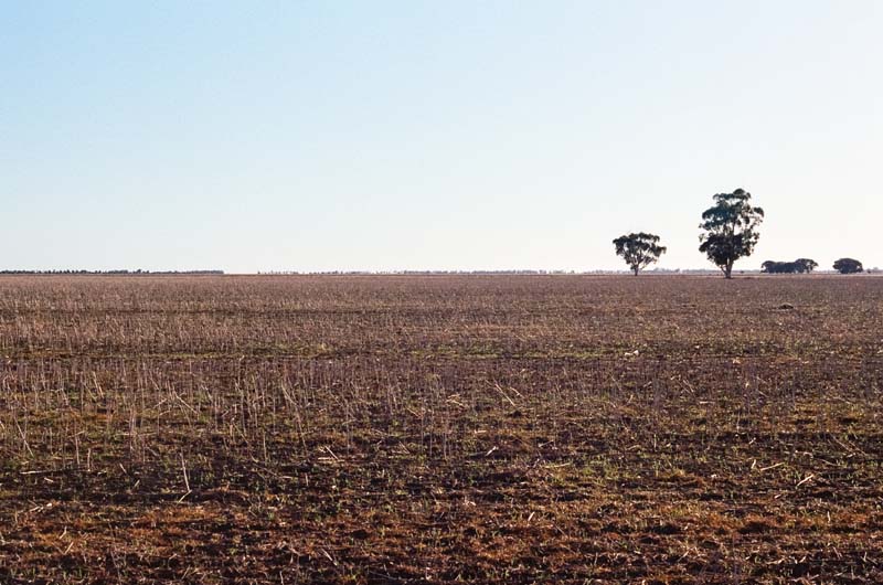
Fig. 23. Winter fields in the Wimmera. Minimal trees are left to provide shade during pasturing.
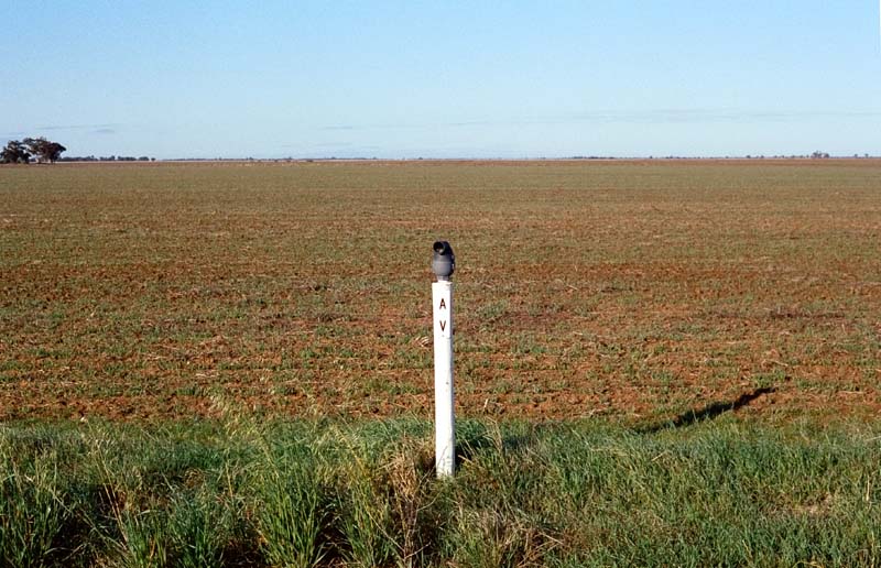
Fig. 24. A rare sign of the heavily engineered environment beneath the topsoil.

Fig. 25. Winter fields, shade trees, and a hill covered in prickly pear cactus.
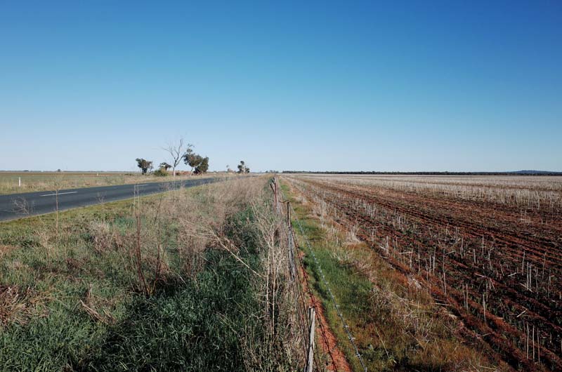
Fig. 26. Fences, roads, lots, and furrows all point the same way in the Wimmera.
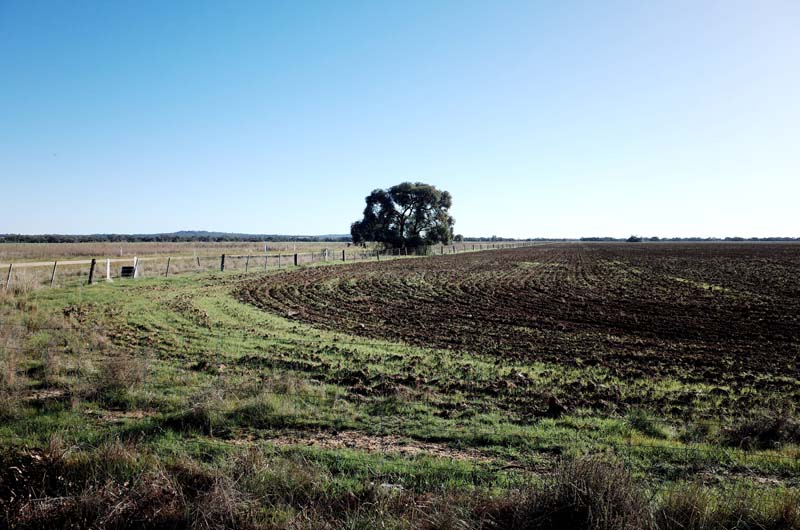
Fig. 27. The only curves found in the Wimmera, other than the creeks and rivers, are at the corners of its fields, where tractors and machinery complete a ninety-degree sweeping turn.
By 1910, adoption of superphosphate for the fertilization of wheat—Australia’s largest export crop—had risen to around 80 percent from only 25 percent two decades prior.17 By the outbreak of World War One, Australia was the highest user of superphosphate of all land-abundant economies, including the US, Russia, and Canada.18 The effects of superphosphate over this period radically altered entire ecologies such as the Wimmera Mallee—an almost completely flat, once forested sandy plain that was comprehensively cleared to make room for wheat fields. Driving across the Wimmera today, the violence to which the Mallee was subjected is largely invisible. Instead, the fences, gates, irrigation systems, and occasional sheds read as inert props in the performance of an entrenched ruralism, their banality somehow all the more confronting when encountered with the broader material and political history of chemification in mind. The serpentine rivers and creeks appear almost alien in the otherwise orthogonal landscape, redoubled in the dense stands of eucalypts that follow the banks and edges before petering out into stubbly winter fields. Concrete grain silos reappear whenever the road intersects with a deteriorating rail line, infrastructural remnants of a centralized distribution system that once connected the Wimmera’s wheat fields to international markets via the Port of Melbourne. At Murtoa, I stop to walk through the Stick Shed: a vast 265 x 60 meter emergency bulk wheat store, referred to as the Cathedral of the Wimmera, that was constructed during World War Two to preserve up to 3.4 million bushels of grain. More than 500 unmilled Mountain Ash (Eucalyptus regnans) poles reach up to around 18 meters high, fixed to timber roof trusses using galvanized hoop iron and lending the interior a sense of impossible lightness. Integrated into the same rail line as the concrete silos it was designed to replace, the Stick Shed attests to the cumulative development of agricultural systems in the Wimmera, where infrastructural interventions built on and expanded the productive capacities of those that preceded them. Today, growers store their harvests wrapped in plastic and left on the ground in so-called “sausages,” ready for when the market price turns in favour of selling a particular grain.

Fig. 28. Concrete wheat silos in Warracknabeal built in the 1930s, now redundant as grain growing has diversified.

Fig. 29. The abandoned train station in central Warracknabeal, built in 1886 to connect the booming Wimmera to the Port of Melbourne.
Fig. 30. The exterior of the Murtoa Stick Shed. Light passes into the interior through thousands of old screw holes in the metal roof sheeting.
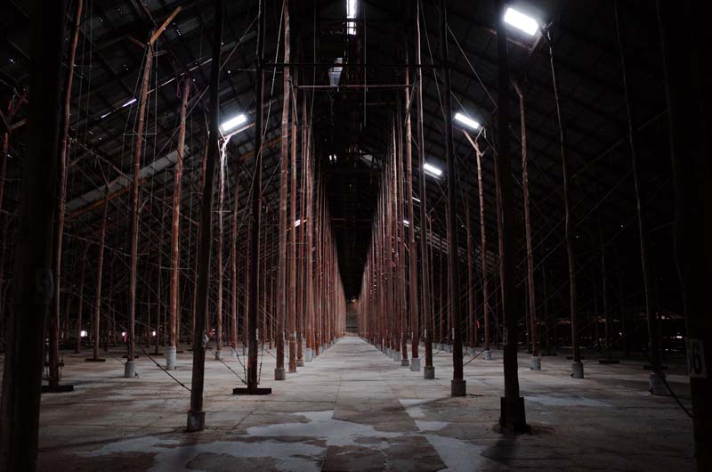
Fig. 31. The unmilled Mountain Ash poles form a central aisle running the length of the Stick Shed. Grains of wheat still fill the cracks in the concrete slab. The smell is a mix of mechanical equipment—oil, diesel, grease—and the sweetness of the wheat.
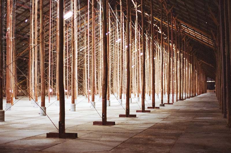
Fig. 32. A longer exposure photo of the Stick Shed’s interior. The ties that cross-brace the tall poles wobble with each gust of wind that hits the exterior of the building.
The straight road eventually deposits me on Wotjobaluk, Jaadwa, Jadawadjali, Wergaia, and Jupagik Country, in the town of Warracknabeal: the capital of the Victorian wheat district and, surprisingly, the birthplace of the musician Nick Cave. Much like Tocal, the history of “Warrack” is one of spectacular landscape transformation in pursuit of profit. As explained in Prosperous and Progressive Warracknabeal, a 1910 pamphlet promoting the development of the town:
Up till a few years ago it was no uncommon thing for a Land Board to say persuasively to an applicant for Mallee land: “There is a fine block adjoining your land. You can have it, too, if you will only keep the rabbits down.” And in all probability the applicant would say that he had quite enough Mallee already. To-day, if he wanted the same land, he would have to pay anywhere from £5 to £10 per acre for it. It is only a few years ago when it seemed that Warracknabeal would be buried beneath the drifting Mallee sands, but in the same town house rent is higher than in Melbourne. Building is being rushed ahead almost feverishly to keep pace with the demand for houses, and on every side are the evidences of prosperity and expansion.19
The accumulation of capital in the Mallee was directly linked to the accumulation of phosphorous in its soils and the development of the technologies required to deliver it there. “The Mallee was always fertile,” continues the pamphlet’s author, “but the fact was not known, or, if it was known, the knowledge necessary to take advantage of it was lacking. But the chemist, the implement maker, and the experienced farmer appeared on the scene, and, lo! a transformation.” While the chemists demonstrated “how the use of fertilizers added manifold to the productiveness of the soil,” the implement makers “armed [the settler] for the fight.” Meanwhile, the state extended irrigation channels throughout the northern plains, “with the result that the Wimmera and the Mallee are even now rendered practically drought proof.”20 Once again, the historical record denaturalizes the contemporary landscape, revealing it to be a heavily engineered terrain.

Fig. 33. “15 Ton Truck Mallee Roots, c.1930.” Roots of the Eucalyptus dumosa, known as the Mallee tree: a small Eucalypt with a dense lignotuber, allowing it to survive fire and making it notoriously difficult to clear. Source: State Library of Victoria, Victorian Railways Collection, H92.301/243.

Fig. 34. A Type AL harvester manufactured by the Sunshine Harvester Works on display at the Wheatlands Agricultural Machinery Museum in Warracknabeal.

Fig. 35. The Sunprong Pasture Renovator, manufactured at the Sunshine Harvester Works in c.1935. Doses of superphosphate are dropped onto the ground before the rotating prongs turn over the topsoil, mixing in the fertilizer.
Equipment from the early period of the Mallee’s transformation is exhibited at the Wheatlands Agricultural Machinery Museum on the outskirts of town. Among grain cleaners, seed picklers, harvesters, harrowers, and winnowers from Britain, Canada, and Germany, by far the most impressive machinery on display stems from the Victorian Sunshine Harvester Works. To provide farming machinery to the burgeoning Wimmera district, as well as South Africa and Argentina, a large industrial facility emerged on the outskirts of narrm/Melbourne in the late nineteenth century, forming an entire suburb still today known as Sunshine.21 The recognizable red and yellow paint schemes applied at the Sunshine factory formed part of the company’s marketing strategy, which extended to the model names assigned to each implement. The Mallee Rake, for example, boasted spring-loaded steel teeth that could withstand “the severest strain… If the land is covered thickly with Mallee, it will rake it up quite as easily as if sparsely laid. Nothing left behind.”22 Horse-powered Sun Grain Drills deposited pickled seed in furrows at the correct depth along with a small dose of superphosphate. The Sunprong Pasture Renovator aerated the field with rotating steel prongs while mixing in an adjustable quantity of super prior to planting. Understood as technologies of improvement deployed at the coalface of colonial dispossession and ecological destruction, the bright colors and optimistic marketing produce a jarring effect.
It should be stressed that the chemical transformation of Australia’s soils through the routine application of increasingly potent fertilizers did not, in fact, erase Country. As explained by the late Big Bill Neidjie, a Bunitj man and Gagudju speaker from the Kakadu area of the Northern Territory, Country is omnipresent, inextinguishable and abiding:
Our story is in the land […] it is written in those sacred places. My children will look after those places, that’s the law. Dreaming place […] you can’t change it no matter who you are. No matter you rich man, no matter you King. You can’t change it […] Rock stays, earth stays. I die and put my bones in cave or earth. Soon my bones become earth […] all the same. My spirit has gone back to my Country.24
While they did not displace Country, fertilizers nevertheless enabled the physical transformation of the Australian landscape—into “wilderness,” to paraphrase Daly Pulkara—in pursuit of imported agricultural systems and attendant ideas of political order and sovereignty. Aileen Moreton-Robinson, a scholar and Goenpul woman of the Quandamooka people in Queensland, argues that the legal regimes of the colonizing state place “Indigenous people in a state of homelessness because our ontological relationship to the land, which is the way we hold title, is incommensurable with [the state’s] own exclusive claims of sovereignty.”24 These claims emerged from the imbrication of the law, the atomization of the land as property, and the material practices of improvement to which it was subjected over time. In other words, colonial sovereignty is processual and material as much as it is a historical product of the legal imagination—material in the sense that it takes place and is enacted in discrete ways, and perhaps especially through the extraction of value from and transformation of the soil.
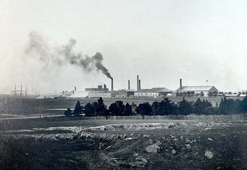
Fig. 36. Cuming Smith & Co.’s Yarraville works in c.1906. Source: “Catalogue of Manures,” 1906–7, Cuming Smith and Company Limited Collection, University of Melbourne Archives, 30.15.1.5.

Fig. 37. Plaque in Yarraville outlining the history of Cuming Smith & Co., from its establishment in 1870 until operations ceased in 2000. The timber attached to the concrete plinth was reclaimed from one of the former factory buildings. The site is now part of a major new infrastructure project.

Fig. 38. Dee Cottage (c.1880), the former residence of James Cuming, founder of Cuming Smith & Co.
In narrm/Melbourne, I spend time organizing my thoughts after many days of driving on my own. I visit Sunshine but find no real trace of the former factory. I drive to Yarraville, which adjoins the Port of Melbourne, seeking an industrial heritage trail I had read about online. I was eager to see one site on the trail in particular: the former factory of Victoria’s most influential superphosphate manufacturer, Cuming Smith & Co. From the 1870s on, the company imported hundreds of thousands of tons of guano and rock phosphate into the colony, blending them with acids, sulphates, and nitrate of ammonia to offer a diverse range of chemical fertilizers. Its awkward—albeit direct—slogan reappears on the catalogues for its Sickle Brand of manures, which I access the following day at the University of Melbourne archives: “BEFORE USING ‘SICKLE’ MANURES: HARD WORK, NO CROPS. BUT AFTER USING, SPLENDID CROPS, NO WORK, AND THE BANKING ACCOUNT GREW LARGER AND LARGER.”26 In addition to manufacturing superphosphate, Cuming Smith & Co. also conducted its own experiments into topdressing ratios, sponsored a state school propaganda program, organised pasture and crop yield competitions, and was instrumental in the formation of an industrial cartel, the Victorian Fertiliser Association, in 1907. Perhaps attuned to the veneration I had encountered in the heritage interpretation at Tocal, or maybe because I had already read the 200-page report commissioned to inform its contents, I was surprised by the meagre plaque I eventually located at the former factory site. Affixed to a bland polygonal concrete plinth, the plaque disappeared into the overgrown road siding; almost invisible unless—even if—you knew what you were looking for. Further along the road I came across Dee Cottage: the boarded-up former residence of Cuming Smith & Co.’s manager—a building, much like the plaque, seemingly resigned to its untimely demise as foreshadowed by the sprawling construction site that already surrounds it.
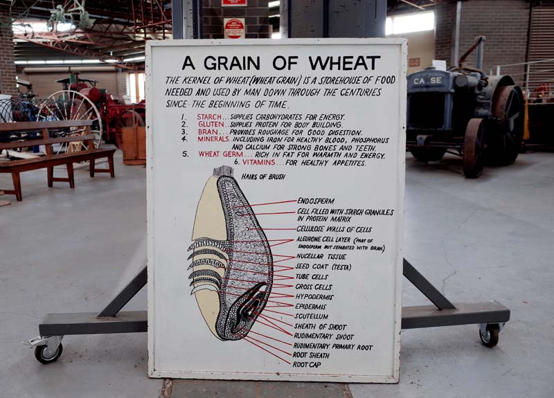
Fig. 39. “A Grain of Wheat.” Microscopic view of the main source of wealth in the Wimmera—wheat—painted on a display board at the Wheatlands Agricultural Machinery Museum in Warracknabeal.
Chemification—its historical geography, effects, residues—is shot through with invisibilities at different registers, a point reiterated here at Yarraville in the diminishing presence of some of its most legible sites and buildings. The type of thinking to which architectural historiography is accustomed (object-oriented, preoccupied with intention and authorship) struggles to accommodate the material movements and displacements inherent in this history. But as the past month of travel has made plain, chemification is also fundamentally a spatial process; a kind of triple displacement in which the transformation of land through the routine application of synthetic fertilizer drew on material and labor elsewhere, which in turn displaced both people and nature in service of the colonial project. This is what the sociologists Brett Clark and John Bellamy Foster refer to as the “environmental overdraft,” imperialistically drawing on natural resources to fuel “the social metabolic order of capitalism.”26 Intervening in the biogeochemical cycle in this sense involved a telescoping of space across scales, connecting geological material excavated from the Pacific and Indian Oceans to chemical processes controlled in urban factories in the metropole, to yet more chemical processes in the soils of the Tasman world, producing diverse profits along the way. Buildings, equipment, and infrastructure appear at every turn and with varying degrees of causality—the disaggregated relics of an otherwise largely subterranean and invisible history. It is to its European dimensions that I turn in my upcoming travels.
1 Marion W. Dixon, “Chemical fertilizer in transformations in world agriculture and the state system, 1870 to interwar period,” Journal of Agrarian Change 18 (2018), 783.
2 James Grant, “Journal of Exploration of Hunter’s River, 1801,” in Historical Records of Australia, vol. 3, ed. Frederick Watson (Sydney: Government Printer, 1915), 407.
3 Peter Cunningham, Two Years in New South Wales (Sydney: Angus & Robertson, 1966 [1827]), 77.
4 James Atkinson, An Account of the State of Agriculture and Grazing in New South Wales (London: J. Cross, 1826), 31–32.
5 Atkinson, An Account of the State of Agriculture, 32.
6 David Ricardo, “On Rent,” in On the Principles of Political Economy and Taxation (London: John Murray, 1817), 65–66.
7 Stephen J. Gale, “Making the European Landscape: Early Contact Environmental Impact in Australia 2003,” conference paper, Geographic Society of New South Wales, 2003, 8.
9 Deborah Bird-Rose, Reports from A Wild Country: Ethics for Decolonisation (Sydney: UNSW Press, 2004), 4.
10 M. A. Clements, “Frank Tate and the Politics of Agricultural Education in Victoria, 1895–1905,” in Melbourne Studies in Education 1977, ed. Stephen Murray-Smith (Carlton, Vic.: Melbourne University Press, 1977), 192.
11 “Visit to Dookie Experimental Farm, Cashel, Victoria,” South Australian Register, 10 November 1888, 6.
13 “Table Showing Result of Experiments Conducted at Government Experimental Farm, 1879,” University of Melbourne, Dookie Historical Collection, LJ20.
14 Jane Hutton, Reciprocal Landscapes: Stories of Material Movements (New York: Routledge, 2020), 28.
15 Jasper Ludewig, “‘Lonely Dots’: John Thomas Arundel and the Architecture of Greater British Enterprise in the Pacific,” Fabrications 32, no. 1 (2022): 340–67.
17 Derek Byerlee, “The Super State: The Political Economy of Phosphate Fertilizer Use in South Australia, 1880–1940,” Jahrbuch für Wirtschaftsgeschichte/Economic History Yearbook 62, no. 1 (2021), 108.
18 Byerlee, “The Super State,” 100.
19 J. Edward Robertson, Prosperous and Progressive Warracknabeal, Victoria’s Greatest Wheat-Growing District, Present and Future (Melbourne: Wilke, Mitchell & Co., 1910).
21 Ken Arnold, ed., Sunshine Harvester Works. H. V. McKay: An Agricultural Icon (Bendigo, Vic.: Crown Castleton Publishers, 2005), 8
23 Quoted in Aileen Moreton-Robinson, The White Possessive: Property, Power and Indigenous Sovereignty (Minneapolis, Min.: University of Minnesota Press, 2015), 3.
Leave a commentOrder by
Newest on top Oldest on top